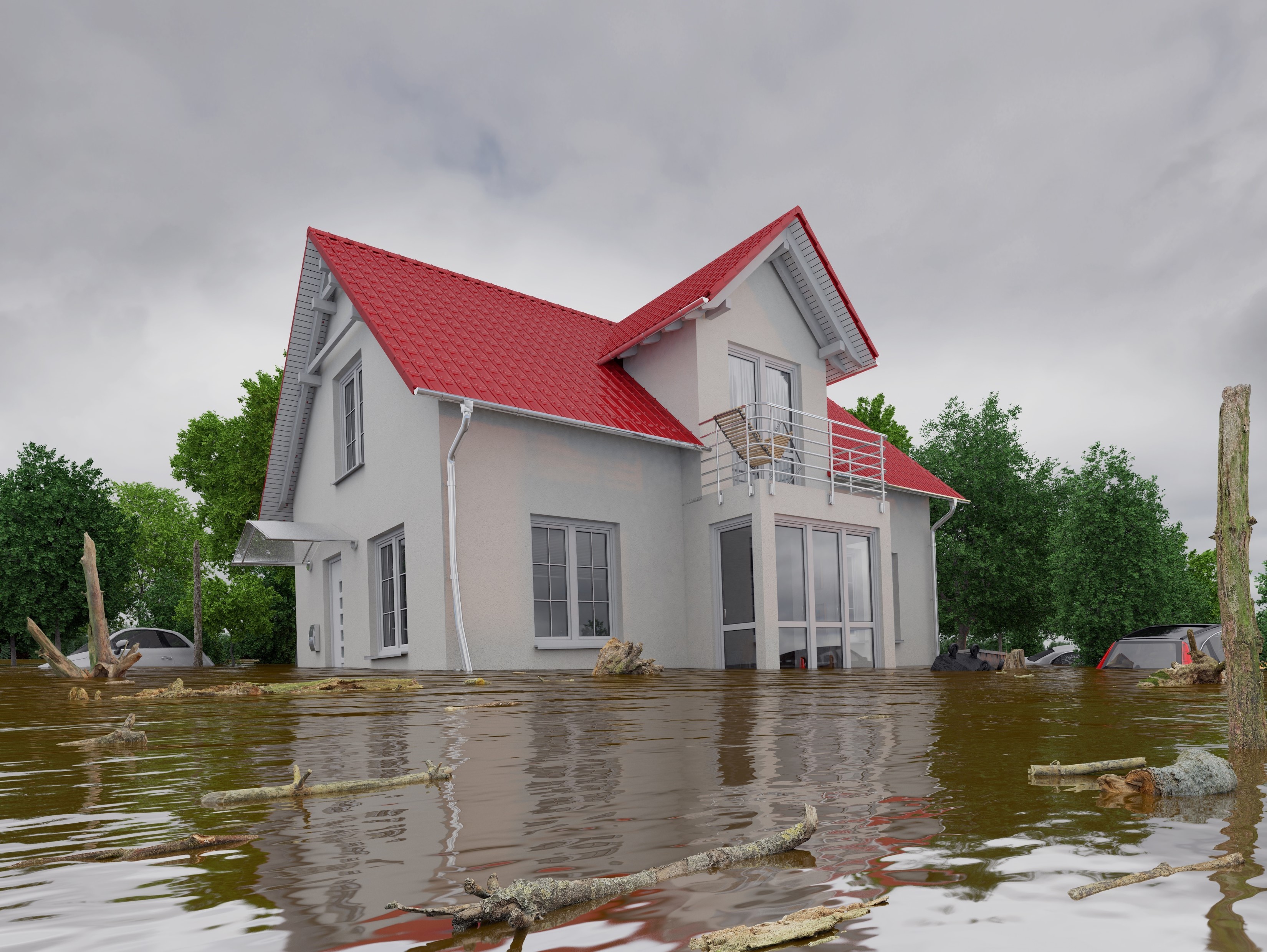
Improving our Coasts with High-Resolution Land Cover Data [#NOAA]
--
https://coast.noaa.gov/states/stories/landcover.html <-- shared technical article
--
https://coast.noaa.gov/ccapatlas/ <-- on-demand, online NOAA CCAP Landcover Atlas
--
https://coast.noaa.gov/digitalcoast/data/ccaphighres.html <-- #opendata C-CAP High-Resolution Land Cover
--
Use Case Examples:
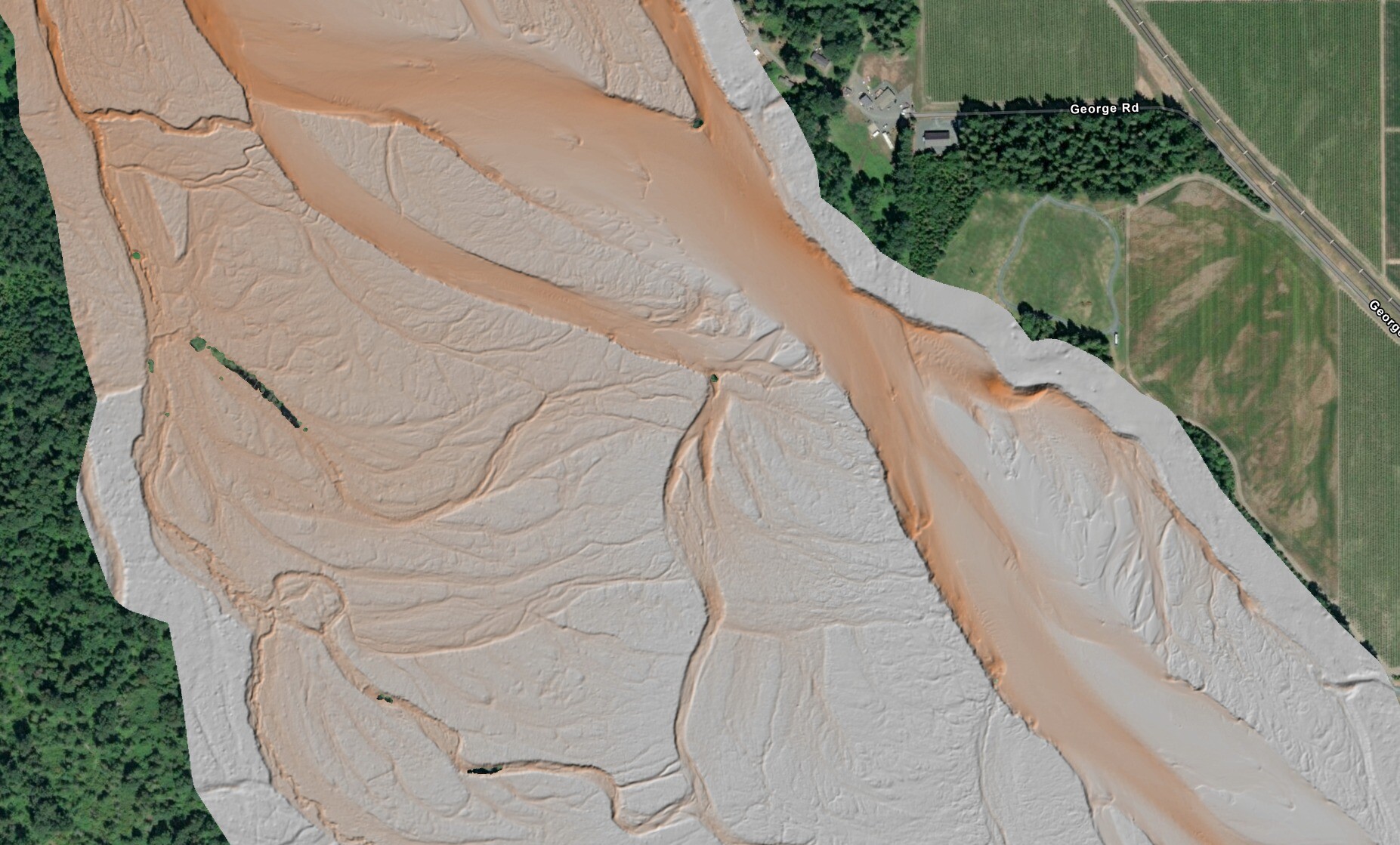
• Flood Inundation Modeling and Risk Assessment
• Stormwater Management and Water Quality Protection
• Heat Risk and Urban Forestry
• Wetland Monitoring, Conservation, or Restoration Planning
• Other – e.g., Discovering Gaps in Broadband Access
--
#GIS #spatial #mapping #NOAA #DigitalCoast #LandCover #CoastalManagement #GeospatialData #EnvironmentalData #ResilientCommunities #landcover #usecase #economics #remotesensing #earthobservation #opendata #floodinnundation #waterquality #water #hydrology #risk #hazard #spatialanalysis #spatiotemporal #stormwater #management #heatrisk #urbanforestry #wetland #monitoring #conservation #planning #resortation
@noaa #NOAAOfficeForCoastalManagement
#DigitalCoast


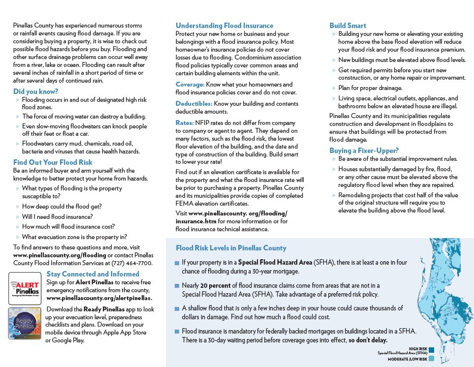
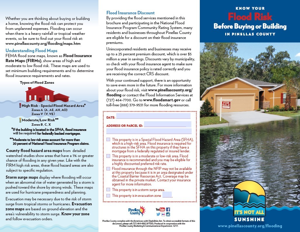
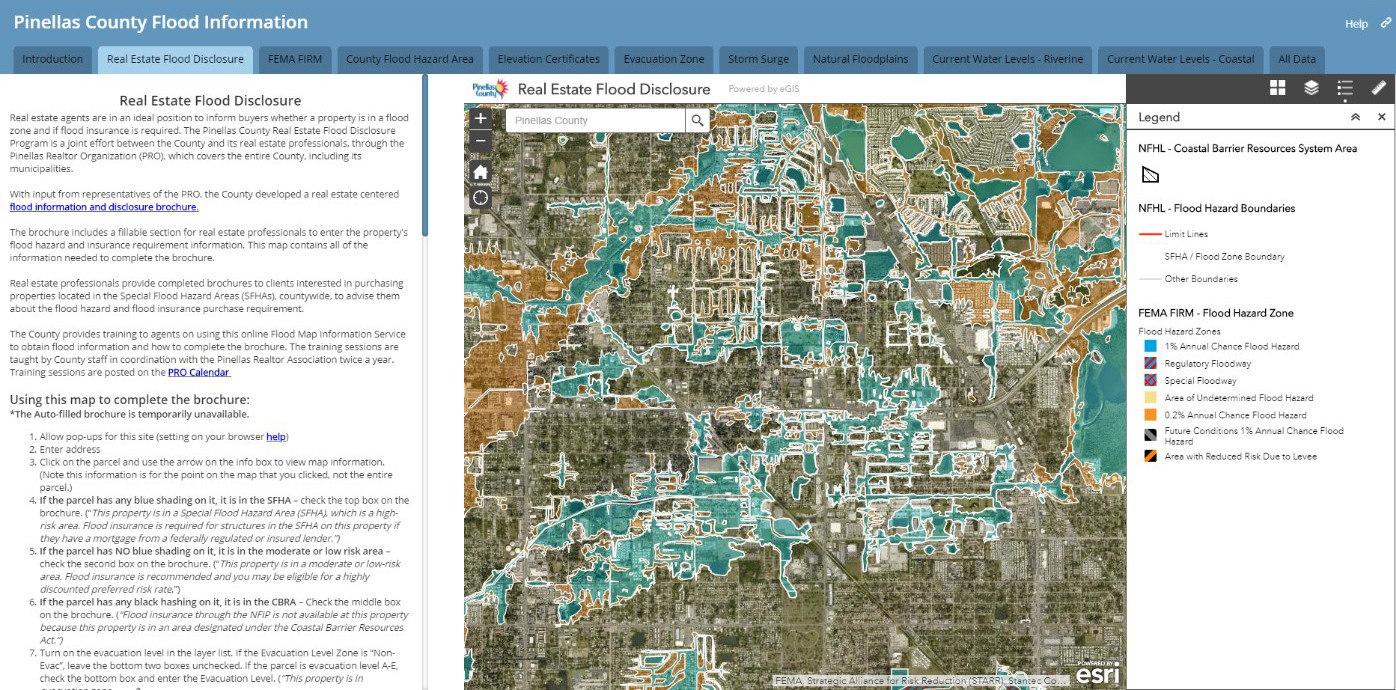
Increasing Flood Risk Awareness Through A Real Estate Professional Training Program
--
https://coast.noaa.gov/digitalcoast/training/flood-risk.html <-- link to article
--
#GIS #spatial #mapping #NOAA #DigitalCoast #PinellasCounty #flood #flooding #education #risk #hazard #training #program #realestate #residential #floodzones #floodinsurance #publicsafety #loss #damage #economics #tools #analysis #information #Florida #floodrisk #investment #infrastructure #publicawareness #realtor #awareness #CommunityRatingSystem #disclosure #publicinformation #premiums #costsaving #water #hydrology #extremeweather #climatechange #naturaldisasters #coast #coastal #NOAA
@NOAA
NOAA Digital Coast – Data Access Viewer [USA]
--
https://coast.noaa.gov/digitalcoast/tools/dav.html <-- shared link to viewer
--
[lots of new data added in the last 6 months]
“This online tool allows a user to search for and download lidar, imagery, and land cover data by user-defined geography. Once found, the data can be downloaded with an easy-to-use checkout interface. Users can select from multiple file formats, projections, and datums.
Features:
• View image services for applicable data
• View technical specifications and metadata for each data set
• Access data in several projections and datums…”
#GIS #spatial #mapping #spatialdata #opendata #LiDAR #imagery #NOAA #digitalcoast #USA #DataAccessViewer #landcover #topobathy #topography #bathymetry #charts #coast #coastal #CoastalChangeAnalysisProgram #CCAP #NLCD
@NOAA


What Exactly Is The [NOAA] Sea Level Calculator And Why Would You Want To Use It?
--
https://coast.noaa.gov/digitalcoast/tools/sea-level-calculator.html <-- link to tool
--
“It allows you to:
👉 Understand sea level change scenarios and visualize potential impacts on a map
👉 Explore water level and flood frequency trends
👉 See the top 10 flood events for your location
👉 Determine what time of the year your community is most likely to experience a flood..”
#GIS #spatial #mapping #digitalcoast #coast #coastal #sealevel #sealevelrise #SLR #climatechange #spatialanalysis #spatiotemporal #waterlevel #flooding #flood #stormsurge #risk #hazard #planning #management #subsidence #model #modeling #tool #resource
@NOAA
NOAA Digital Coast - Coastal Elevation Data [open data access, USA]
--
https://coast.noaa.gov/dataviewer/?#/lidar/search/ <-- link to open data portal
--
https://www.usgs.gov/special-topics/coastal-national-elevation-database-applications-project/data <-- USGS Coastal National Elevation Database Applications (CoNED) Project Viewer
--
“This repository contains U.S. topographic data gathered by many groups using a variety of lidar sensors. Using the custom download for up to 1.5 billion points, users may search and select output by year, area, data provider, elevation product, projection, datum, and format. Output types include point clouds, digital elevation models, and contours. Requests are submitted to an automated system for custom processing, and a URL link is emailed to the user upon completion…”
#GIS #spatial #mapping #usa #opendata #CoNED #DigitalCoast #elevation #topobathy #bathmetry #LiDAR #remotesensing #dataportal #digital #data #topographic #download #freedata #DEM #pointcloud #spatialanalysis #coast #coastal #SLR #sealevelrise
#NOAA #USGS