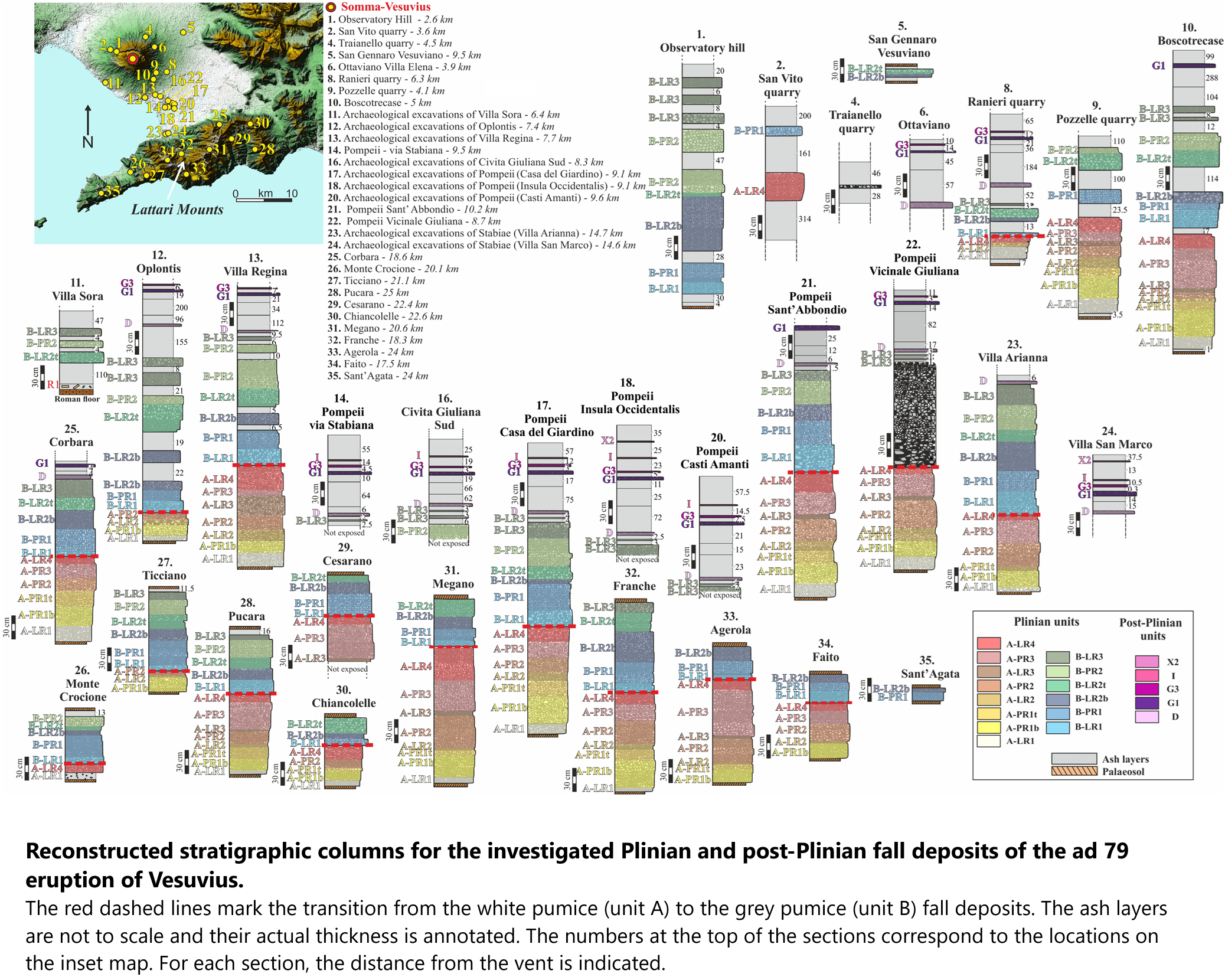
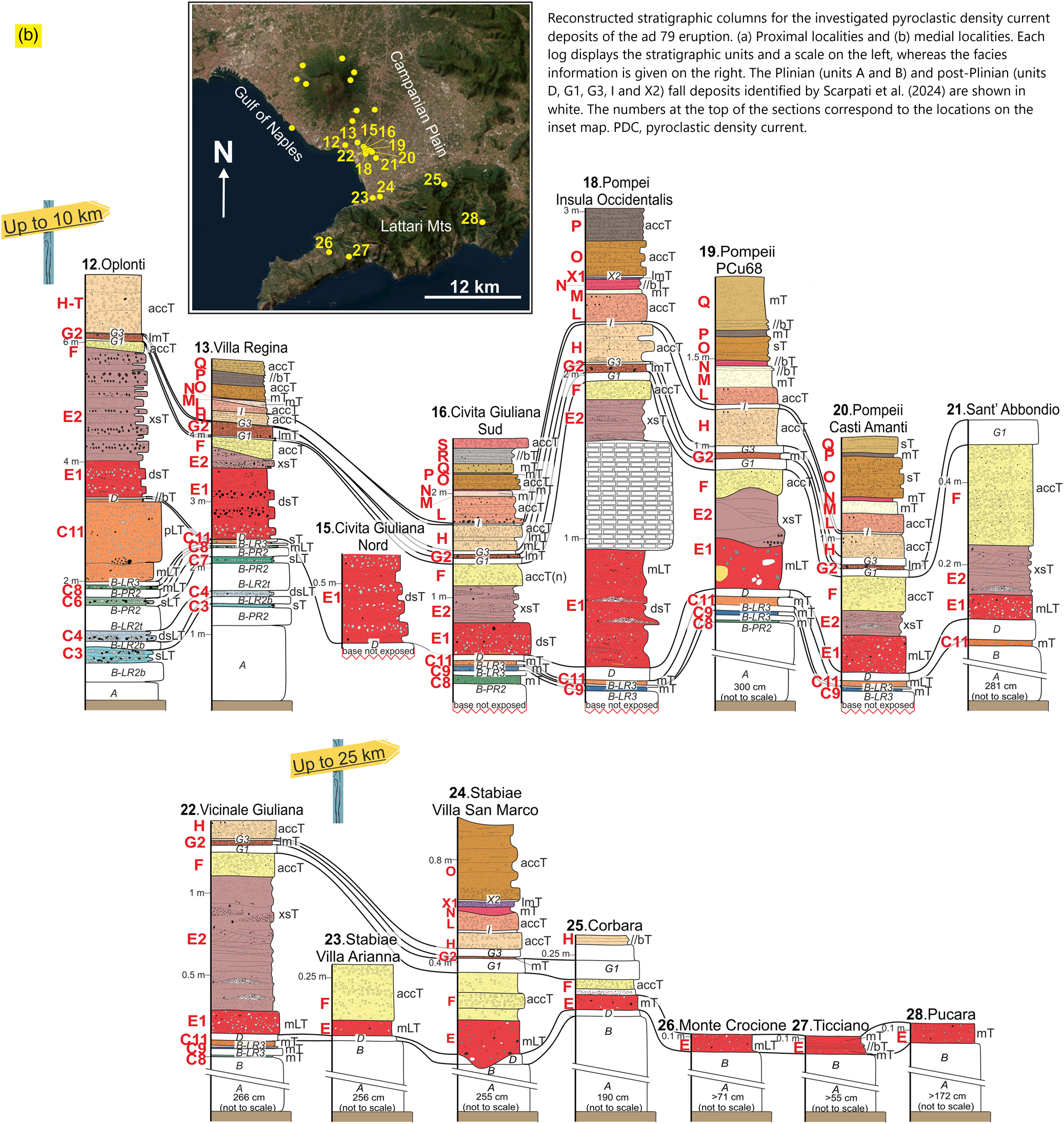
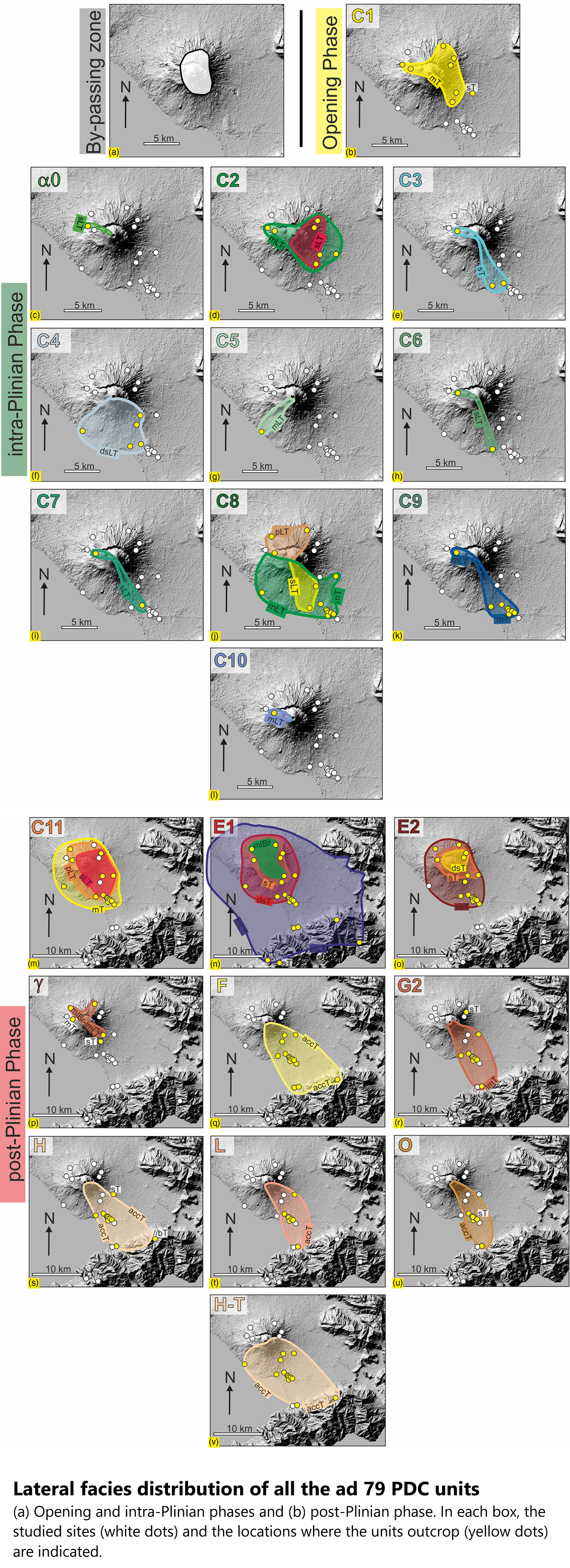
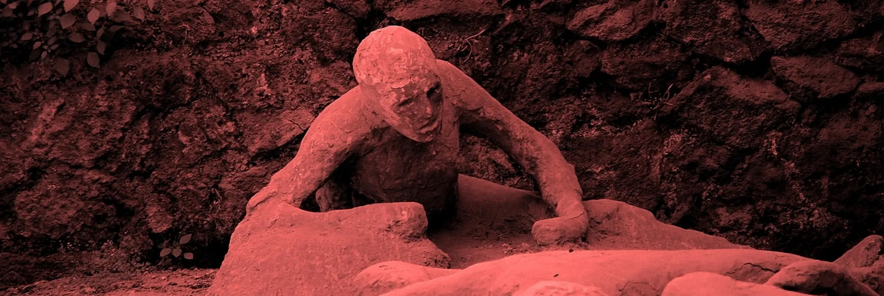
A Minute-By-Minute Account Of The Pompeii Eruption, Revealed In Agonizing Detail
--
https://www.science.org/content/article/minute-minute-account-pompeii-eruption-revealed-agonizing-detail <-- shared technical article
--
https://doi.org/10.1144/jgs2024-071 <-- shared paper
--
https://doi.org/10.1144/jgs2024-072 <-- shared paper
--
#GIS #spatial #mapping #spatialanalysis #spatiotemporal #timeline #reconstruction #model #modeling #Italy #Naples #Roman #79CE #eruption #volcanic #volcano #geology #engineeringgeology #Campanian #Pompeii #Herculaneum #ancienthistory #eyewitness #history #risk #hazard #naturalhazard #naturaldisaster #publicsafety #Vesuvius #debris #pyroclastic #gas #nueeardente #deposition #Pliny #PlinyTheYounger #geologicmapping #fieldwork #romanempire #impact #cost #economics #infrastructure #lossoflife #deaths
#pyroclastic
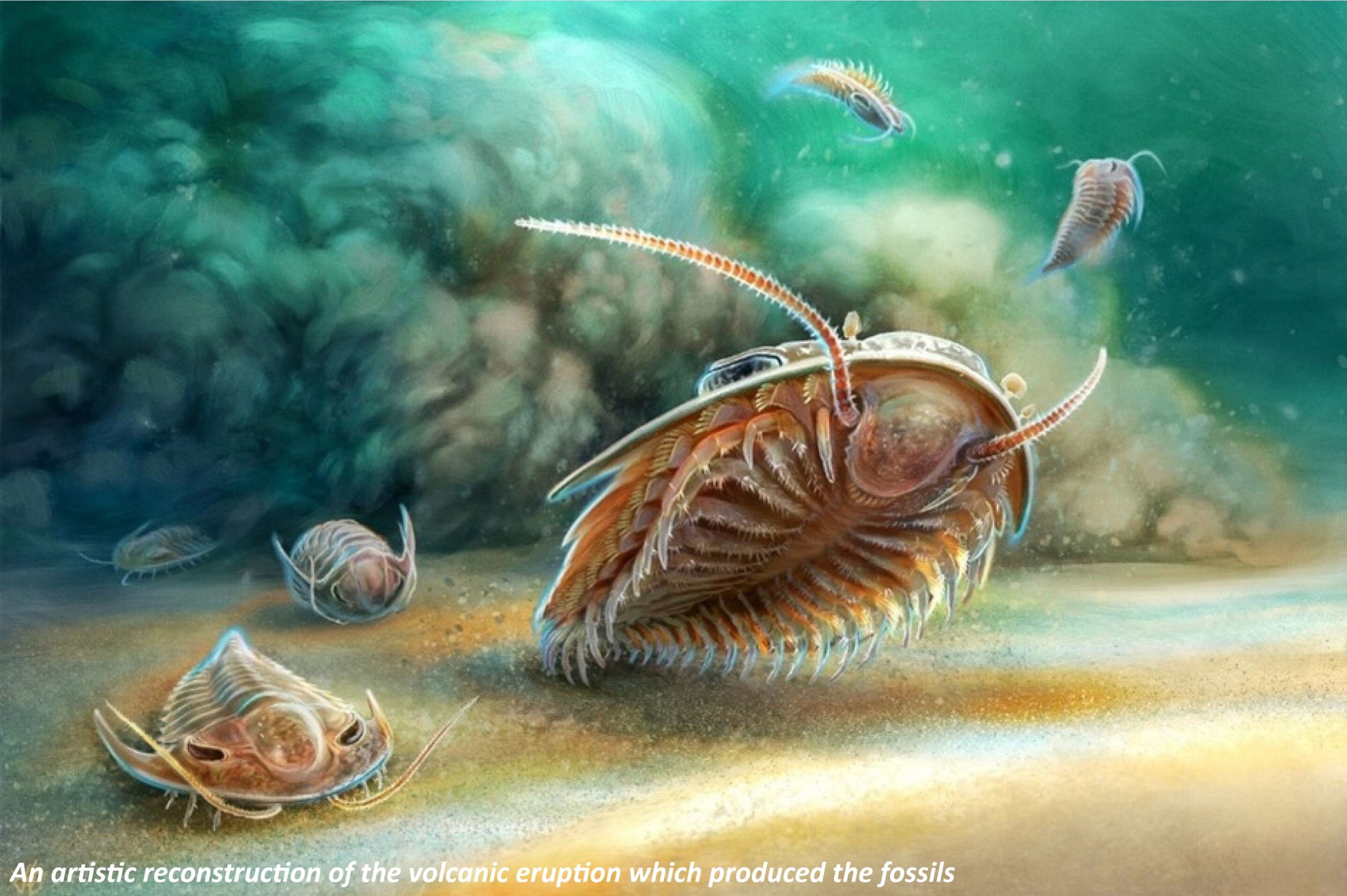
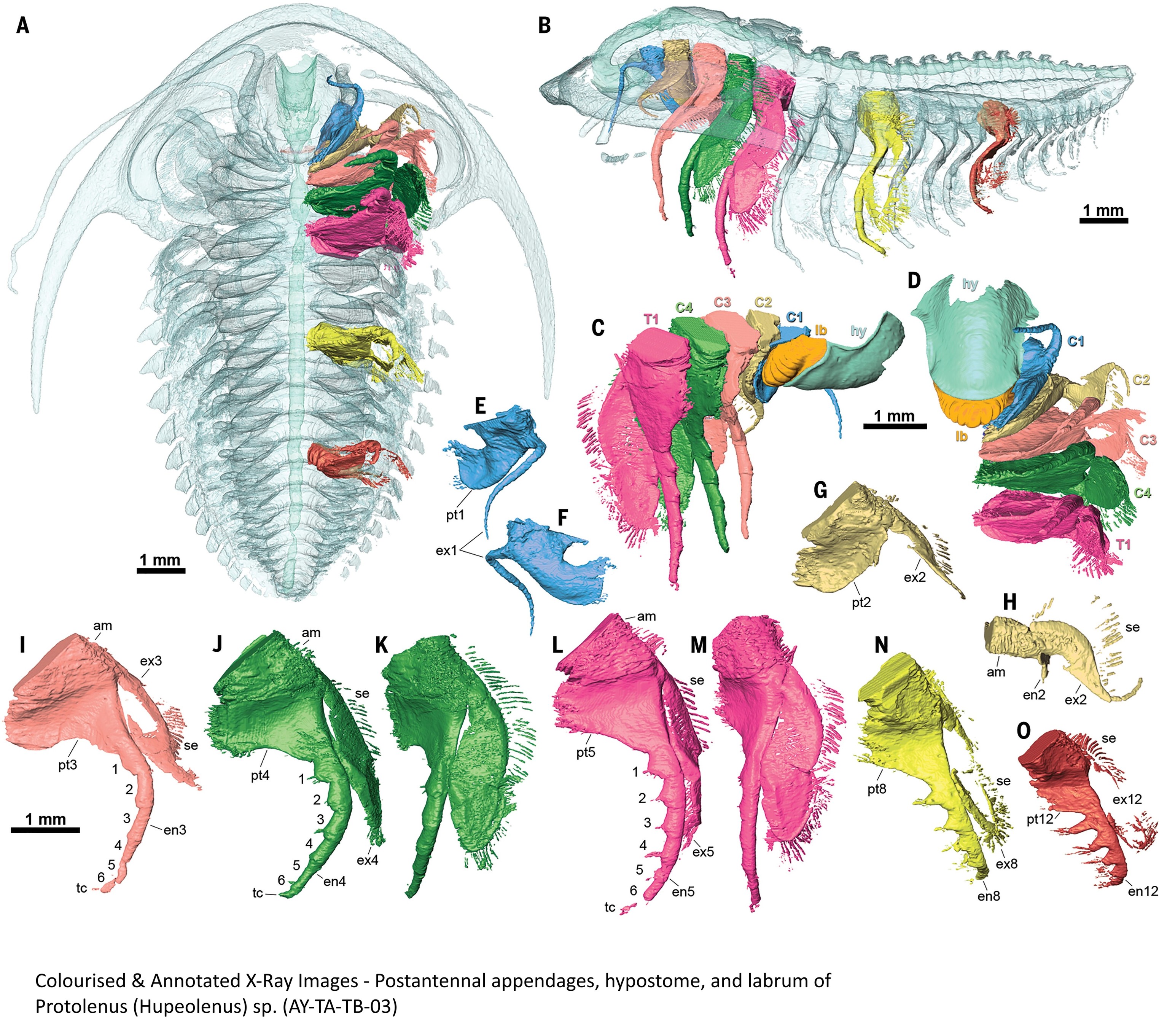
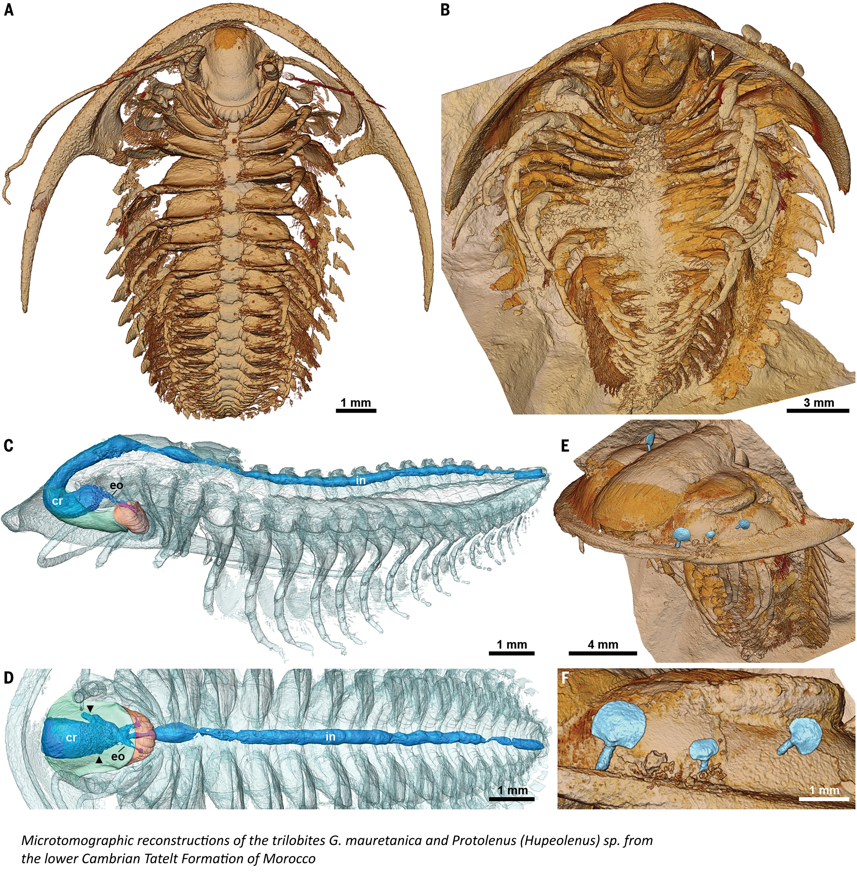
Volcano-Formed Fossils Reveal Trilobites In Never-Before-Seen Detail
--
https://newatlas.com/biology/trilobite-fossils-volcanic-ash/ <-- shared technical article
--
https://doi.org/10.1126/science.adl4540 <-- shared paper
--
[Palæontology was a ‘minor’ in my MSc (Geology) coursework, I have always had a fascination with it, and continue to follow it – and wonder…]
#geology #palæontology #paleontology #fossil #trilobite #marine #fossilrecord #Morocco #AtlasMountains #volcanic #pyroclastic #seafloor #ash #Cambrian #xray #microtomography #imaging #imagery #geochemistry #petrography #invertebrate
#art #zombie #horror #fiery #undead #apocalyptic #inferno #pyroclastic #survival #challenge #creativity #imagination #nightmare #charred #flesh #searing #pain #relentless #pursuit #creepy #macabre #blazing #surreal #artisticexpression #aiart #stablediffusion #generativeAI


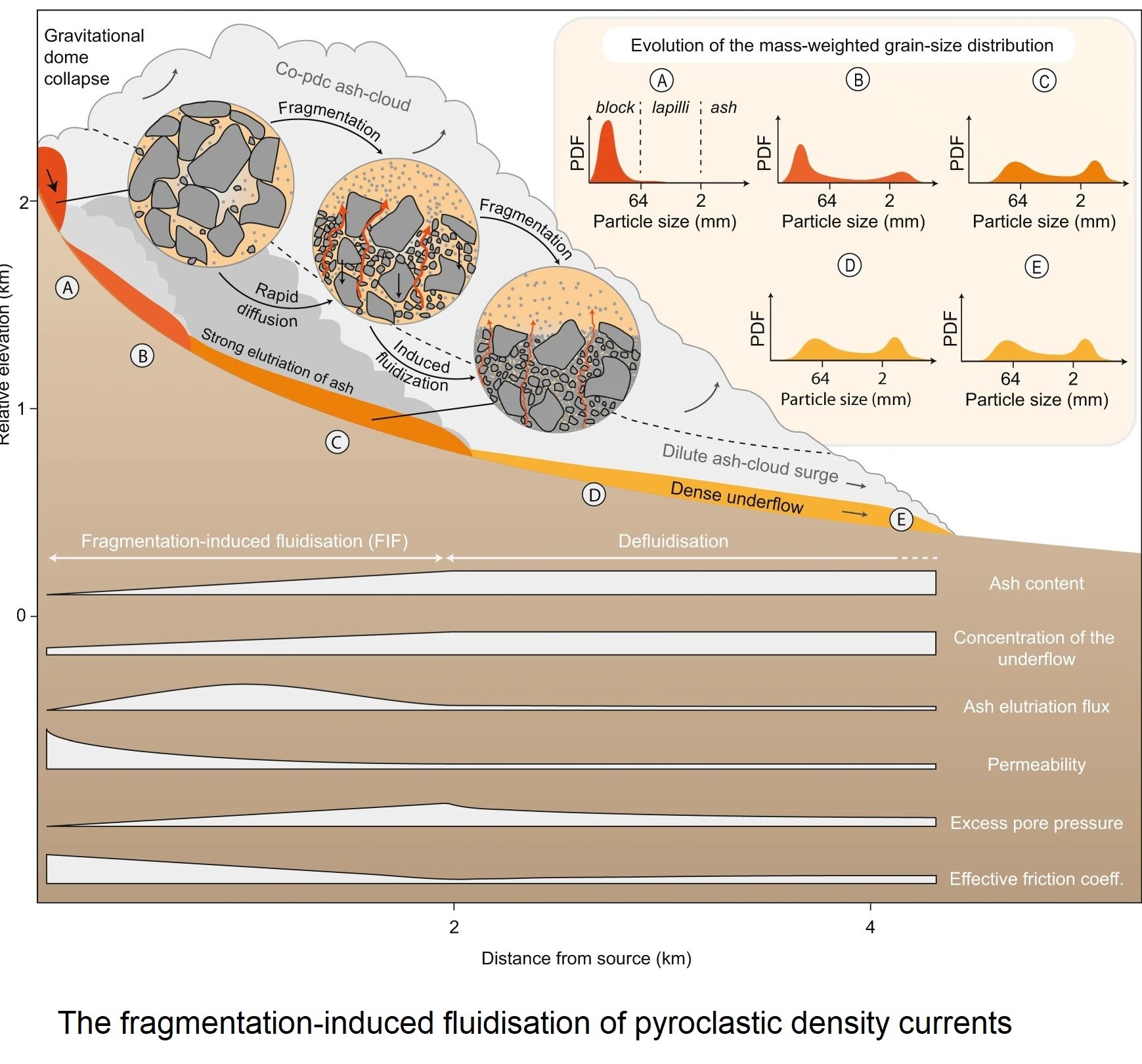
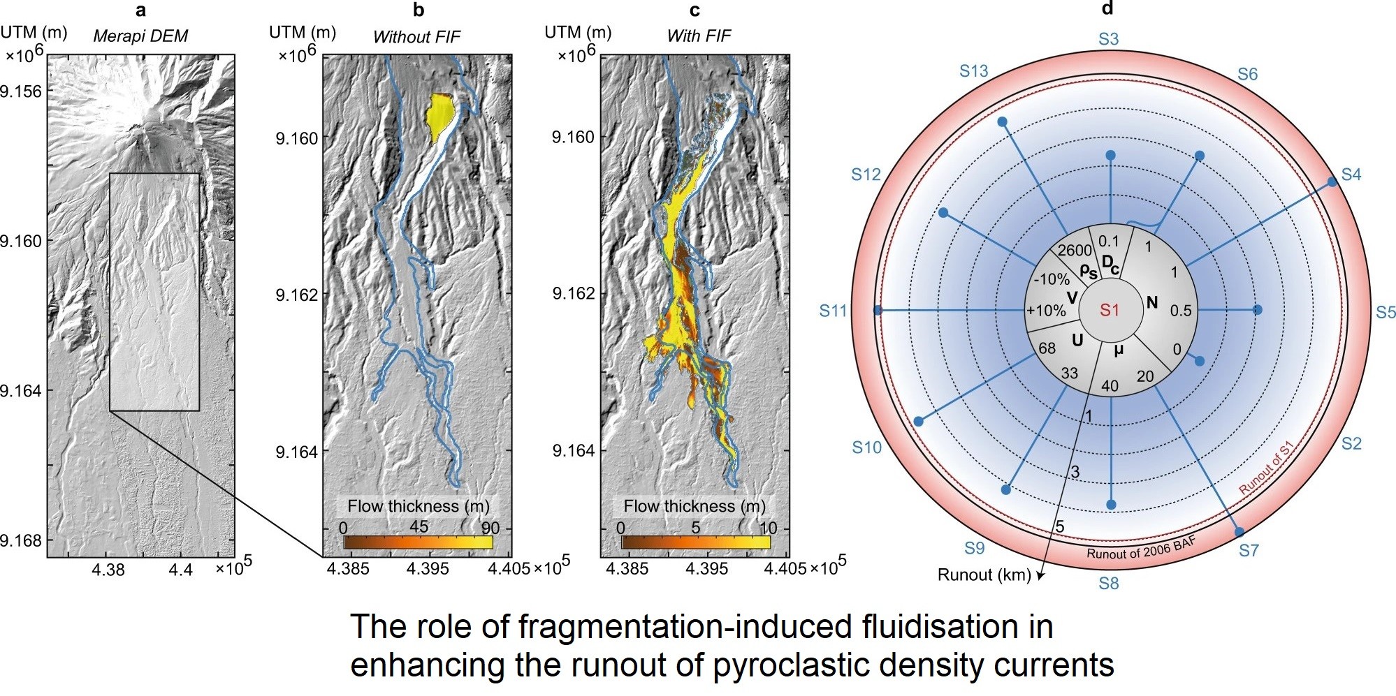
Deadly Volcanic Flow Insights Could Aid Forecasting [pyroclastic flows]
--
https://www.geologypage.com/2023/05/deadly-volcanic-flow-insights-could-aid-forecasting.html <-- shared technical article
--
https://doi.org/10.1038/s41467-023-37867-1 <-- shared paper
--
#GIS #spatial #mapping #spatialanalysis #model #modeling #numericalmodeling #pyroclastic #pyroclasticflows #volcanic #volcanichazard #geology #engineeringgeology #naturalhazard #naturaldisasters #publicsafety #fatalities #rock #ash #transport #injury #death #infrastructure #pompei #pinatubo #pyroclasticdensitycurrents #prediction #forecasting #mitigation #flowmodel #simulations ##
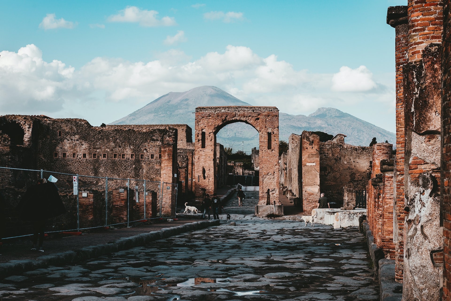
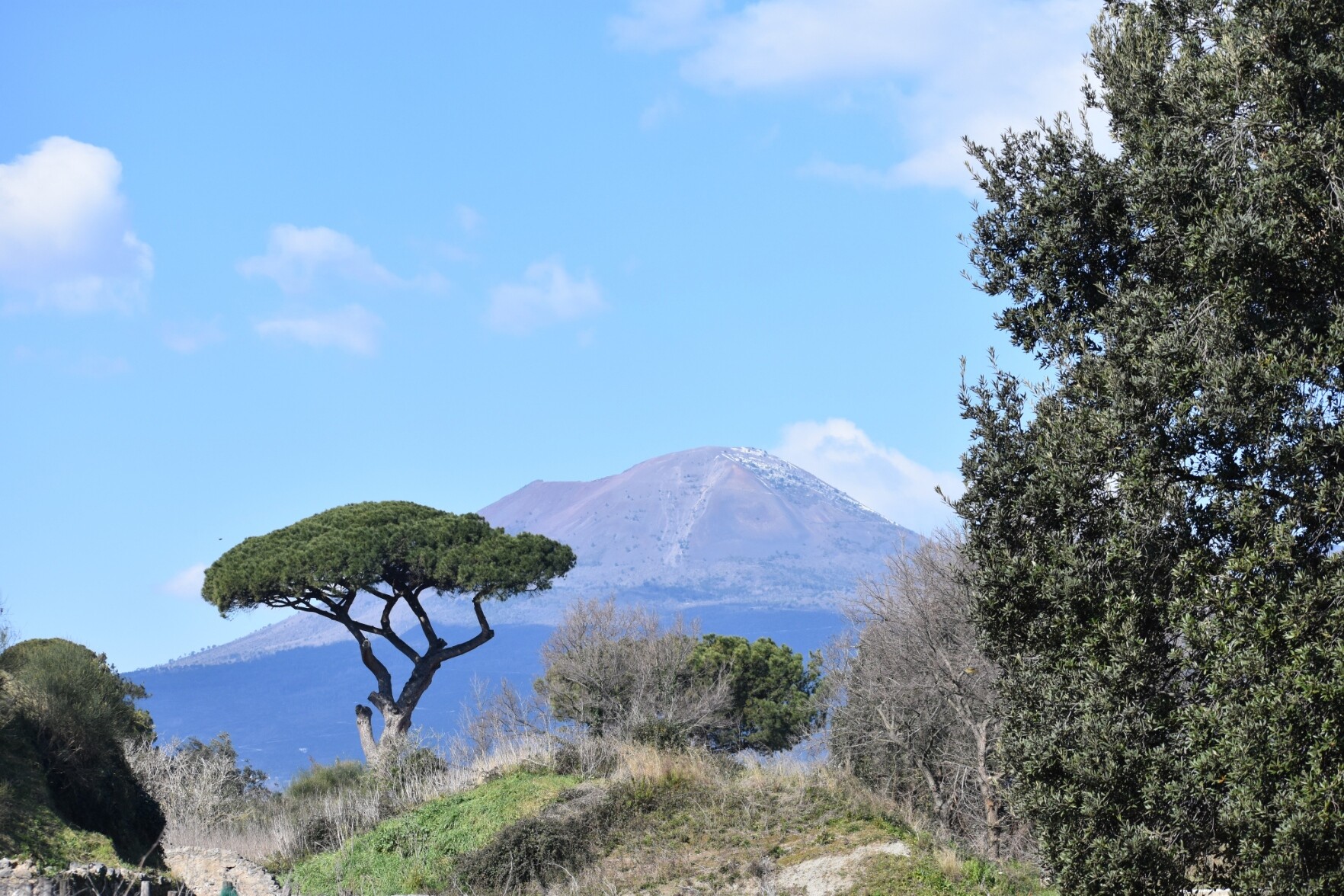
Vesuvius, stately yet brooding, as seen from Pompeii. The 79AD pyroclastic flow must have been quite something, looking at that distance!
Also, isn't the pine on the left wonderfully stately?
#geology #volcanology #volcanoes #vesuvius #vesuvio #vesuvio #pompeii #PompeiiArchaeologicalPark #pyroclastic #pinetree #trees
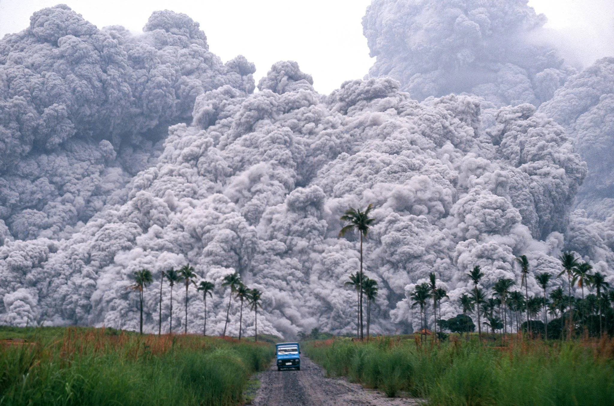
The second episode, #Volcano, was less emotional for me because it focuses more on possibilities and long-past events.
It does have footage of the #Fuego eruption in #Guatemala a few years ago and there's one part that's just terrible as we see a person be overtaken by the incredibly fast-moving #pyroclastic flow that killed up to 2,000 people.
In both episodes there's video and audio by survivors as they're living through these events and the effects are visceral.
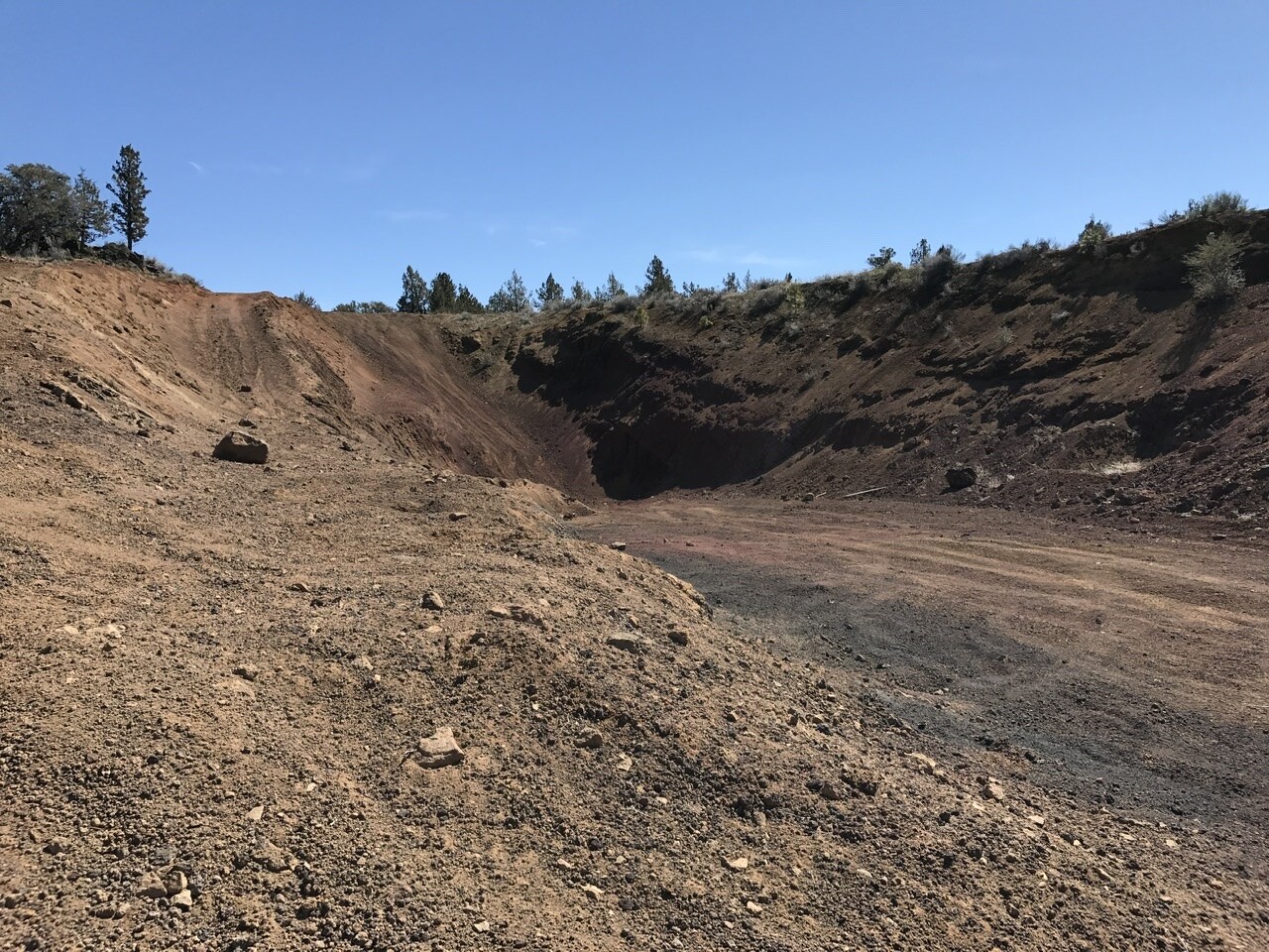
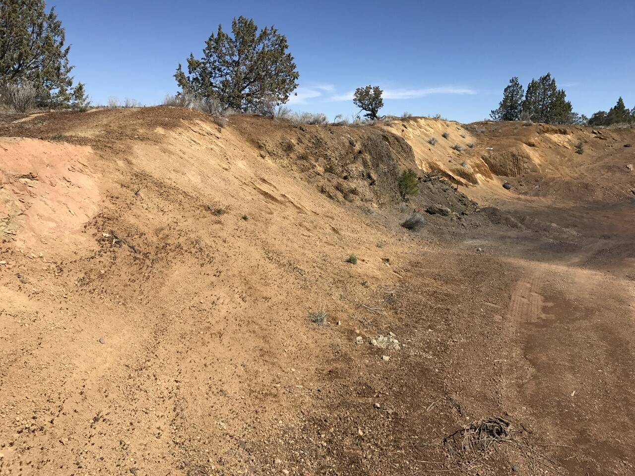
A range of #Oregon #volcanic #soils developed over fragmental #pyroclastic #rocks and #tuff.
All are well drained soils that show little compaction or development of #clay…though some are used extensively for local agriculture.
1) Butte Falls
2) Prospect
3) Bonanza (Hildebrand)
4) Hood River (Parkdale)
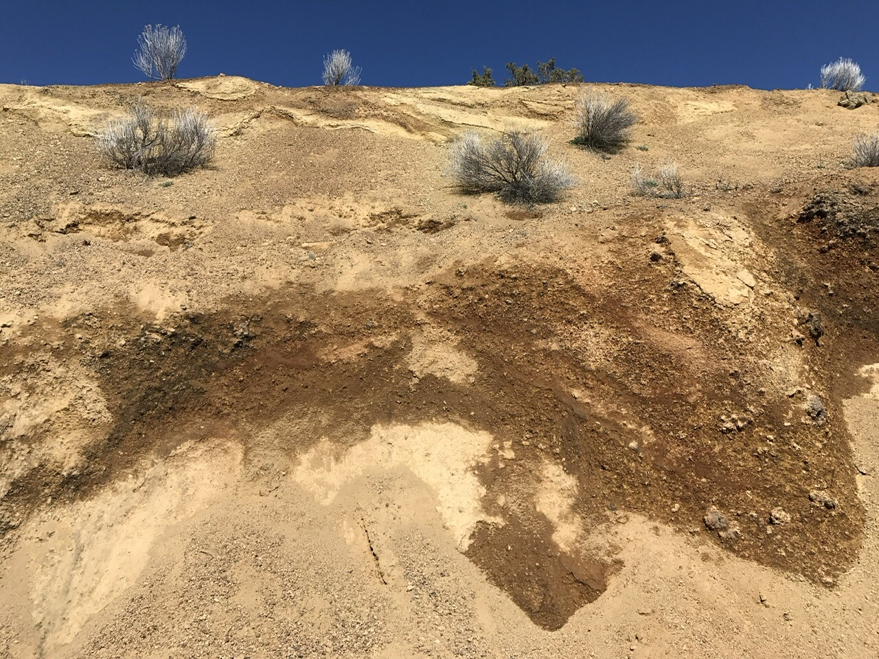
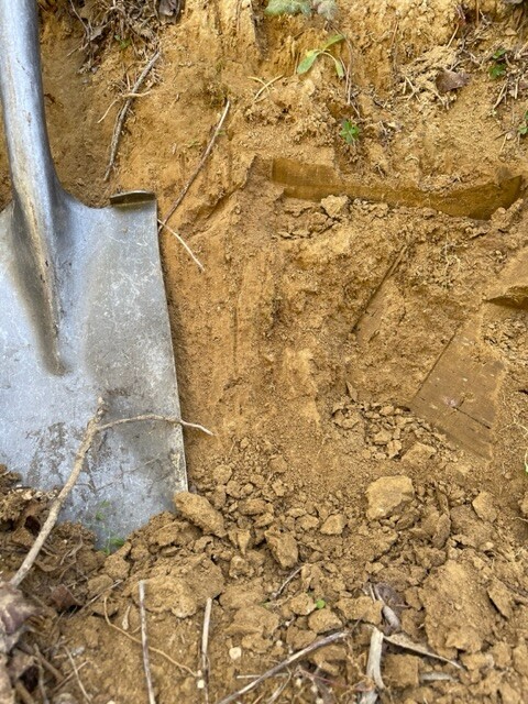
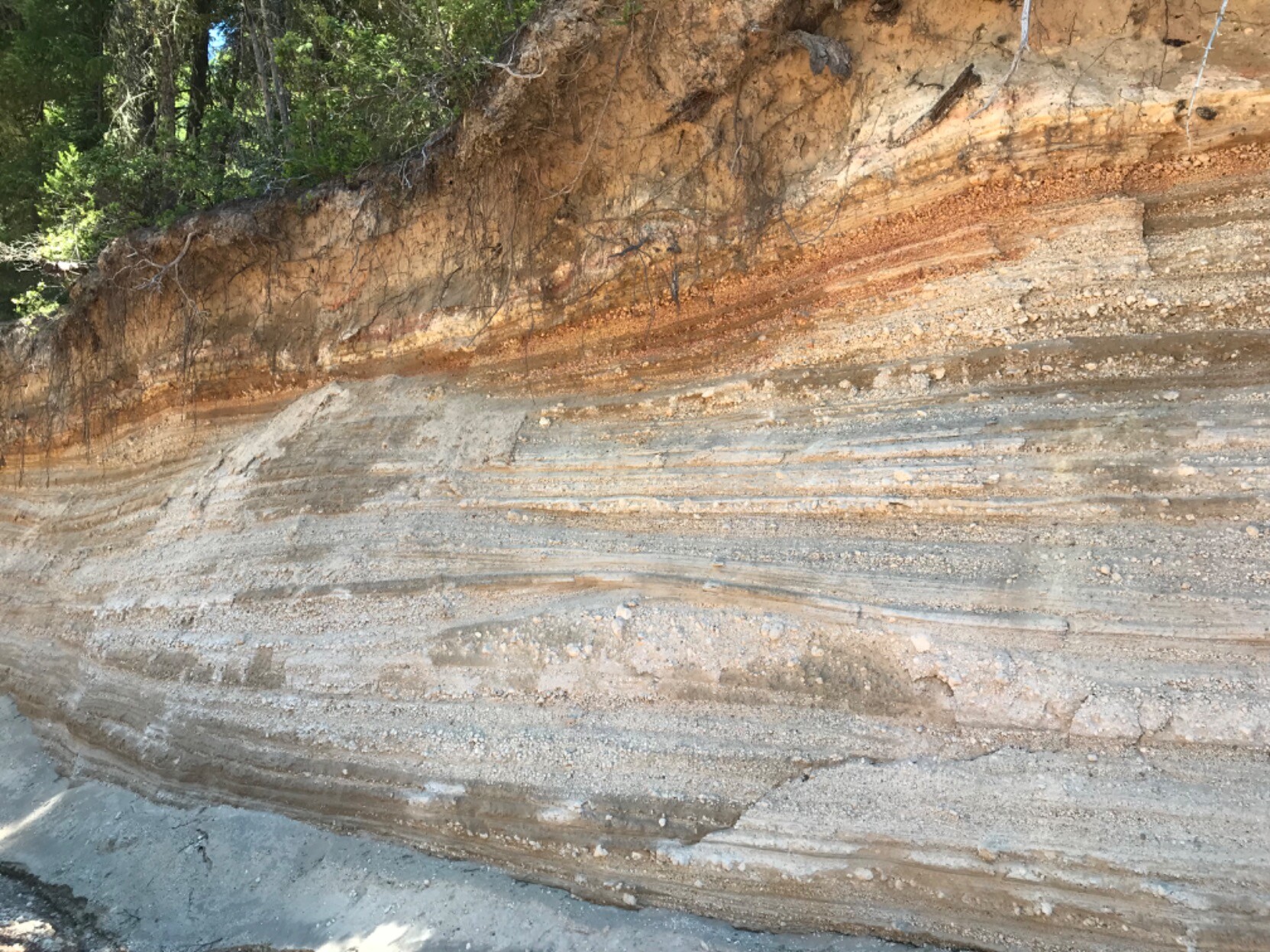
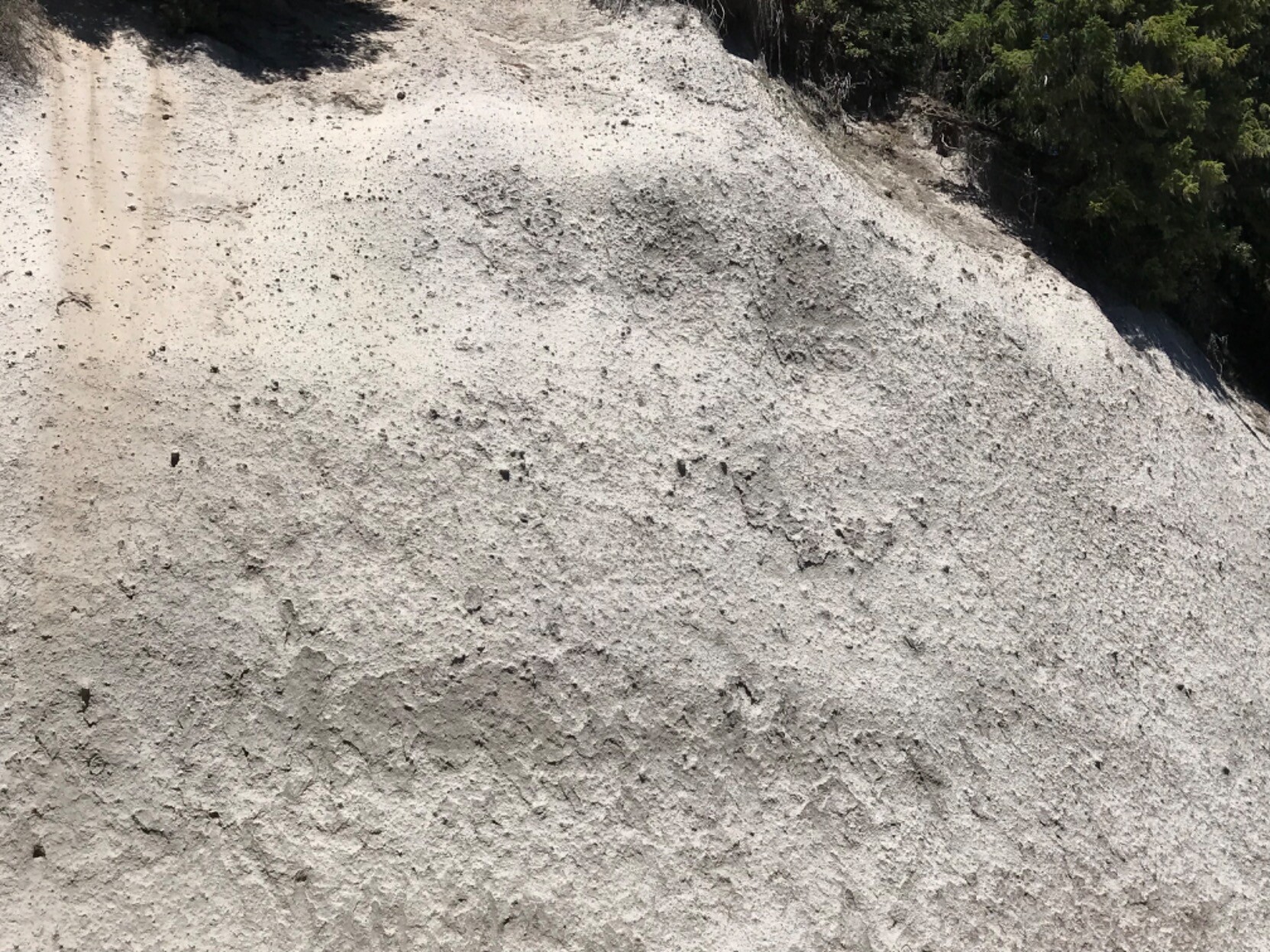
#Pyroclastic #SurgeDeposits of ash and other #tephra in road cut along #CraterLake Highway. These surge deposits sit atop at least 100m of ash, the tops of which are exposed in nearby #Roadcuts.
Near the flanks of former #MtMazama #volcano , the pumice filled existing valleys and created enormous water reservoirs that temper seasonal cycles to support local hydrology year round.
The contrast in #eruption style is evident between these two proximal exposures.

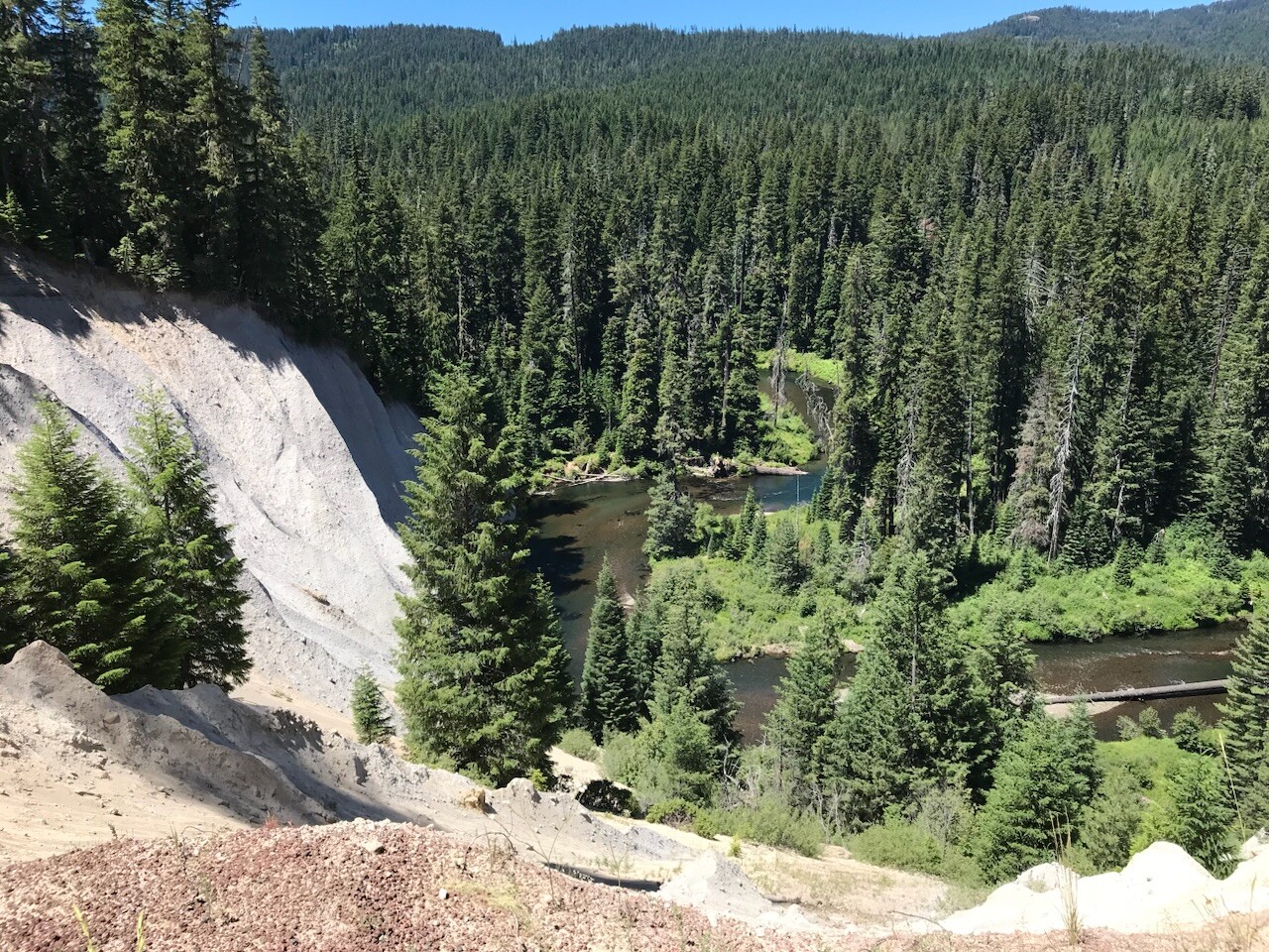
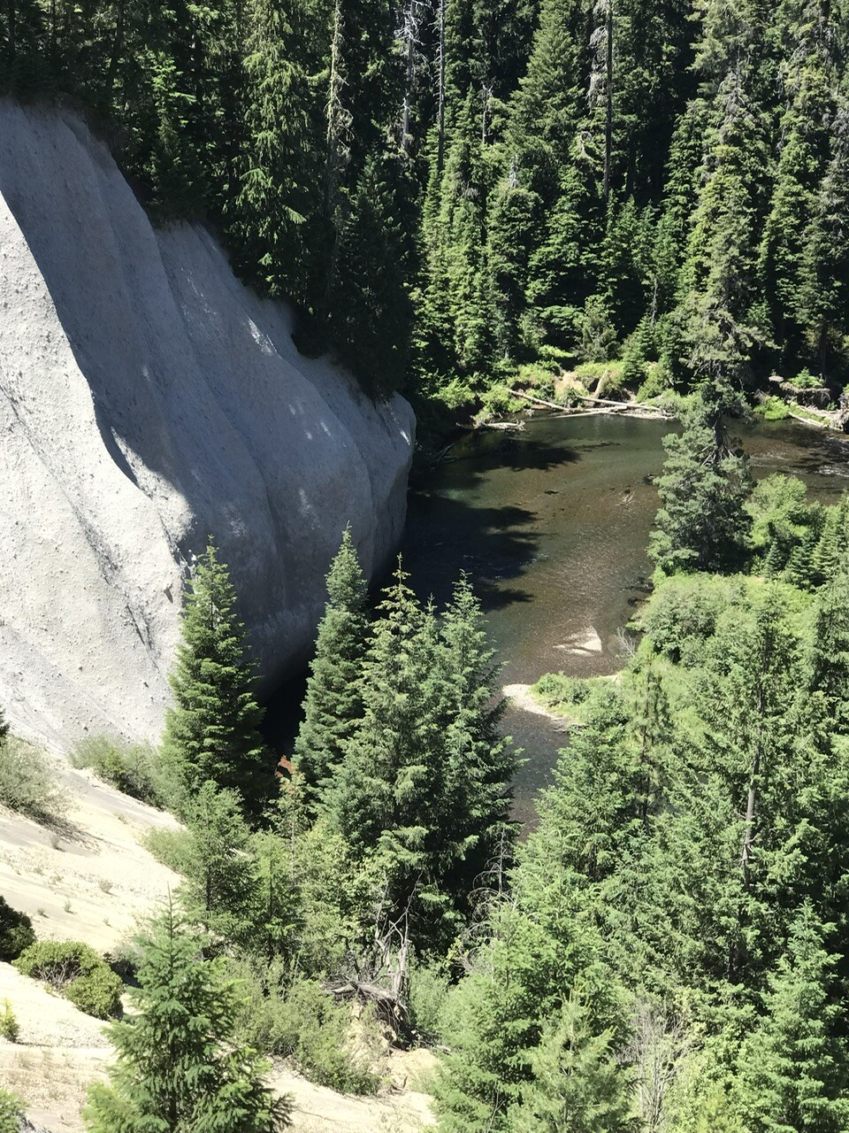
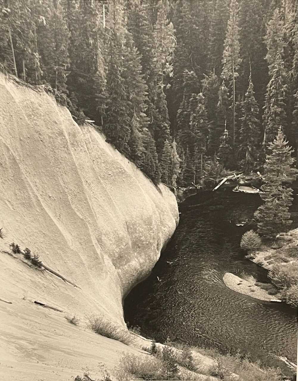
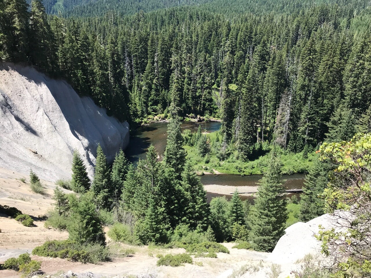
Not often I get a chance to recreate a photo after 33 years have elapsed…but a couple years ago, I did…along the Upper #RogueRiver above Prospect, OR.
The view was better in 1984(ish) B/W when the few scant trees present on the cut-bank were saplings…but recently we’re 50’ tall or more.
What always impressed me was the immensity of the #pyroclastic flows that created the exposure, likely filling a paleo valley to a few hundred feet depth.
#volcano #pumice #caldera #geomorphology #geology #Oregon #PNW #Rivers #photography
#Geology #Tuff #Volcano #Hydrovolcanism #Palagonite
#EruptionStyle #TuffCone #Rocks #Pyroclastic #Geoscience
Eastern Klamath County, #Oregon volcanic eruption that transitions from explosive hydrovolcanism to classic cinder cone eruptive styles as rising magma initially encounters groundwater and/or shallow surface water, then either seals itself from those waters as eruption proceeds, or the water was consumed by the eruption.
On 4 December, at 15:19 UTC, a strong #pyroclastic flow along the Sciara del Fuoco on #Stromboli #volcano reached the sea and generated a moderate #tsunami, hopefully not causing damage (according to INGV). Tide gauge in Ginestra recorded it with a delay of only a few minutes, and crest to crest amplitude of ~60cm.
Stromboli is an Italian very active volcano from the Aeolian islands in the Tyrrhenian sea (Mediterranean). Its activity, and more particularly hazards due to the pyroclastic flows, are monitored by INGV.
INGV reported about the tsunami: https://ingvterremoti.com/2022/12/05/stromboli-4-dicembre-2022-tsunami-si-o-tsunami-no/
And about the volcanic event itself: https://ingvvulcani.com/2022/12/05/cosa-e-successo-a-stromboli-il-4-dicembre-2022/
An unusual, though decisively not photogenic pair of rocks today. Both are mostly hectorite (Na0.3(Mg,Li)3Si4O10(OH)2), an unusual lithium bearing clay that is often used in the cosmetics industry. They were soft when collected but hardened within a day. One comes from close to Barstow, CA, the other from the McDermott caldera in Northern NV. The hectorite is an alteration product of volcanic ash with a high glass content

USA Alert, Super-Planet, #Pyroclastic Flows | #S0News Apr.9.2019