Saving Lives, One Pixel at a Time - End Users Share Their Stories
--
https://disasterscharter.org/news/saving-lives-one-pixel-at-a-time-end-users-share-their-stories <-- shared technical article
--
“For 25 years the International Charter has organized the distribution and use of satellite and remotely sensed data for response to natural disasters across the globe, informing countless applications where timely acquisition of remote sensing data literally...saves lives…”
--
#GIS #spatial #mapping #webmapping #remotesensing #earthobservation #satellite #imagery #risk #hazard #global #emergencymanagement #naturaldisaster #monitoring #response #planning #management #landsat #hurricane #cyclone #climatechange #extremeweather #flood #flooding #city #urban #crops #agriculture #foodsecurity #infrastructure #emergencyresponse #spatialanalysis #spatiotemporal
@InternationalCharterSpaceAndMajorDisasters | U.S. Geological Survey (USGS) | @earth Resources Observation And Science #EROS
#Webmapping
📍 Nouveau billet sur le blog !
💡 Comment utiliser le format MBTiles avec Leaflet pour des cartes web légères et performantes ?
👉 Structure, outils, cas d’usage, bonnes pratiques : tout y est !
🔗 https://www.sigterritoires.fr/index.php/mbtiles-et-leaflet/

🎓 Tutoriel Leaflet – Session 5 disponible !
✔ Gérer les clics, survols et sélections sur la carte
✔ Afficher des infobulles, tooltips et popups dynamiques
✔ Déclencher des actions selon l’interaction de l’utilisateur
🛠 Jeudi prochain : place au mini-projet final !Un vrai défi... à votre portée !
📎 Session 5 ici : https://t.co/IuIjjVm83A
#SIG #Leaflet #Webmapping #QGIS #FormationSIG #CartographieInteractive #ÉducationNumérique #ProjetPédagogique #OpenSource

🚀 New blog post by Tim Appelhans: State of the (open source) web map – Part I: The base(map)
A thoughtful dive into the open source web mapping tools. Recommended.
Read here: https://tim-salabim.codeberg.page/sotwm/sotwm.html
Sig & Territoires
@sigterritoires
[#LeafletTraining] ¡La 2ª sesión está en línea!
👉 En la agenda: Capas e interactividad - Puntos, polilíneas, polígonos - Personalización, eventos, interacciones.
Únete a nosotros para construir tus propios mapas web dinámicos
🔗https://shorturl.at/6fdNb
#GIS #Leaflet #WebMapping #OpenSource

generated by GDAL2tiles: select "layer" and zoom in, it's the gull colony on the sandbank at Wells-Next-The-Sea that I surveyed a couple years ago. How easy was that! 🤯
https://sarahdal.github.io/Maps/WellsNextTheSea/leaflet.html
Bonjour Mastodon
Je suis passionné de cartographie, de SIG et d’open source.
Je débute ici sur #Fosstodon et je partage un super tutoriel pour apprendre Leaflet pas à pas :
https://www.sigterritoires.fr/index.php/tutoriel-leaflet/
Another little #webmapping project with #leaflet (mostly) finished and blogged
https://tlohde.com/blog/2025/04/bagging/
I'm not sure if hiking motivates me to poke around with #maps and data more than poking around with maps and data motivates me to go hiking.
Image taken a week ago at our camp in between Chno Dearg and Stob Coire Sgriodain.

Wrote myself a how-to (or rather a "how did I?") for adding #leaflet maps to my #11ty site.
A personal analysis of the current situation of maps on the web, libraries and formats, thinking about open source and without considering mobile devices #webmapping
European Geological Open Data (Map And Data) From The European Geological Data Infrastructure (EGDI)
--
https://www.europe-geology.eu/data-tools/map-viewer/ <-- shared link to map viewer
--
#geology #geosciences #earthsciences #data #spatialdata #criticalminerals #mining #geothermal #netzero #groundwater #carboncapture #ccs #GIS #spatial #mapping #opendata #webmapping #mapportal #Europe #EGDI #framework #GSEU #resources #naturalresources #opendata #water #naturalresources #geomorphology #bathymetry #geophysics #topobathy #remotesensing #earthobservation #waterresources
Want to go somewhere this weekend, but not sure where?
Try following your shadow...or if you don't want to do that - have a look at where it would have taken you.
I made a thing, and wrote about it:
https://tlohde.com/blog/2025/03/shadow-chasing/
#WebMapping #map #GnomonOnWheels #shadow #RoutePlanning #indieweb #blog #leafletjs #suncalc #gis #gischat #osm #cycling #builtwith11ty #eleventy
Seeking recommendations for a #WebMapping tutorial / course?
Slightly at sea on where to start.
- My current JS skill level is _extreme novice_.
- I don't have access to ArcGIS.
- Comfortable with #QGIS [*] and the #python #geospatial ecosystem (#geopandas #xarray #rasterio and plotting with #matplotlib)
Suggestions welcome. TIA. 👍
* I have looked at the qgis2web plugin, but having some issues associated with my aged laptop (2012 mbp running Ubuntu) and a 'Wayland session'.
#Leaflet #OpenLayers #MapBox #PrototoMaps #MapLibre #d3js #OpenStreetMap #GIS
Liebe #GEO / #GIS Menschen, ich suche einen klassischen Kataster-Nordpfeil so wie im Bild als SVG-Datei. Hat jemand so etwas in petto?
Vielen Dank!
#WebMapping

Anyone has tips how to conveniently show large dataset linked to H3 grid (level 10, over part of Europe) on a MapLibre map? I've found https://github.com/INSPIDE/h3j-h3t but getting h3t seems quite cumbersome and the only other solution I can think of is to use tippecanoe and turn it into PMTiles. But that sorts of defies the benefits of H3. I thought I could somehow simply ship just the H3 IDs but can't force myself to write a code to generate h3t from scratch... #webmapping #maplibre #h3
🎄 Ever thought about where your Christmas tree grows? 🌍 GIS connects us to stories like these—mapping the roots of our traditions 🌲✨. Dive into the geography of Christmas tree farming: https://www.maps.com/where-christmas-trees-grow/. Let's grow your #GIS and #WebMapping skills together! 🌐📊 #Geoinformation #CapacityBuilding
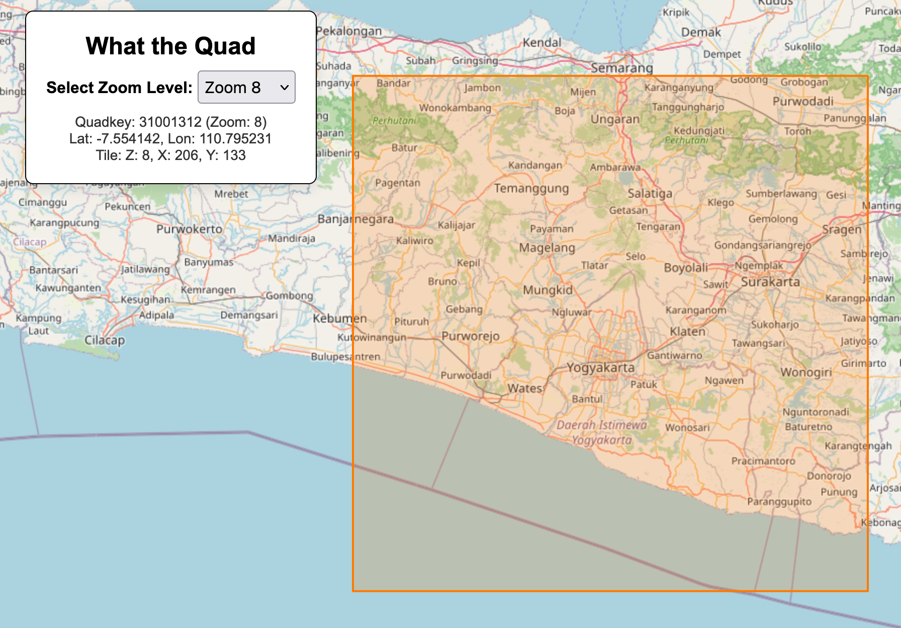
Perhaps I am the only one who ever needs to quickly look up the z/x/y or quadkey for a map tile, but I made this thing a while ago to do just that. Ehm, enjoy, I guess? https://mvexel.github.io/whatthequad/ #gis #maps #webmapping
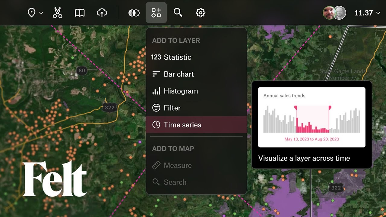
We've introduced a lot of exciting updates with Felt 3.0! 🚀 Explore our revamped user interface and discover all the new features. 👀 https://youtu.be/99roNtqD4GQ
Nächste Woche gehts wieder los! Unsere Weiterbildung "GIS und Webmapping" startet am 28. Juni. Es gibt noch freie Plätze, meldet Euch an! https://gis-trainer.com/de/gis_webmapping.php
Ihr erhaltet einen tiefen Blick in wichtigen Software- und Anwendungsbereiche, die für die Erstellung von Webmapping-Lösungen erforderlich sind, bzw. lernt Ihr, wie geographische Information mit dem Internet nutzen kann. Hierzu gehören natürlich auch grundlegende GIS-Kenntnisse.

Am 28.06.2024 startet wieder unsere Weiterbildung „GIS und Webmapping“.
Modul 1 (ArcGIS) startet am 28.06.2024
Modul 2 (Open Source GIS) startet am 29.07.2024
Modul 3 (GIS Webmapping) startet am 27.08.2024
Modul 4 (Projekt) startet am 25.09.2024
Mit einem Bildungsgutschein wird die Weiterbildung zu 100% gefördert!
Jetzt anmelden -> https://gis-trainer.com/de/gis_webmapping.php
#webmapping #gisakademie #geoinformation #weiterbildung #bildungsgutschein #neuerjob #zukunftsgestaltung
