A stunning new global map reveals how rivers truly flow—reshaping flood prediction and climate planning worldwide. #ClimateResilience #FloodMapping #WaterSecurity
https://geekoo.news/how-rivers-really-flow-a-bold-new-global-map/
A stunning new global map reveals how rivers truly flow—reshaping flood prediction and climate planning worldwide. #ClimateResilience #FloodMapping #WaterSecurity
https://geekoo.news/how-rivers-really-flow-a-bold-new-global-map/
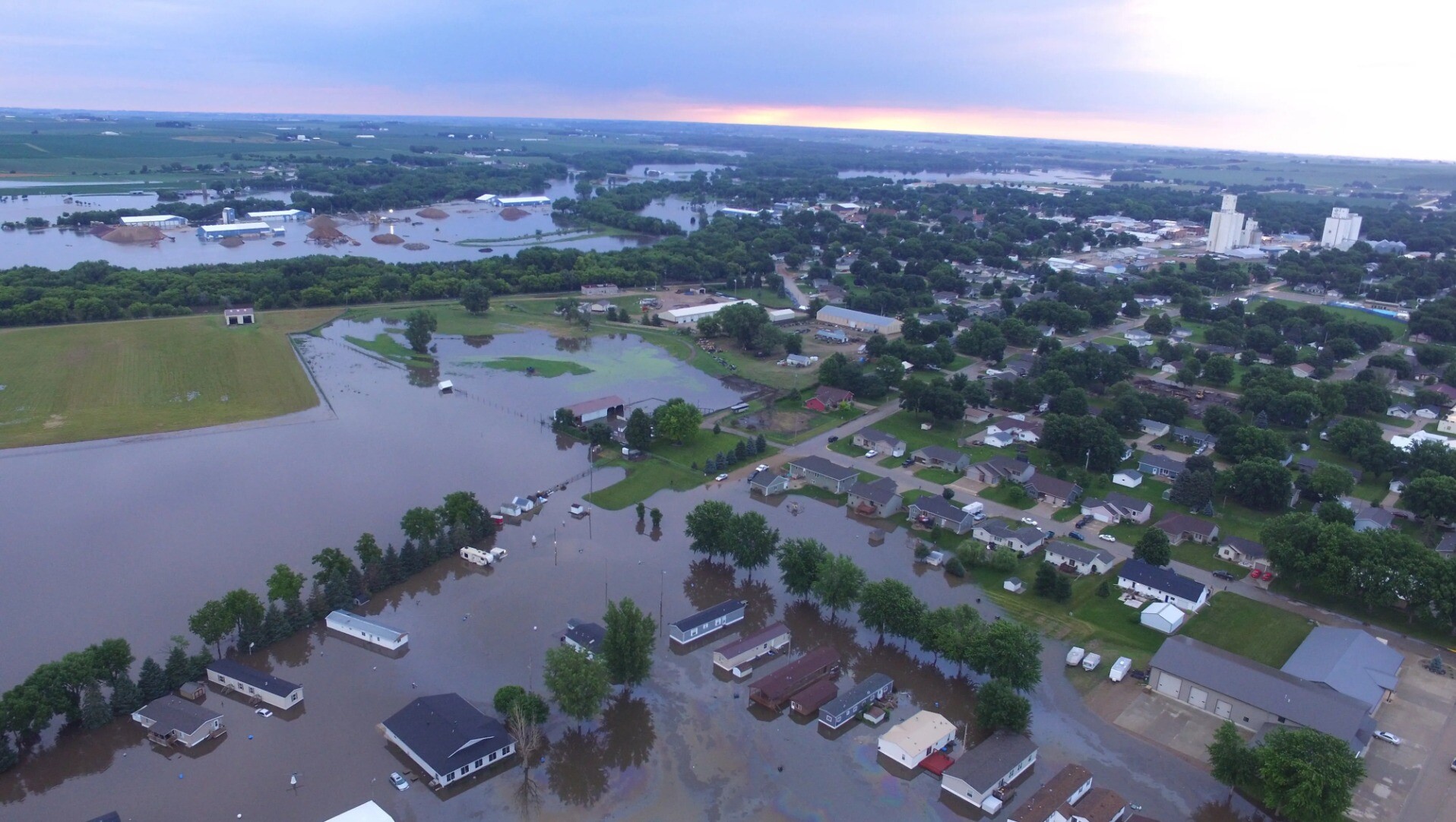
We're mapping areas affected by the flood in the southern region of Thailand. Click here to view the area on OpenStreetMap
#OpenStreetMap #disastermapping #disasterresponse #floodmapping #thailand #น้ำท่วมใต้67
We need your help! 📢
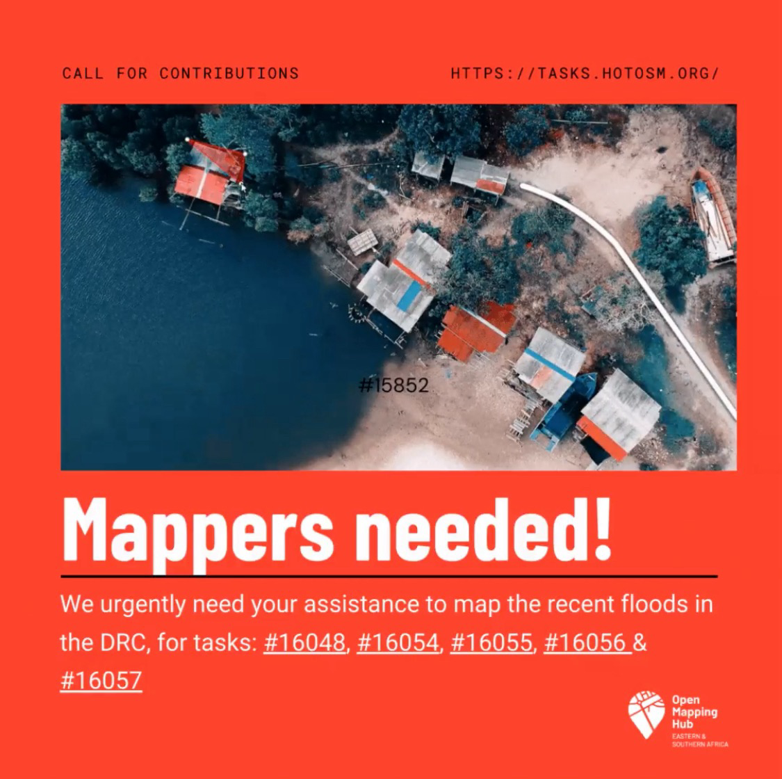
☎️🗺️Call for Mappers: We urgently need your assistance to map the recent floods in the DRC
https://tasks.hotosm.org/projects/16048
https://tasks.hotosm.org/projects/16054
https://tasks.hotosm.org/projects/16055
https://tasks.hotosm.org/projects/16056
https://tasks.hotosm.org/projects/16057
#DisasterResponse
#ESADisasterResponse
#DRCFloods
#DRCFloodResponse
#openstreetmap #humanitarian #openmapping #floodmapping #disastermapping
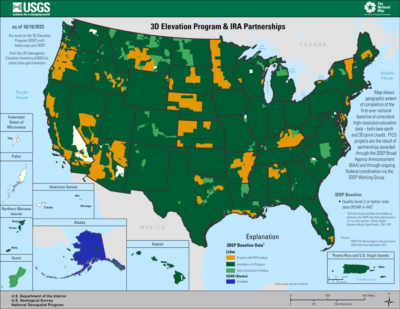
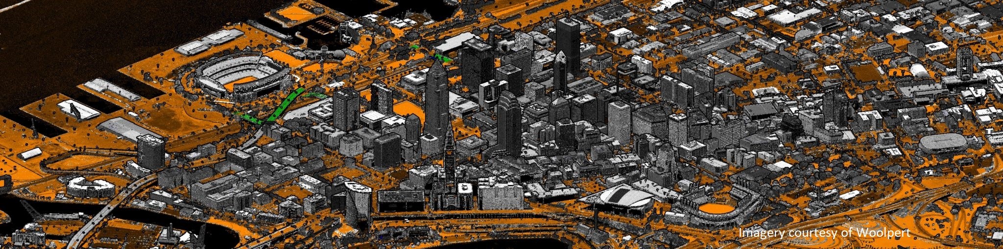
Inflation Reduction Act Accelerates USGS Effort To Collect High-Resolution Data Of Landscapes Across 25 States [3DEP LiDAR and other elevation open datasets]
--
https://www.usgs.gov/news/national-news-release/inflation-reduction-act-accelerates-usgs-effort-collect-high-resolution <-- USGS news release
--
#GIS #spatial #mapping #NGTOC #3DEP #elevation #lidar #ifsar #opendata #ira #infrastructure #USGS #CONUS #Alaska #topography #pointcloud #dem #costbenefit #roi #benefits #naturalresources #3delevationprogram #funding #seamless #1metre #topobathy #CoNED #tbdem #hydrospatial #bathymetry #landscapes #landcover #hydrology #riverbeds #precisionagriculture #floodmapping #flooding #ecosystems #partnerships
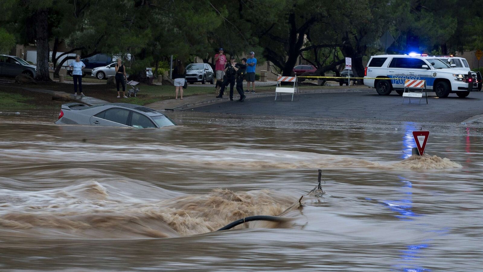
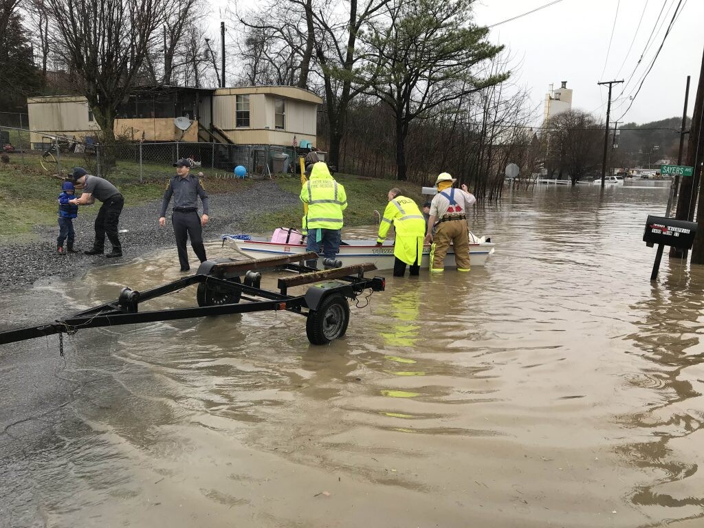
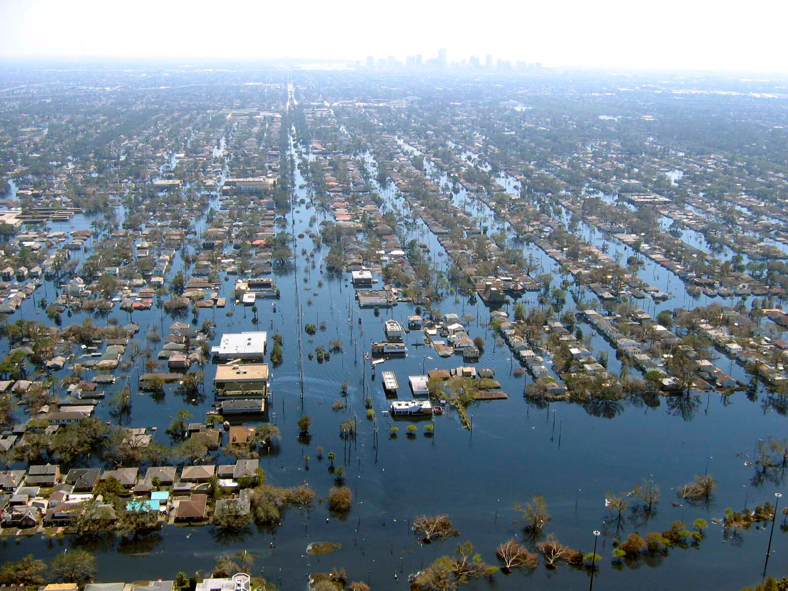
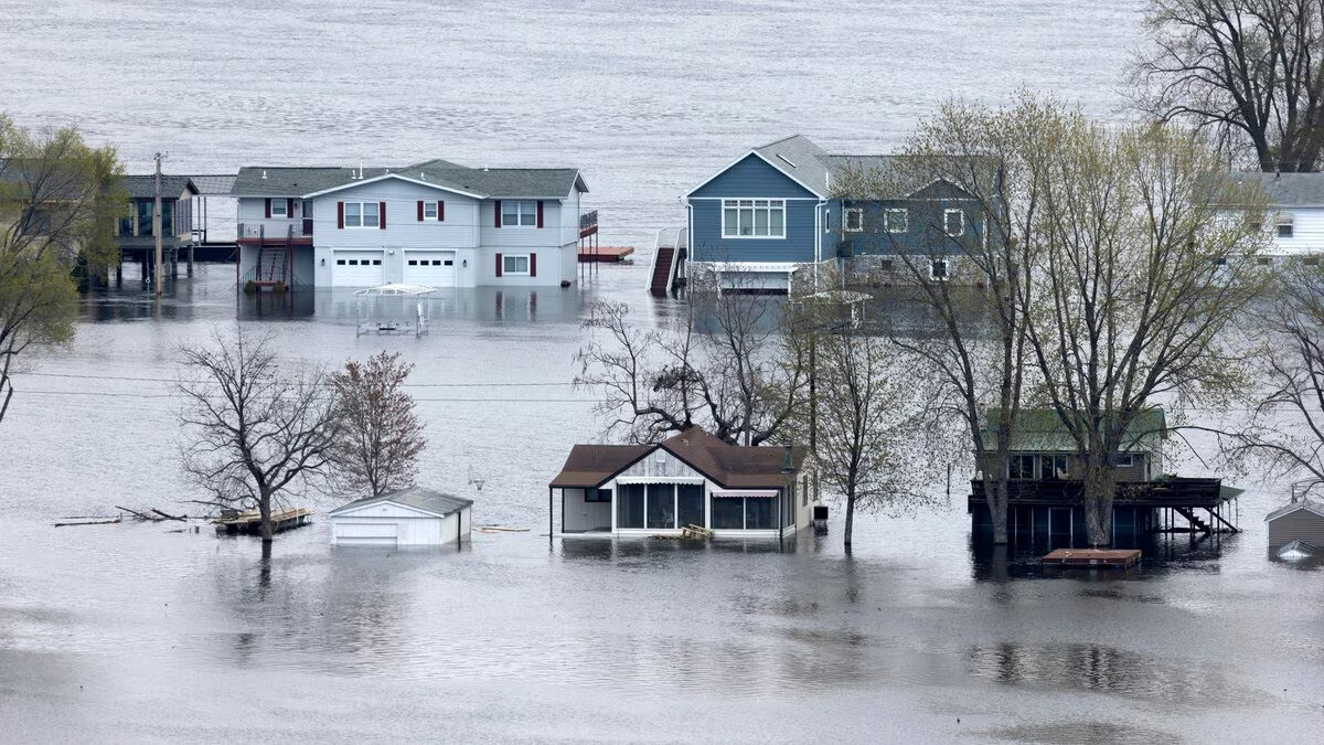
Climate Change And Crumbling Infrastructure Create A ‘Perfect Storm’ For Americans Living In Flood Zone
--
https://thehill.com/opinion/energy-environment/3978721-climate-change-and-crumbling-infrastructure-create-a-perfect-storm-for-americans-living-in-flood-zones/ <-- shared article
--
https://doi.org/10.1038/s41893-019-0437-5 <-- shared paper
--
#GIS #spatial #mapping # #infrastructure #realestate #sustainability #climatechange #people #development #future #property #tax #maintenance #engineers #concrete #work #model #modeling #flood #flooding #naturalhazard #naturalhazards #naturaldisaster #river #rivercontrol #floodmapping #floodzones #weather #mitigation #floodcontrol #planning #risk #hazard #levees #levee #dam #riverside #oceanside #community #coastalcommunities #coastalengineering #coastalresilience #natural #engineered #floodplains
Global News BC: Flood preparation investments made into B.C. communities by province, Canada https://globalnews.ca/news/9641770/flood-preparation-investments-made-into-b-c-communities-by-province-canada/ #globalnews #britishcolumbia #news #MinistryofEmergencyManagementandClimateReadiness #Governmentfloodinginvestment #BCfloodinginvestment #MinistryofForests #BCgovernment #floodmapping #Environment #BCFlooding #Politics #Science #Weather #BCFlood #Canada #Tech
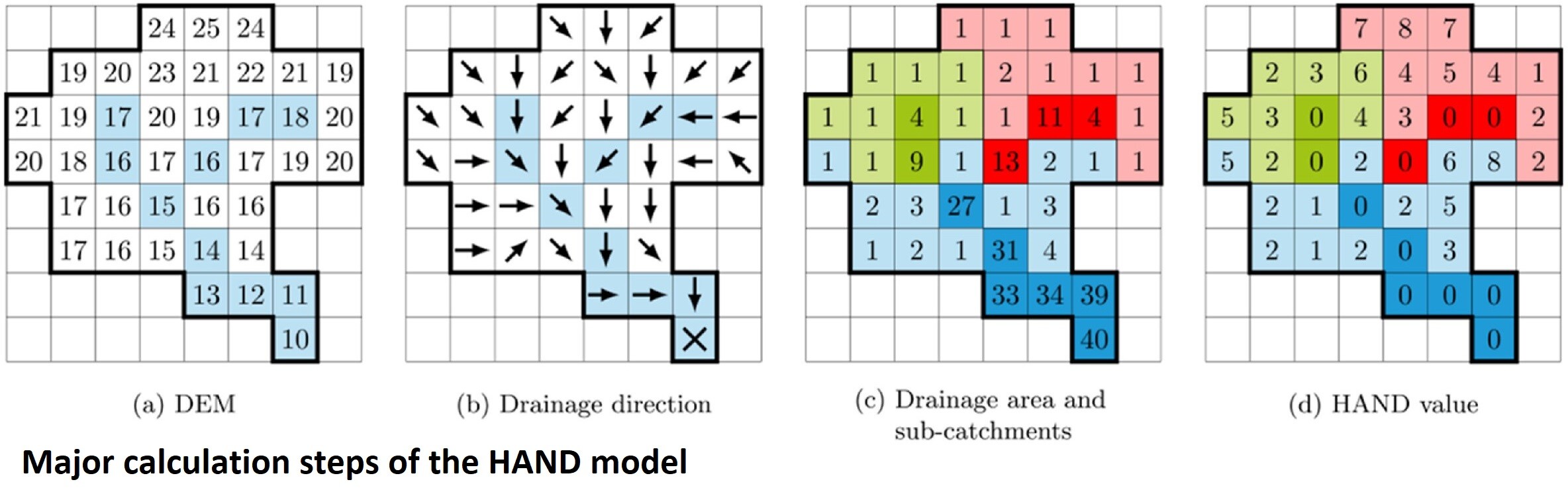
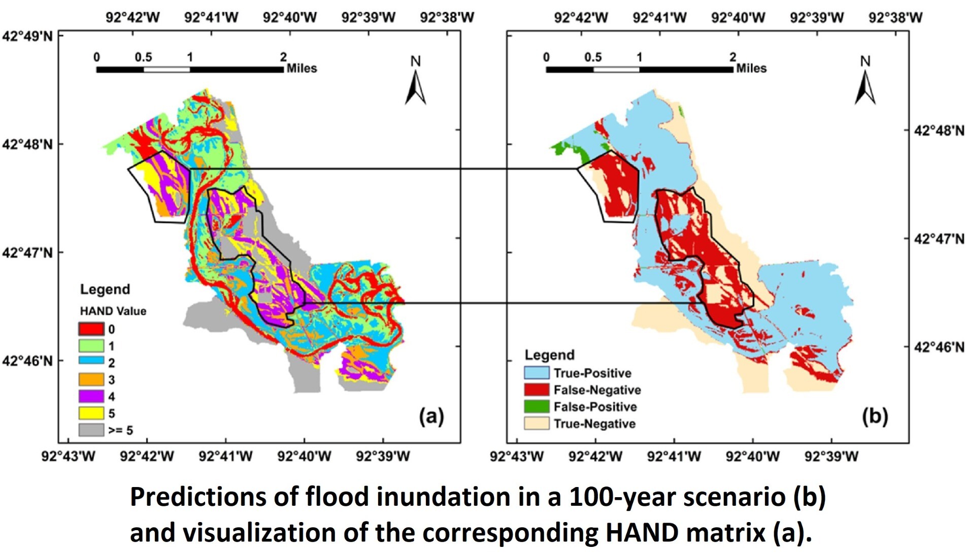
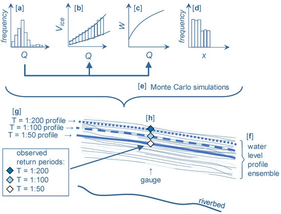
Comparative Analysis Of Performance And Mechanisms Of Flood Inundation Map Generation Using Height Above Nearest Drainage
--
https://doi.org/10.1016/j.envsoft.2022.105565 <-- shared paper
--
#GIS #spatial #mapping #model #modeling #flood #water #hydrology #floodinundation #floodinundationmapping #heightabovenearestdrainage #modelcomparison #modelconfiguration #performanceanalysis #FIM #HAND #NWC #NWM #hydrofabric #USA #nationwide #floodmapping #NWCH #NHD #NHDPlusHR #NHDPlus #inundation #weather #precipitation #catchment #ratingcurves #prediction #climate #NOAA @nws #USGS
Assessing and Mitigating Ice-Jam #Flood Hazards and Risks: A European Perspective
https://www.mdpi.com/2073-4441/15/1/76
It would certainly be interesting to organize a similar workshop in #Canada, with a lot of work on-going in #icejam #modeling, both from a #floodhazard and #floodrisk perspective
#hydrology #hydraulic #floodmapping #winter #ice #river #risk #FHIMP #NRCan #ECCC
Global News BC: Dealing with ‘erasure’: The role of Indigenous knowledge in drawing maps of Canada https://globalnews.ca/news/9342987/dealing-with-erasure-indigenous-knowledge-maps-canada/ #globalnews #britishcolumbia #news #Indigenouswaysofknowingandbeing #TraditionalEcologicalKnowledge #Indigenousprotectedareas #IndigenousEducation #IndigenousGuardians #Indigenousknowledge #Indigenousmapping #ClimateChange #ClimateCrisis #TheNewReality #biodiversity #floodmapping #roleofnature #Environment
Fantastic article about applications of flood mapping. I’m so excited about this! The potential is huge. Can’t find the original post this came from, please let me know if it was yours (lost in scrolling about 5 minutes ago). https://www.geospatialworld.net/prime/interviews/satellite-images-mitigate-flood-impacts/
#ClimateResilience #CommunityPlanning #CommunityRelocation #flood #FloodMapping #reolcation #SatelliteImagery
I am working on using natural language processing to detect urban flash flood events in local newspaper reports and map impacts at street/building level. I'd be really interested to hear from anyone who might have uses for this data in their work. For more details see:
https://www.climatenode.org/maps/about_UFF_maps.html
The new Historical #Flood Events data layer (HFE) is now LIVE in #Canada! And updated continuously using media records.
"With over 1400 flood events documented in over 7000 locations, the #NRCan Historical Flood Events data layer provides an accessible way to view the who, what, when, and where of historical flood events in Canada."
#floodriskmanagement #floodmapping #climatechange #resilience
#introduction
Good morning everyone!
Engineer specialized in #hydrology and #hydraulics, #flood mapping and #geospatial data
🌍✈️ Formerly at #Cowater, worked across the globe for about 10 years on #waterinfrastructure, #water resources management and #environment in a developing context
💧🛰️ Now working closer to home, focused on #floodriskmanagement and #floodmapping in #Canada with #NRCan #gischat #eochat
When not working: #photography, #F1 and spending time with the little family!