#srtm

2025-05-12

"ETOPO 2022 is an updated topographic–bathymetric dataset at 15 arcsec global resolution that incorporates bare-Earth datasets with forests and buildings removed. ETOPO 2022 integrates more than a dozen source datasets for land topography, sea bathymetry, lake bathymetry, and ice-sheet bed elevation data, all of which have been carefully evaluated for quality, accuracy, and seamless integration."

Quality controlled with nearly a trillion #ICESat2 #LIDAR shots.

Did some successful microwave keyhole shots back in the day, using #SRTM data. This would have been even better.
#DigitalElevationModel
#DEM

essd.copernicus.org/articles/1

#DLR:
"
Wie eine Space-Shuttle-Mission d. Erdbeobachtung revolutionierte

SRTM lieferte 2000 d. erste nahezu globale Höhenmodell d. Erde.
DLR prägte mit der Verarbeitung + Analyse d. Missionsdaten d. Fernerkundung.
Jubiläumsvideo mit exklusiven Einblicken von Astronaut Gerhard Thiele, Anke Pagels-Kerp + DLR-Experten ..
"
dlr.de/de/aktuelles/nachrichte

11.2.2025

#Endeavour #EO #Erdbeobachtung #Fernerkundung #Höhenmodell #Radar #Radarinterferometrie #Raumfahrt #SpaceFlight #SpaceShuttle #STS99 #SRTM

2025-02-11

25 Jahre SRTM-Mission zur 3D-Vermessung der Erdoberfläche 🚀🌍

Am 11. Februar 2000 startete die Shuttle Radar Topography Mission (#SRTM) ins All. Auf ihrem 11-tägigen Flug konnte sie erstmals fast die gesamte Erdoberfläche vermessen. Das DLR spielte eine zentrale Rolle bei der Verarbeitung und Analyse der gesammelten Daten. Diese Geländedaten sind bis heute von großer Bedeutung - für die #Wissenschaft und z.B. im Katastrophenschutz.

Mehr zur Mission in der DLR-Doku!
🎞️ s.dlr.de/SRTM25

Screenshot aus dem der DLR-Doku zur SRTM-Mission, die vor 25 Jahren startete. Zu sehen ist das Space Shuttle Endeavour, das senkrecht startet. Diese Szenerie ist auf einem alten Röhrenfernseher zu sehen.

From time to time I mess around with this little side project. It's a mashup of #python #panda3d #jsbsim #srtm terrain and online map tiles forming a simplistic flight simulator. I have been looking into #GeoDeep which can find trees and other objects in the imagery as an idea for populating the world with realistically placed objects.
youtube.com/watch?v=WR6JeLOauIY

2024-10-25

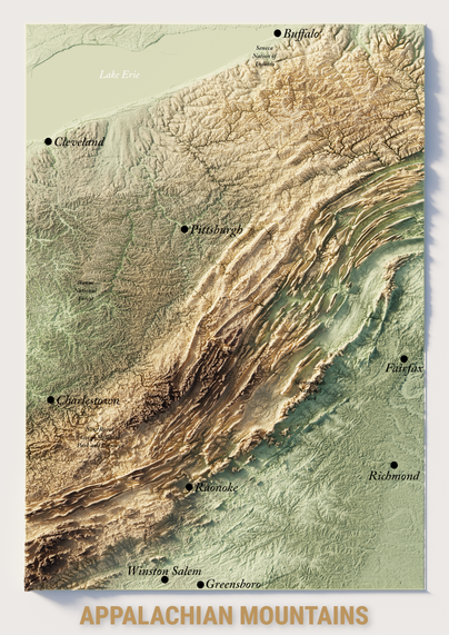
United States: the annotated version of Appalachian mountains :)

#Map #Mapping #3Dmap #Blender #BlenderMap #USA #Appalachian #Carte #Cartographie #3D #QGIS #SRTM #Beauty #Landscape

3D map, made with Blender, of the Appalachian mountains (colorized in green and brown, fonction of the heitght).
2024-10-25

⛰️United States: the Appalachians and its folded mountains. Personally I find this relief fascinating. These folded mountains in the USA are impressive. 🇺🇸

⛰️ Personnellement je trouve ce relief fascinant. Ces montagnes plissées, aux USA, sont impressionnantes.

#USA #Appalaches #Blender #QGIS #3D #Maps #blender3d #maps #cartographie #SRTM #Art #topography

Shuttle Radar Topography Mission (SRTM) view of Appalachians mountains.3D map, made with Blender, of the Appalachians mountains (black and white).3D map, made with Blender, of the Appalachians mountains (colorized in green and brown, fonction of the heitght).
2024-09-09

Wochenrückblick, Ausgabe 57 (2024-36).

marcusjaschen.de/blog/2024/202

Themen:

🗺️ Hochauflösendes Geländemodell für bikerouter.de

🐘 Bikerouter auf Mastodon

📃 Long Read: HTML Whitespace is Broken

🔡 Routed Gothic Font

🛫 Departure Mono Font

🍎 Die macOS-Apps mit „V“: Visual Studio Code, Vivaldi, VLC

🔊 In dieser Woche gehört: Karlo Kurbel, Anahit Vardanyan, Wildschreck, Bizzarro Universe, Gizmo

#Wochenrückblick #Bikerouter #SRTM #DTM #Mastodon #HTML #WebDevelopment #Font #macOS #VLC #Vivaldi #VisualStudioCode #Techno

marcusjaschen.de/blog/2024/202

2024-09-02

Wochenrückblick, Ausgabe 56 (2024-35).

marcusjaschen.de/blog/2024/202

Themen:

🗺️ Bikerouter bekommt ein hoch aufgelöstes Geländemodell für Europa

💻 Umzug des Ensembles aus Mosquitto, Zigbee2MQTT, Telegraf, InfluxDB und Grafana auf den neuen Raspberry Pi 5

🔌 Der mittlerweile dritte Delock-Schaltsteckdoseneinsatz wandert auf Grund eines hochfrequenten Pfeifens in den Elektroschrott

🌳 Rotdorn-Bäume mit dem zweiten Satz Blätter und Blüten in diesem Jahr

🍎 Die macOS-Apps mit „U“

🔊 In dieser Woche gehört: Lowski, Lena Brysch, Milla Lou, Kölsch, Markus Schulz, SHA, Naicet & zaharaa drekk

#Bikerouter #SRTM #RaspberryPi #Mosquitto #Zigbee2MQTT #Telegraf #InfluxDB #Grafana #Delock #MacOS #Ultraschall #Techno

marcusjaschen.de/blog/2024/202

Marcos Dionemdione@en.osm.town
2024-07-23

I was wondering if my method for calculating slopes and hillshades was wrong because I was seeing bad pixelation in Iceland:

grulic.org.ar/~mdione/glob/pos

My suspicion was that my method was right, but that #gdal's warping implementation was crappy, which made no sense.

Today tweaking my map style once again I was a zone close to 60N, which is the cut-line for #SRTM data, and I wondered... I don't know what #mapzen used as source there, but it was BAD. Back to #EU-DEM, maybe...

#dem #gis

Relief map at 60N. Below we can see SRTM based data being more or less smooth all over, but above 60N we see big chunky pixels, which points to issues in the original data.
💧🌏 Greg CocksGregCocks@techhub.social
2024-04-30

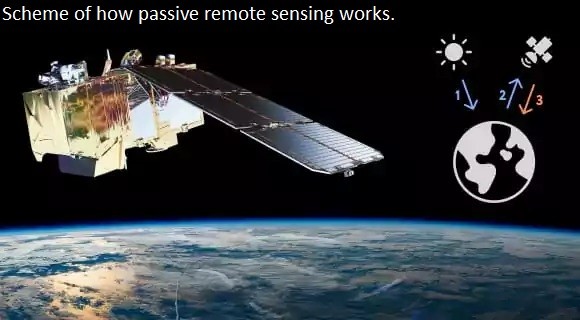
Types Of Remote Sensing - Devices And Their Applications [broad overview]
--
eos.com/blog/types-of-remote-s <-- shared technical article
--
[sharing of this blog post should not be considered an endorsement of this company]
#GIS #spatial #mapping #remotesensing #earthobservation #overview #tutorial #instrumentation #satellite #devices #implementations #radar #laser #sensors #usecase #appliedscience #RADARSAT #TerraSARX #SRTM, #EOSDA #ERS #Sentinel #LANDSAT #insar #ifsar #LiDAR

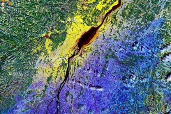
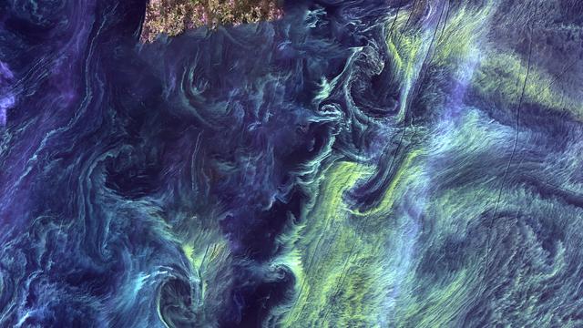
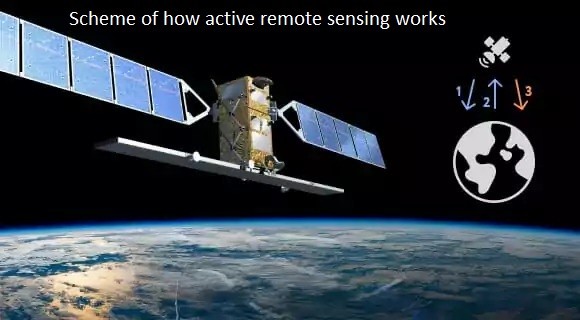
image - Scheme of how active remote sensing worksimage - Scheme of how passive remote sensing workssatellite imagery examplesatellite imagery example
2024-01-25

Explore the SRTM15_PLUS dataset, a combination of SRTM topography data and ETOPO1 ocean floor data, in a 3D globe #srtm

portal.gplates.org/cesium/?vie

Eugene Alvin Villar 🇵🇭seav@en.osm.town
2023-11-22

For the first time this challenge, I fully used #QGIS to render the map. In previous maps, I would create a simple HTML+JS-based map or do the final polishing in GIMP or Inkscape. This time, I used QGIS to render and style symbols+labels, and used the Print Layout feature to add the surrounding texts.

Data sources:
▪︎ Base raster map and water outlines from #NaturalEarth
▪︎ DEM data for hillshading from #SRTM via #Mapzen’s terrain tiles
▪︎ Ultras data from Peaklist: peaklist.org/WWlists/ultras/ph

2/2

2023-11-21

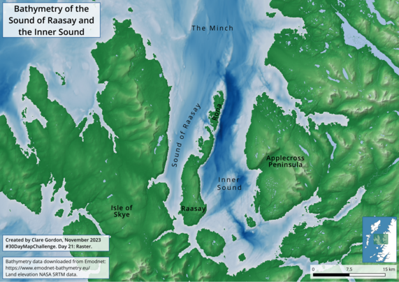
Day 21: Raster. Bathymetry of the Sound of Raasay and the Inner Sound, also showing the elevation of the Isle of Skye and Applecross Peninsula. I combined data from NASA and bathymetry data from emodnet-bathymetry.eu/ in . Exported the layout and added the labels in . The deep water on the east of Rona shows why the lovely sheltered harbour is on the west of the island.

A map of the sea between the Isle of Skye and the Scottish Mainland.  Elevation is shown for the land, bathymetry for the sea with the deepest water in the Inner Sound between Raasay and Applecross.
2023-11-20

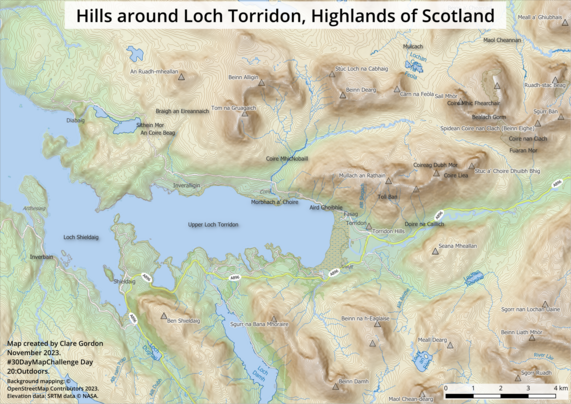
Day 20: Outdoors. Our favourite place to be outdoors is Torridon in the North West Highlands of Scotland. Here is a map of the hills around Loch Torridon. Data from and . Made in .

Map of the hills around Loch Torridon in the Highlands of Scotland showing contours, hill names and colours to emphasise the hills surrounding the Loch.
Pedro Fernandespfernandes
2023-02-11

Looked up the latest coordinates to get accest to files to be used on the, slowly being documented, repository github.com/apfernandes/NASA-SR

Pedro Fernandespfernandes
2023-01-06
Pedro Fernandespfernandes
2023-01-01

data with red showing 5m rising of the oceans. Interesting Mastodon screws video aspect ratio

Pedro Fernandespfernandes
2023-01-01

Getting back on my data visualization explorations.

Client Info

Server: https://mastodon.social
Version: 2025.04
Repository: https://github.com/cyevgeniy/lmst