Towards A Simpler Assessment Of The Environmental Impact Of Hydrographic Echosounders
--
https://ihr.iho.int/articles/towards-a-simpler-assessment-of-the-environmental-impact-of-hydrographic-echosounders/ <-- shared paper
--
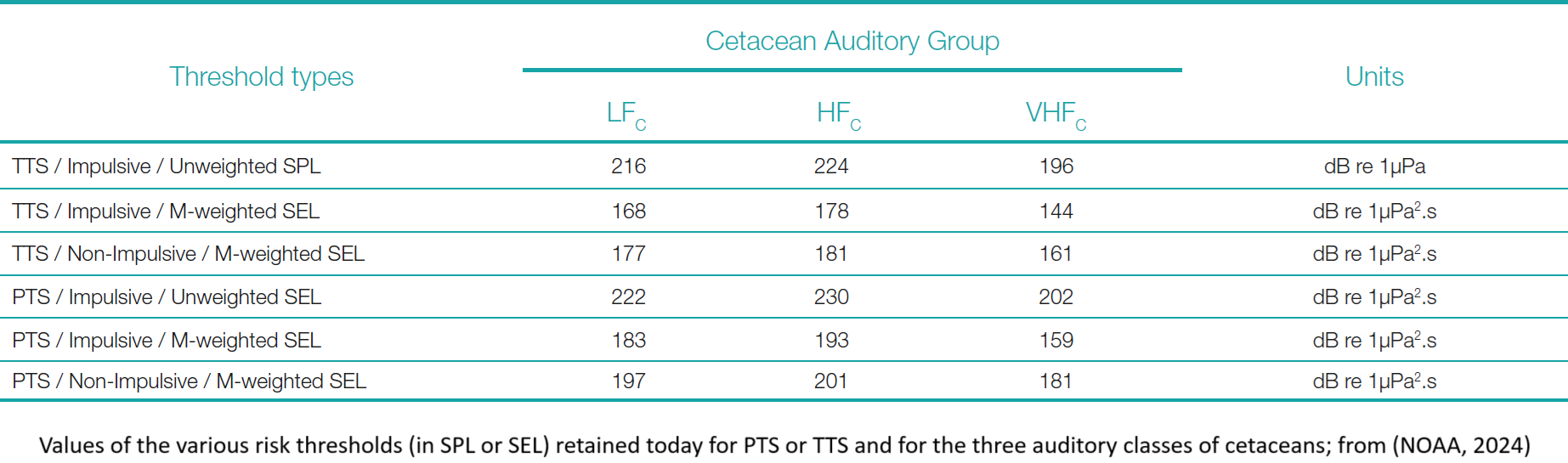
https://www.fisheries.noaa.gov/s3/2024-05/NMSFAcousticGuidance-DraftTECHMEMOGuidance-3.0-FEB-24-OPR1.pdf <-- shared NOAA 2024 guidance
--
https://doi.org/10.1098/rspb.2020.0070 <-- shared paper
--
#GIS #spatial #mapping #communityhydrography #echosounder #environmentalimpact #hydrography #marinemammals #whales #cetaceans #survey #impacts #humanimpacts #logistics #management #planning #ecosystems #seafloor #sonar #remotesensing #marine #animals #risk #hazard #multibeam #model #modeling #impactassessment #riskassessment #auditory #fish #habitat #strandings
#multibeam
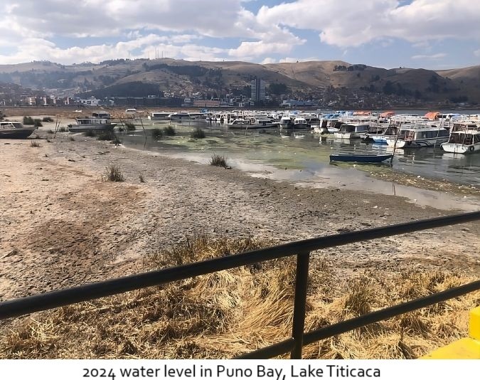
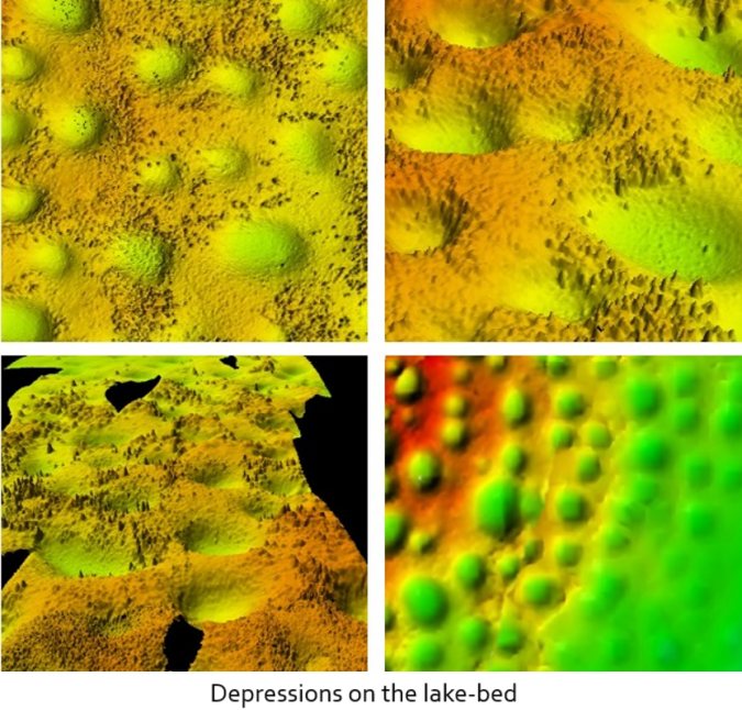
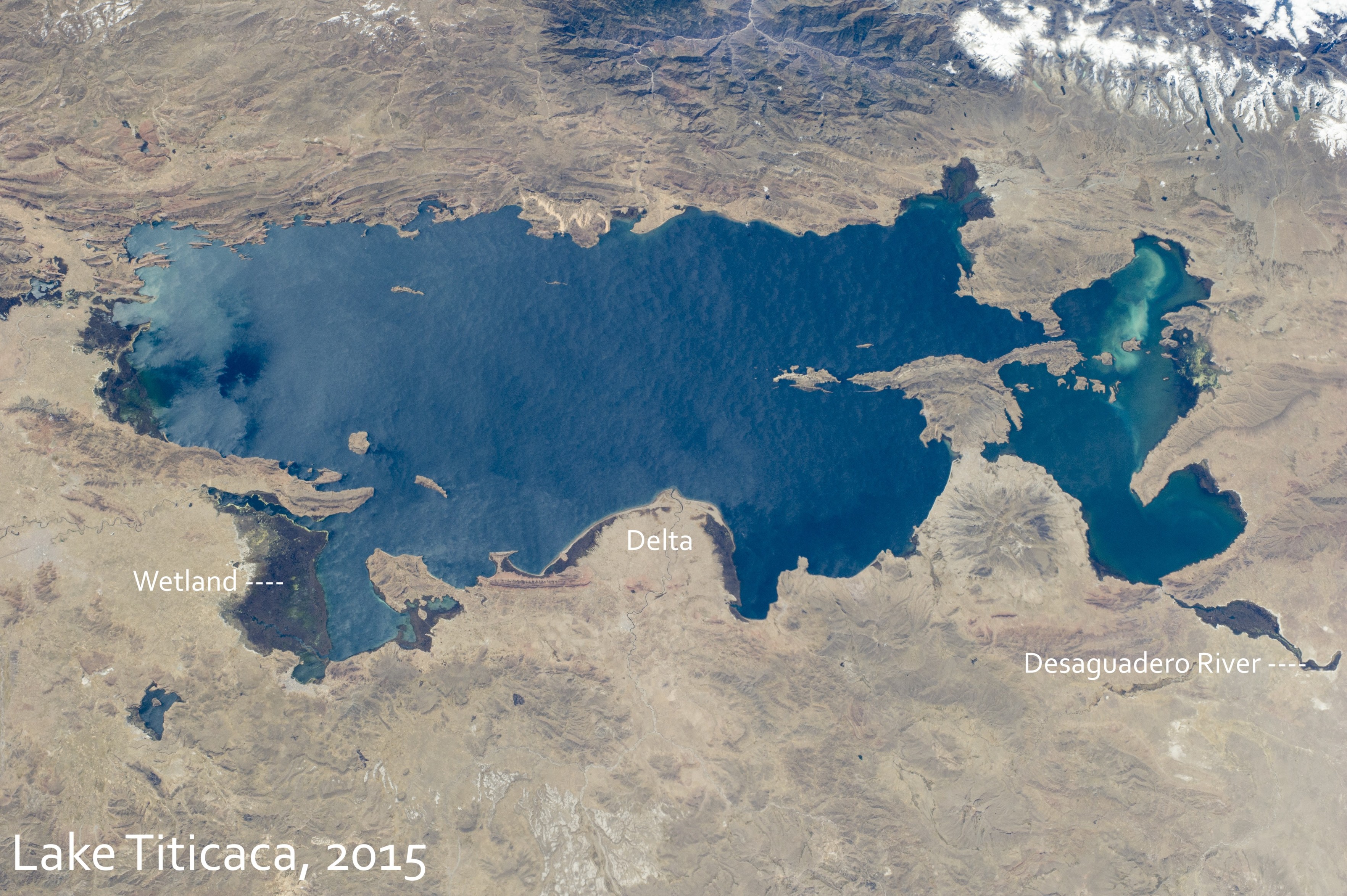
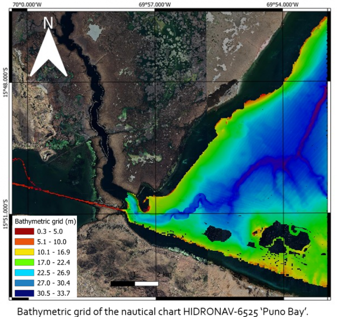
Surveying Lake Titicaca [2024]
--
https://www.hydro-international.com/content/article/surveying-lake-titicaca <-- shared technical article
--
[A very comprehensive hydrographic and shallow geophysical study and mapping effort of Lake Titicaca…]
“In October 2024, officers from the Category “A” Specialization Programme in Hydrography for Naval Officers of the Peruvian Navy conducted their complex multidisciplinary field project at Lake Titicaca at Puno in Peru, which is the highest navigable lake in the world (3,800 metres above sea level). The purpose of this survey was to address issues in the lacustrine environment due to hydrological processes that have occurred in recent years in this water body.…”
#GIS #spatial #mapping #hydrospatial #hydrology #hydrography #LakeTiticaca #Bolvia #Puno #Peru #PeruvianNavy #lake #remotesensing #survey #lacustrine #vertical #multibeam #echsounder #sonar #geomatics #cartography #QGIS
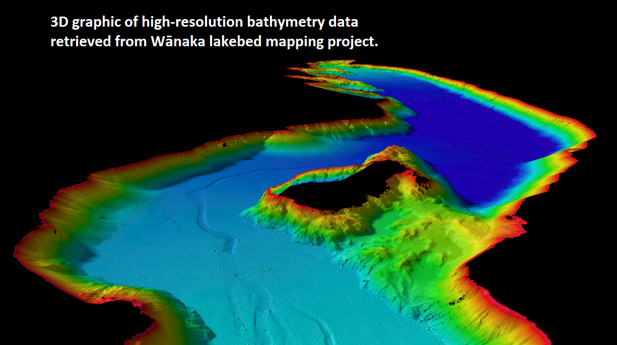
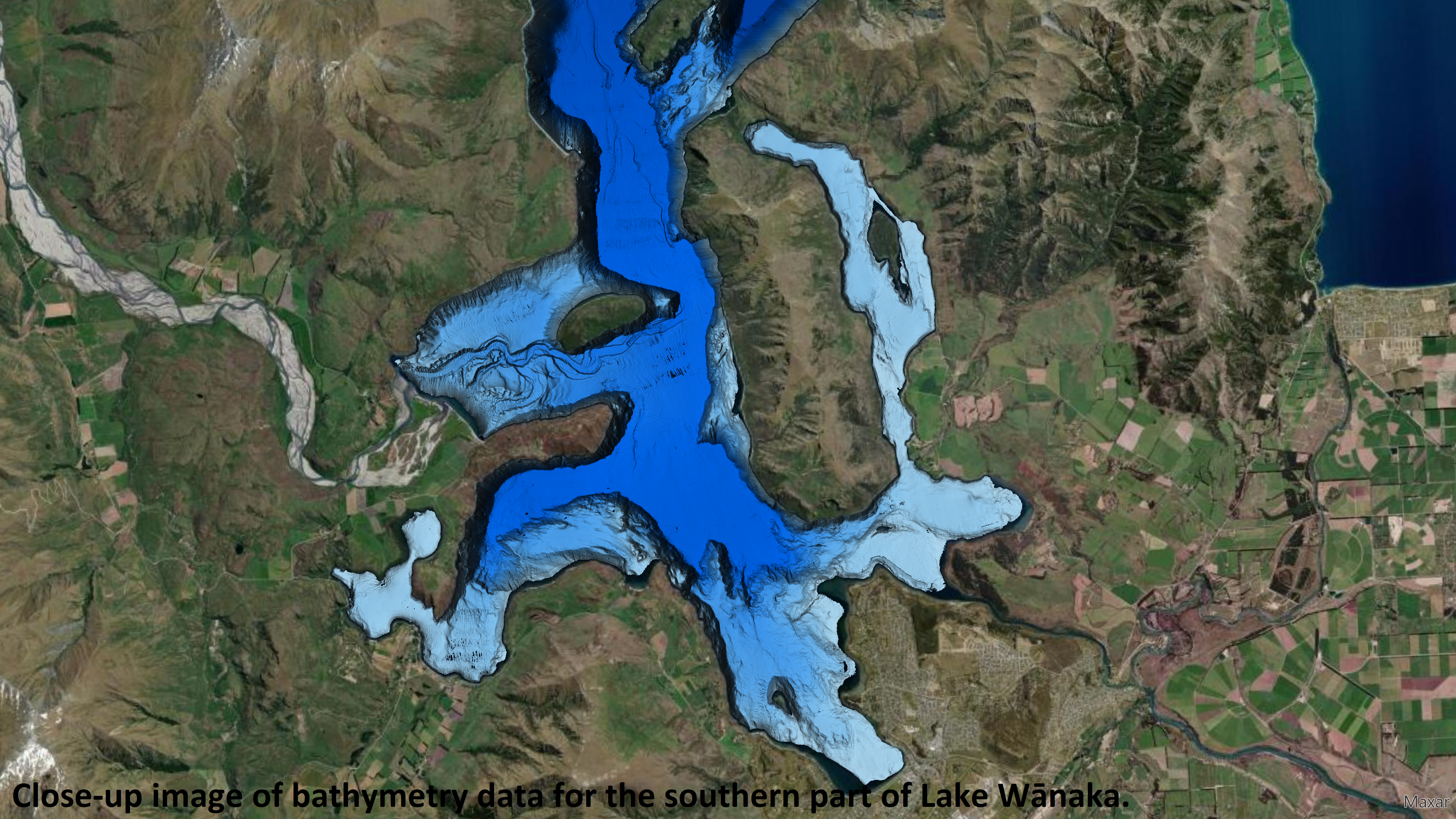
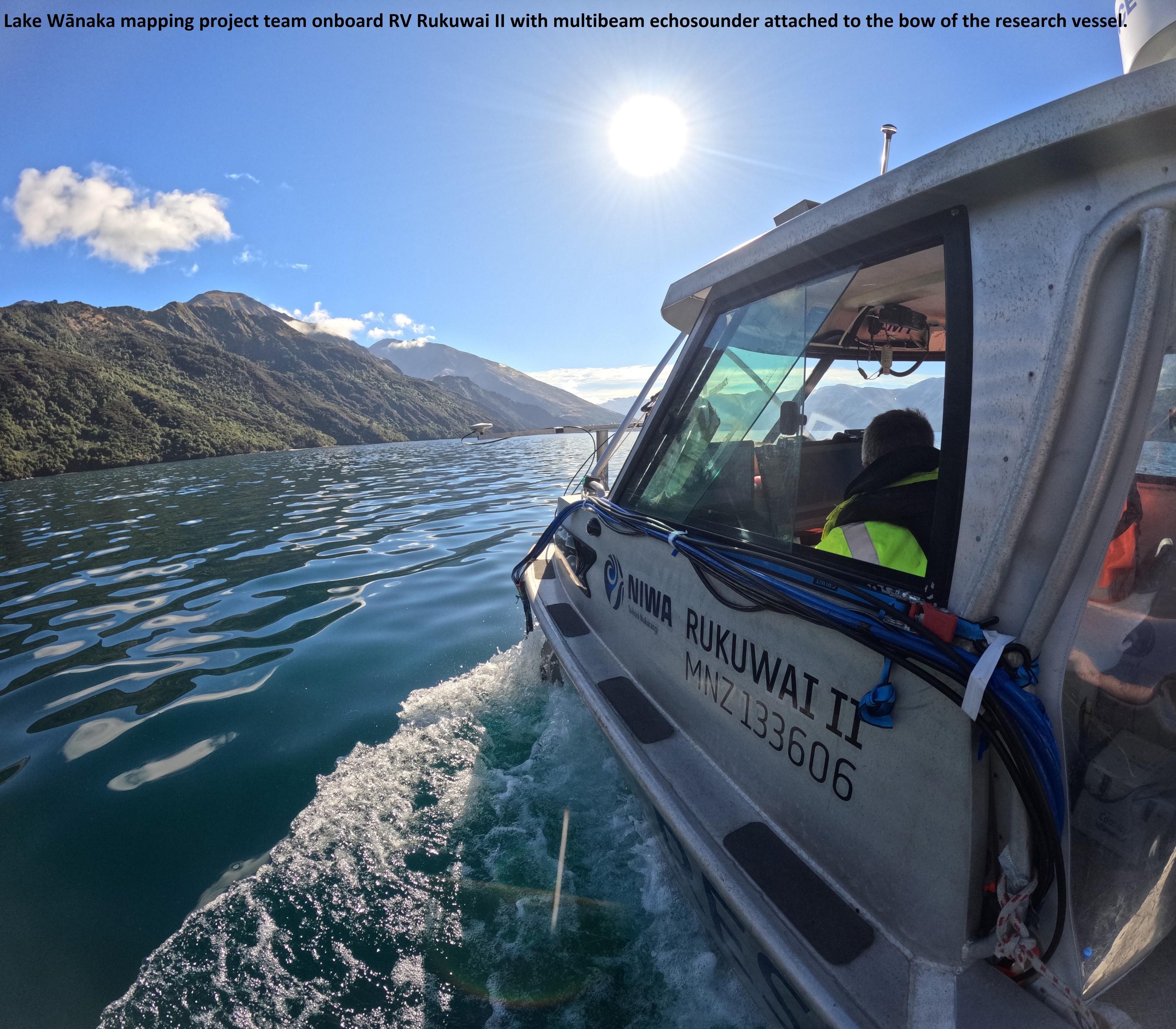
Lake Wānaka Mapped In Exquisite Detail [topobathy, New Zealand]
--
https://niwa.co.nz/news/lake-wanaka-mapped-exquisite-detail <-- shared technical article
--
#GIS #spatial #mapping #hydrospatial #bathymetry #remotesensing #LakeWanaka #Wanaka #NewZealand #topobathy #lake #floor #water #hydrology #survey #underwater #geology #geomorphometry #earthquake #fault #faulting #NIWA #lakebed #glacial #glacier #multibeam #echosounder #3dmodel #waterquality #landuse #freshwater #nutrients #sediment #sedimentation #climatechange #model #modeling #catchments #hydrodynamics
@niwa_nz

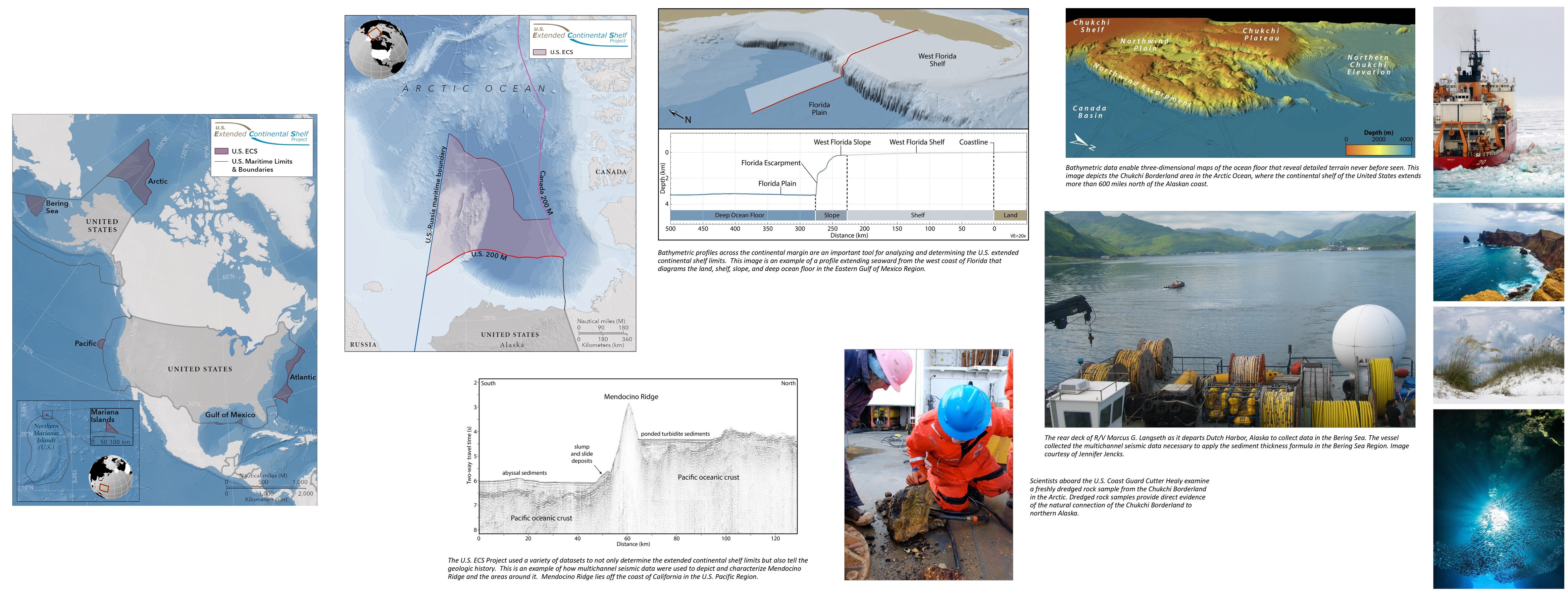
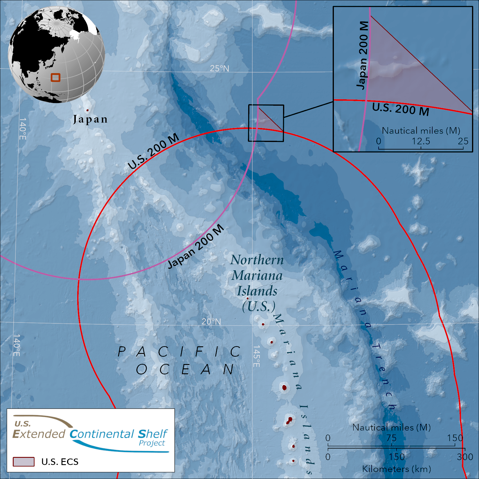
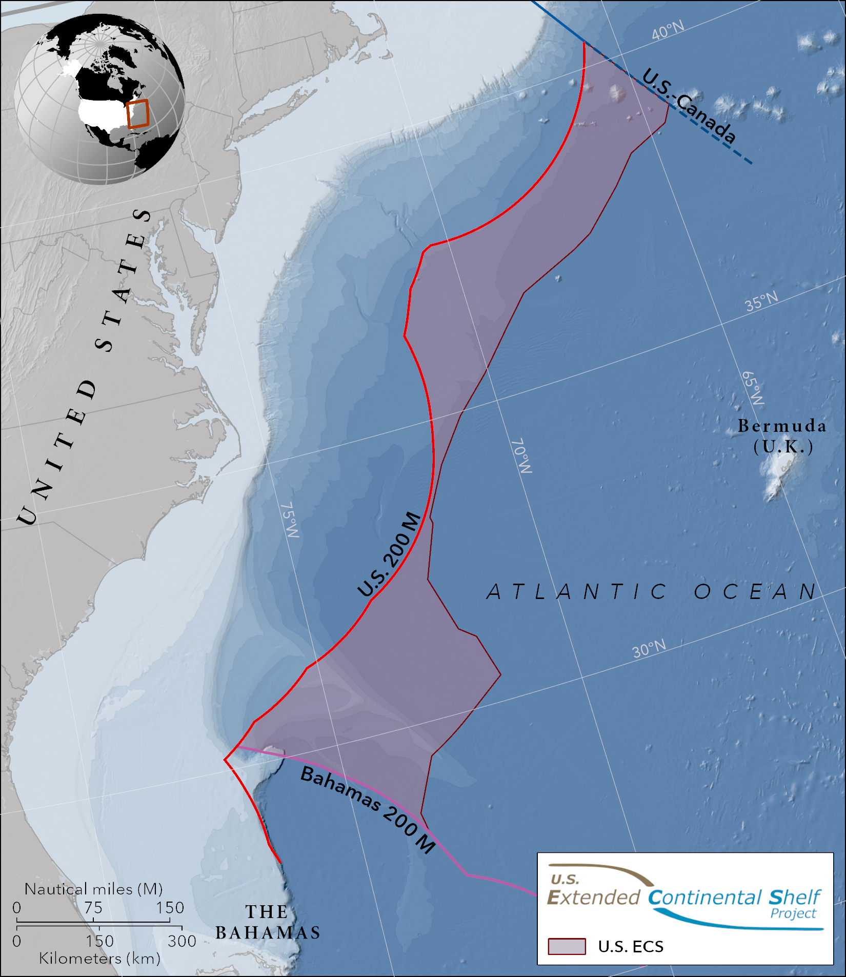
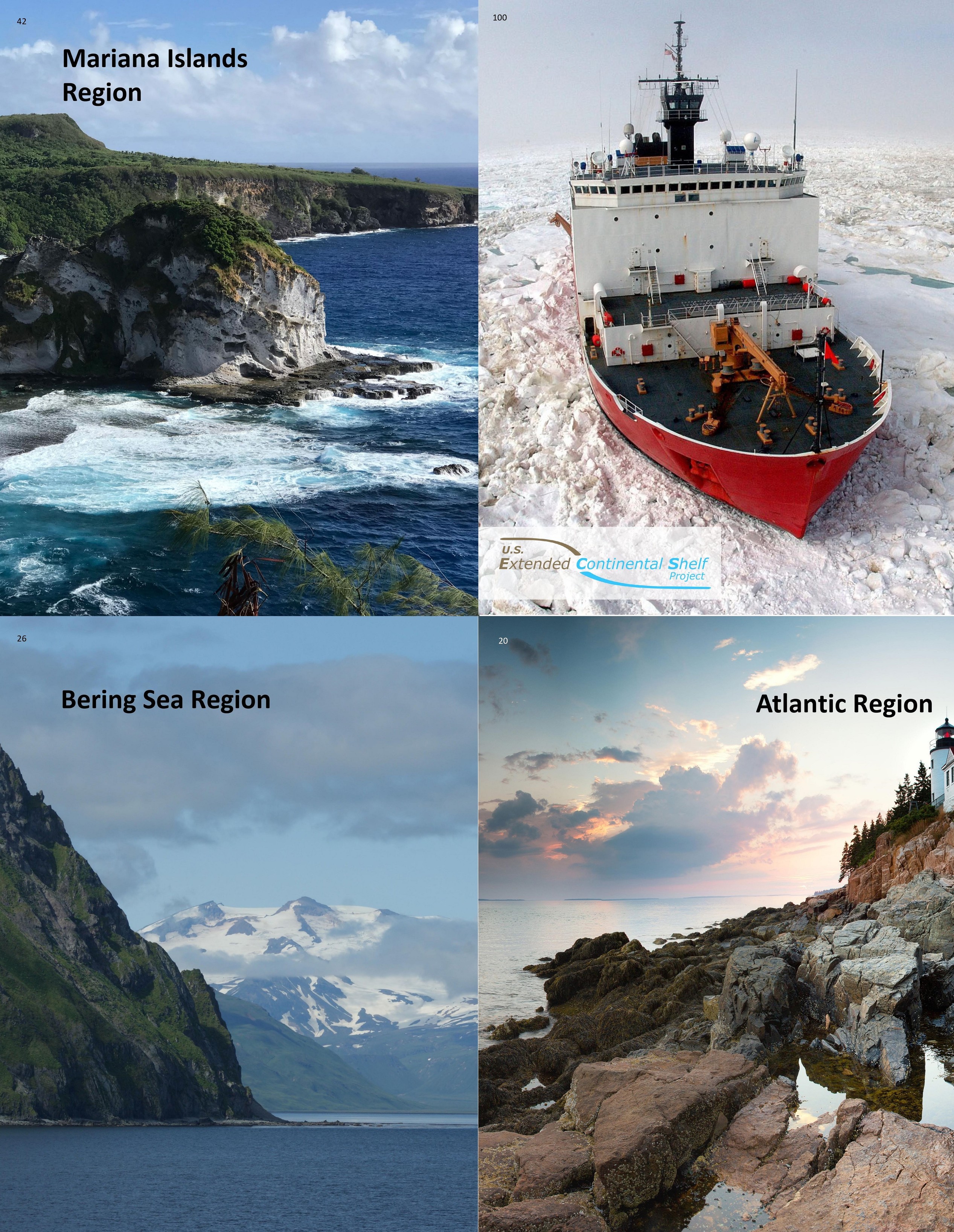
Continental Shelf Maps Could Add Egypt-Size Area To U.S. Territory – A Two-Decade Mapping Effort Yields Bounty Of Seafloor Data
--
https://www.science.org/content/article/continental-shelf-maps-could-add-egypt-size-area-u-s-territory <-- shared technical article
--
https://www.state.gov/the-us-ecs/ <-- US Dept. Of State Extended Continental Shelf (ECS) project page
--
#GIS #spatial #mapping #ECS #ExtendedContinentalShelf #remotesensing #hydrospatial #bathymetry #bathy #topobathy #sonar #seafloor #economics #terrority #underseamapping #geology #biology #resources #energy #continental #continentalshelf #governmentinitiative #biodiversity #exploration #habitat #geoscience #minerals #submarine #mudslides #tsunami #sediments #deposition #seafloormapping #marine #ocean #multibeam #3d #sampling
@USGS @NOAA @StateDept
The Geomorphology Of Ireland’s Continental Shelf [mapping, remotesensing]
--
https://www.tandfonline.com/doi/full/10.1080/17445647.2023.2283192 <-- shared technical article
--
https://atlas.marine.ie <-- Irish Marine Atlas
--
#GIS #spatial #mapping #remotesensing #geomorphology #geomorphometry #Ireland #geology #ISSGM #opendata #Irish #continentalshelf #INFOMAR #multibeam #echosounder #sonar #seabed #bathymetry #topobathy #elevation #interpretation #digitalmap #marine #atlas #IrishShelf #machineassisted #machinelearning #coast #coastal #offshore
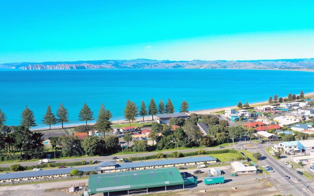
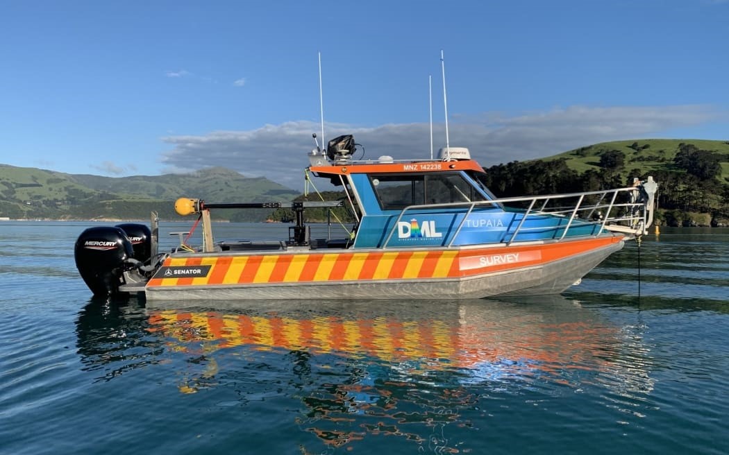
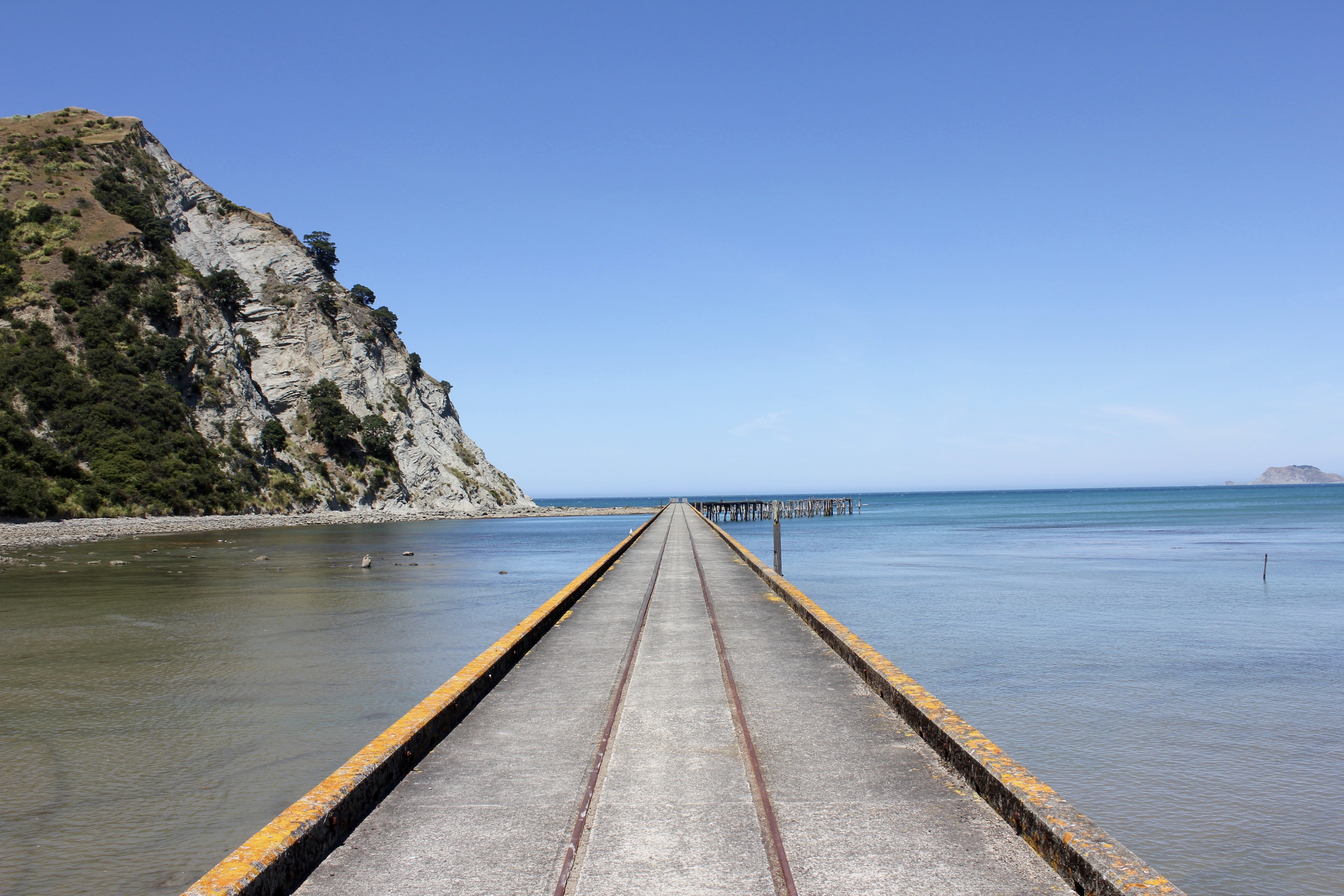
Mapping The Poverty Bay Seabed Like Never Before [New Zealand]
--
https://www.rnz.co.nz/news/ldr/501907/mapping-the-poverty-bay-seabed-like-never-before <-- shared media article
--
https://data.linz.govt.nz/ <-- LINZ data service website
--
#GIS #spatial #mapping #bathymetry #NewZealand #PovertyBay #Gisborne #remotesensing #multibeam #sonar #opendata #datacollection #usecase #navigation #marine #marinesurvey #nauticalcharts #charts #LINZ
@LINZ

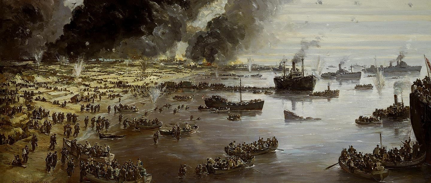
Survey Shows Striking Legacy Of 'Operation Dynamo' On The Seabed Off Dunkirk [remote sensing]
--
https://historicengland.org.uk/whats-new/news/survey-shows-striking-legacy-of-operation-dynamo/ <-- shared technical article
--
#GIS #spatial #mapping #remotesensing #bathymetry #shipwreck #history #historic #multibeam #sonar #echosounder #WorldWar2 #WW2 #WWII #Dunkirk #evacuation #OperationDynamo #survey #seafloor #marine #Archaeology #MarineArchaeology #geophysics #Drassm #HistoricEngland
@Drassm_Culture @HistoricEngland
Bathymetric Data Viewer [global, NOAA]
--
https://www.ncei.noaa.gov/maps/bathymetry/ <-- spatial open data web portal
--
“NCEI and the IHO Data Center for Digital Bathymetry (DCDB) archive and share depth data acquired by hydrographic, oceanographic, and industry vessels and platforms during surveys or while on passage. These data, which are used in several national and international mapping bathymetry projects, are free to the public with no restrictions…”
#GIS #spatial #mapping #remotesensing #bathmetry #global #opendata #openaccess #download #NCEI #DCBD #NOAA #elevation #sonar #water #hydrography #hydrospatial #webportal #science #spatialanalysis #DEM #data #digital #multibeam #survey #visualisation #BAG #raster #GEBCO #GMRT #IBSCO #GSHHG
@NOAA @NCEI @GEBCO
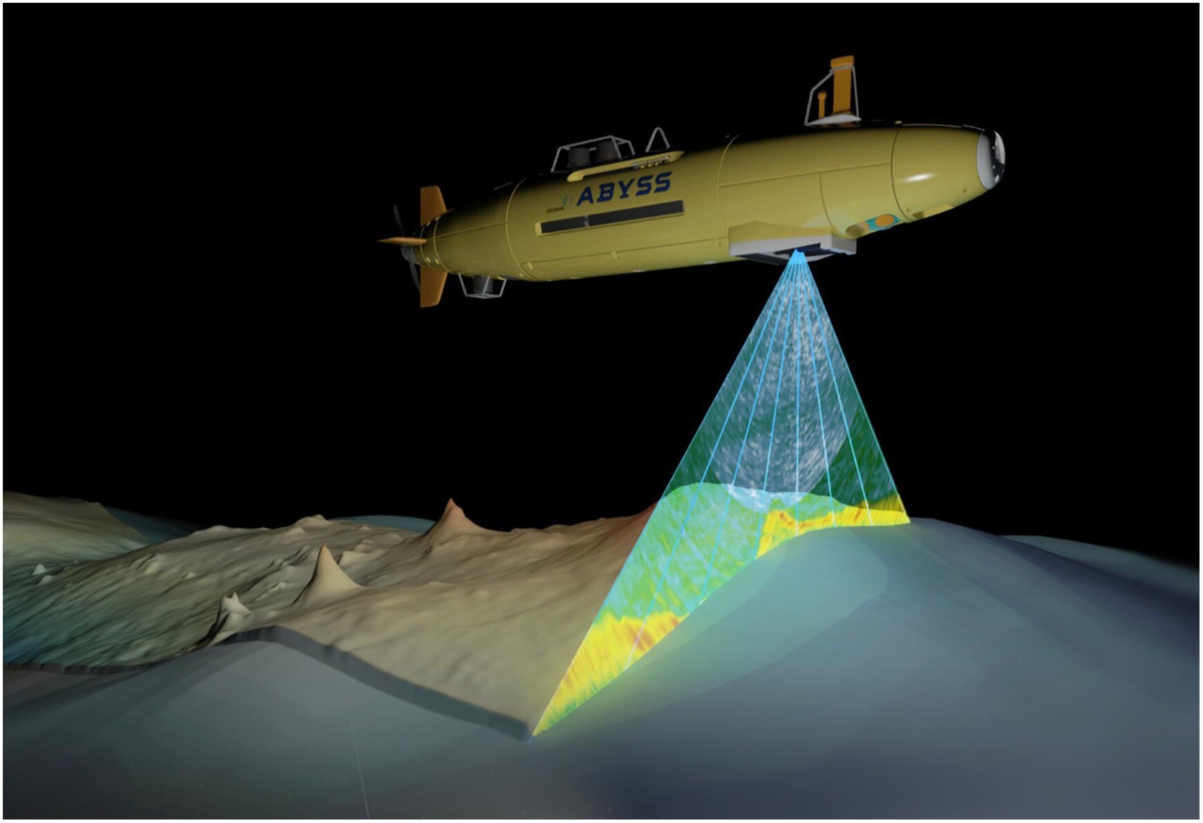
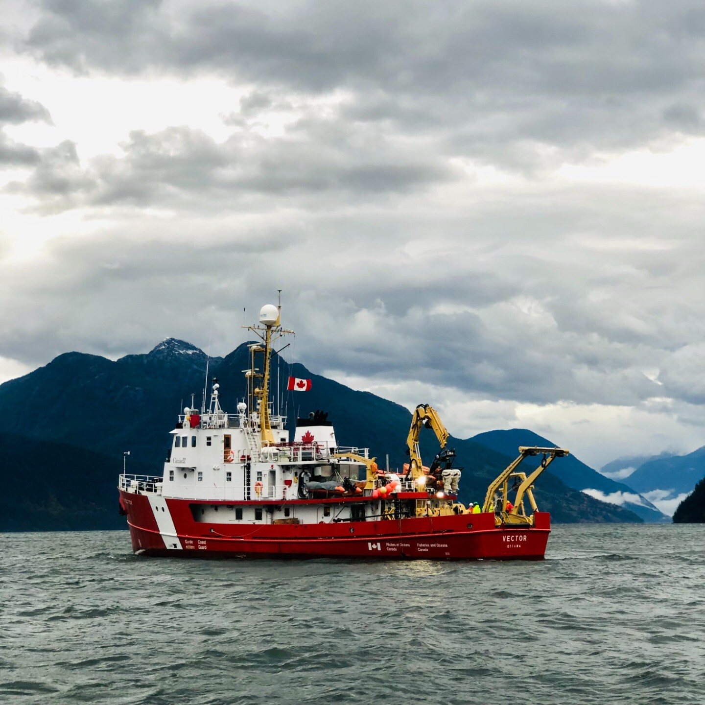
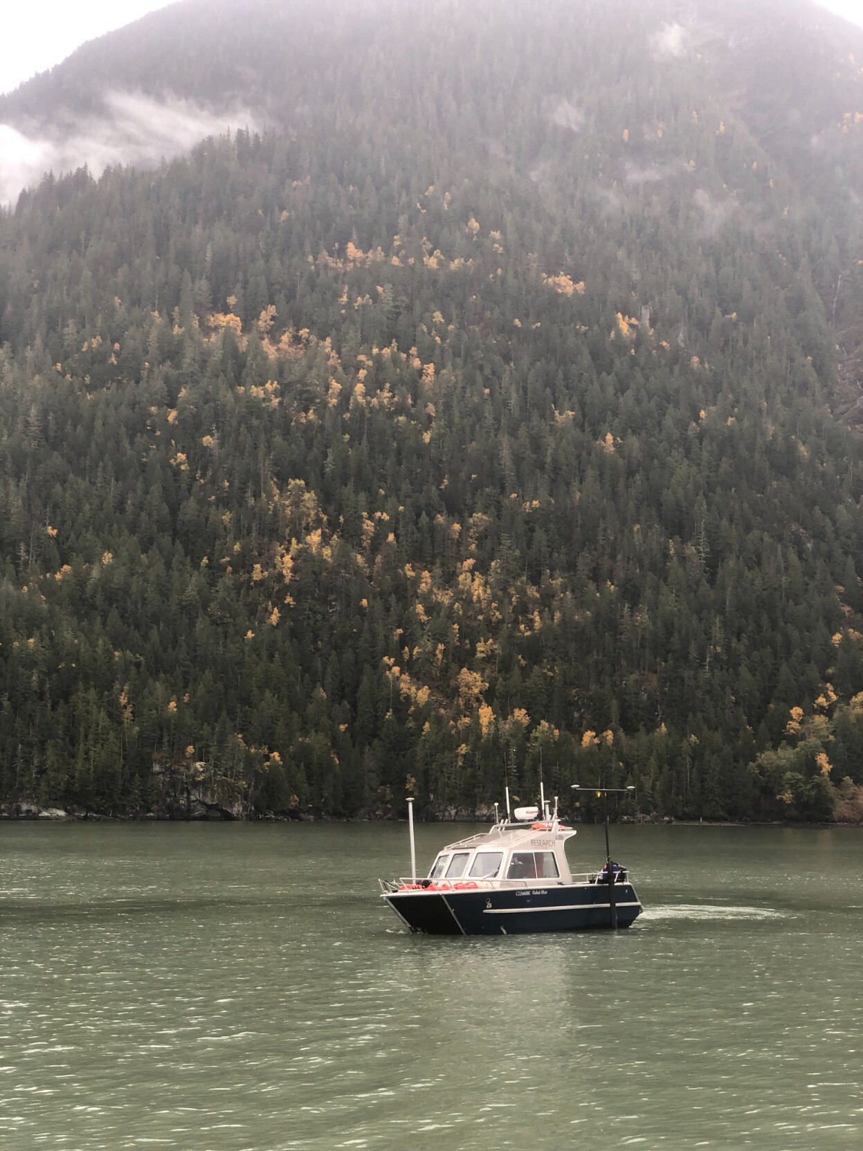
Last fall, Mike Tilston and I joined #HakaiInstitute to survey the upper part of the fjord with a #multibeam sonar to study the #geomorphic impacts of the turbidity current. We were joined by #GeologicalSurveyofCanada
and #CoastGuard, who surveyed the rest in their much bigger ship the #Vector.