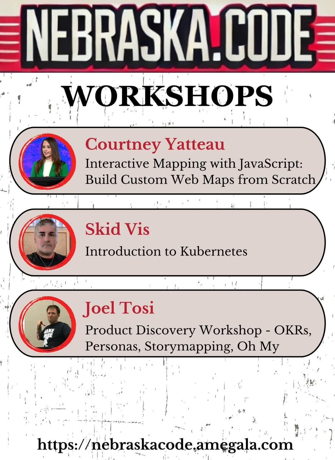
Courtney Yatteau, Skid Vis, and Joel Tosi have Full-Day Workshops this July at Nebraska.Code().
https://nebraskacode.amegala.com/
#javascript #kubernetes #OKRs #Technology #StoryMapping #TechWorkshop #lincoln
#TechConference #WebMaps @joeltosi
Courtney Yatteau, Skid Vis, and Joel Tosi have Full-Day Workshops this July at Nebraska.Code().
https://nebraskacode.amegala.com/
#javascript #kubernetes #OKRs #Technology #StoryMapping #TechWorkshop #lincoln
#TechConference #WebMaps @joeltosi
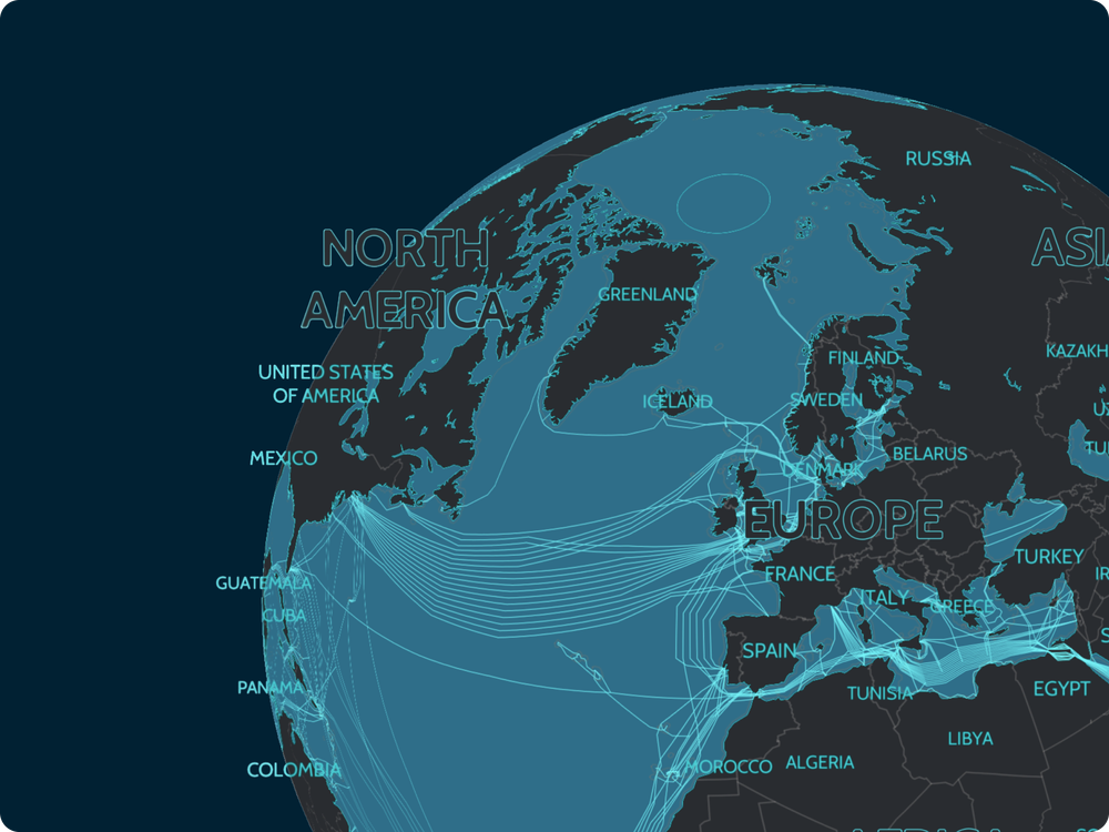
Highlight the global nature of your data, like undersea cables, by putting them on an actual globe! We have made it really easy to switch your existing maps; simply set the projection to globe. Find out more on the blog: maptiler.link/3E8CjSU #JavaScript #TypeScript #WebMaps #WebGL #Globe
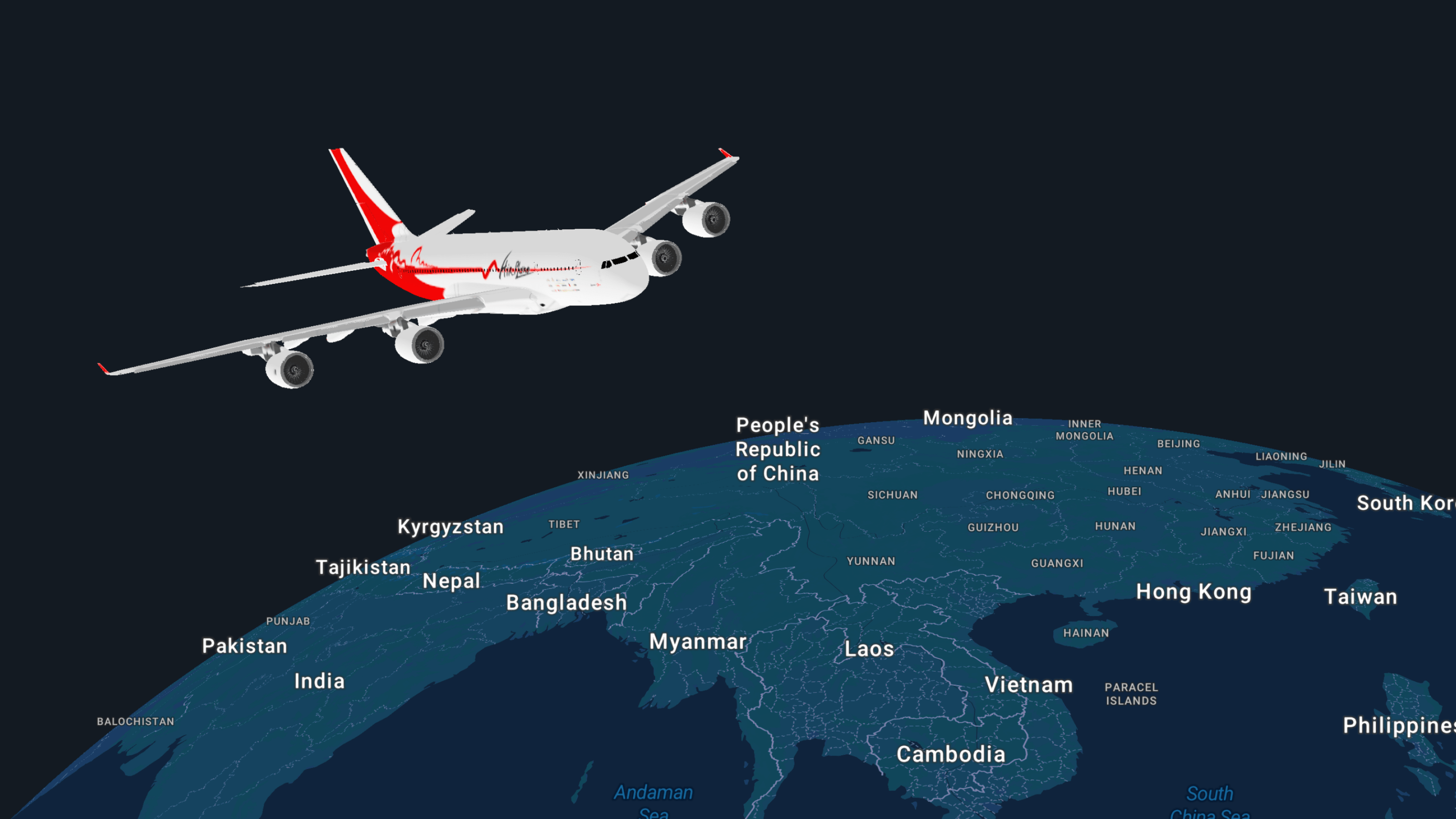
Animate flight paths with a 3D plane on a globe using the MapTiler SDK! Find out how: https://maptiler.link/3WwaQB7 #JavaScript #TypeScript #WebMaps #WebGL #Globe
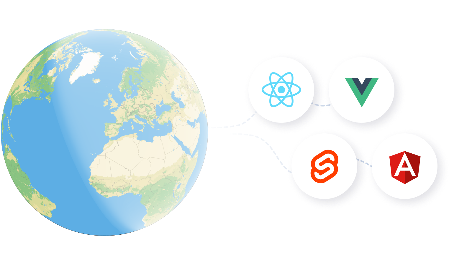
Create #3D globes in all the popular JavaScript frameworks like #React, #Angular, #Svelte, #Vue, and #Vite! Check out our code examples to get started: https://maptiler.link/42ovJSk #JavaScript #TypeScript #WebMaps #WebGL #Globe
Go global with the MapTiler SDK! Find out just how easy it is to add a 3D globe to a website or app! Read more: https://maptiler.link/3WxkZxn #JavaScript #TypeScript #WebMaps #WebGL #Globe
Turn your flat map into a globe with a single line of code! The MapTiler SDK makes it so easy to display maps on a 3D planet, just as nature intended! Start here: https://maptiler.link/40mZi46 #JavaScript #TypeScript #WebMaps #WebGL
Try out the Static maps generator! Visualize and fine-tune your map idea before using Static maps via API in production; the generator helps you understand how the API call is constructed. Start exploring: https://maptiler.link/42mOcyF #MapStyling #WebMaps
3D Globe maps using a JavaScript SDK! Show your maps on a 3D globe with a single line of code! Read all about it here: https://maptiler.link/4jimwBb #WebMaps #Globe #WebGL
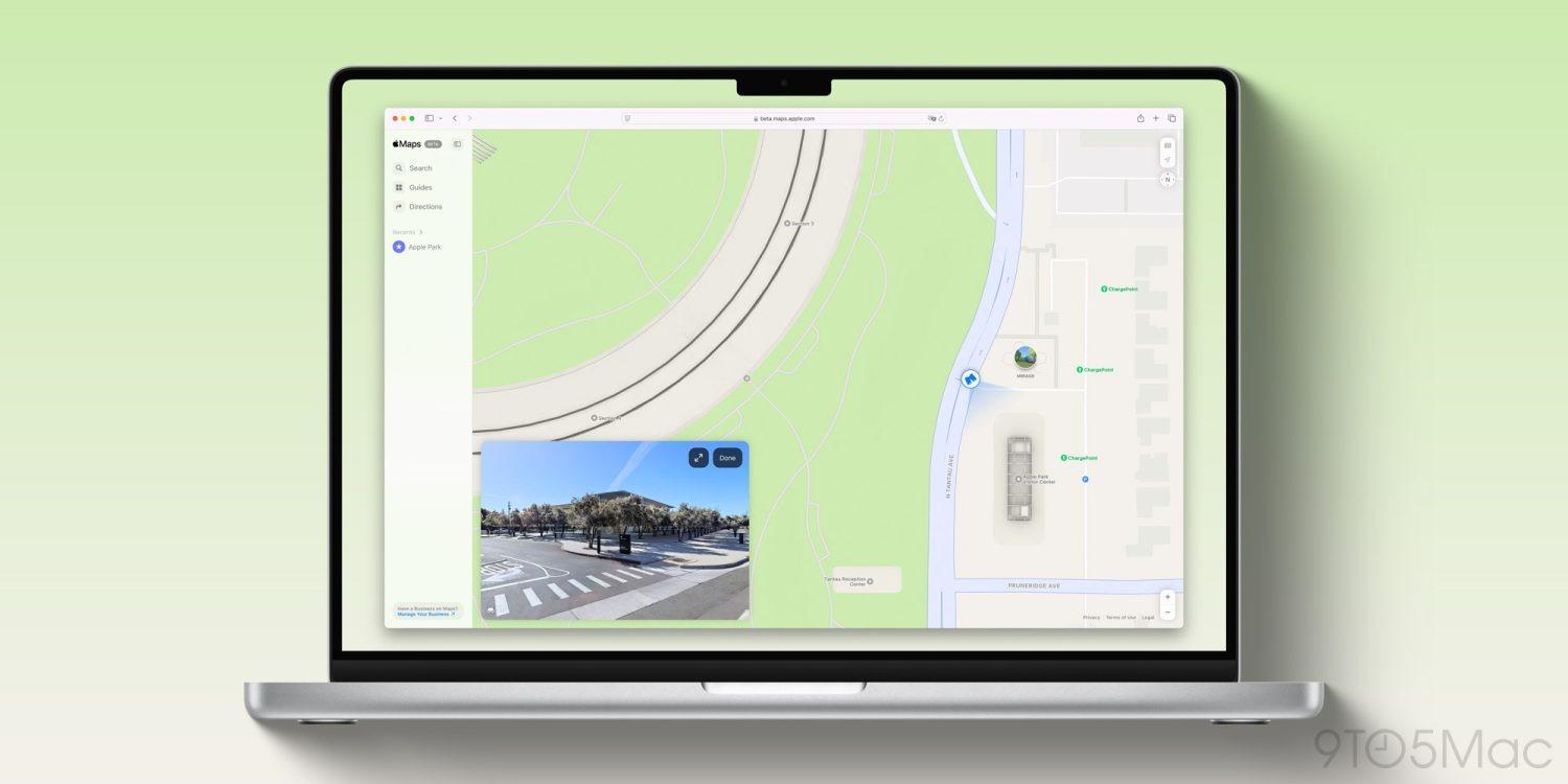
Apple Maps on the web now supports Look Around, Apple’s answer to Google Street View, offering immersive street-level navigation. #AppleMaps #LookAround #StreetView #WebMaps #TechNews #Apple #DigitalNavigation #MappingTechnology #Web3 #Innovation #Geolocation
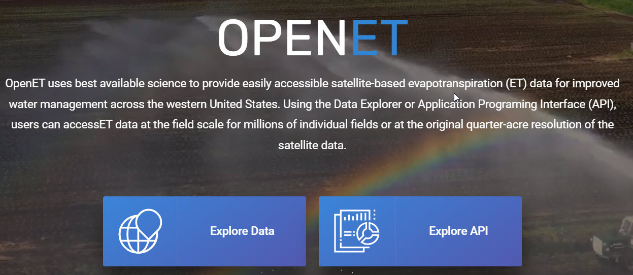
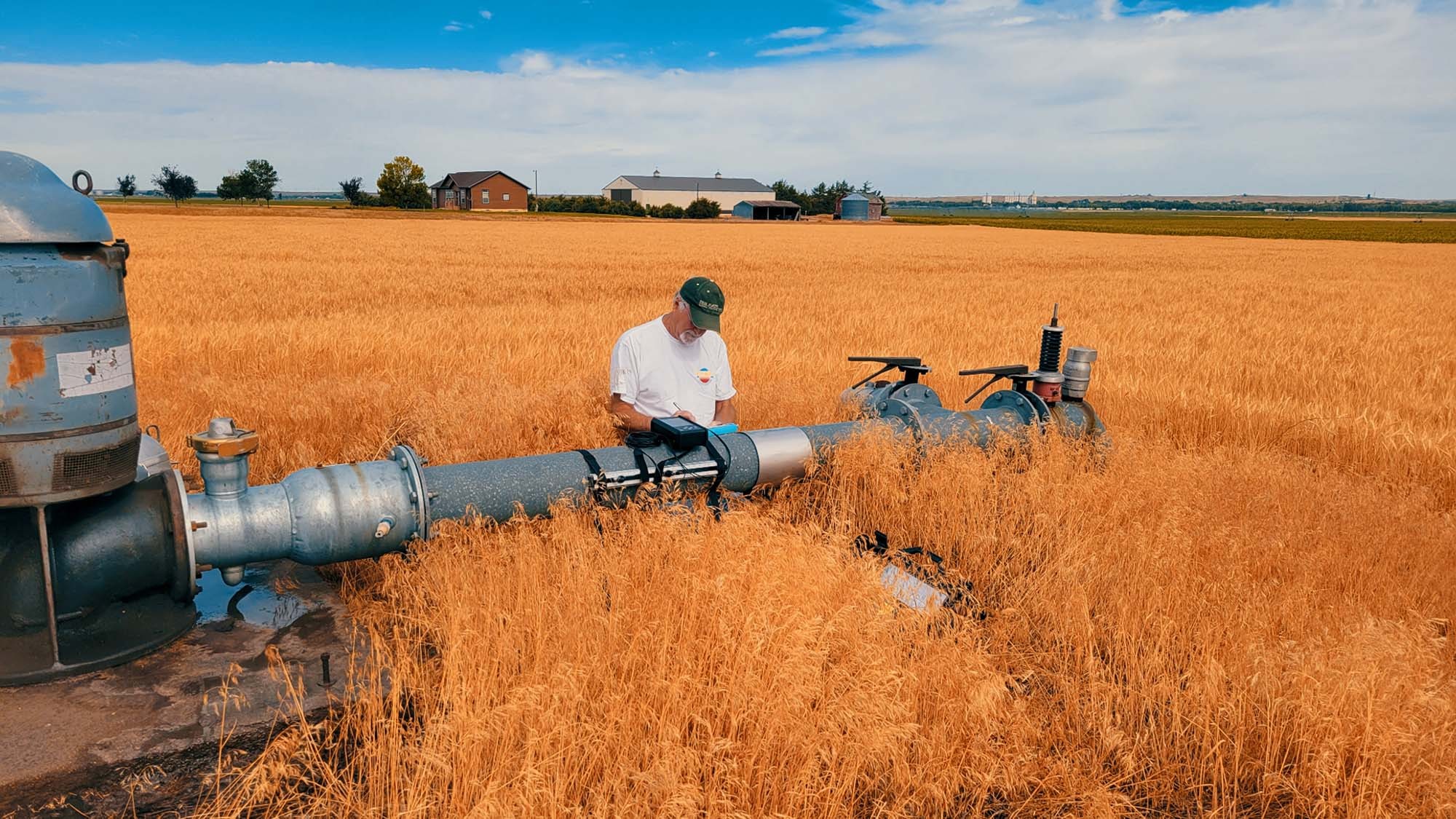
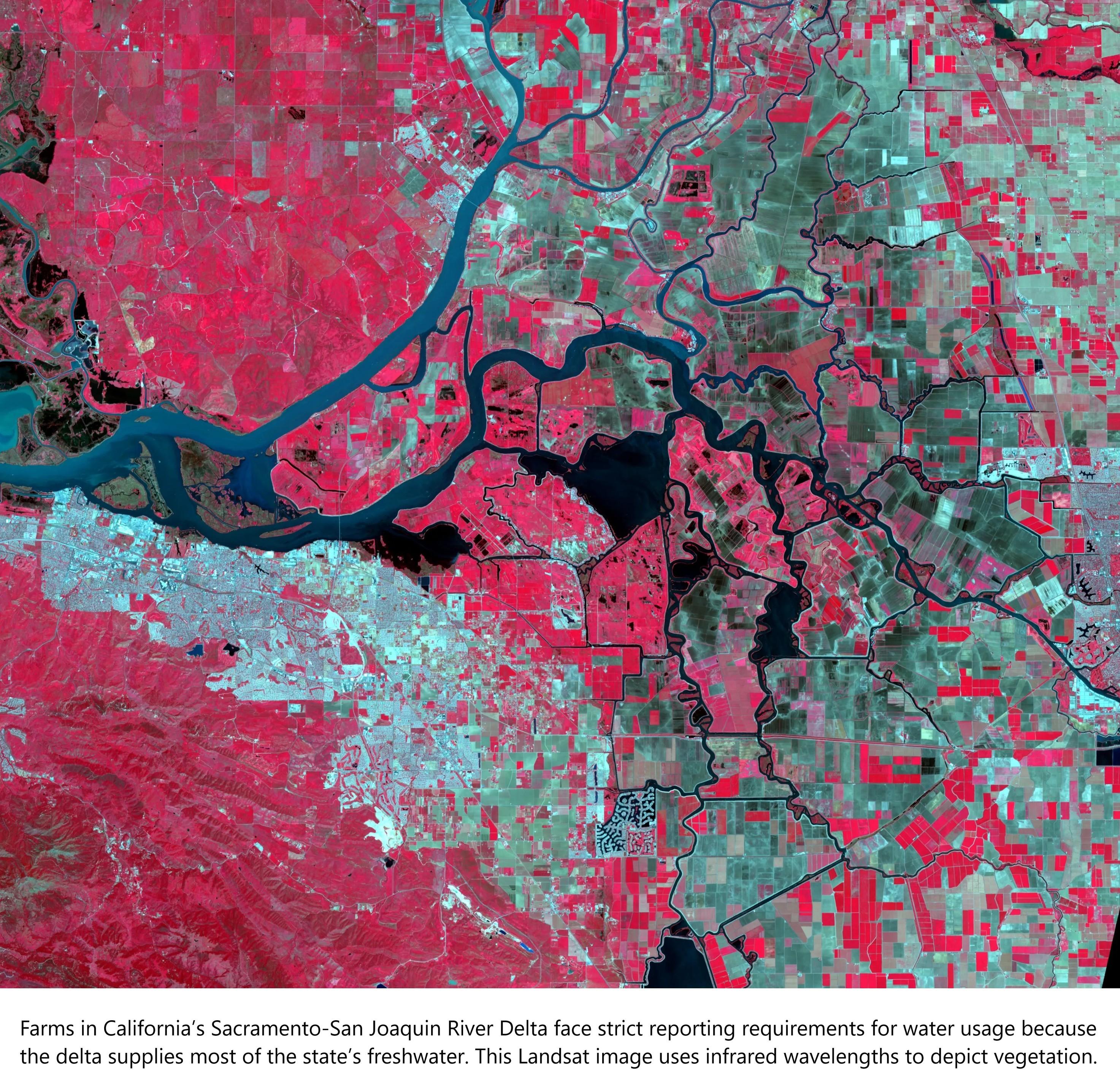
OpenET Project – Estimating The Volume Of Evapotranspiration From Remote Sensing Weather & Other Data Sources
--
https://etdata.org/ <-- link to the project / data resources
--
[sharing of this post does not constitute an endorsement of this product or company]
#GIS #spatial #mapping #remotesensing #OpenET #evapotranspiration #weather #waterresources #watersecurity #watermanagement #water #hydrology #USWest #US #USA #webmaps #EarthEngine #spatialdata #API #ET #farming #agriculture #satellite #DataExplorer #sustainability #irrigation #landsat #waterbudgets #people #ecosystems #environment #groundwater #consumption #planning #budgeting #model #modeling
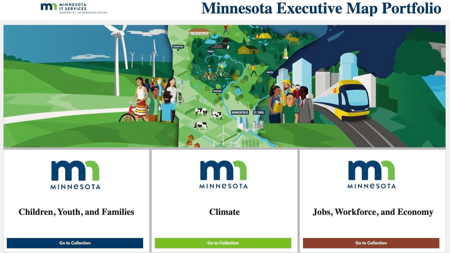
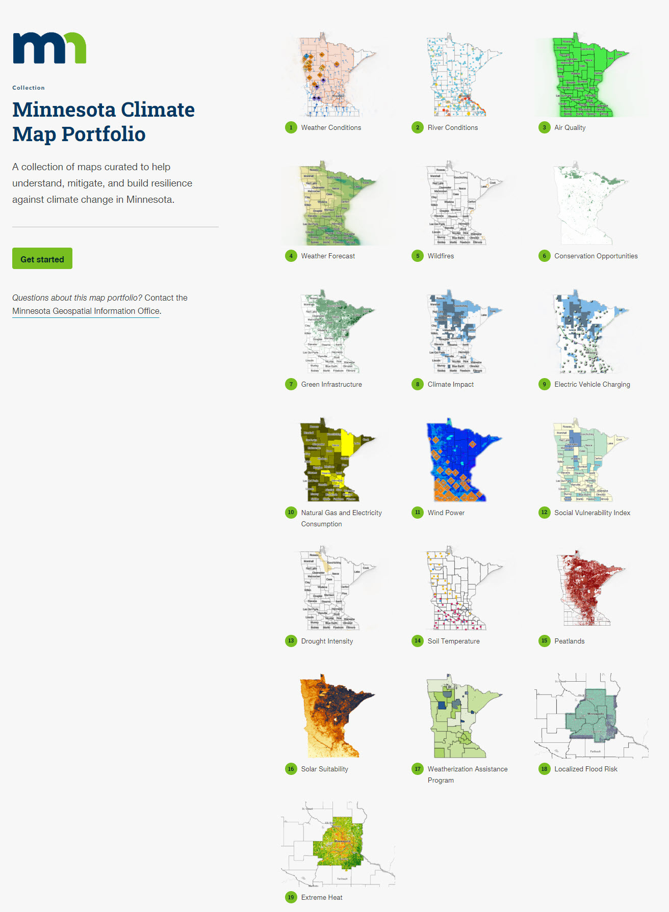
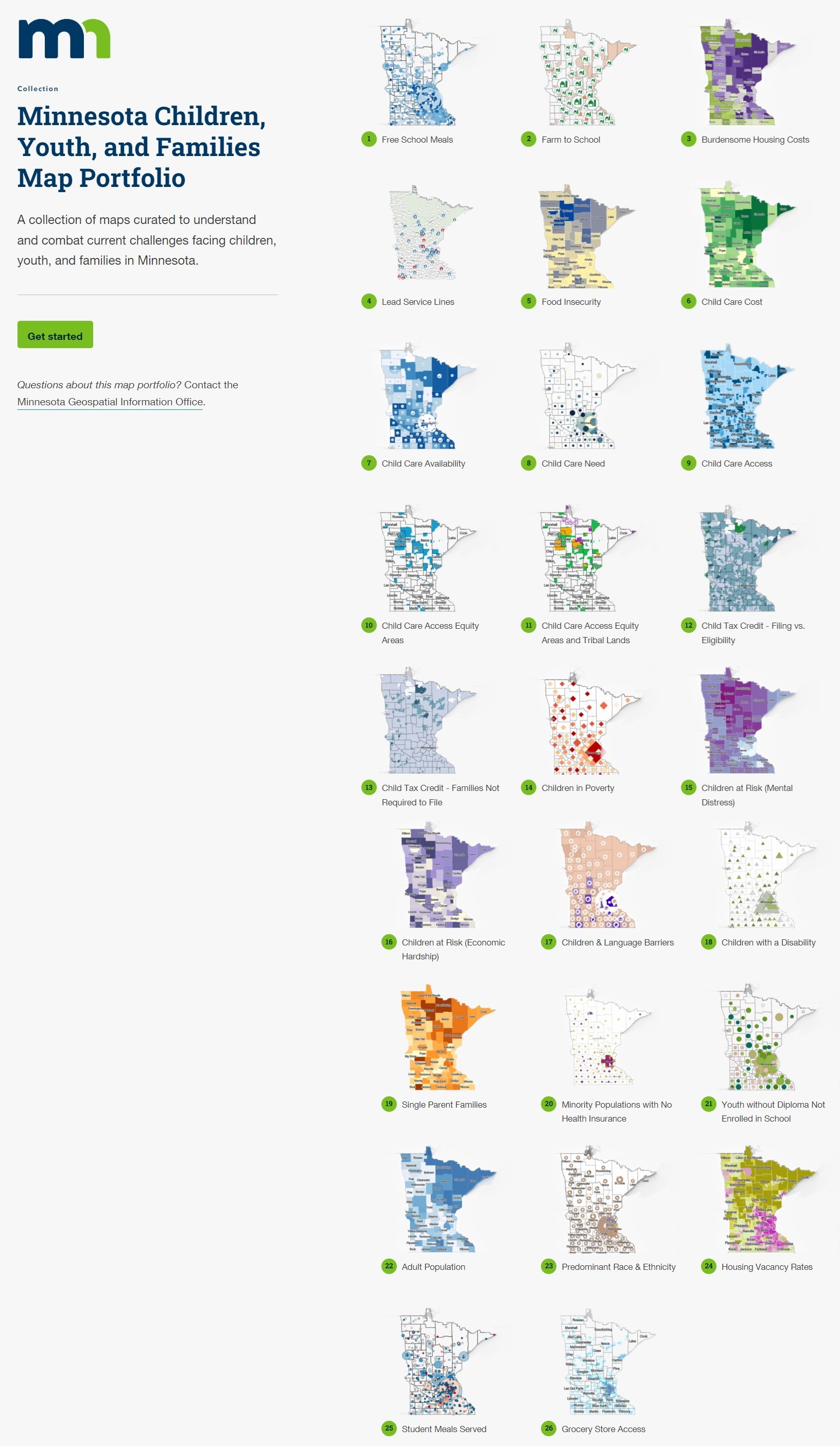
The Secret To Making Government Faster, Better, More Effective – Maps [Minnesota]
--
https://www.forbes.com/sites/esri/2024/08/27/the-secret-to-making-government-faster-better-more-effective-maps/ <-- shared media article
--
http://alturl.com/axrqh <-- Minnesota Executive Map Portfolio
--
#GIS #spatial #mapping #government #StateGovernment #Minnesota #MN #MnGeo #solutions #usecase #alldataisspatial #poverty #children #water #waterquality #infrastructure #watersupply #childcare #peatlands #broadband #investment #highspeedinternet #solutions #spatialanalysis #spatiotemporal #resources #children #youth #families #climate #jobs #workforce #economy #spatialdata #opendata #geography #governmentofficals #publicservice #demographics #management #planning #webmaps #economicdevelopment
@forbes

Is anyone aware of interactive webmaps which integrate sound based on geographic position? e.g. play birds chirping if map shows forest.
I think there is great potential to transport additional information or even feelings with soundscapes in maps, yet I have barely seen it.
#webmaps #cartography #soundscapes #Mapping
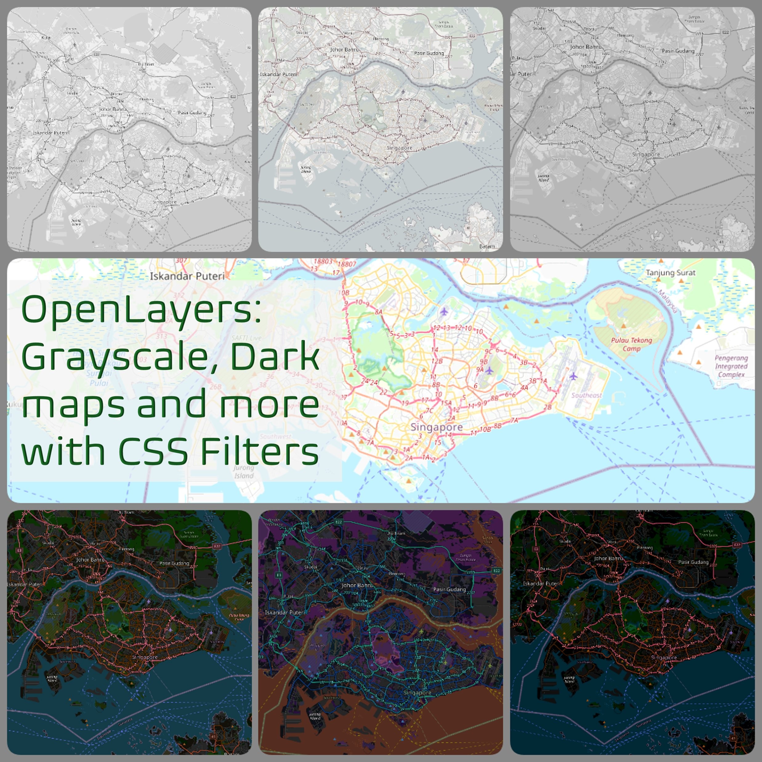
Using #OpenLayers and #CSS filters to style #OSM #WebMaps in your application into greyscale, dark mode and more. Some note and sample filters at:
https://notepad.onghu.com/2024/open-layers-greyscale-maps-more-with-css-filters/
Throwback to when I talked a lot about disasters (pardon the awkwardness of youth 🤣): https://ayos.blog/foss4g-2015/
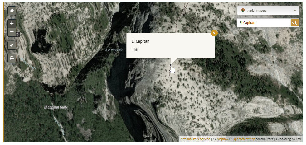
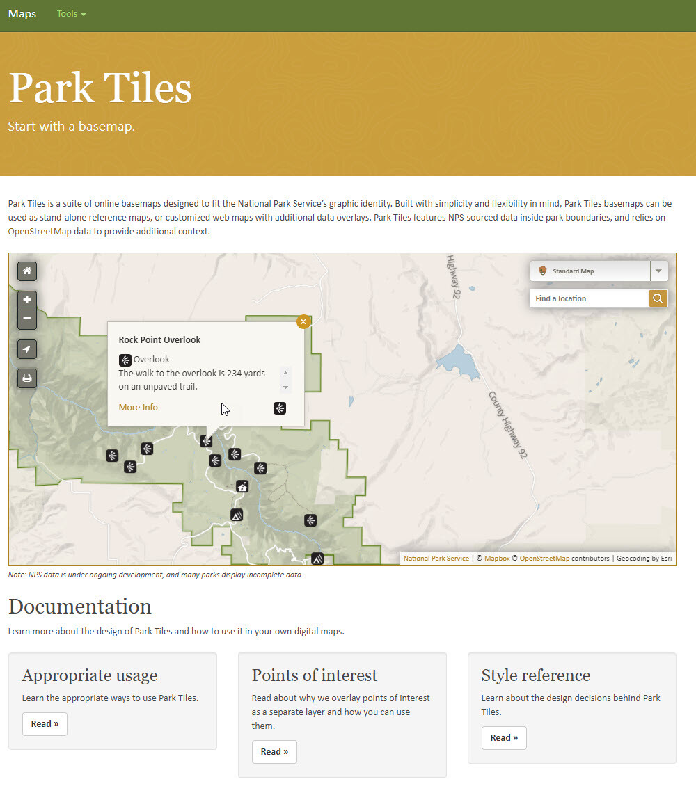
National Park Services (NPS) ‘Park Tiles’ [public web mapping, USA]
--
https://www.nps.gov/maps/tools/park-tiles/index.html#12/38.5640/-107.6372 <-- entry point
--
[also a mobile app ]
“Park Tiles is a suite of online basemaps designed to fit the National Park Service’s graphic identity. Built with simplicity and flexibility in mind, Park Tiles basemaps can be used as stand-alone reference maps, or customized web maps with additional data overlays. Park Tiles features NPS-sourced data inside park boundaries, and relies on OpenStreetMap data to provide additional context…”
#GIS #spatial #mapping #PostGIS #PostgresSQL #QGIS #vectortiles #opendata #opensource #gischat #ParkTiles #OSM #basemaps #NPS #maps #webmaps
@NPS

AirNow Fire And Smoke Map [North America]
--
https://fire.airnow.gov/ <-- online interactive map
--
#GIS #spatial #mapping #online #webmaps #interactivemaps #opendata #crowdsourcing #smoke #fire #airquality #northamerica #environmental #health #publichealth #publicsafety #situationalawareness #hazard #planning #data #events #riskassessment #riskmanagement #communityhealth #communityawareness #climatechange #citizenscience #pollution #wildfires #wildfires2023 #fireriskassessment #quality #help #USA #canada #mexico #puertorico #AirNow
Huge thread about the history of vector tiles from Nathaniel Kelso! It's the 10th anniversary of a landmark blog post by @migurski that defined much of the modern landscape of #VectorTileCartography: https://mstdn.party/@kelsoscorner/110029394759495359 #cartography #WebMapping #WebMaps #maps
Is it just me or are touch events on slippy #maps made with #MapBoxGLJS really broken? When I try pinch zooming on these Covid maps by the #nytimes they keep jumping back to their default zoom and extent:
https://www.nytimes.com/interactive/2021/us/california-covid-cases.html