
Mapping of Closed Depressions in Karst Terrains - A GIS-Based Delineation of Endorheic Catchments in the Alburni Massif (Southern Apennine, Italy)
--
https://doi.org/10.3390/hydrology12070186 <-- shared paper 🔗
--
#doline #poljes #endorheic #karst #GIS #spatial #mapping #DEM #spatialanalysis #geomorphometry #morphometry #remotesensing #glacial #proglacial #glacier #tectonics #geology #water #hydrography #hydrology #hydrogeomorphic #groundwater #surfacewater #closeddepressions #overland #epigenic #subsurface #hypogenic #flow #landform #geomorphology #AlburniMassif #Apennines #Italy #spatialanalysis #elevation #geostatistics #structuralgeology #waterresources #watermanagement #recharge #modeling #tracertest #dyetest #mapping
#StructuralGeology


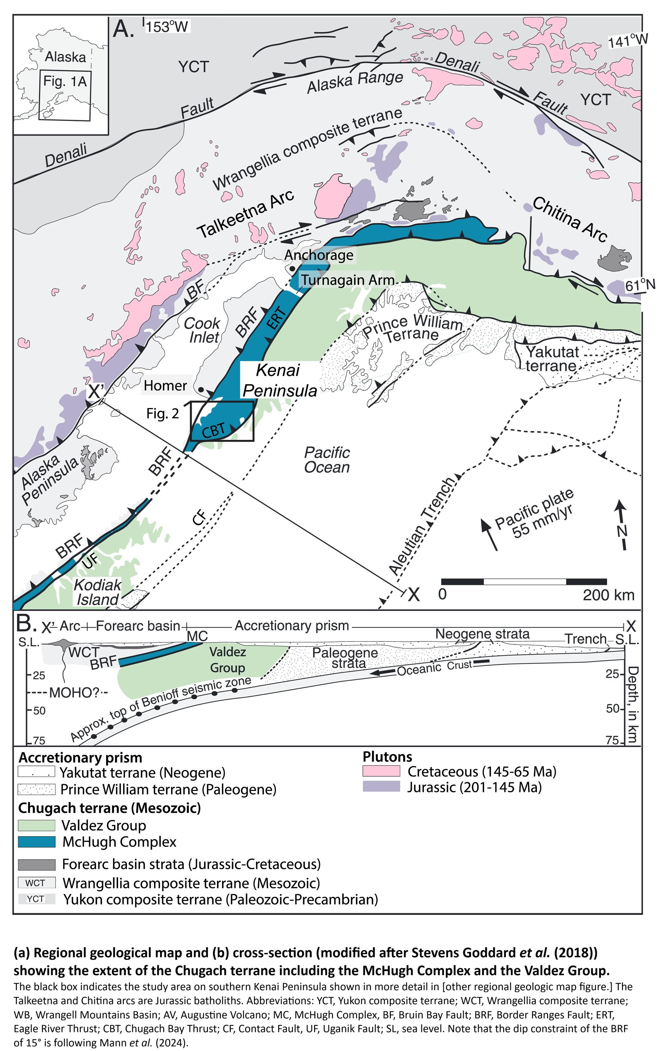
Timing And Style Of Tectonic Assembly And Exhumation Of The Mchugh Complex Within The Chugach-Kodiak Accretionary Wedge, Alaska
--
https://doi.org/10.1029/2025TC009004 <-- shared paper
--
https://discoveryalert.com.au/chugach-prince-william-terrain-geology-alaska-2025 <-- shared technical article
--
[this paper is WAY over my head in terms of the nuance of structural geology, but still fascinating; further, I have to say: these are TRULY gorgeous, well-designed & presented, and useful geologic maps, cross-sections, annotated photographs and other visualisations (I am jealous of that level of skill, in the BEST of ways!)]
#geology #structuralgeology #fieldwork #geologic #mapping #KenaiPeninsula #McHughComplex #tectonics #underplating #faulting #subduction #erosion #Exhumation #ChugachKodiak #AccretionaryWedge #Alaska #coast #coastal #mineralogy #transects #crosssections #model #modeling #sampling #spectroscopy #accretionary #accretionarymargin #plateboundary #trench #interpretation #peneplanation #forearc


The Seismometers At The End Of The Earth Have Names [Antarctica]
--
https://www.npr.org/2026/02/08/nx-s1-5691843/the-seismometers-at-the-end-of-the-earth-have-names <-- shared radio interview (audio and transcript)
--
https://www.usgs.gov/news/science-snippet/loneliest-seismometers-earth <-- shared #USGS page
--
https://www.usgs.gov/news/science-snippet/loneliest-seismometers-earth <-- shared USGS overview video
--
#radio #NPR #AllThingsConsidered #interview #IceCube #Antarctica #seismometer #SouthPole #globa; #earthquake #monitoring #remotesensing #seismic #GlobalSeismographicNetwork #fedscience #publicgood #publicsafety #earthscience #geology #structuralgeology #spatialanalysis #interdisciplinary #collaboration #geophysics #research #ScienceSnippet
@Npr @USGS @NSF


Geosurvey Reveals Hidden Australia Magnetic Anomaly
--
https://www.csiro.au/en/news/All/Articles/2026/January/Australia-magnetic-anomaly <-- shared CSIRO (Australia) technical article
--
https://research.csiro.au/potential-fields/ <-- shared CSIRO ‘Potential Field Geophysics’ home page
--
https://www.sciencebase.gov/catalog/item/6193e9f3d34eb622f68f13a5 <-- shared @USGS tri-national (Canada, USA and Australia) geologic, geophysics, and mineral resource data release / report
--
https://www.ga.gov.au/scientific-topics/disciplines/geophysics/airborne-electromagnetics <-- shared Australian government airmag overview page
--
https://doi.org/10.5382/Mono.06.30 <-- shared paper, “The Contribution Of High Resolution Aeromagnetics To Archean Gold Exploration In The Kalgoorlie Region, Western Australia”
--
#CriticalMinerals #GIS #spatial #Mapping #CriticalMineralsMappingInitiative #geology #structuralgeology #mineralresources #exploration #discovery #remotesensing #model #modeling #mining #economics #Australia #NorthernTerritory #MagneticAnomaly #AustraliaMagneticAnomaly #geomagnetism #openscience #opendata #openaccess #geoscience #geophysics #aeromagneticsurvey #aeromagnetic #spatialanalysis #CSIRO
@CSIRO


Slab Tearing Along A Subducted Oceanic Plate Joint Beneath The Alaska Peninsula
--
https://doi.org/10.1038/s41561-025-01749-6 <-- shared paper
--
#fault #faulting #subduction #slab #oceanic #plate #trench #Alaska #USA #geophysics #seismic #seismology #remotesensing #tomography #model #modeling #seismicity #volcano #vulcanism #Aniakchak #asthenosphere #geology #structuralgeology #mantle


Earth's Magnetic Shield Protecting The Planet From A Pelting By The Solar Wind
See how the sun's energy drives a remarkable planetary engine, the climate
--
https://youtu.be/6hD52H7rQak?si=OBGYbK8Czbi0uwlc <-- shared video
--
[‘cannibalising’ (sic) my own post (!) to bring attention to this outstanding video visualisation and overview, science education/explanation at its finest!; narrated so well (of course!) by #liamneeson !!]
#GIS #spatial #mapping #geology #structuralgeology #magneticfield #SouthAtlanticAnomaly #SAA #spaceweather #geomagnetism #risk #hazard #hardening #magneticfieldstrength #protection #CME #coronalmassejection #sun #solar #solarwind #visualisation #visualization #education #scienceeducation #overview #explanation
#NASA
NASA Is Watching a Huge Anomaly Growing in Earth's Magnetic Field [SAA]
--
https://www.sciencealert.com/nasa-is-watching-a-huge-anomaly-growing-in-earths-magnetic-field <-- shared technical article
--
https://youtu.be/qpdQcw_52iM?si=Hn0EZkOGJOMihC71 <-- shared @nasa video - “NASA Explores Earth's Magnetic 'Dent'”
--
https://en.wikipedia.org/wiki/South_Atlantic_Anomaly <-- shared SAA wiki
--
https://youtu.be/6hD52H7rQak?si=OBGYbK8Czbi0uwlc <-- shared video – “Watch [a visualisation of how the] Earth's magnetic shield protect[s] the planet from a pelting by the solar wind…” [narrated so well (of course!) by #liamneeson !!!!]
--
#GIS #spatial #mapping #remotesensing #earthobservation #geology #structuralgeology #magneticdent #magneticanomaly #magneticfield #SouthAtlanticAnomaly #SAA #spaceweather #geomagnetism #satellite #SWARM #orbitalspacecraft #spacecraft #risk #hazard #hardening #magneticfieldstrength #protection #CME #coronalmassejection #sun #solar #solarwind #NASA #ESA
@nasa@social.beachcom.org @esa


Dip-slip fault (Geology ⛰️)
In geology, a fault is a planar fracture or discontinuity in a volume of rock across which there has been significant displacement as a result of rock-mass movements. Large faults within Earth's crust result from the action of plate tectonic forces, with the largest forming the boundaries between the plates, such as the megathrust f...
https://en.wikipedia.org/wiki/Dip-slip_fault
#DipSlipFault #EarthSCrust #Stratigraphy #Faults #StructuralGeology #TectonicLandforms
Joint (geology) (Geology terminology ⛰️)
In geology, and more specifically in structural geology, a joint is a break of natural origin in a layer or body of rock that lacks visible or measurable movement parallel to the surface of the fracture. Although joints can occur singly, they most frequently appear as joint sets and systems. A joint set is a family of parallel, evenly spaced joints...
Why Is The Federal Government Spending Millions On Aerial Geological Mapping In Southern Colorado?
--
https://www.cpr.org/2025/11/19/geological-survey-earth-mri-colorado-minerals/ <-- shared media article
--
https://www.usgs.gov/earth-mapping-resources-initiative-earth-mri <-- shared (USGS) Earth Mapping Resources Initiative (Earth MRI) entry page
--
https://ngmdb.usgs.gov/emri/#3/40/-96 <-- shared Earth MRI web map(s)
--
https://www.usgs.gov/centers/gggsc <-- shared USGS Geology, Geophysics, and Geochemistry Science Center entry page
--
https://mrdata.usgs.gov/earthmri/data-acquisition/project.php?f=html&pid=1071 <-- shared USGS Colorado Alkaline Igneous Belt Survey report
--
https://www.usgs.gov/programs/mineral-resources-program/science/what-are-critical-minerals-0 <-- shared final 2025 #DOI / #USGS report on list of critical minerals
--
#geophysics #remotesensing #earthobservation #airborne #mapping #spatial #criticalminerals #colorado #geology #structuralgeology #Colorado #USA #EarthMRI #SouthernColorado #geologicdata #geologicmapping #geochemistry #igneous #survey #geophysicalsurvey #economic #economy #mineral #mineralresources
@CPR @USGS @NV5


Mid-Proterozoic Expansion Of Passive Margins And Reduction In Volcanic Outgassing Supported Marine Oxygenation And Eukaryogenesis
--
https://doi.org/10.1016/j.epsl.2025.119683 <-- shared paper
--
https://zenodo.org/records/17353904 <-- supplementary data
--
#proterozoic #platetectonics #tectonics #deepcarboncycle #eukaryogenesis #evolutionoflife #life #evolution #geology #geologichistory #pangea #supercontinent #diversification #volcanic #offgassing #marine #thermodynamics #model #modeling #spatialanalysis #spatiotemporal #nuna #subduction #structuralgeology #CO2 #carbondioxide #climate #eukaryotic #BoringBillion #rodinia #oceanbasins #marinechemistry #outgassing #global #earth


Giant ‘Gravity Hole’ in the Ocean May Be the Ghost of an Ancient Sea
--
https://www.scientificamerican.com/article/giant-gravity-hole-in-the-ocean-may-be-the-ghost-of-an-ancient-sea1/ <-- shared technical media article
--
https://doi.org/10.1029/2022GL102694 <-- shared 2023 paper
--
https://oceanservice.noaa.gov/facts/geoid.html <-- technical description of a geoid
--
[theories abound]
"... KEY POINTS
• Employing time dependent global mantle convection models since the Cretaceous. [the authors] simulate the origin of the enigmatic Indian Ocean geoid low
• Plumes forming along the edges of the African Large Low Shear Velocity province (LLSVP) control the regional geoid in the Indian Ocean
• These plumes, in turn are generated by lower mantle Tethyan slabs that perturb the African LLSVP…”
#GIS #spatial #mapping #geoid #gravity #mapping #global #remotesensing #plume #ocean #ancientocean #gravityhole #geophysics #IndianOcean #geology #structuralgeology #crust #mantle #core #high #low #potsdamgravitypotato #IOGL #tomography #model #modeling #plate #tectonicplate #Tethys #slab #mantleplume #LLSVP #AfricanLargeLowShearVelocity


Flow banding (Volcanology 🌋)
Flow banding is a geological term to describe bands or layers that can sometimes be seen in rock that formed from magma. Flow banding is caused by friction of the viscous magma that is in contact with a solid rock interface, usually the wall rock to an intrusive chamber or, if the magma is erupted, the surface of the Earth across which the lav...
https://en.wikipedia.org/wiki/Flow_banding
#FlowBanding #Volcanology #IgneousRocks #IgneousPetrology #StructuralGeology

Joint (geology) (Petrology 💎)
In geology, and more specifically in structural geology, a joint is a break of natural origin in a layer or body of rock that lacks visible or measurable movement parallel to the surface of the fracture. Although joints can occur singly, they most frequently appear as joint sets and systems. A joint set is a family of parallel, evenly spaced joints that can b...

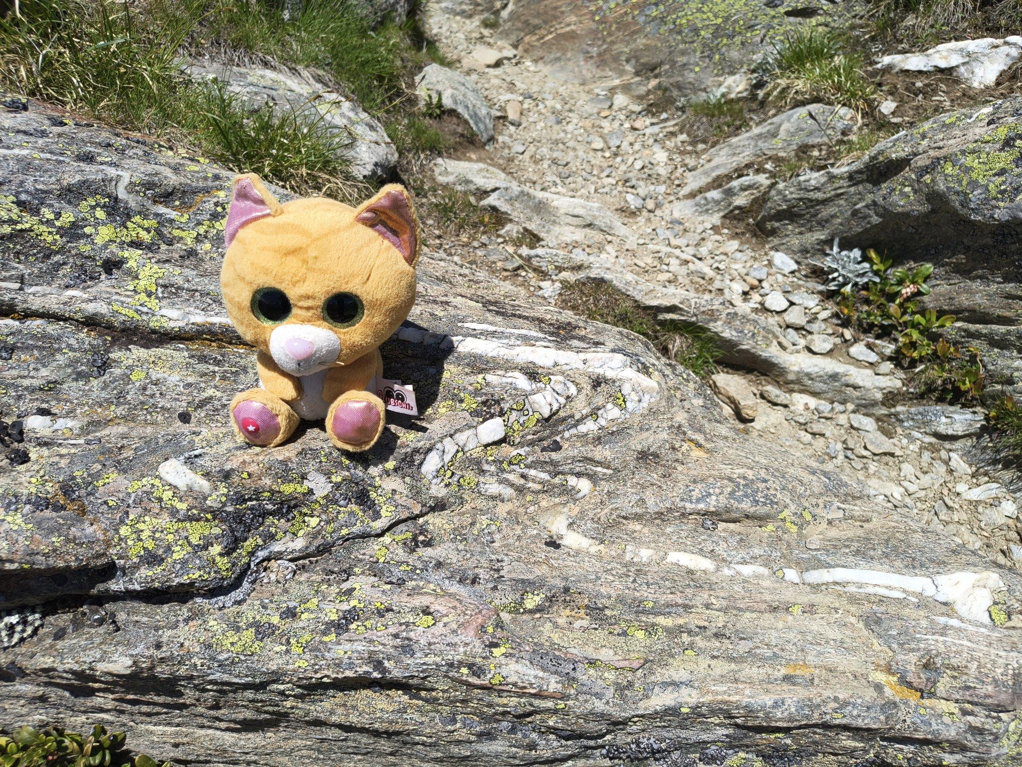
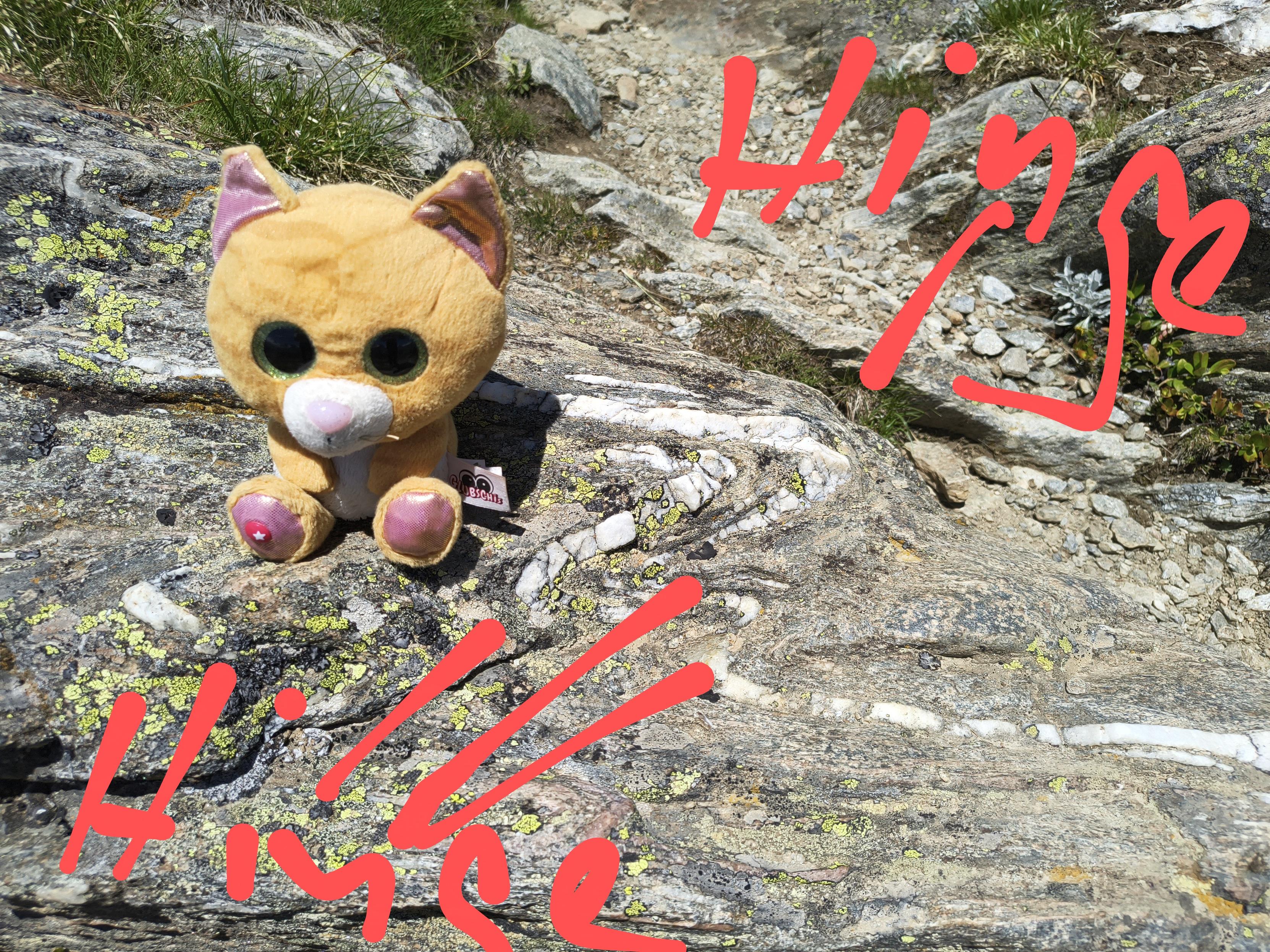
Today: during #hedgewatch in #Switzerland we found this deformed #rock. It underwent #ductil #deformation so that this #fold made of #quartz formed. During deformation material can move from the limbs to the hinge so that the hinge becomes thicker.
#PawForScale
Non-Collisional Orogeny In Northeast Japan Driven By Nearby Same-Dip Double Subduction
--
https://doi.org/10.1038/s41561-025-01704-5 <-- shared paper
--
#geology #structuralgeology #japan #subduction #system #plate #geometry #mantle #tectonics #geodynamics #orogeny #Ryukyu #IzuBoninMarianas #kinematics #backarc #earthquake #fault #faulting #orogenesis #platetectonics


Mélange (Petrology 💎)
In geology, a mélange is a large-scale breccia, a mappable body of rock characterized by a lack of continuous bedding and the inclusion of fragments of rock of all sizes, contained in a fine-grained deformed matrix. The mélange typically consists of a jumble of large blocks of varied lithologies. Both tectonic and sedimentary processes can form mélange. Mélange occurrences are associated with...


2022
Patterson-UTI 293 - targeting the Woodford Formation (Upper Silurian - Devonian) through overthrusted Arbuckle Group (Silurian-Ordovician)….AND basement (Precambrian, ~2GA unconformity).
Basically, we drilled the whole sequence twice (per well) before reaching the target formation. Drilling the lateral portion was a whole other adventure due to the crazy structure of the area -imagine pushing an 18K’ string through a hard substance with the goal of making it 29K’ feet, through that substance, which, is actually perpendicular to the direction from which you started the hole. Oh, and you have to stay in between the lines, which undulate, dive, climb, and sometimes - disappear entirely, plus, you have to be blindfolded.
I was on this pad for 3.5 months, and we drilled TWO holes….only one successful. We drilled through 12K ft of granite, diorite, and granodiorite in between the Ordovician/Silurian limestones and dolomites. It was crazy.
Unfortunately for me - this was a post-layoff gig for a year, and the type of work I should have done at the beginning of my career, not the middle. And in my mid 40’s at that…..which, in a word, “sucked.” However, I learned a lot about the operations side of the business, which, having been in technical geoscience groups my whole career, was definitely enlightening. Rigs are an interesting place, with interesting people.
Never. Again. Lol
#geology #oilandgas #oklahoma #oldrocks #reallyoldrocks #reallyolderrocks #arbucklemountains #structuralgeology #worldclassgeology

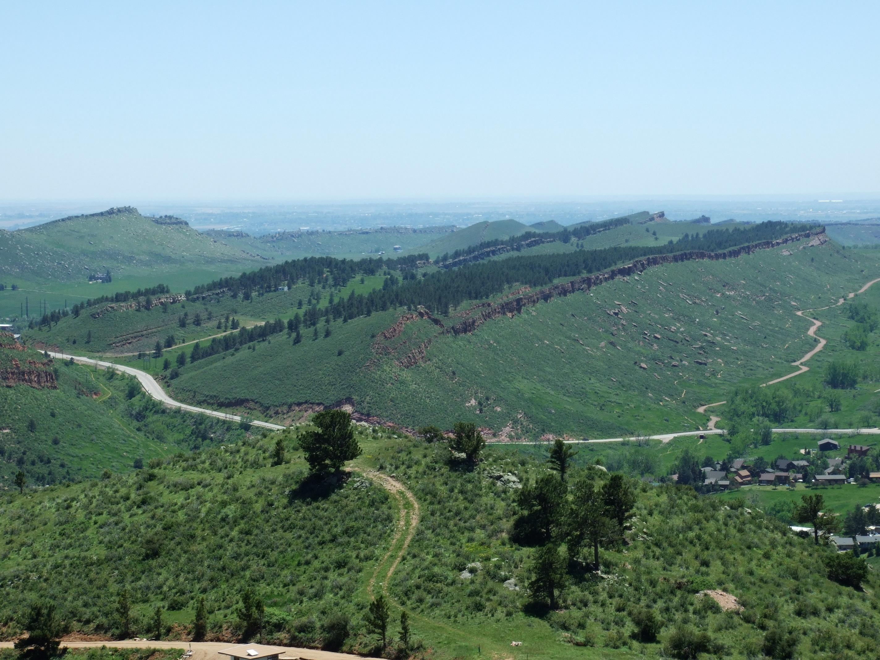
Homoclinal ridge (Geomorphology 🏞️)
A homoclinal ridge or strike ridge is a hill or ridge with a moderate, generally between 10° and 30°, sloping backslope. Its backslope is a dip slope, that conforms with the dip of a resistant stratum or strata, called caprock. On the other side of the other slope, which is its frontslope, of a homoclinal ridge is a ...
https://en.wikipedia.org/wiki/Homoclinal_ridge
#HomoclinalRidge #Ridges #Geomorphology #SlopeLandforms #ErosionLandforms #StructuralGeology
Understanding Geological Time With Associate Professor Stijn Glorie [video]
--
https://youtu.be/H2M2ZuVe9pE?si=iTahPKcOe2q2Yhs5 <-- shared video
--
“A/Prof Stijn Glorie is a geochronologist at University of Adelaide who uses radio-isotope decay to date rocks, revealing Earth’s evolution and aiding insights into mountains, ores, and climate-tectonics links…”
#geology #time #learning #education #dating #age #epochs #understanding #rocks #structuralgeology #Quaternary #conception
Client Info
Server: https://mastodon.social
Version: 2025.07
Repository: https://github.com/cyevgeniy/lmst