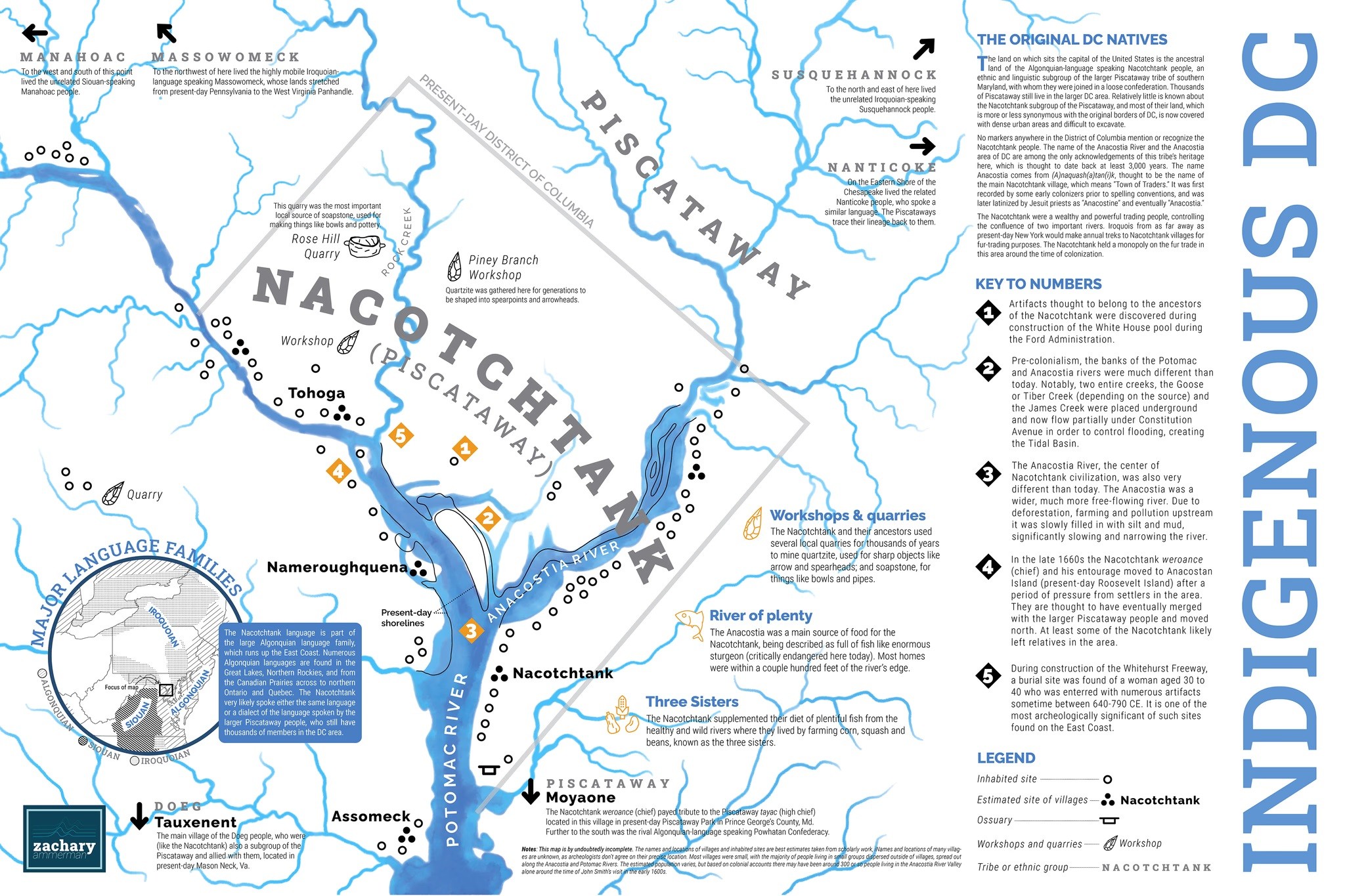
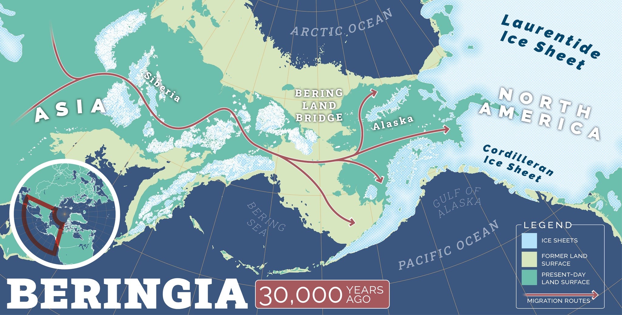
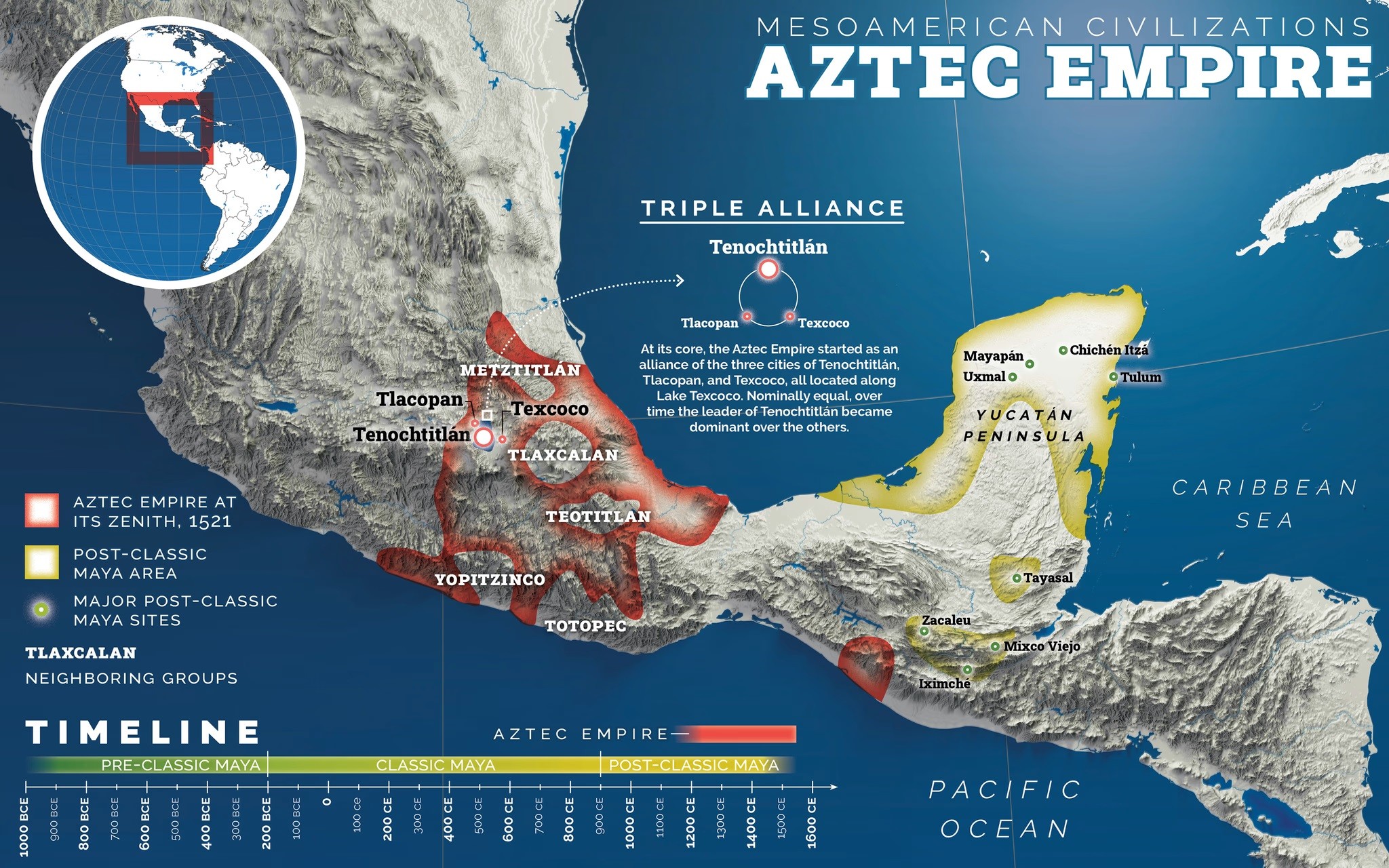
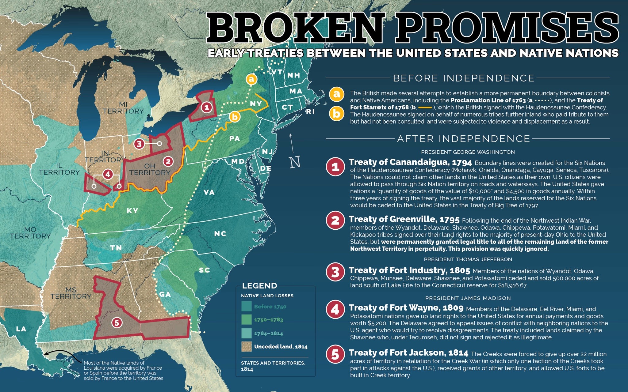
Educational Infographics – Sharing Some Of The Work Of Zachary Ammerman
--
https://www.zacharyammerman.com/portfolio/infographics <-- shared infographic examples, including maps…
--
[I do not know Zachry personally or professionally, but these examples of his work are TOO dang good not to share 😊 ]
#GIS #spatial #mapping #alldataisspatial #cartography #education #infographics #FirstNation #history #ancienthistory #StoryOfAmerica #USHistory #K12 #schools #designer #NativeAmericans #mestizo #culture #migration #geography
@ZacharyAmmerman
#AllDataIsSpatial
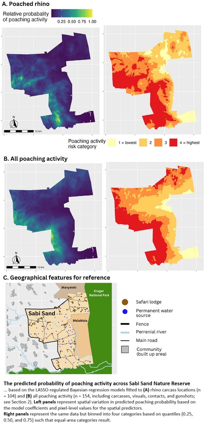
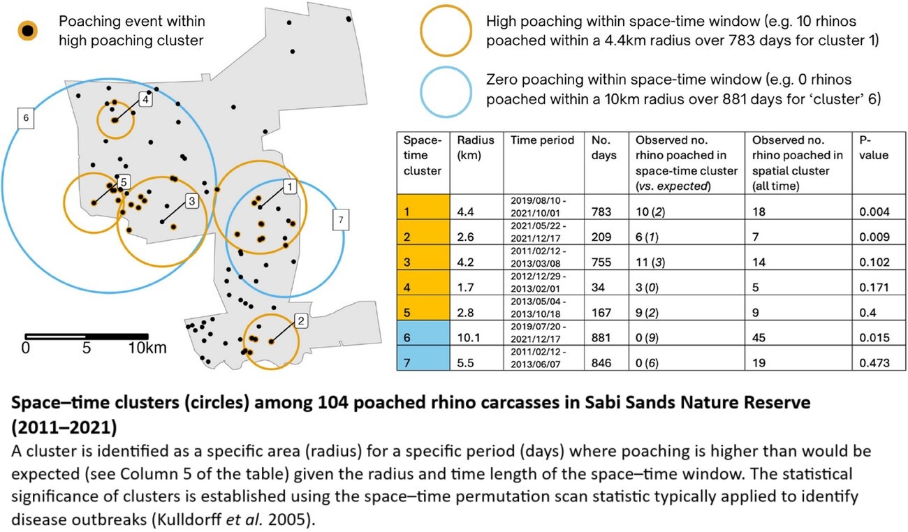
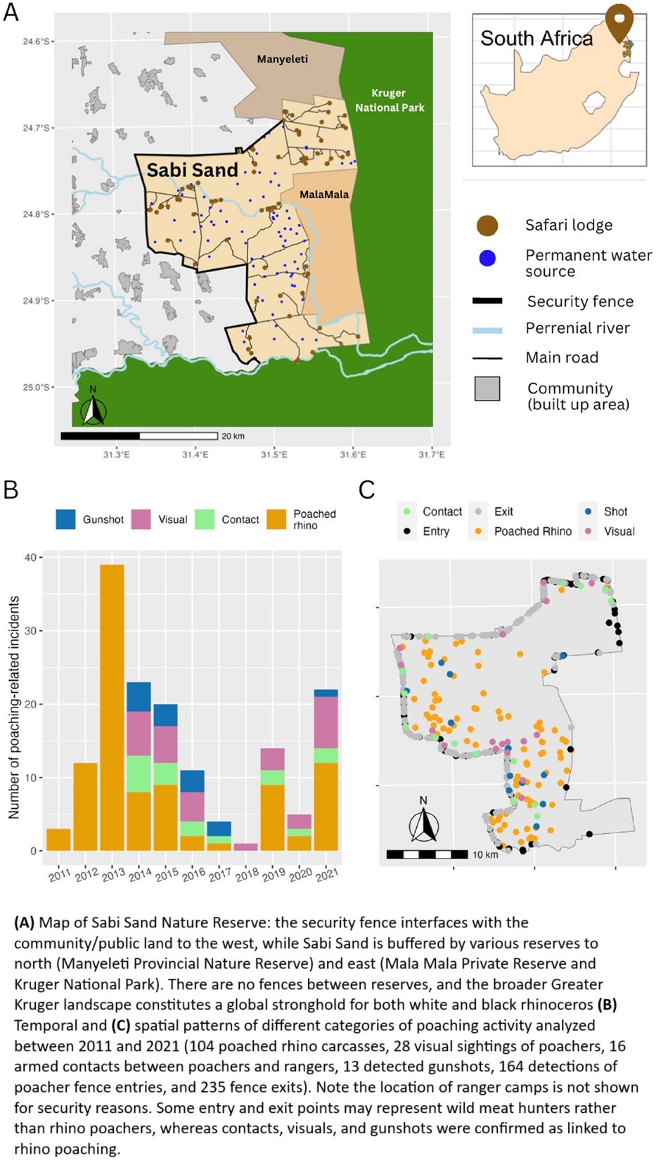
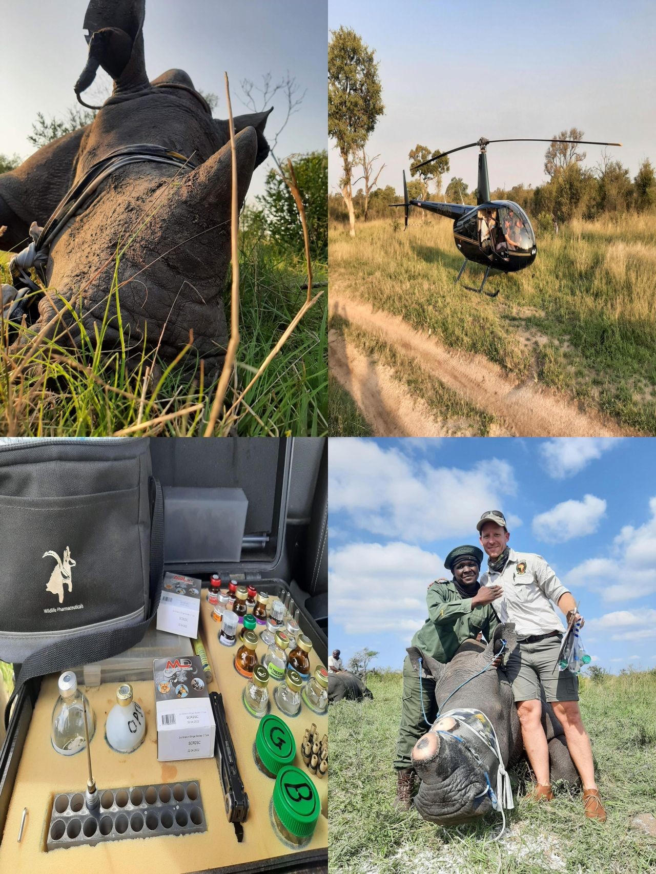
Colluding Rhino Poachers Exploit Space–Time Variation In Opportunity And Risk
--
https://doi.org/10.1111/conl.13106 <-- shared paper
--
“[R]esearch analysing over 500 rhino poaching incidents and exploring what these patterns reveal about the behaviours of poachers, rangers, and rhinos. [Their] study highlights concerning evidence of criminal syndicate infiltration, space–time targeting by poachers, and how behavioural insights can inform effective responses—from targeted dehorning to bolstering ranger resilience…”
#GIS #spatial #mapping #spatialanalysis #wildlifeconservation #wildlife #conservation #statistics #geostatistics #rhino #rhinohorn #rhinoceros #poaching #rangers #criminal #syndicate #mafia #criminalsyndicate #activity #crime #illegal #behaviour #dehorning #rangerstation #protection #humanimpacts #ecosystem #habitat #deterrencetheory #deterrence #methodology #tourist #tourism #reserve #spatiotemporal #opportunity #risk #hazard #riskassessment #Africa #SouthAfrica #alldataisspatial
@Sabi Sand Nature Reserve
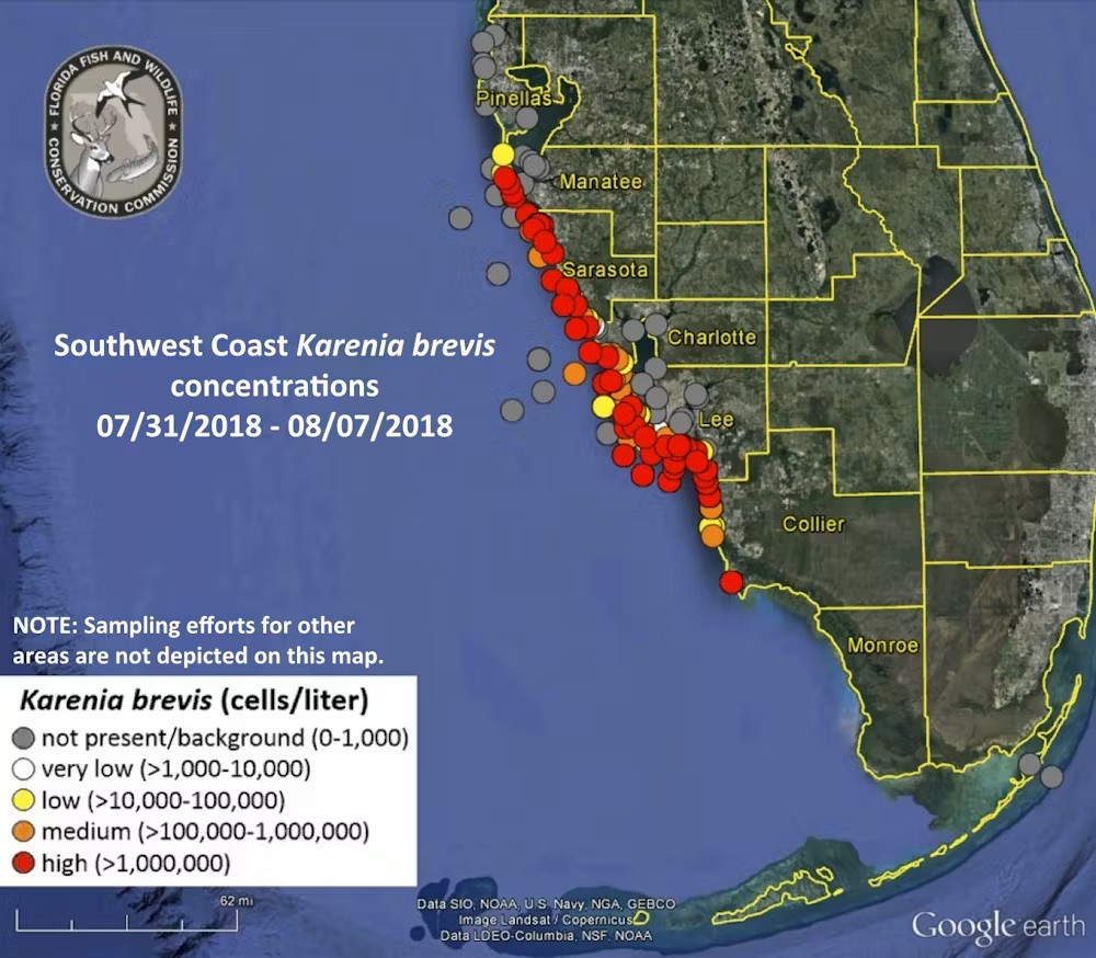
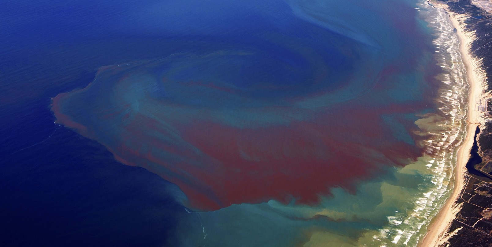
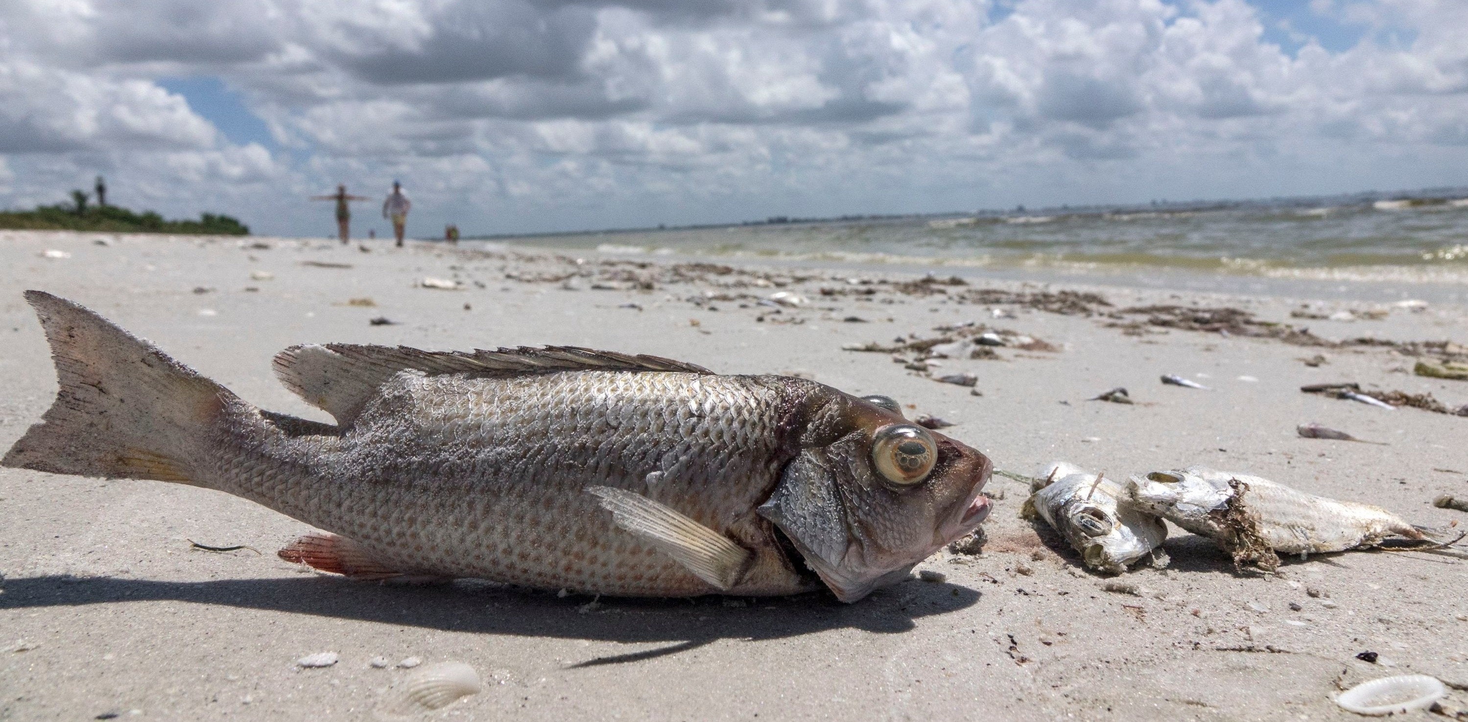
Total Economic Impact Of 2018 [Florida, USA] Red Tide Now Estimated at $2.7B
--
https://coastalscience.noaa.gov/news/total-economic-impact-of-2018-red-tide-now-estimated-at-2-7b/ <-- shared article
--
https://doi.org/10.1016/j.jenvman.2023.119811 <-- shared paper
--
https://habforecast.gcoos.org/ <-- shared Red Tide Respiratory Forecast web map
--
#GIS #spatial #mapping #fedservice #fedscience #Florida #alldataisspatial #USA #redtide #cost #economics #tourism #tourist #economy #localeconomy #algaebloom #fish #fisheries #ecosystems #humanimpacts #anthropogenic #habitat #2018redtide #publichealth #RedTideRespiratoryForecast #forecast #monitoring #spatialanalysis #spatiotemporal
#NOAA

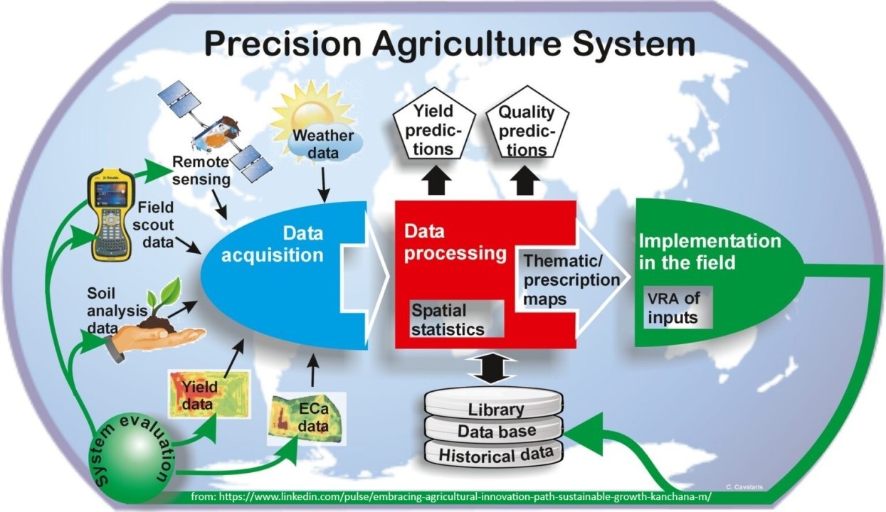
Geospatial Without Maps [blog post]
--
https://cercanasystems.com/2025/05/geospatial-without-maps/ <-- shared blog posts
--
[I will be honest, I can’t remember the last time I personally made a map…]
#GIS #spatial #mapping #mapless #AllDataIsSpatial #usecase #appliedscience #appliedtechnology #automation #coding #machinelearning #AI #maintenance #utilities #GPS #infrastructure #datasupply #dataflow #spatialdata #spatialanalysis #spatiotemporal #farming #agriculture #precisionagriculture #yield #InternetOfThings #integration #smartinfracture #earthobservation #model #modeling #routing #urban #planning #spatiallogic #proximity #zonal #statistics #geostatistics #context #systemsintegration #workflows #processmodels #spatialintelligence #decisionsystems #businessrules #efficiency
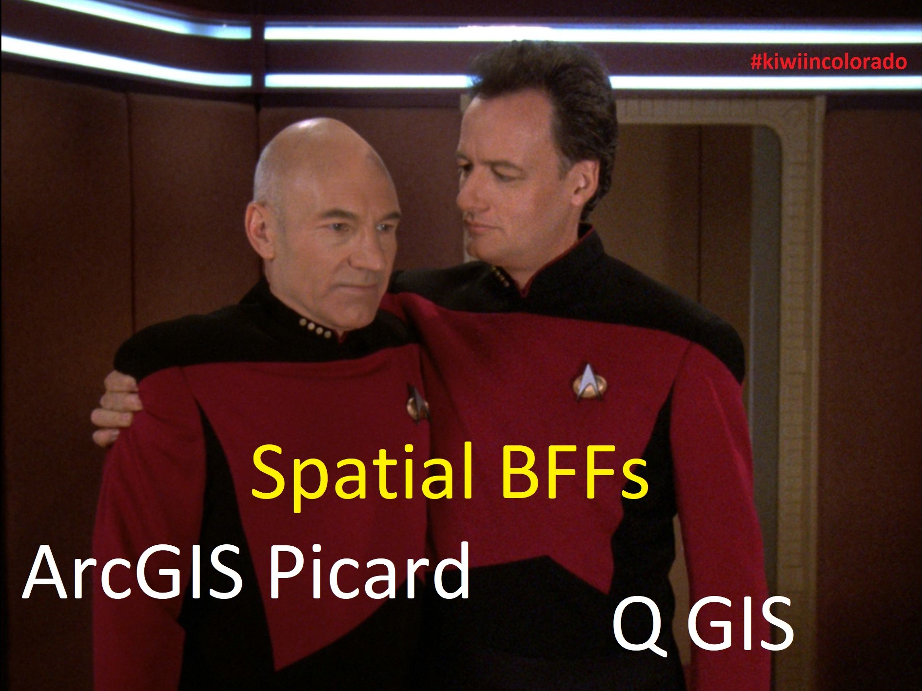
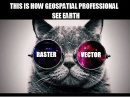
As I was working as part of project planning and a technical exchange this week, I was reminded of a meme I made awhile back on being spatial BFFs
#GIS #spatial #mapping #spatialanalysis #toolbox #ArcGIS #QGIS #COTS #opensource #engagement #meme #gischat #tools #startrek #alldataisspatial
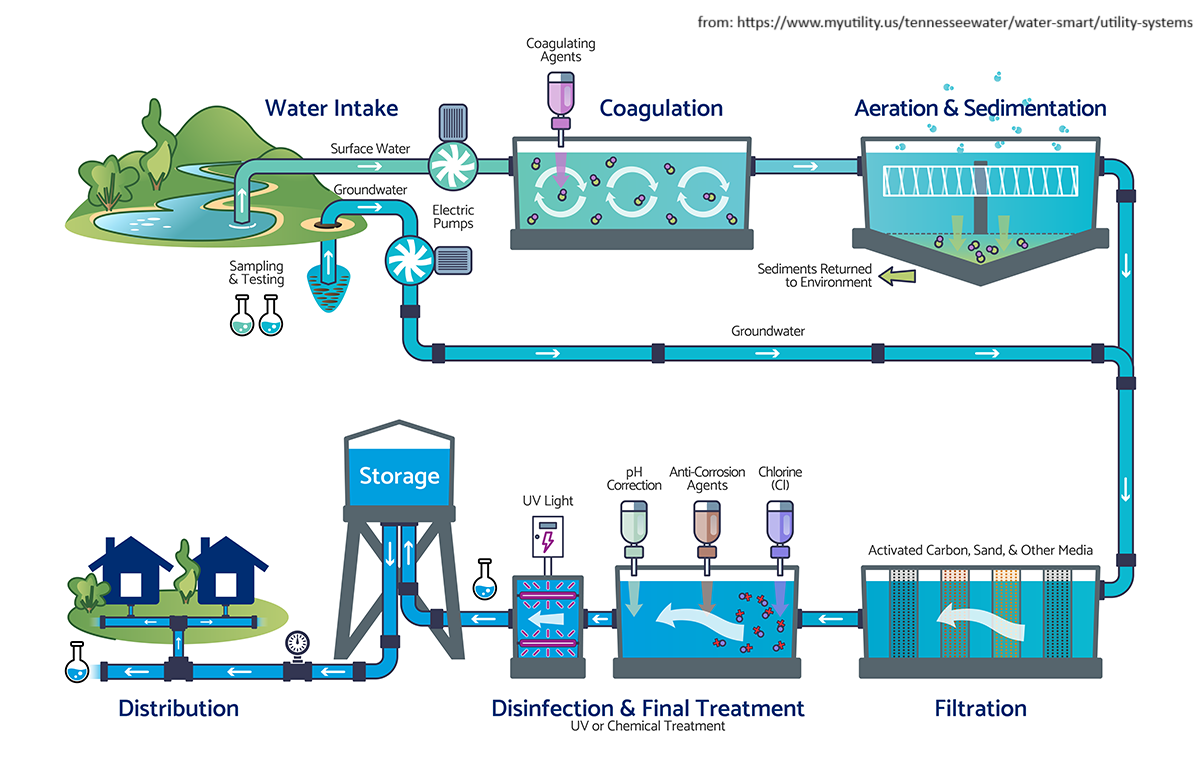
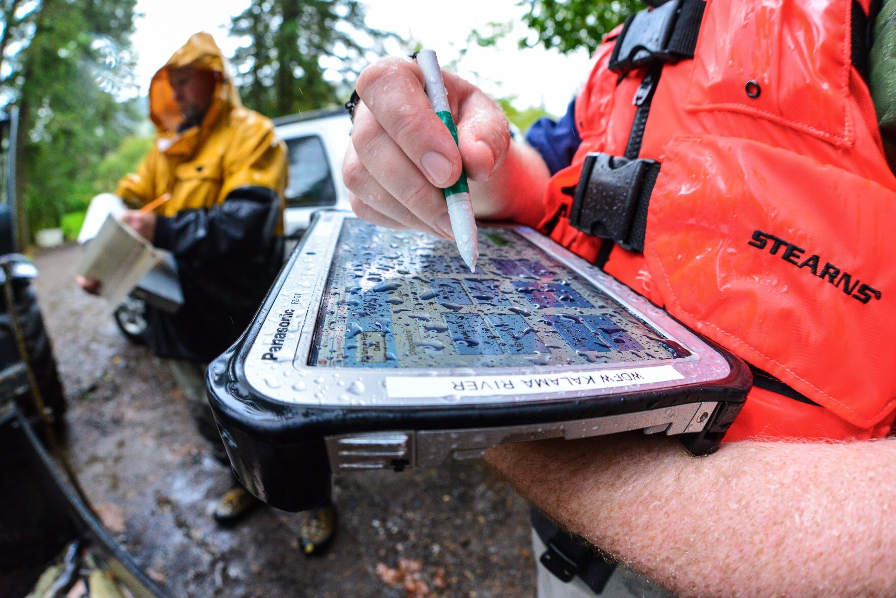
Digital Transformation In GIS & Hydrology
--
https://youtu.be/hz4g491uync?si=2g8TV9kipgWltT6i <-- shared video interview
--
It was a pleasure to do this interview...
[Note: this was NOT as a representative of my employer, rather as a professional in this area]
#GIS #spatial #mapping #usecase #opendata #appliedscience #alldataisspatial #evolvingsystems #water #hydrology #video #interview
@BimTube | @GregCocks
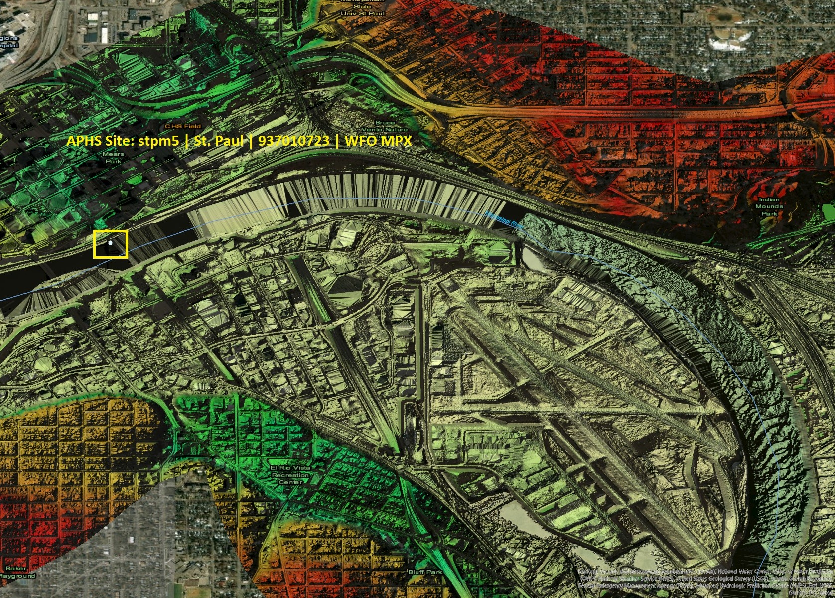
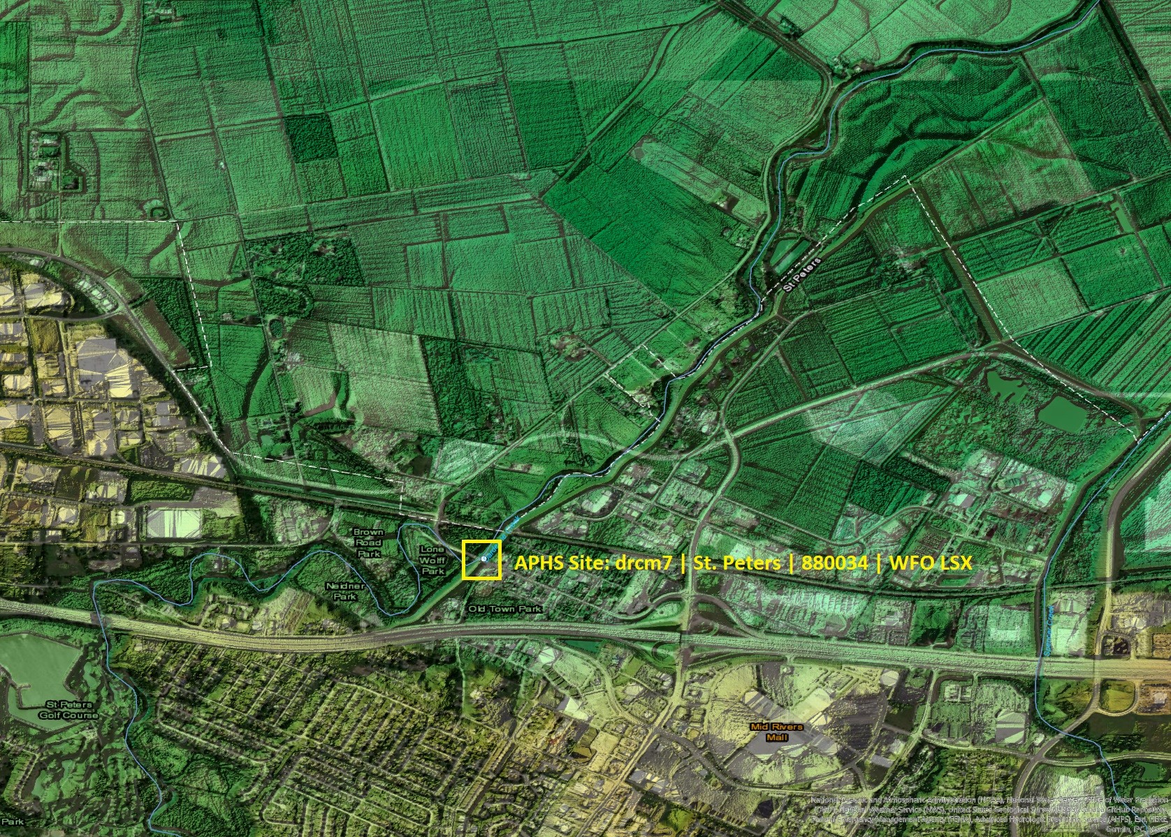
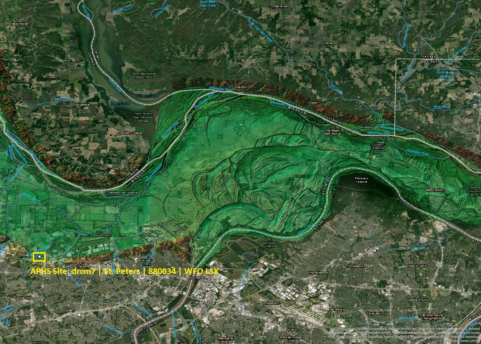
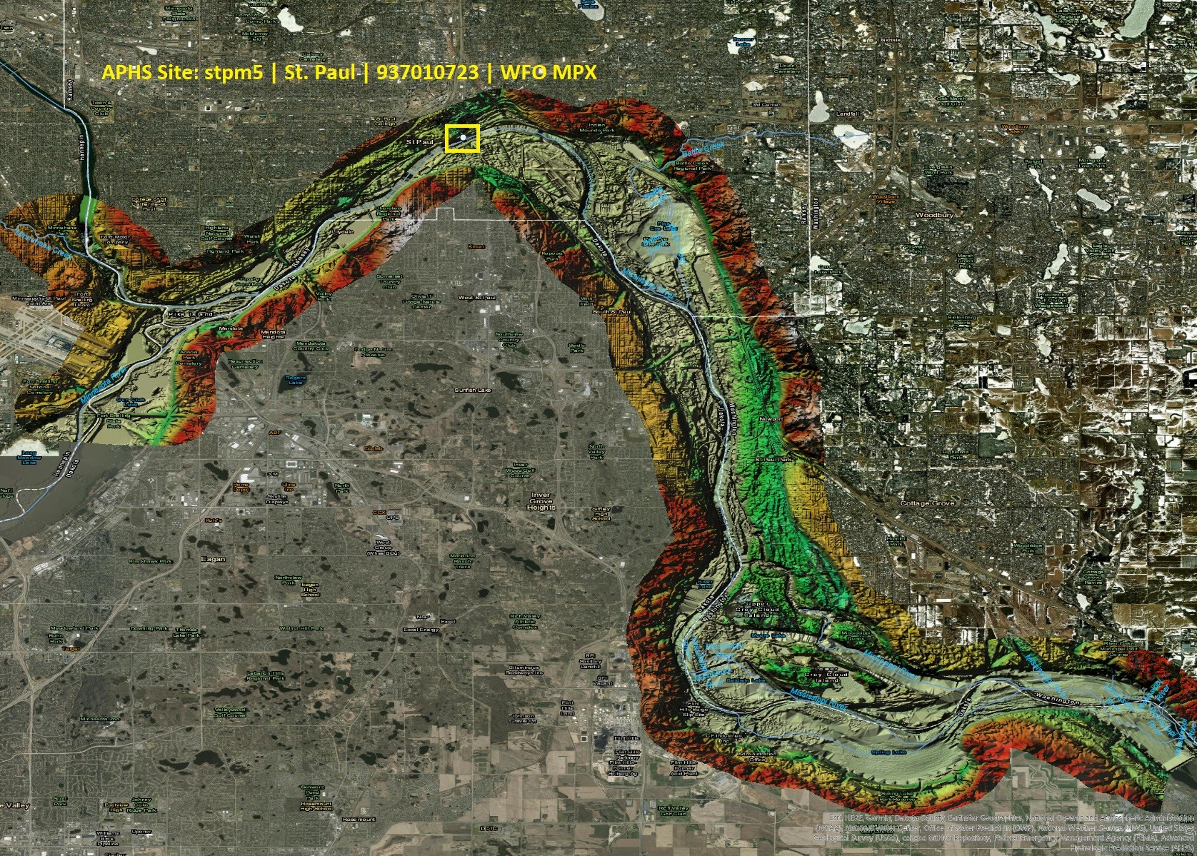
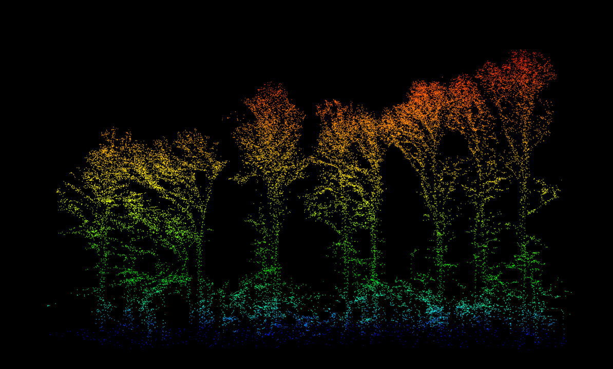
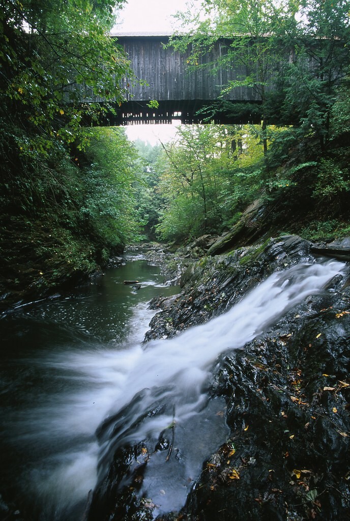
'Some (TopoBathy) Floodplain Images I Made A Few Years Ago, On The Mississippi R.
--
These are some (topobathy) floodplain images I made a few years ago for a specific usecase – and ‘stumbled’ across them again today, lookin’ for something else…
Every time I look at such things, the (engineering) geologist, geomorphologist, (pseudo) hydrologist, spatial data scientist in me is made happy in being reminded what access we have to (often open) spatial data and the sheer volume of it, and the use cases for which it can be leveraged.
We are lucky professionals…
#GIS #spatial #mapping #alldataisspatial #remotesensing #geomorphology #hydrology #water #floodplain #usecase #opendata #LiDAR #geology #geomorphometry #spatialdata #happyprofessional #MississippiRiver #JALBTCX
What Is a Better Way To Recognise GIS Day 2024 Than My And Also Stolen Mappy Memes?
--
#GIS #spatial #mapping #GISDay2024 #memes #GISday #mappymeme #community #spatialdata #usecase #alldataisspatial


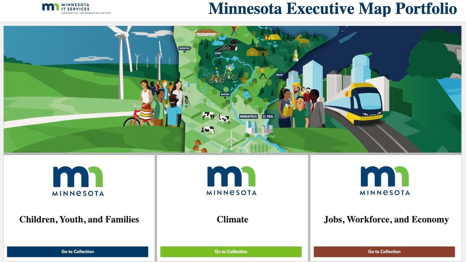
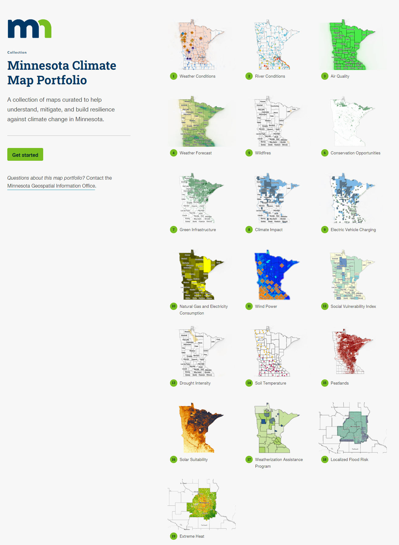
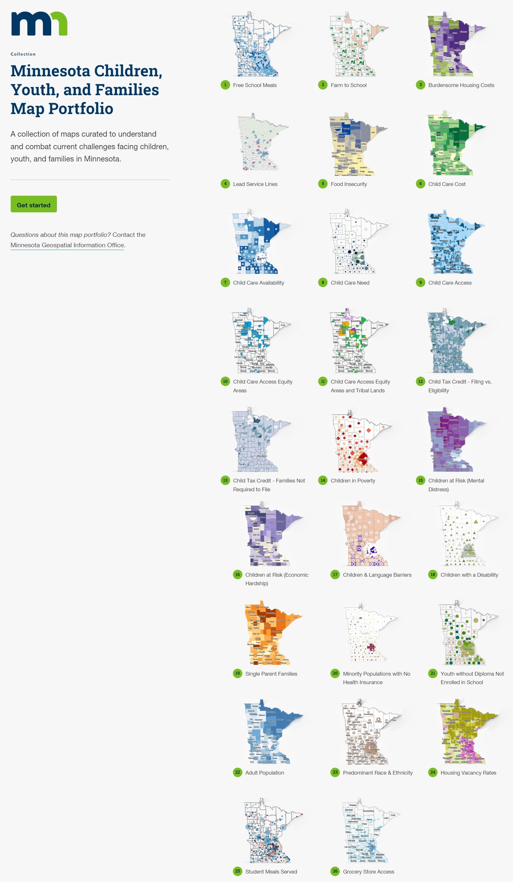
The Secret To Making Government Faster, Better, More Effective – Maps [Minnesota]
--
https://www.forbes.com/sites/esri/2024/08/27/the-secret-to-making-government-faster-better-more-effective-maps/ <-- shared media article
--
http://alturl.com/axrqh <-- Minnesota Executive Map Portfolio
--
#GIS #spatial #mapping #government #StateGovernment #Minnesota #MN #MnGeo #solutions #usecase #alldataisspatial #poverty #children #water #waterquality #infrastructure #watersupply #childcare #peatlands #broadband #investment #highspeedinternet #solutions #spatialanalysis #spatiotemporal #resources #children #youth #families #climate #jobs #workforce #economy #spatialdata #opendata #geography #governmentofficals #publicservice #demographics #management #planning #webmaps #economicdevelopment
@forbes

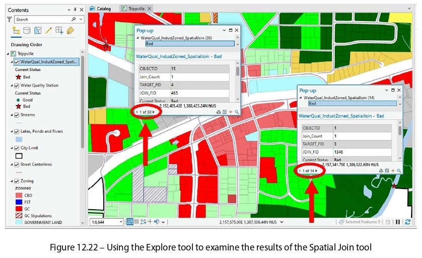
Technical Book Review - ArcGIS Pro 3.x Cookbook – 2nd Edition
--
https://www.facebook.com/EarthStuff/posts/pfbid02tqP1CSZGexGUSwqCR458tD336DzdStXN1yiZS4t5nLHDtRbCDRHsnzTxgWCC82Yel <-- link to full review
--
[disclaimers – (i) a publisher’s representative solicited a review of & provided a copy of this book for review, but no recompense, (ii) this is my impartial, personal review - and hence is not an endorsement by my employer, implicit or otherwise.]
#GIS #spatial #mapping #ArcGIS #ArcGISPro #ESRI #bookreview #review #books #amreading #currentlyreading #nowreading #nonfictionbooks #continuingeducation #alldataisspatial #selflearning #mapmonday #gischat #techbook #techbooks #technology #h #reading #programming #bookshop #techwriting #desktopgis #selflearning #education #learning #selfimprovement #selfdevelopment #onlinelearning #selfeducation #student #motivation #careergrowth #technicalbook #continuouslearning #learningjourney #education #technicalskills #PacktPublishing
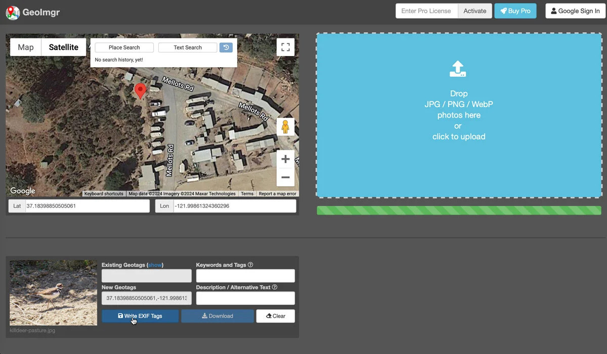
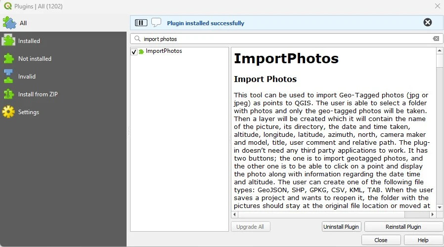
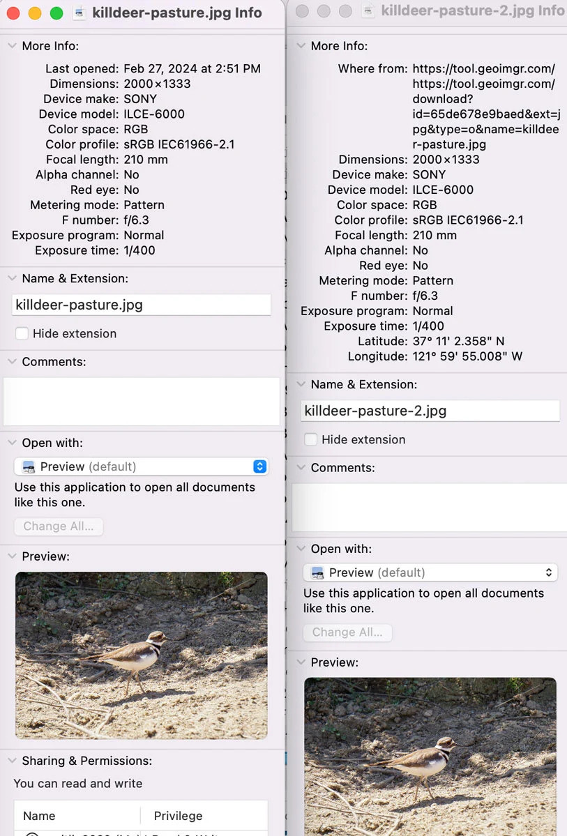
Mapping Geotagged Photos in QGIS [tutorial]
--
https://www.geographyrealm.com/geotagged-photos-qgis/ <-- shared technical article
--
#GIS #spatial #mapping #geotagged #photos #photograph #smartphones #cameras #QGIS #opensource #geotagged #geotagging #encoded #location #alldataisspatial #tutorial
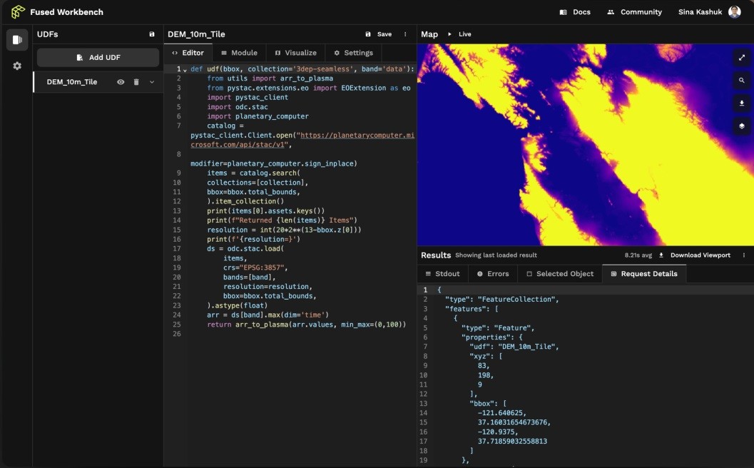
New Geospatial Data Startup Streamlines Satellite Imagery Visualization
--
https://techcrunch.com/2024/03/05/new-geospatial-data-startup-streamlines-satellite-imagery-visualization/ <-- shared media article
--
[sharing of this article is of course not an endorsement]
#GIS #spatial #remotesensing #processing #servers #datastorage #dataprocessing #middleware #earthobservation #spatialdata #alldataisspatial #imagery #visualisation #startup #Fused #spatialanalysis #usecase #appliedscience #ai #datavisualisation #businessmodel #serverless #industry #commercial #api #gateway #satellite
Advantages and Disadvantages of Remote Sensing - Understanding the Limits of a Powerful Technology
--
https://skywatch.com/advantages-and-disadvantages-of-remote-sensing-understanding-the-limits-of-a-powerful-technology/ <-- shared technical article / opinion piece
--
Excellent points, which is why I shared - but one they kind of missed was misinterpretation... it is a natural system, so the algorithms and process to take EA data and interpret necessarily can never be 100% perfect, and nor should they be expected to be. Ground truthing and other checks & balances are a crucial part of any such interpretation.
[This post is not considered an endorsement of this specific company]
--
#GIS #spatial #mapping #remotesensing #earthobservation #advantages #disadvantages #opinionpiece #spatialanalysis #spatiotemporal #alldataisspatial #effectiveness #blackbox #tool #appliedscience #interpretation #limitations #challenges #usefulness #value #roi

How To Create A Simple GIS Map With Plotly And Streamlit [overview and tutorial]
--
https://towardsdatascience.com/how-to-create-a-simple-gis-map-with-plotly-and-streamlit-7732d67b84e2 <-- shared tutorial
--
#GIS #spatial #mapping #Plotly #streamlit #overview #tutorial #mapfunctions #dashboards #graphs #datapresentation #datasummary #spatialdata #alldataisspatial #geography
Spatial BFFs /s
#GIS #spatial #mapping #arcgis #arcgispro #qgis #mappymeme #opensource #StarTrekTNG #startrek #geekdom #geeks #kiwiincolorado #alldataisspatial #gischat

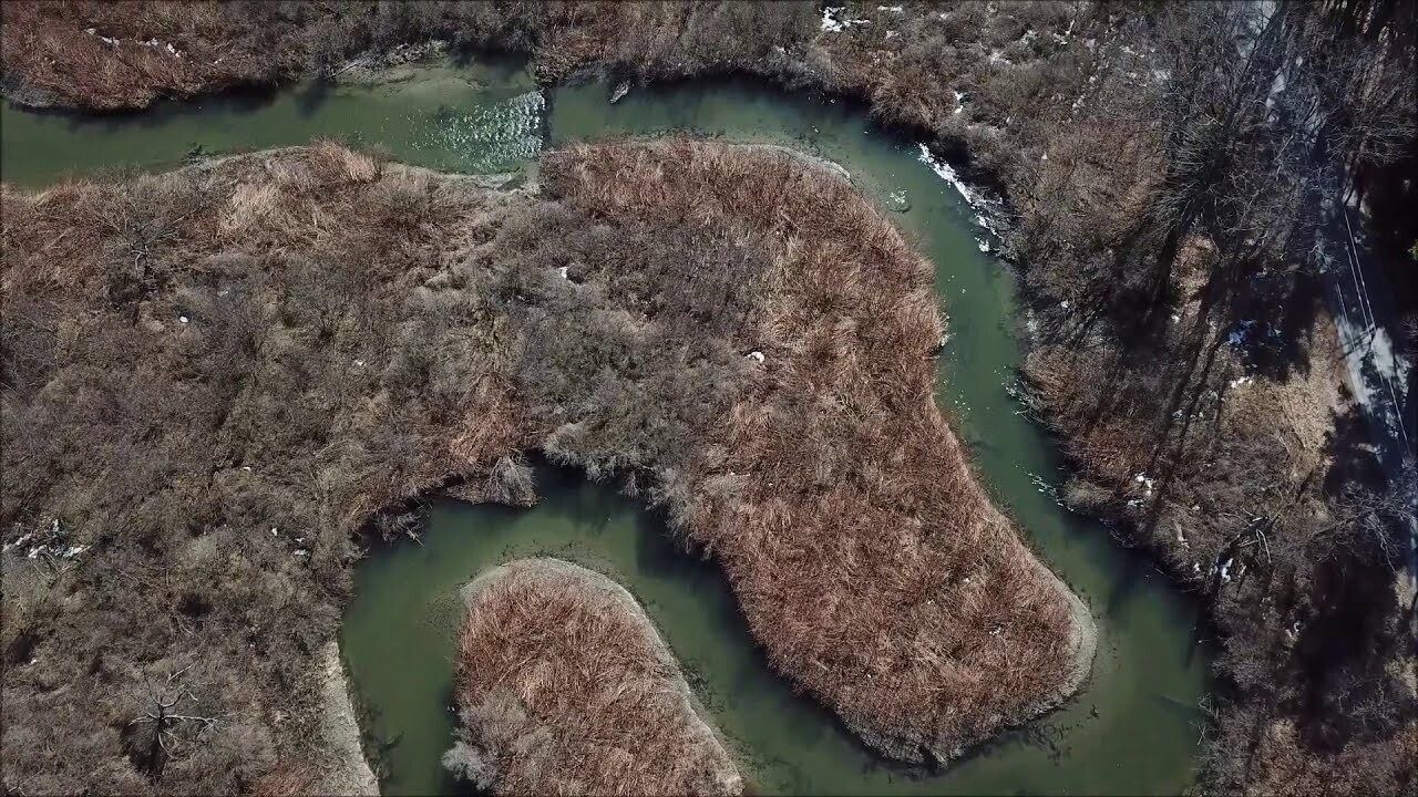
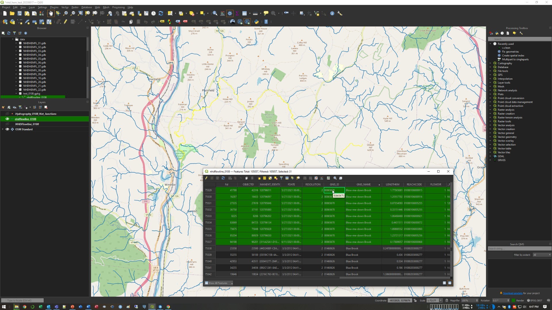
Blow-Me-Down Brook, NH – An NHD Flowline Picked ‘Randomly’
--
http://npshistory.com/brochures/saga/blow-me-down-na-1981.pdf <-- 1981 NPS guide
--
https://www.usgs.gov/3d-hydrography-program <-- USGS’s 3DHP home page
--
I am working on some hydroaddressing / network traversing technical approaches for 3DHP – and needed an example of a multisegment flowline in NHD-sourced dataset, and so ‘randomly’ got this one - Blow-Me-Down, NH, from WBD HUC4-0108.
Although we map so many flowlines (~20 million in the USA for NHD-sourced spatial data, estimated 10x that for the EDH data still to be determined across the USA), I like trying to understand what a flowline or waterbody ‘is’ to the people on the ground as much as I can...
#GIS #spatial #mapping #networktraversing #3DHP #NHD #WBD #water #hydrology #USGS #mapping #USA #elevationderivedhydrography #EDH #3denabled #3dmapping #3dmodeling #3dep #elevation #opendata #nationally #waterresources #appliedscience #newhampshire #watermanagement #watermanagement #alldataisspatial #publicdata
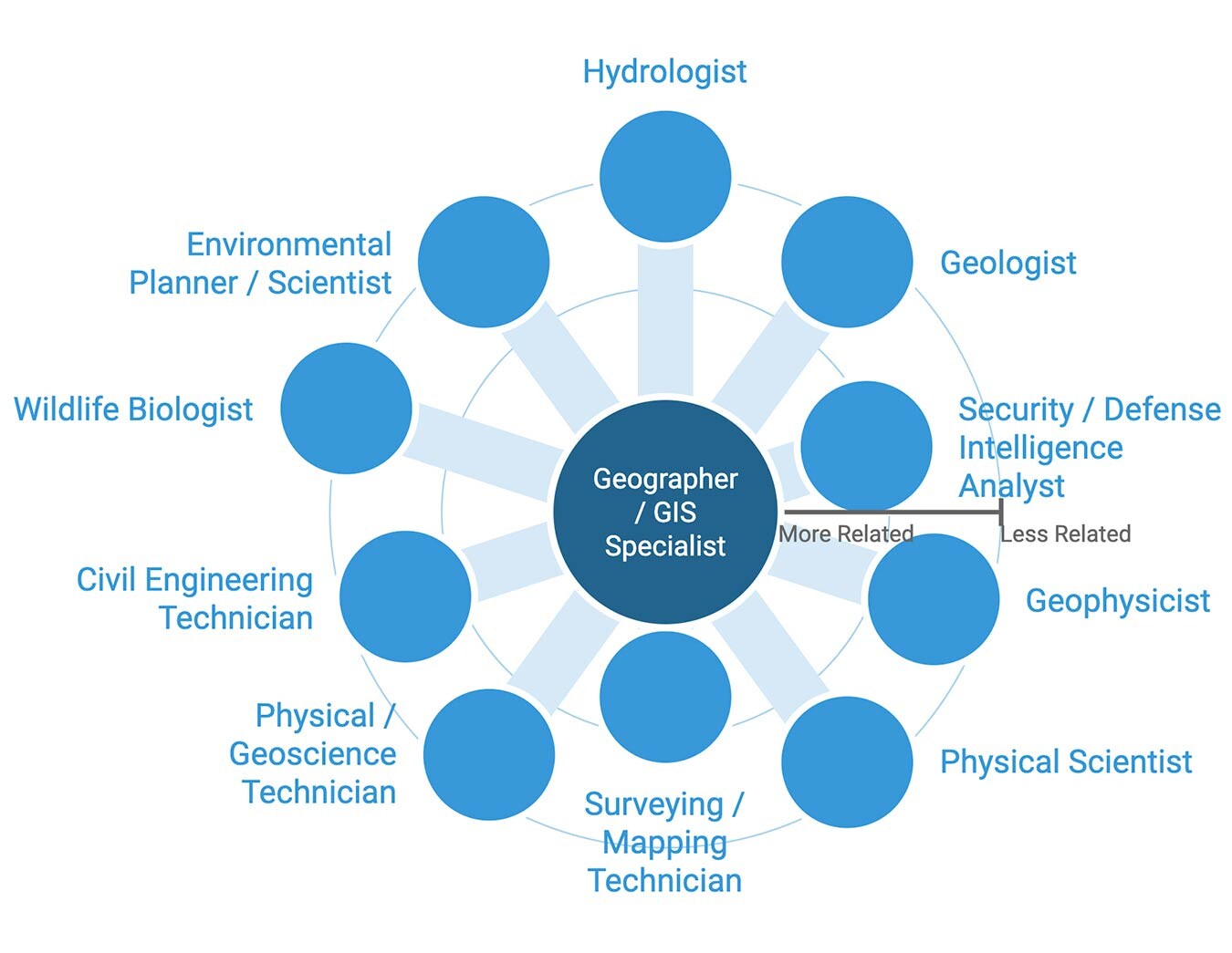
4 [Of Many] Careers In GIS [ / Spatial Data] With Great Job Outlooks
--
https://gis.usc.edu/blog/the-4-fastest-growing-career-fields-in-gis/ <-- shared article
--
[I am not associated with this university in any way, just thought that it was an informative article]
[My personal take is that unless you want specifically to be ‘Spatial Super Hero’ then pick a professional field that you appreciate & interests you - and then use GIS / spatial data skills to support that with your gained knowledge. Note that this field will almost certainly change over your career and that is A-OK; I started out as an engineering geologist, still keep my license current, then environmental scientist including nuclear site cleanups, and now work in the area of spatial data for hydrology, next is…]
#GIS #spatial #mapping #gischat #gismapping #career #careeradvice #careeradvancement #careeracceleration #job #jobtraining #training #traininganddevelopment #spatialdata #spatialanalysis #geography #cartographer #surveyor #urbanplanning #alldataisspatial

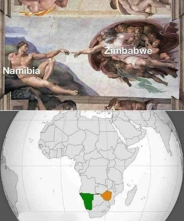
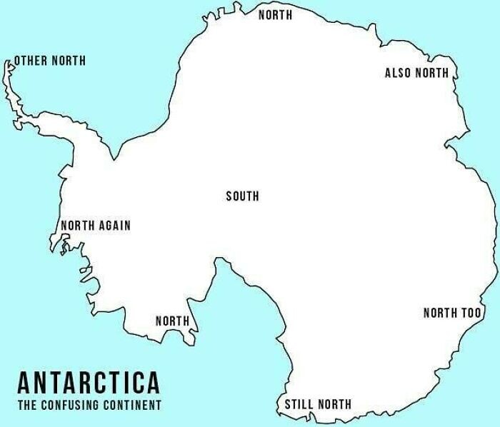
30 [Often Purposefully] Terrible Maps That Are As Funny As They're Useless
--
https://www.boredpanda.com/terrible-maps-funny/ <-- shared article
--
“OK, folks, you might want to keep your GPS on while scrolling through this one because we're heading into the land of 'Terrible Maps.'
It's a bumpy ride, full of wrong coordinates and not-very-helpful legends, however, the unexpected twists and turns are what make it so memorable.
This fun online project, dedicated to geographically incorrect entertainment, features such gems as 'The World According To Fish' and 'What Pedestrian [Signs] Look Like Across Europe.'
Even though its content might not get you from point A to point B, the pictures can, in fact, teach you something and put a smile on your face…”
#GIS #spatial #mapping #cartography #examples #spatialdata #AllDataIsSpatial #map #maps #usecases #representation #examples #mappymemes #badmaps #mappingfails #entertainment

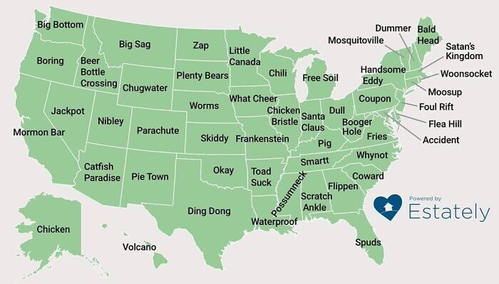
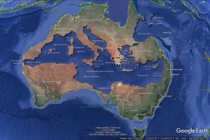
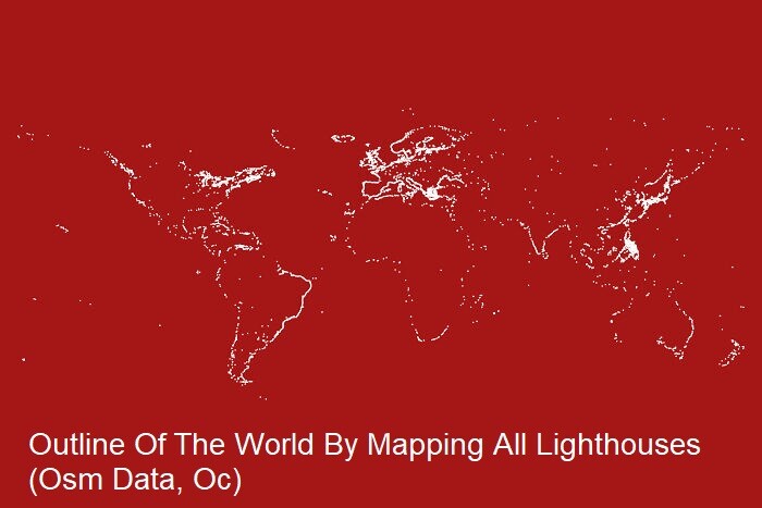
40 Surprising Maps That Show A Completely Different Side To The World We Live In
--
https://www.boredpanda.com/various-interesting-maps-pics/ <-- shared article
--
[All Data Is Spatial!]
“Who doesn't love a good map? I'd even say we'd get lost without one. They enrich our understanding of the world in a simple, visual way.
Maps teach us not only about the size and shapes of countries but also show many more interesting things, like earthquake locations and wealth distribution. The local status of gay marriage or car reliance. Pretty much everything we have data on!..”
#GIS #spatial #mapping #cartography #examples #spatialdata #AllDataIsSpatial #map #maps #usecases #representation #examples

Client Info
Server: https://mastodon.social
Version: 2025.04
Repository: https://github.com/cyevgeniy/lmst