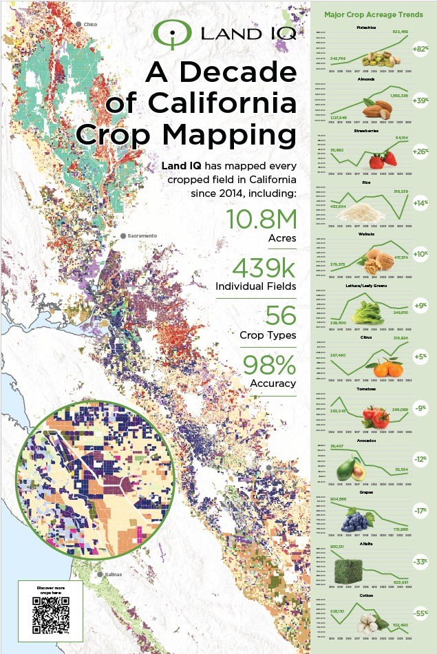
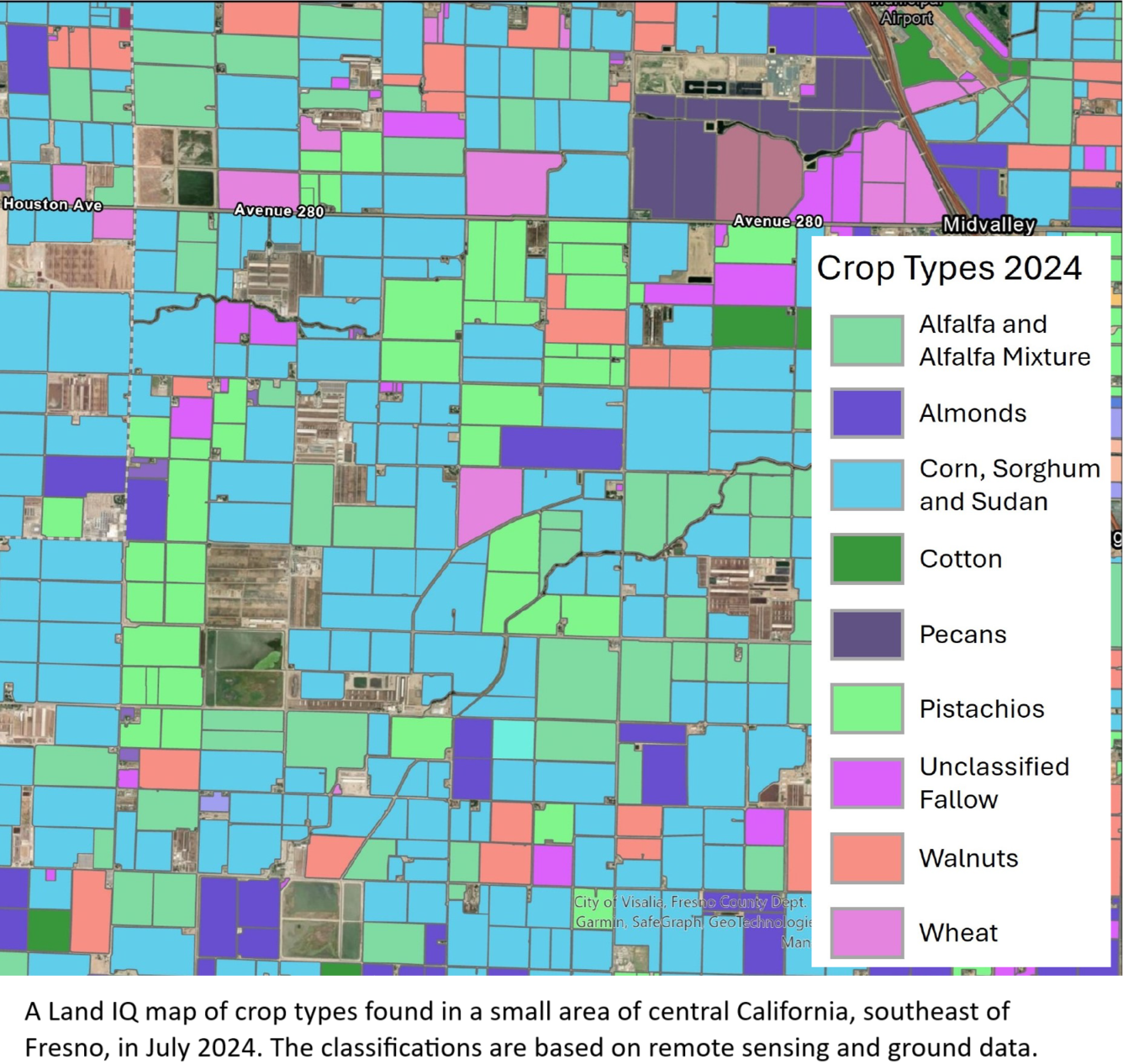
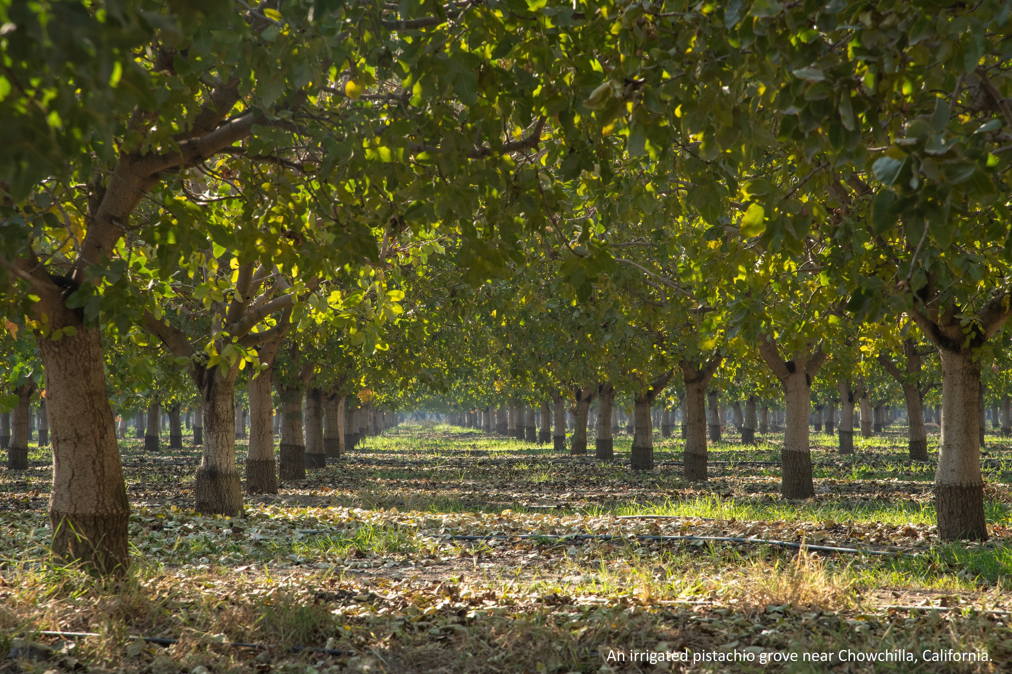
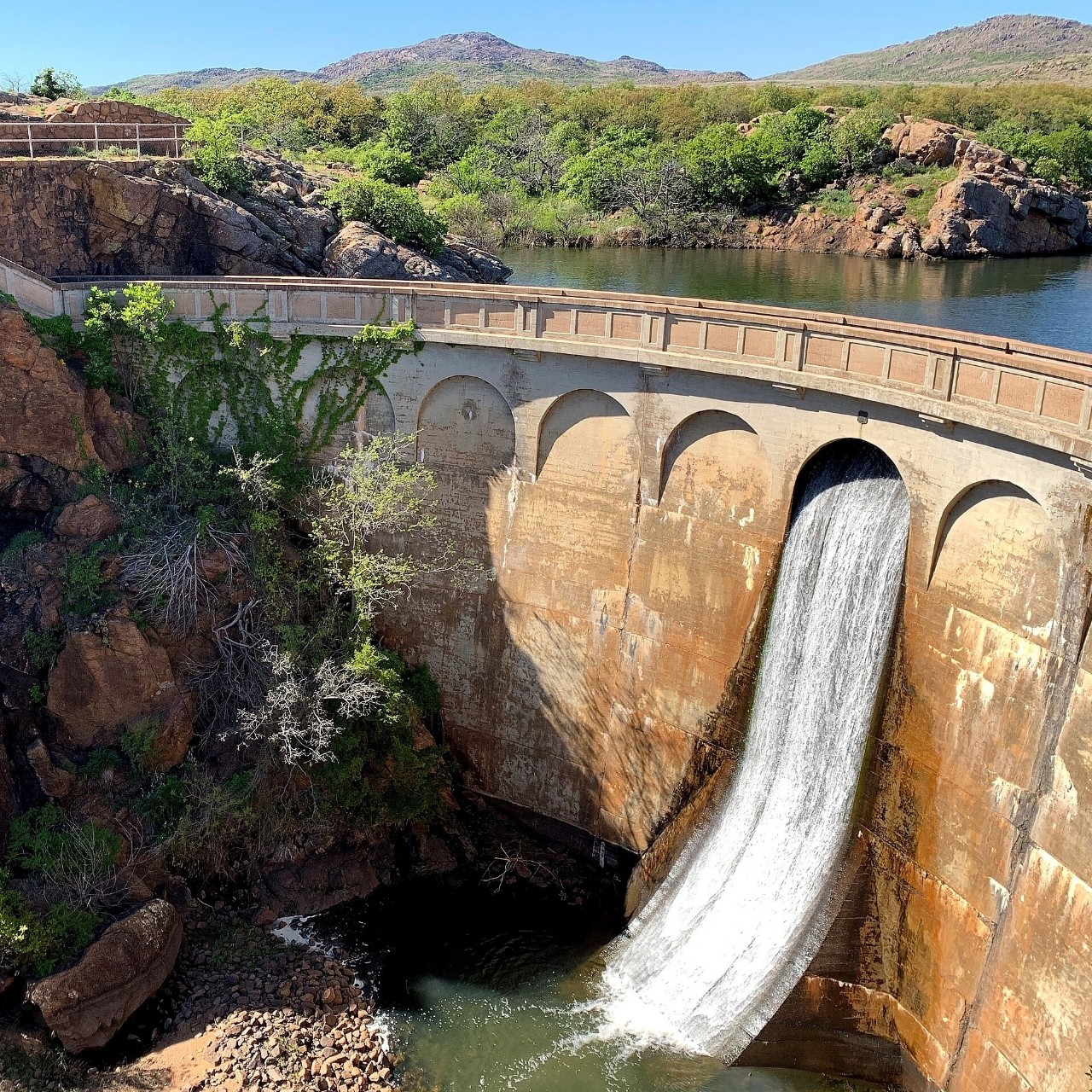
Landsat At Work – Satellites Help With Complex Crop And Water Issues
--
https://www.usgs.gov/centers/eros/news/landsat-work-satellites-help-complex-crop-and-water-issues <-- shared USGS technical article
--
https://www.usgs.gov/landsat-missions/landsat-data-access <-- shared open data USGS landsat datasets
--
#GIS #spatial #mapping #landsat #remotesensing #earthobservation #satellite #agriculture #usecase #irrigation #orchards #California #landsurface #groundwater #pumping #efficiency #watereresources #fedscience #watersupply #monitoring #planning #management #sustainable #sustainability #LandIQ #well #model #modeling #watersecurity #food #foodsecurity #crops
#USGS | #EROS
#FedScience

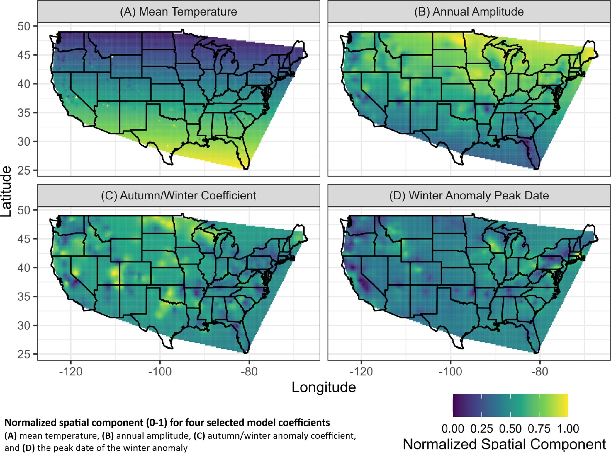
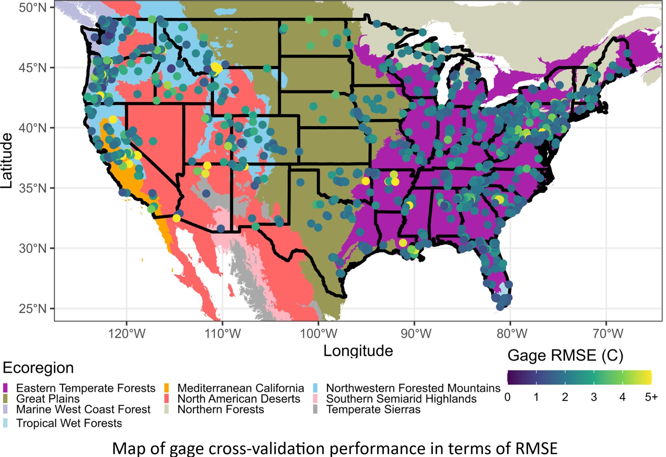
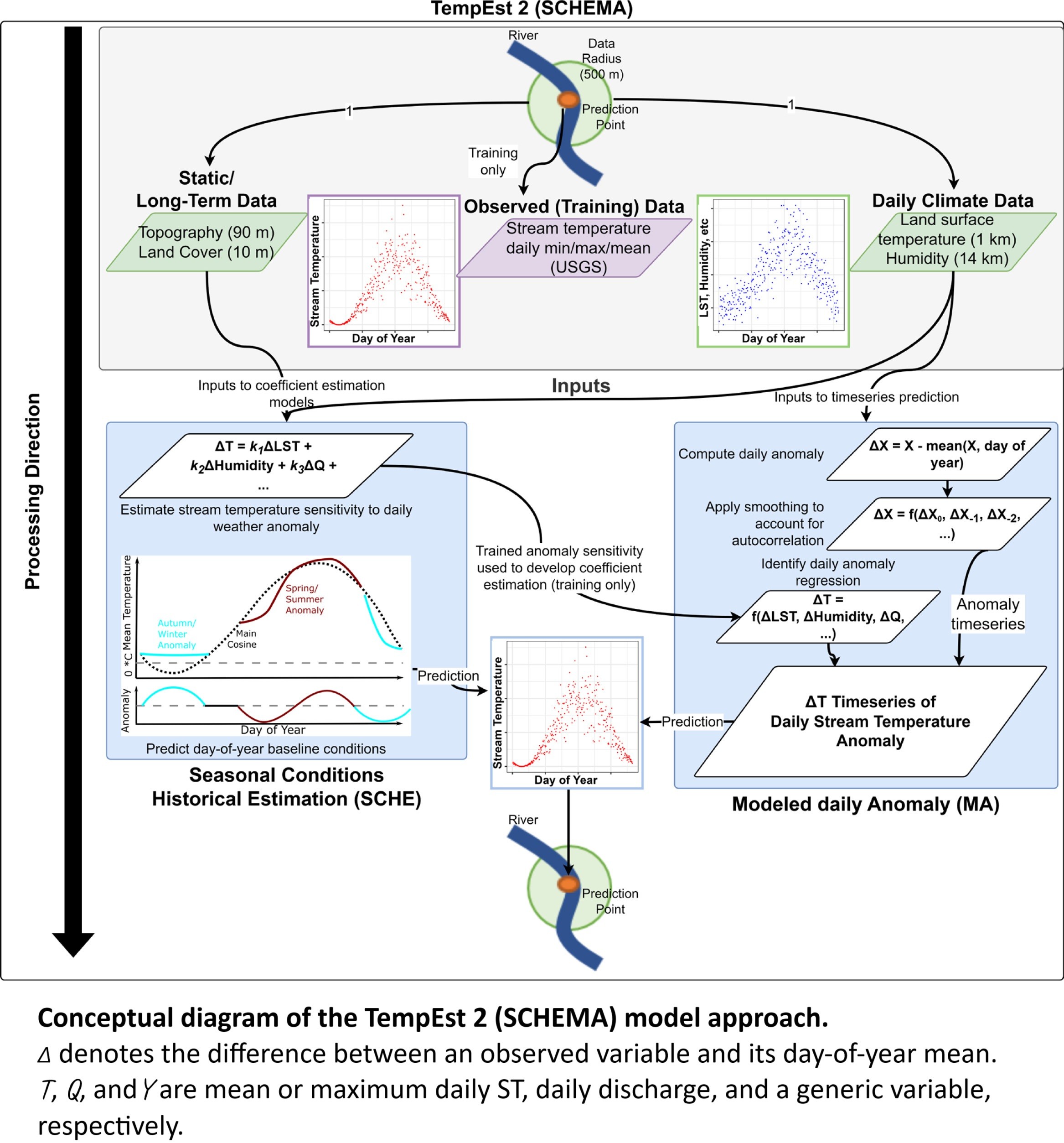
Satellite-Based Spatial-Statistical Modeling Of Daily Stream Water Temperatures At The CONUS Scale
--
https://doi.org/10.1016/j.jhydrol.2025.133321 <-- shared paper
--
#GIS #spatial #mapping #Streamtemperature #Rivertemperature #Watertemperature #Statisticalmodel #Satellite #remotesensing #ContiguousUnitedStates #CONUS #Lower48th #spatialstatistics #geostatistics #earthobservation #water #hydrology #stream #river #temperature #surfacewater #model #modeling ##seasons #weather #TempEst2 #climate #urban #natural #rural #ecoregions #ecosystems #streamgage #USGS #fedscience
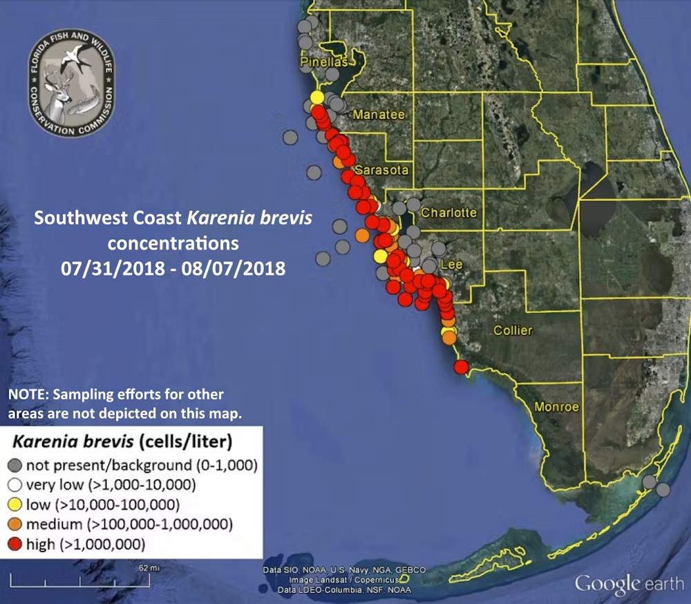
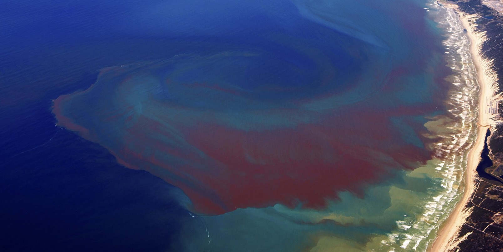
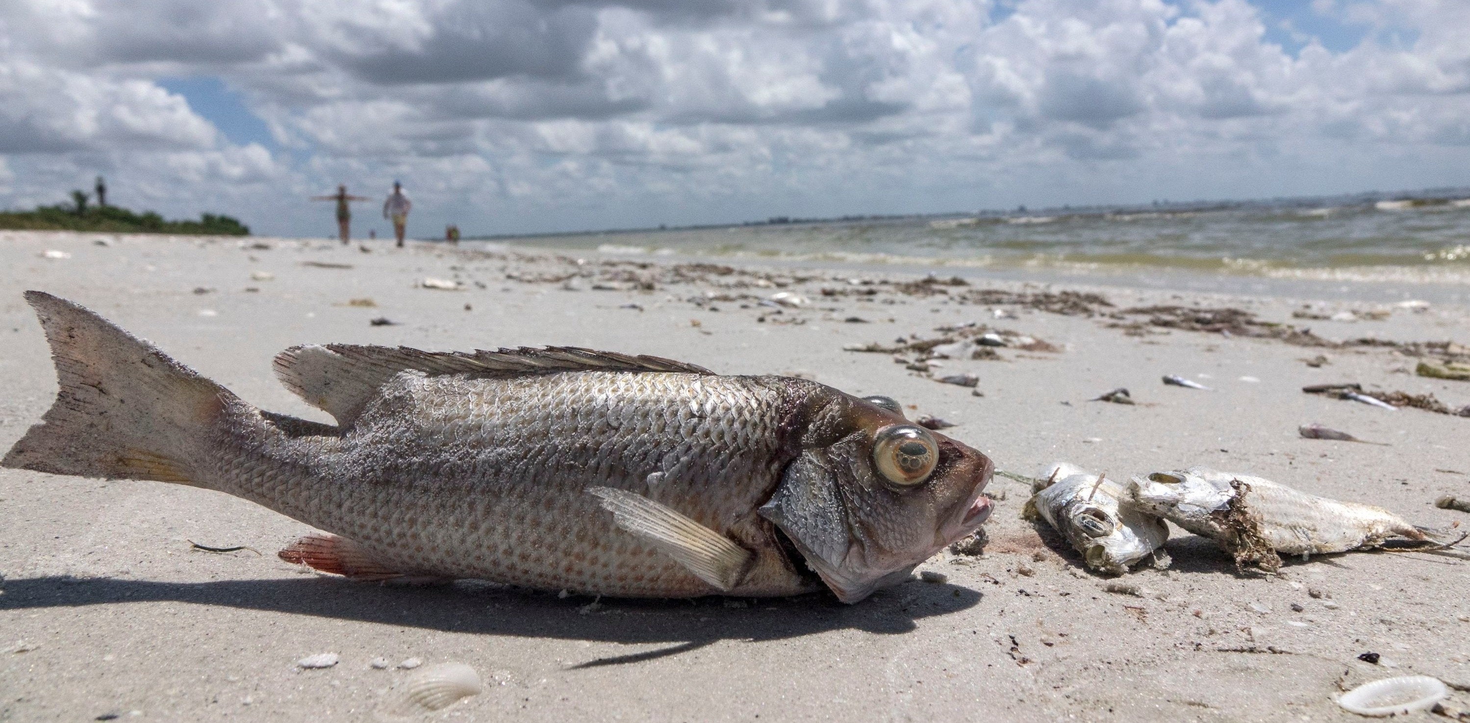
Total Economic Impact Of 2018 [Florida, USA] Red Tide Now Estimated at $2.7B
--
https://coastalscience.noaa.gov/news/total-economic-impact-of-2018-red-tide-now-estimated-at-2-7b/ <-- shared article
--
https://doi.org/10.1016/j.jenvman.2023.119811 <-- shared paper
--
https://habforecast.gcoos.org/ <-- shared Red Tide Respiratory Forecast web map
--
#GIS #spatial #mapping #fedservice #fedscience #Florida #alldataisspatial #USA #redtide #cost #economics #tourism #tourist #economy #localeconomy #algaebloom #fish #fisheries #ecosystems #humanimpacts #anthropogenic #habitat #2018redtide #publichealth #RedTideRespiratoryForecast #forecast #monitoring #spatialanalysis #spatiotemporal
#NOAA

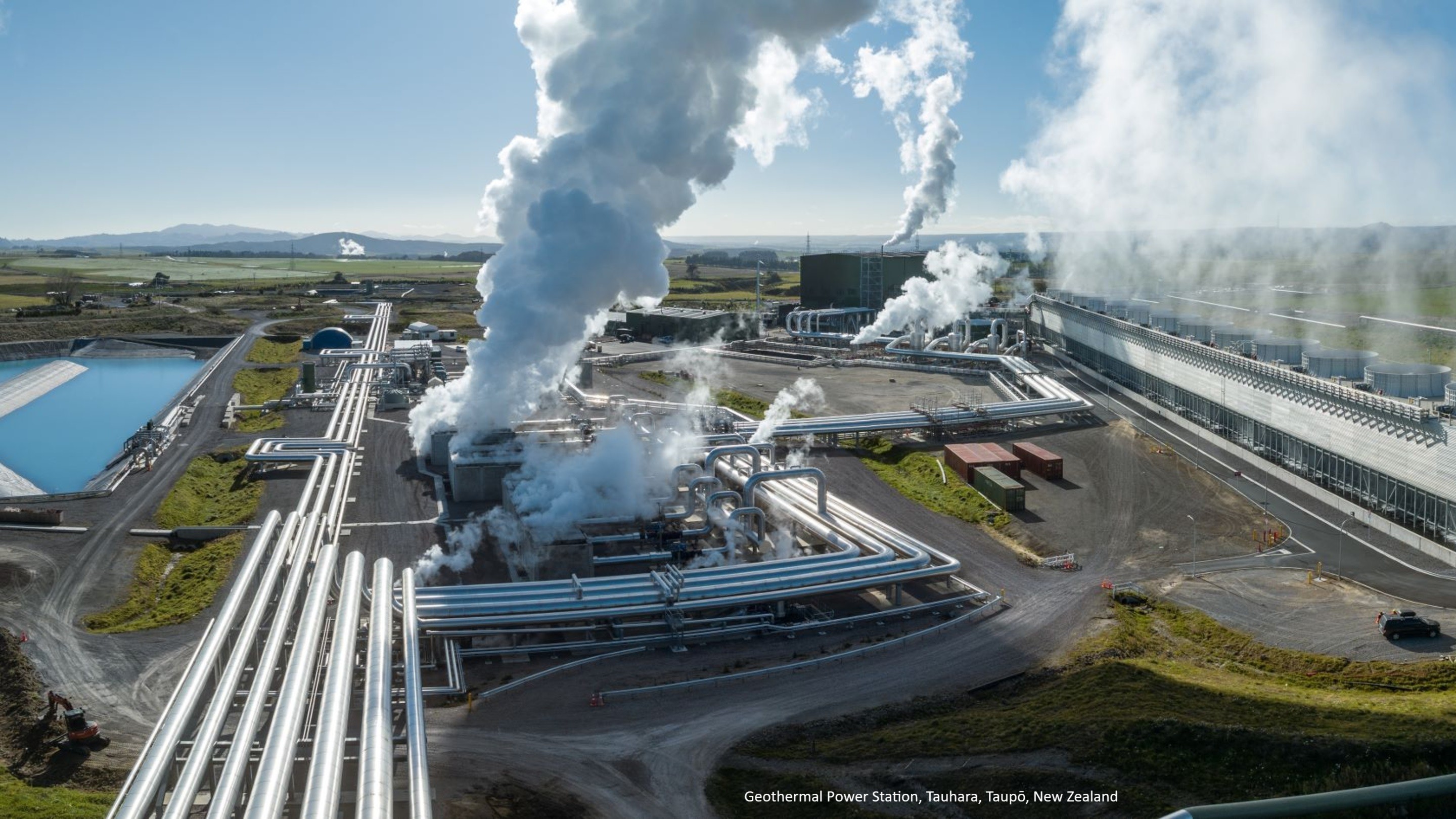
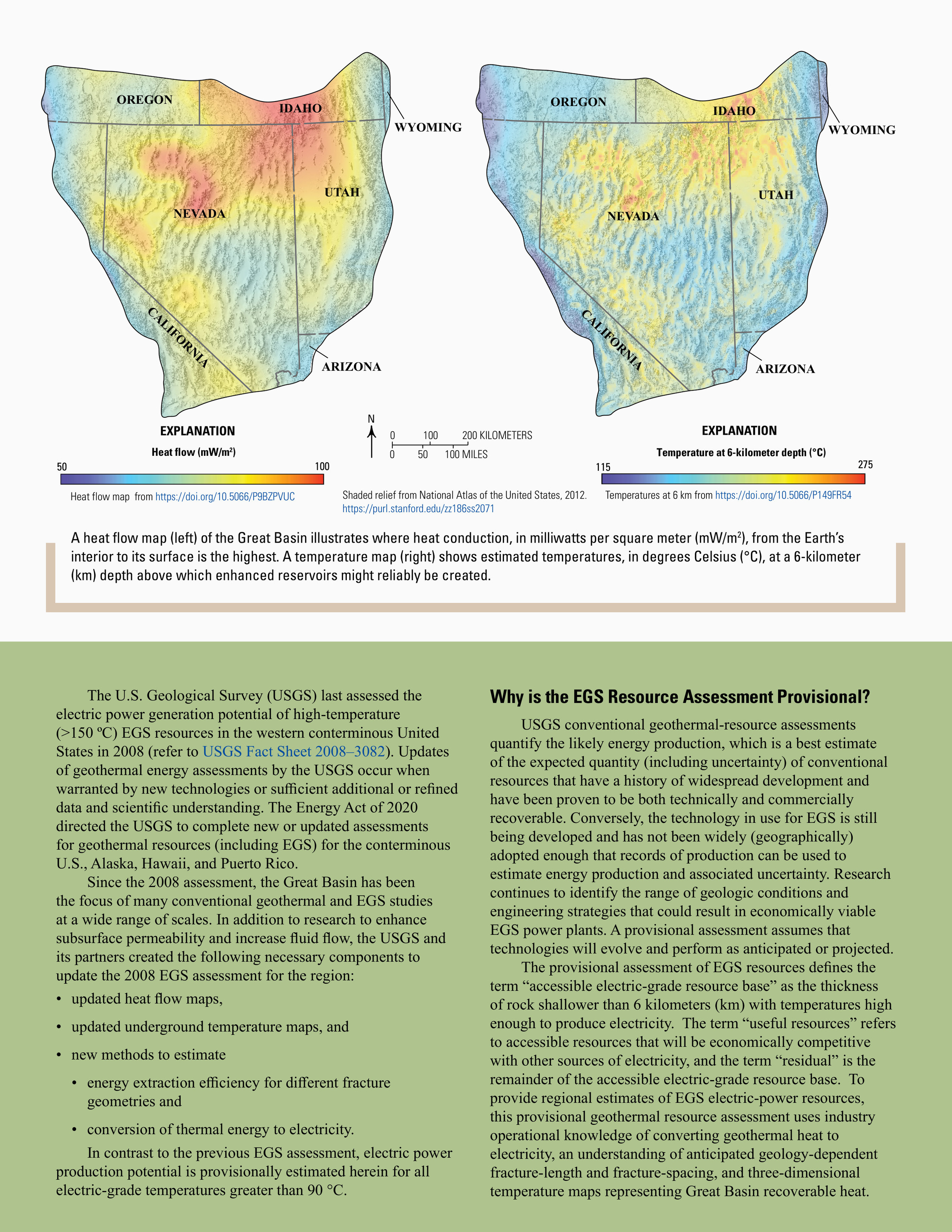
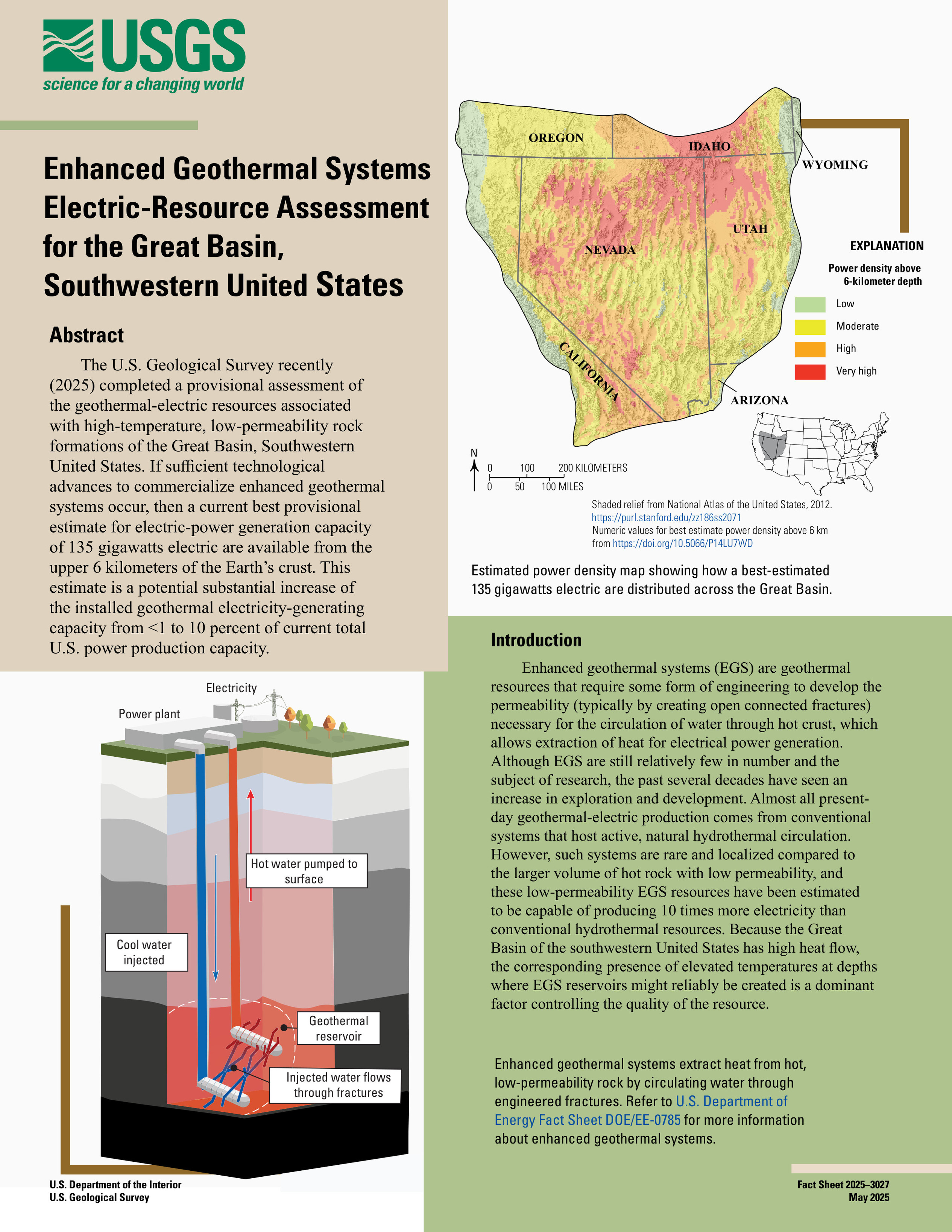
New USGS Geothermal Energy Assessment Released
--
https://pubs.usgs.gov/publication/fs20253027 <-- shared USGS publication
--
https://www.usgs.gov/news/national-news-release/enhanced-geothermal-systems-great-basin-could-supply-10-us-electricity <-- shared USGS technical overview article
--
#energy #independence #naturalresources #energysource #renewableenergy #geothermal #geology #assessment #exploration #development #production #exploitation #GreatBasin #USA #powersupply #electric #electricity #potential #EnhancedGeothermalSystems #fedscience #geothermalresources #technology #powergeneration #USWest #USSouthWest #gigawatts
@USGS
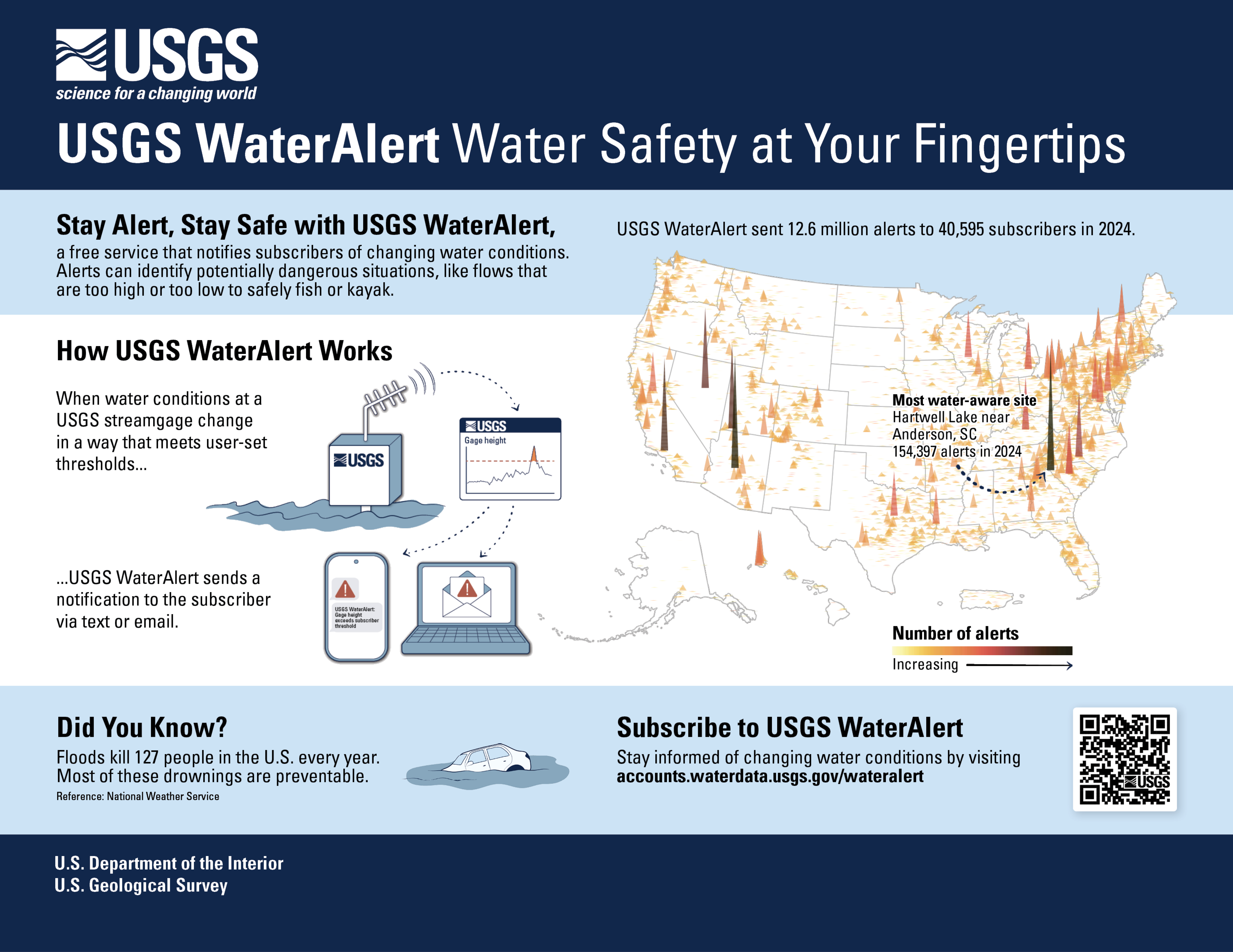
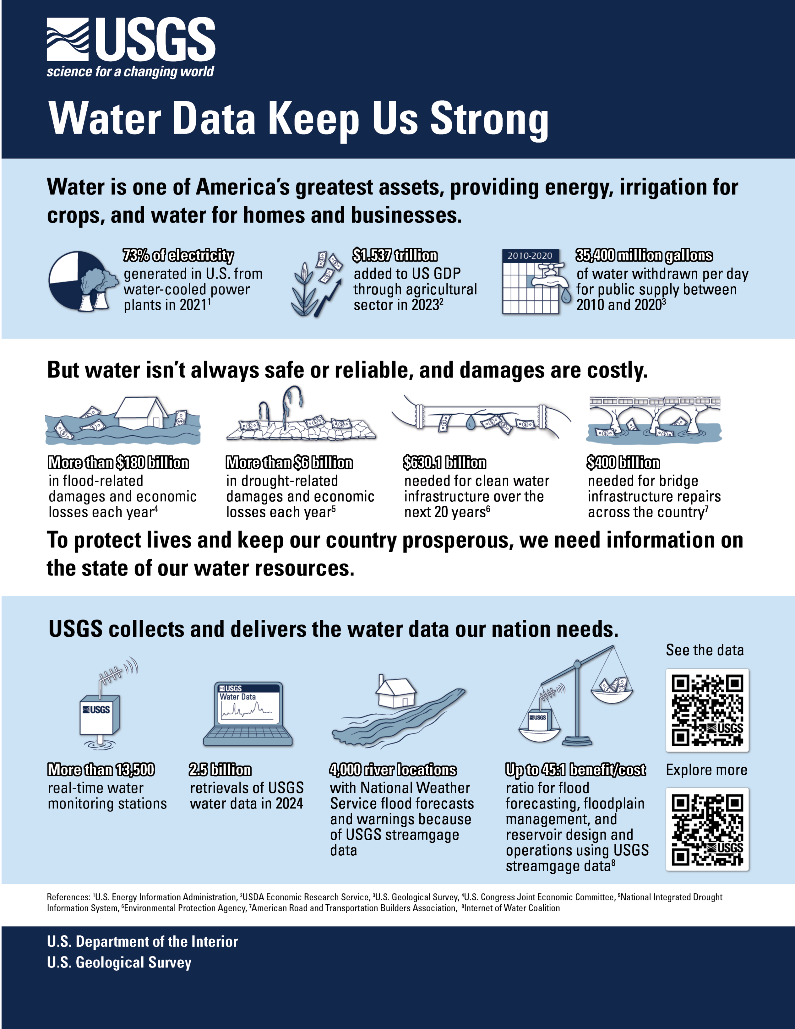
Water Data Keep Us Strong | USGS WaterAlert Water Safety at Your Fingertips [USGS Water]
--
https://www.usgs.gov/media/images/water-data-keep-us-strong and https://www.usgs.gov/media/images/usgs-wateralert-water-safety-your-fingertips <-- shared pair of USGS water-related infographics
--
https://accounts.waterdata.usgs.gov/wateralert/ <-- shared link to subscribe to USGS Water Alert
--
#water #hydrology #fedservice #fedscience #watersecurity #infographics #infographic #opendata #data #GIS #spatial #mapping #US #USA #alert #risk #hazard #monitoring #notification #waterdata #usecase #farms #agriculture #businesses #industry #residential #cost #economics #vitalresource #damage #assesr #resource #energy #HEP #watersupply #waterresources #management #planning #education #awareness #national #nation #WaterAlert #alerts #flows #streamflow #river #streamgauge #notification
@USGS

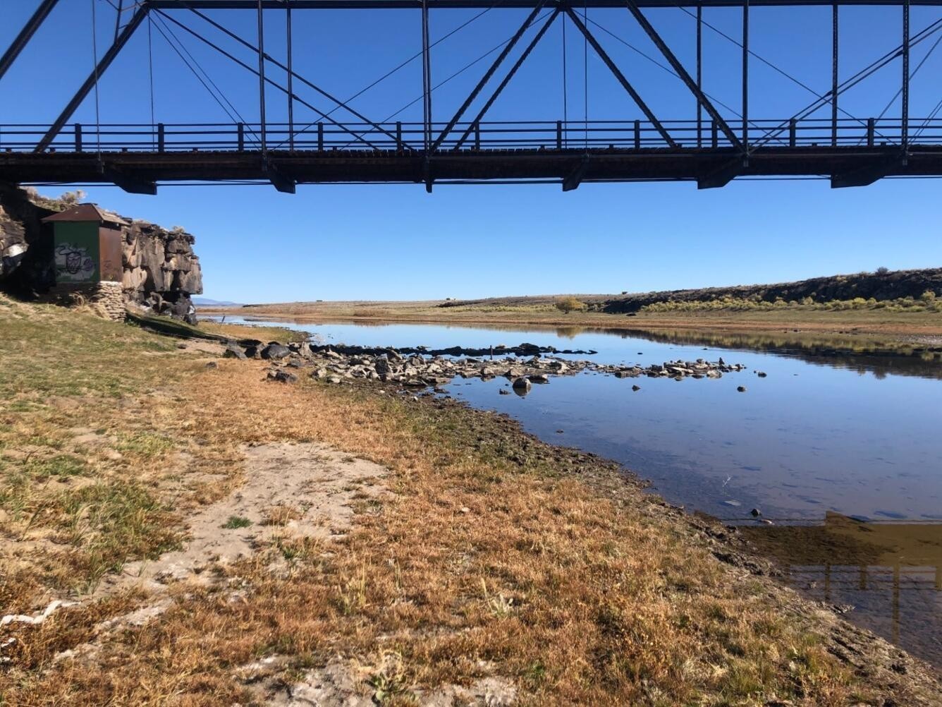
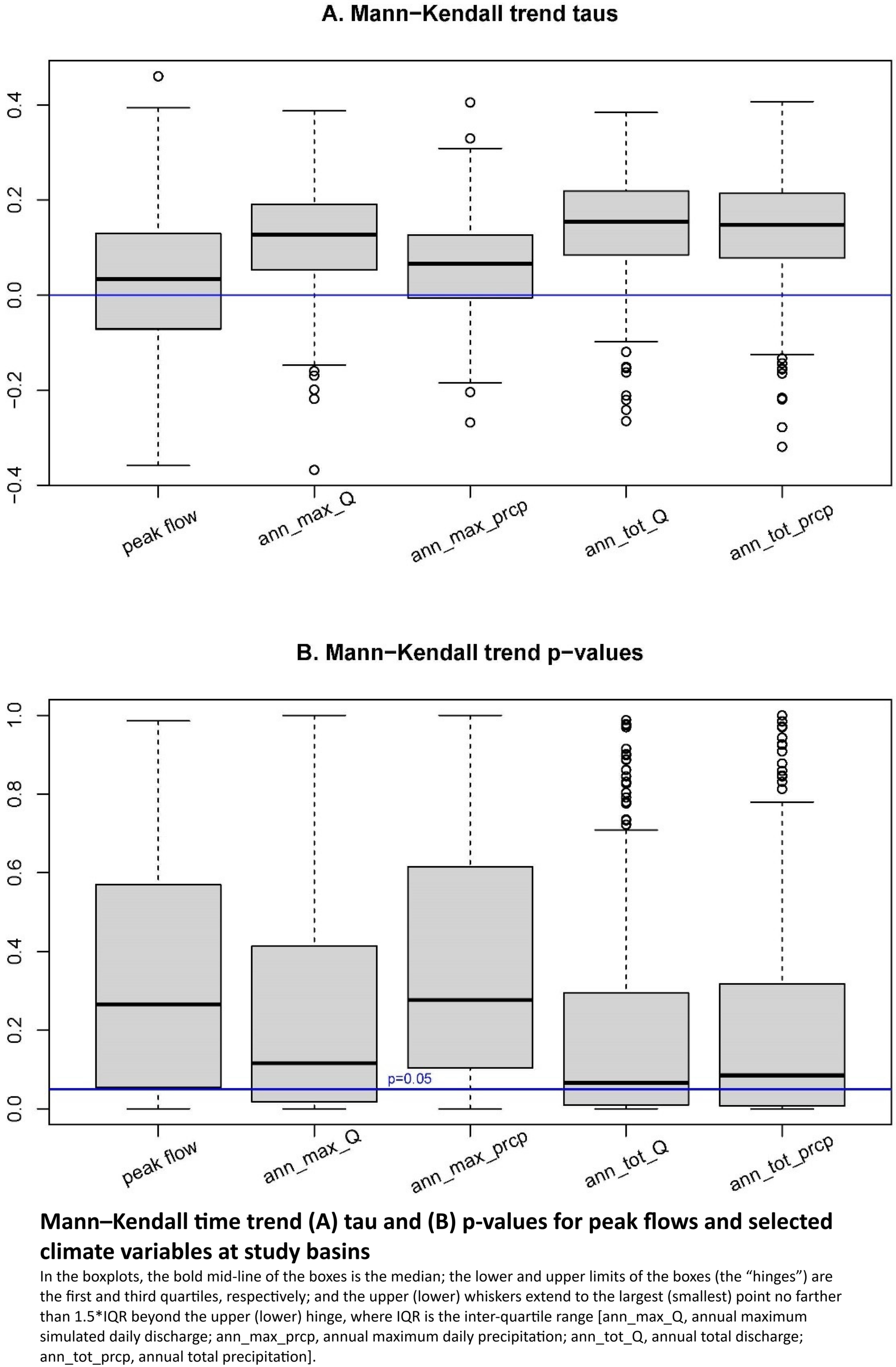
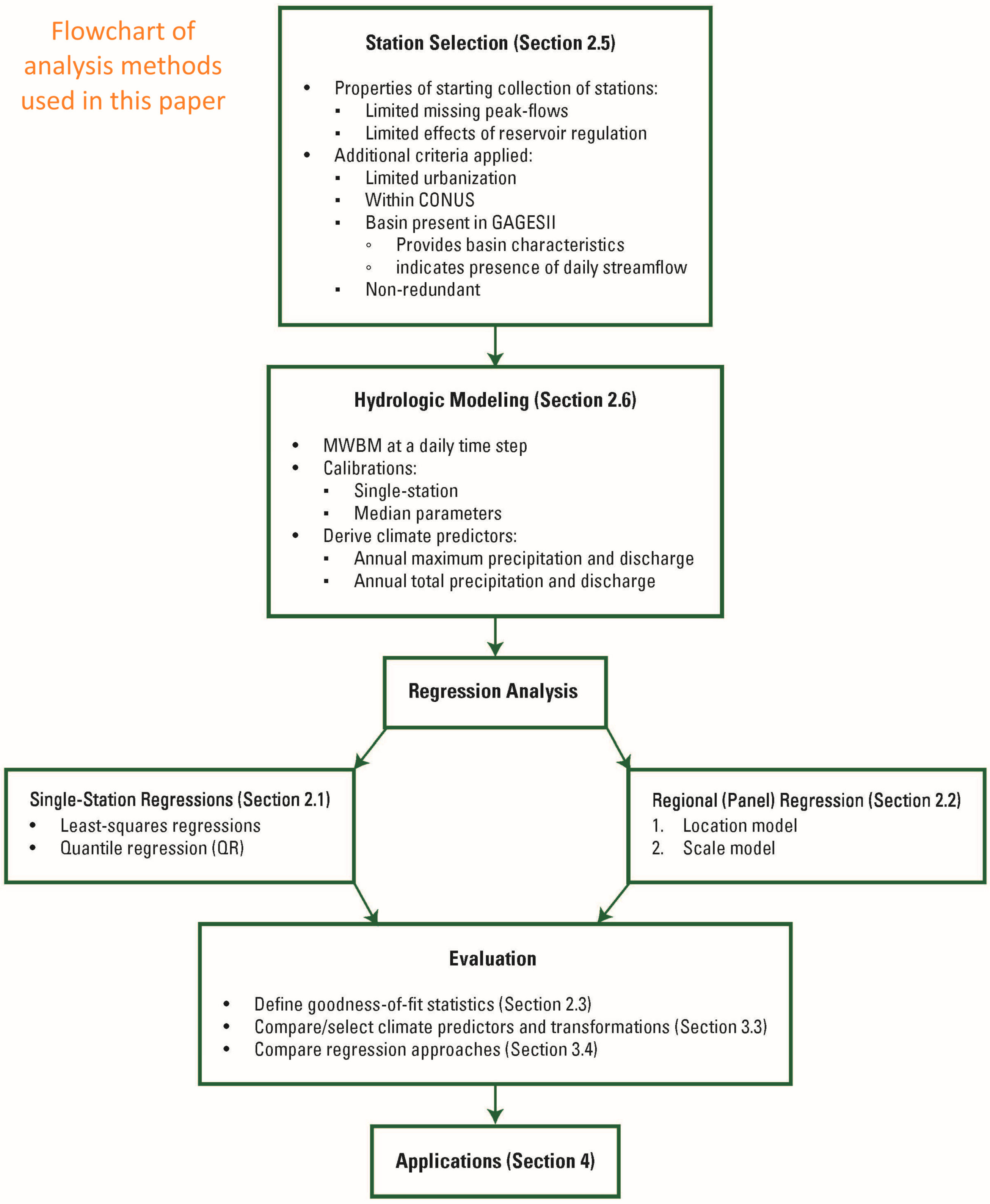
Regional Analysis Of The Dependence Of Peak-Flow Quantiles On Climate With Application To Adjustment To Climate Trends
--
https://doi.org/10.3390/hydrology12050119 <-- shared paper
--
#GIS #spatial #mapping #floodfrequency #nonstationarity #fedscience #climatevariation #climatechange #extremeweather #regression #water #hydrology #flood #flooding #waterbalance #Midwest #USA #spatialanalysis #spatiotemporal #model #modeling #statistics #geostatistics #streamgage #gauge #basins #watersheds #precipitation #discharge
@USGS
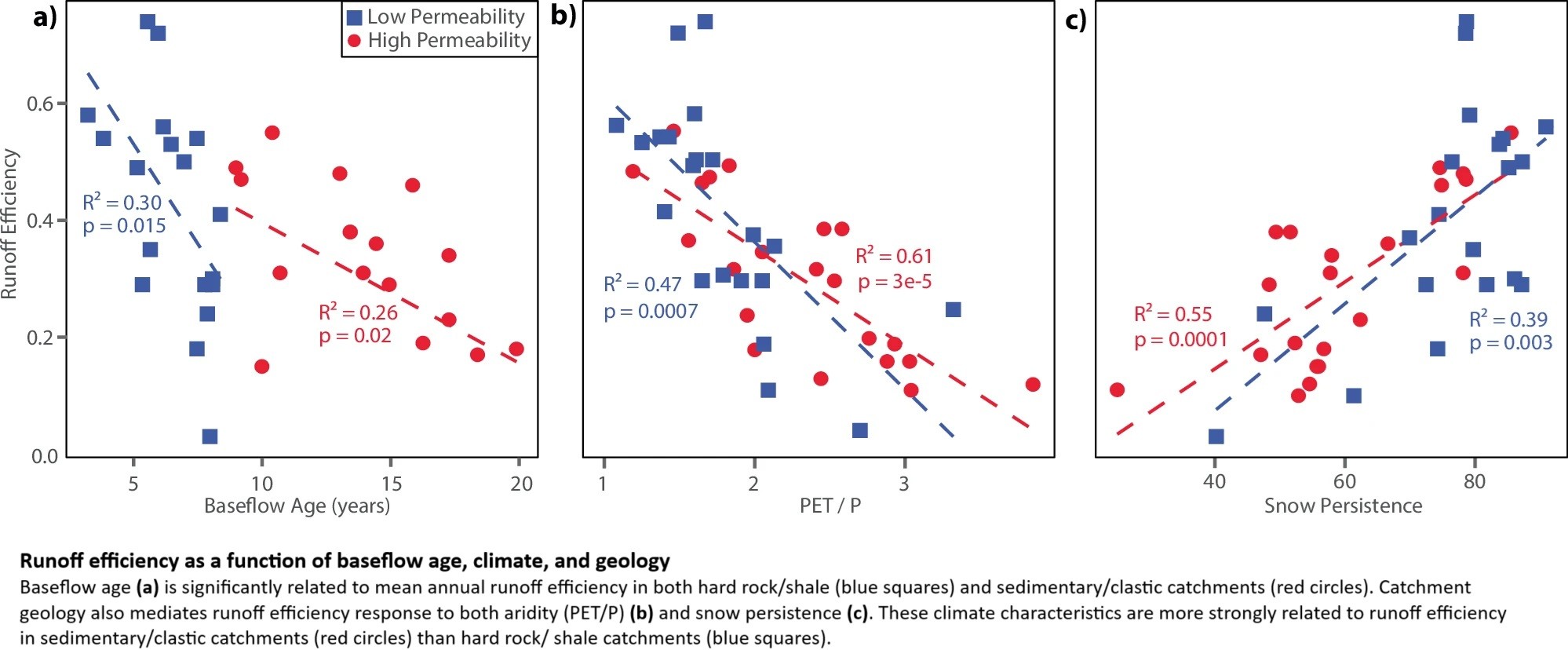
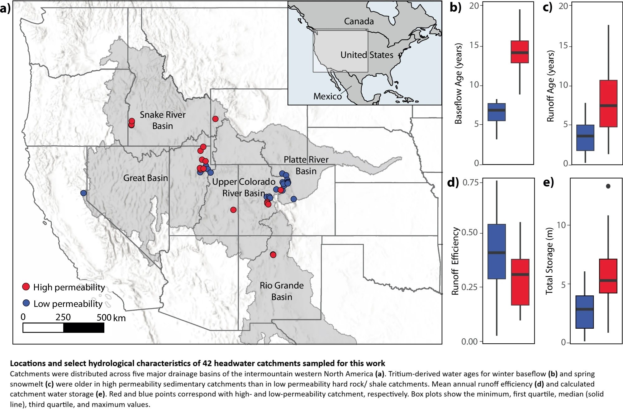
Groundwater Dominates Snowmelt Runoff And Controls Streamflow Efficiency In The Western United States
--
https://doi.org/10.1038/s43247-025-02303-3 <-- shared paper
--
#GIS #spatial #mapping #water #hydrology #fedscience #climatechange #snowmelt #waterresources #watersupply #management #planning #watersecurity #USWest #Rockies #snow #winter #mountain #catchment #dating #tritium #spatialanalysis #spatiotemporal #runoff #streamflow #infiltration #model #modeling #geology #geomorphology #groundwater #storage #surfacewater #streamwater #precipitation #bedrock #soils #sediments #permability #porosity #watershed #subsurfaceflow #storage #climate #future #landscape

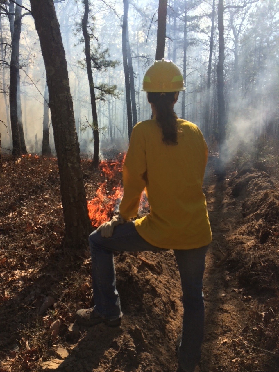
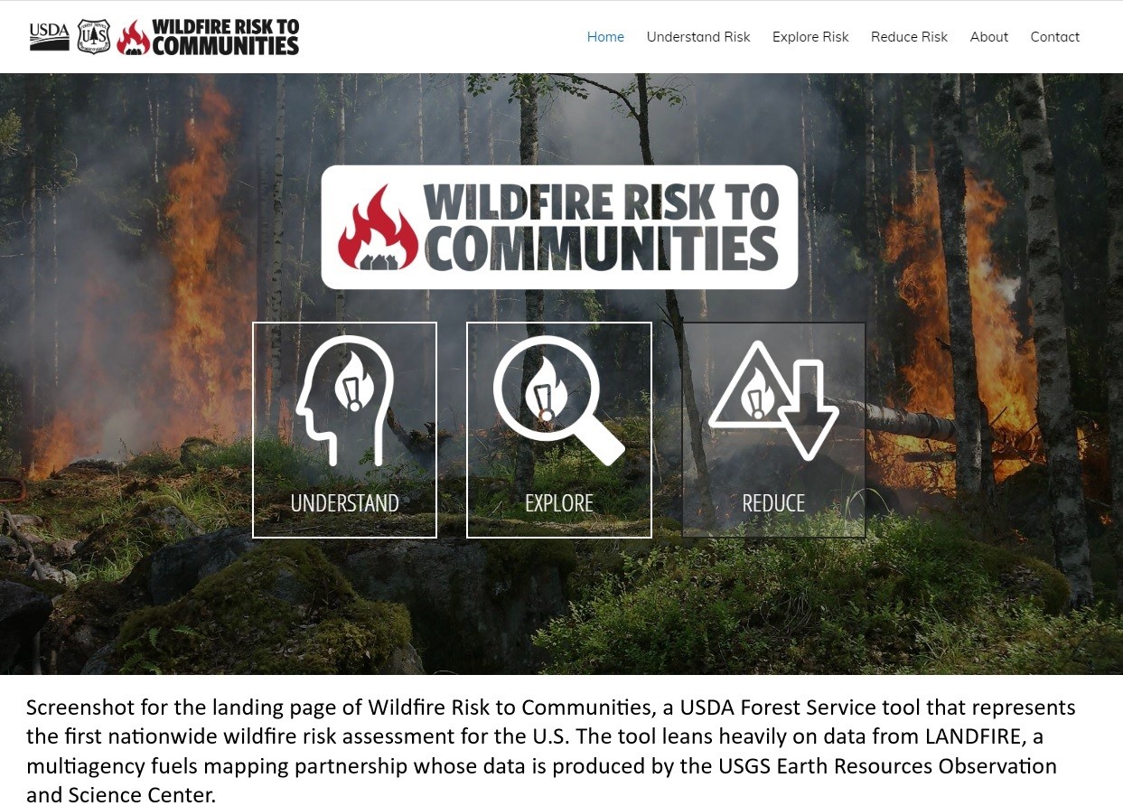
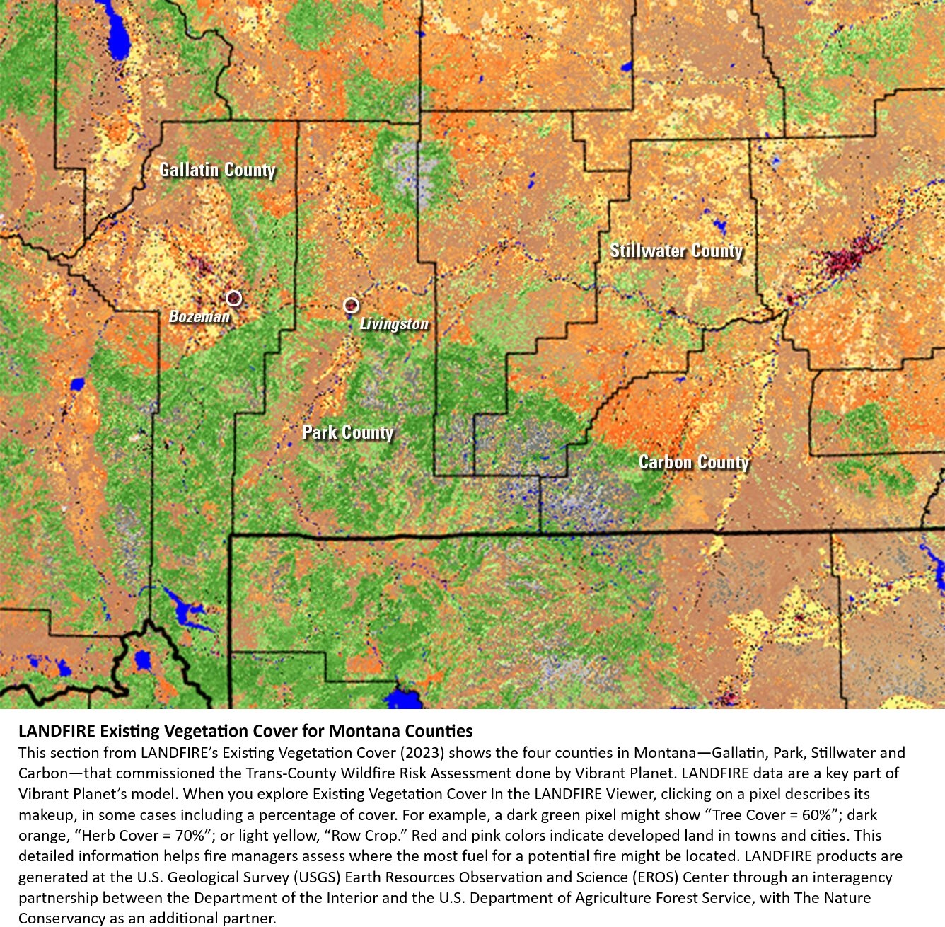
LANDSAT At Work – Satellites Help Extinguish Wildfire Risk
--
https://www.usgs.gov/centers/eros/news/landsat-work-satellites-help-extinguish-wildfire-risk <-- shared technical article
--
https://www.landfire.gov/ <-- shared LandFire project page
--
#GIS #spatial #mapping #fedscience #LANDFIRE #satellite #remotesensing #earthobservation #risk #hazard #fire #wildfire #mitigation #planning #management #spatialanalysis #spatiotemporal #model #modeling #economics #cost #weather #population #extremeweather #naturalhazard #landsat #next #satellite #NationalLandImaging #NLI #LandsatNext
@USGS @USDA @USFS @DOI @EROS
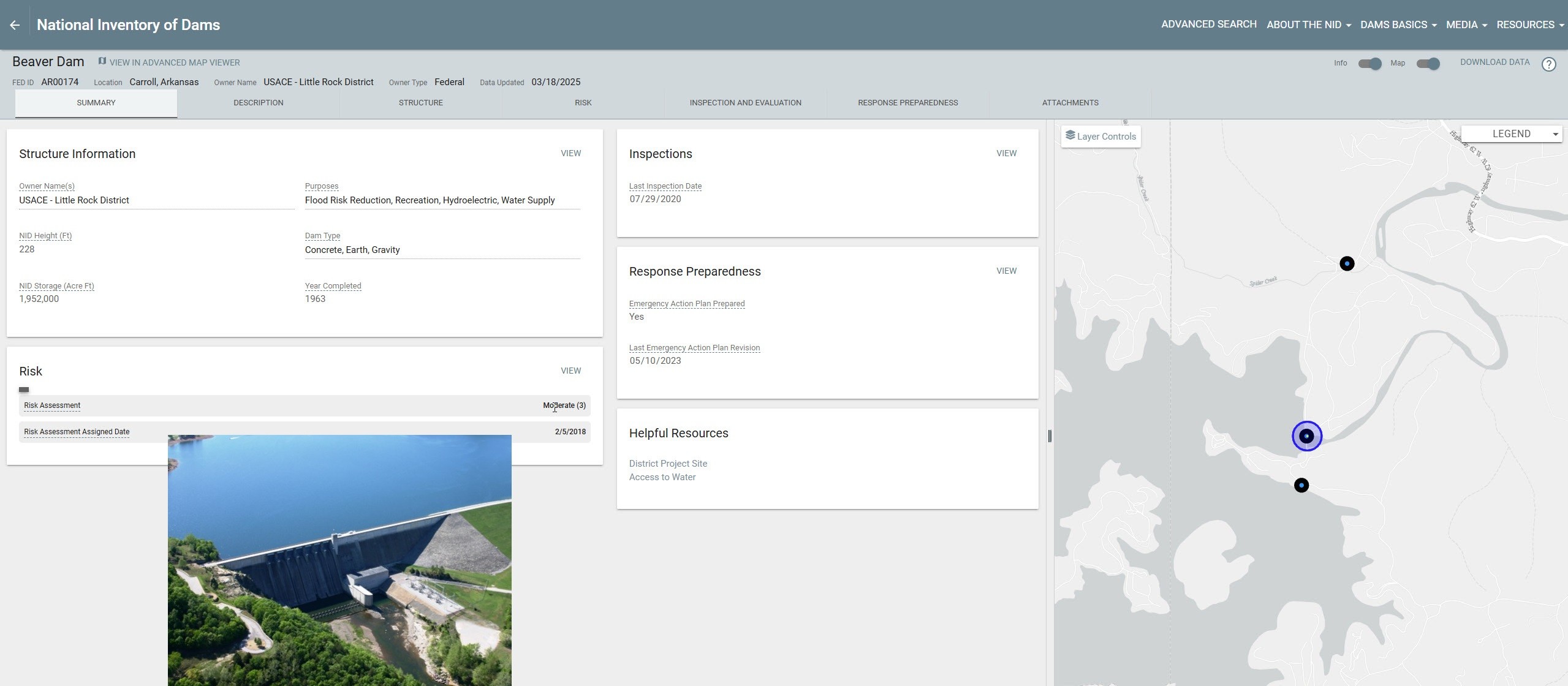
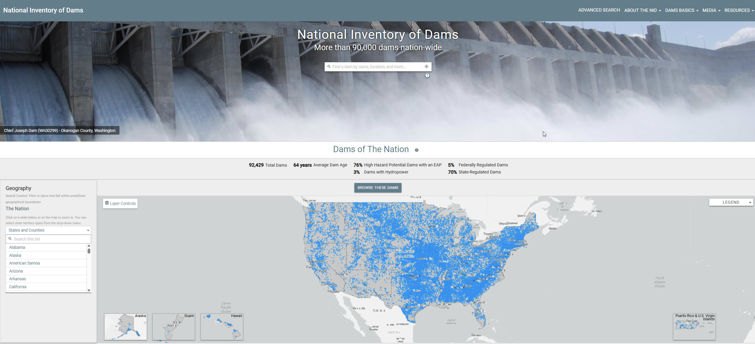
US National Inventory Of Dams [NID] [open spatial data]
--
H/T Data Is Plural https://www.data-is-plural.com/
--
“The National Inventory of Dams [https://nid.sec.usace.army.mil/] [is a is a congressionally authorized] ‘document[ing] all known dams in the U.S. and its territories that meet certain criteria’ related [https://nid.sec.usace.army.mil/#/about-the-nid/mission] to the dam’s height, reservoir size, and likely impacts of its ‘failure or mis-operation.’..."
#GIS #spatial #mapping #fedscience #NationalInventoryofDams #NLDI #US #USA #dams #criteria #inventory #opendata #downloadable #risk #hazard #infrastructure #energy #HEP #waterresources #hydroelectric #webmap #USACE #operations #dataset #safety #inspection #uses
@USACE @FEMA @EPA

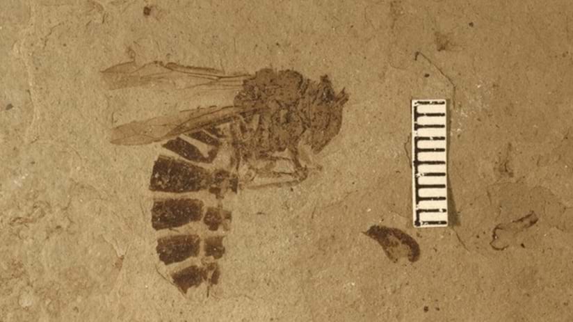
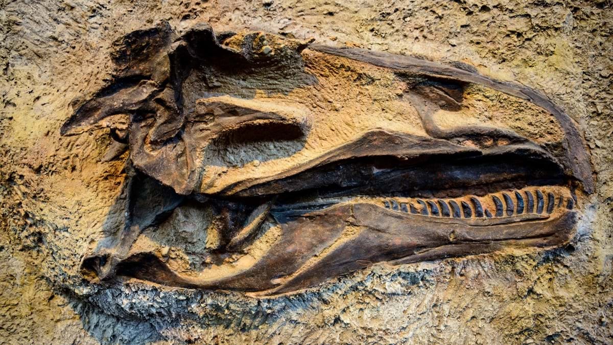
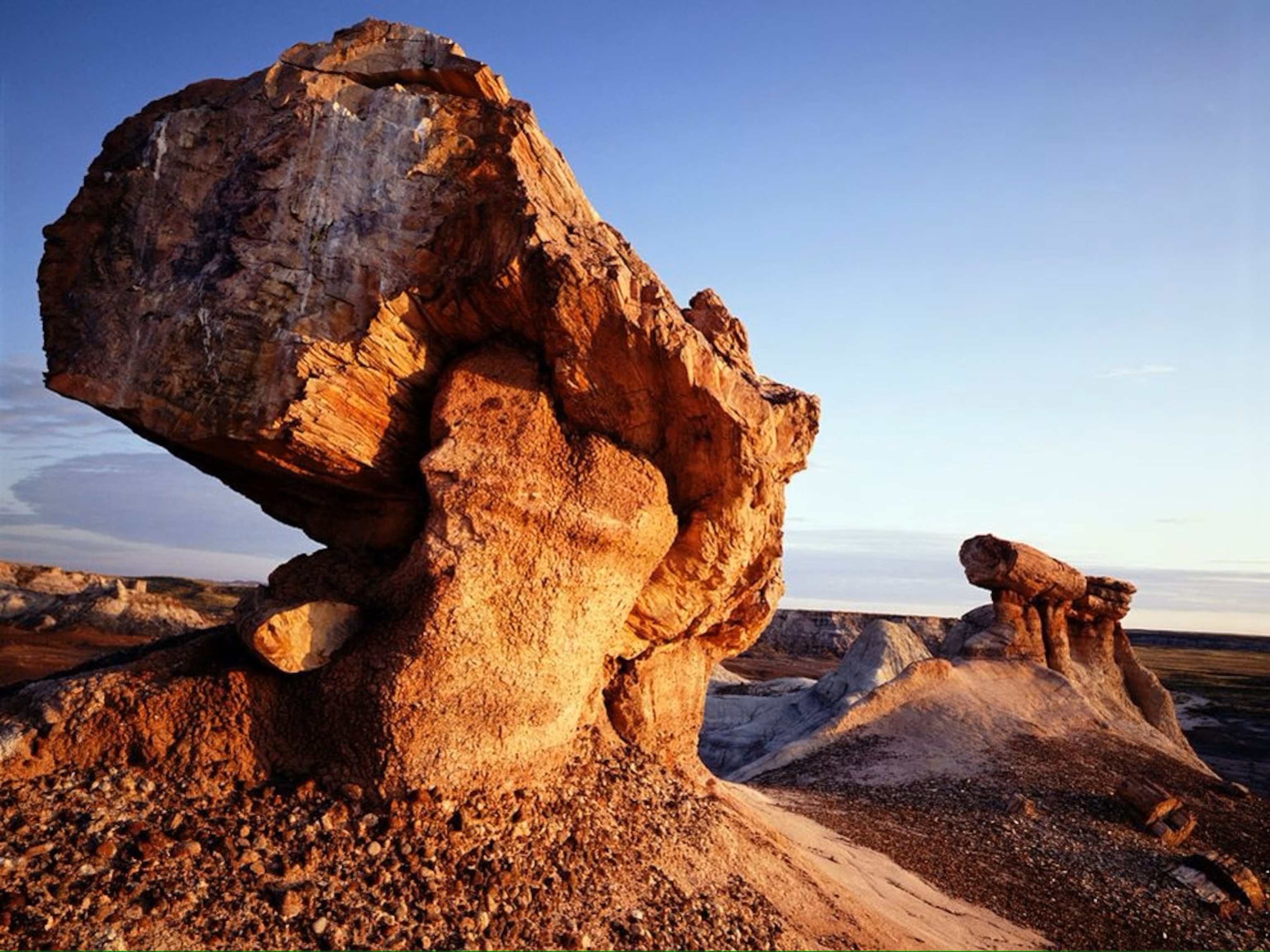
National Park Service Streamlines Fossil Data Collection with GIS
--
https://www.esri.com/about/newsroom/blog/national-park-service-fossil-mapping <-- shared blog post
--
[with palæontology as one of the papers in my MSc studies, seeing another use case in GIS is brilliant…]
#GIS #spatial #mapping #fossil #paleontology #US #NationalParks #NPS #cataloguing #inventory #NationalParkService #palaeontology #fedscience #documenting #spatialanalysis #geology #stratigraphy #fossilrecord #paleo #monitoring #managing #exploration
@NPS
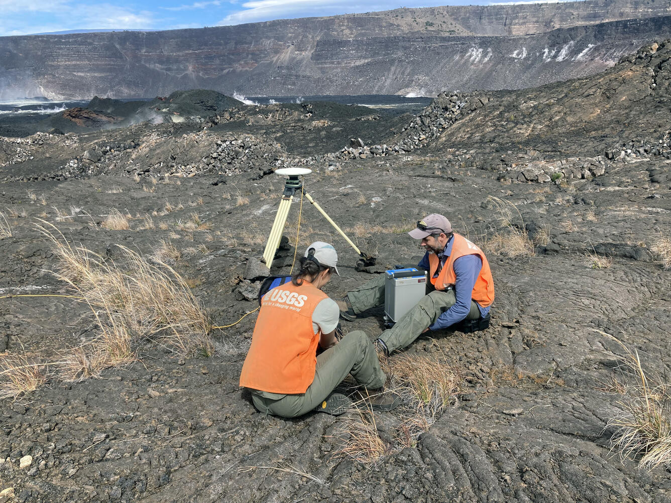
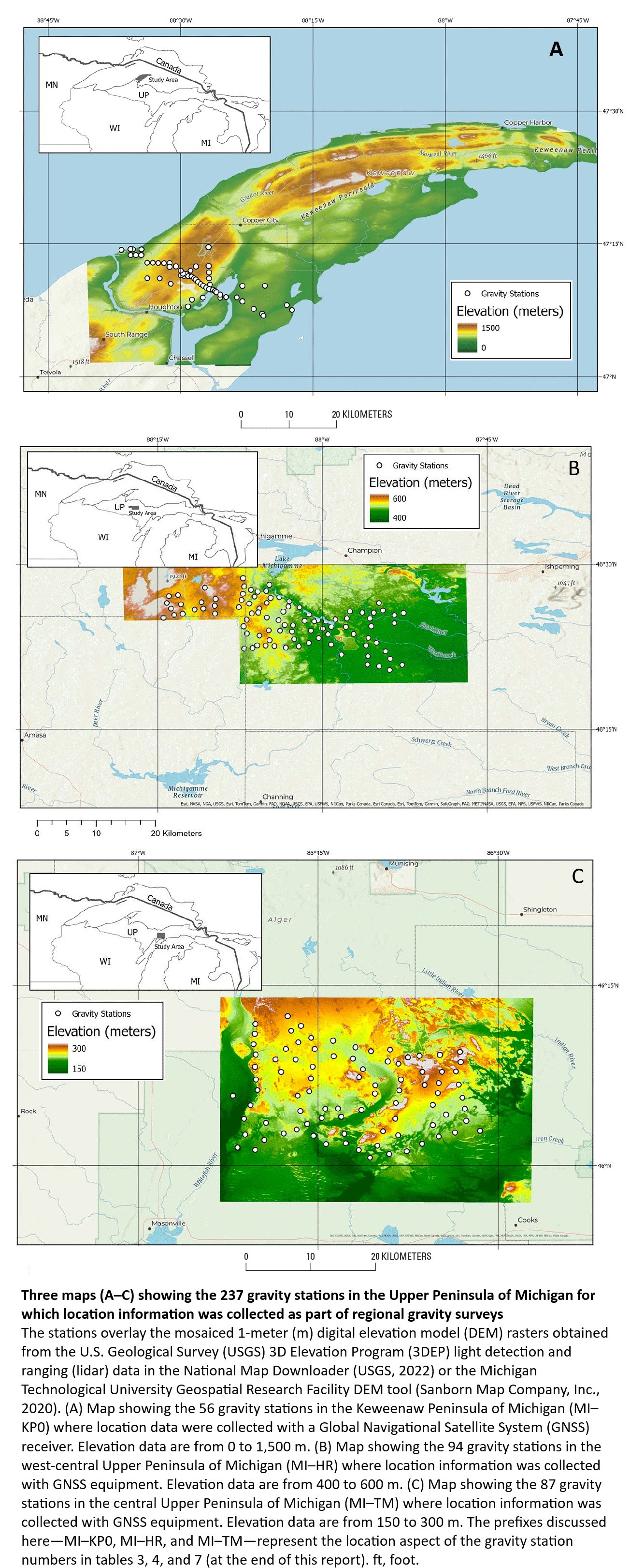
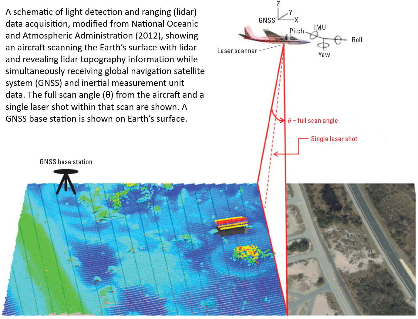
The Feasibility Of Using LiDAR-Derived Digital Elevation Models [DEMs] For Gravity Data Reduction
--
https://www.usgs.gov/3d-elevation-program/news/feasibility-using-lidar-derived-digital-elevation-models-gravity-data <-- shared article
--
https://pubs.usgs.gov/publication/ofr20251019 <-- shared report
--
“A nice report from our colleagues in the USGS Mineral Resources Program on the feasibility of lidar-derived DEMs, including 3DEP data, for gravity data reduction…”
#GIS #spatial #mapping #3dep #elevation #fedscience #remotesensing #earthobservation #gravity #submetre #accuracy #precision #dGNSS #GNSS #global #navigation #satellite #GPS #LiDAR #DEMs #gravimetrics #milligals #Bouguer #anomaly #monitoring #corrleation #refinement #datareduction #appliedscience #usecases
@USGS

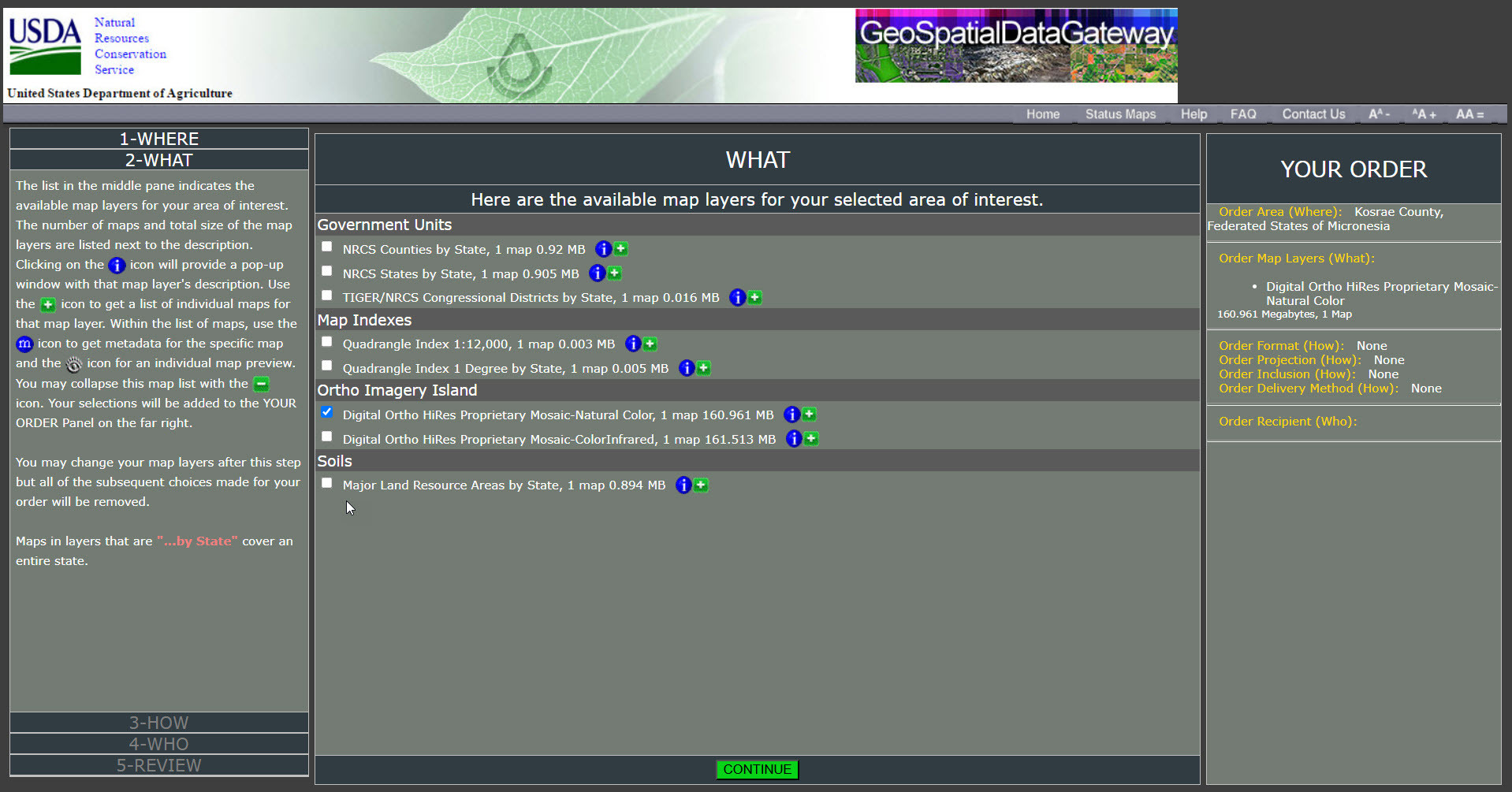
Geospatial Services / Gateway – USDA NRCS [open data]
--
https://gdg.sc.egov.usda.gov/ <-- shared link to USDA NRCS Geospatial Data Gateway
--
#GIS #spatial #mapping #portal #download #spatialdata #opendata #remotesensing #earthobservation #NRCS #ISDA #FSA #FarmServiceAgenct #RuralDevelopment #agriculture #fedservice #fedscience #farming #farmers #soil #SSURGO #environmental #naturalresources #NaturalResourcesConservationService #TIGER #precipitation #temperature #conservation #easement #LiDAR #elevation #names #geography #geology #governmentunits #boundaries #watershed #hydrology #water #WBD #HUC #topo #imagery #roads #transportation #soils #SSURGO #USA #US #landcover #landuse #NLCD


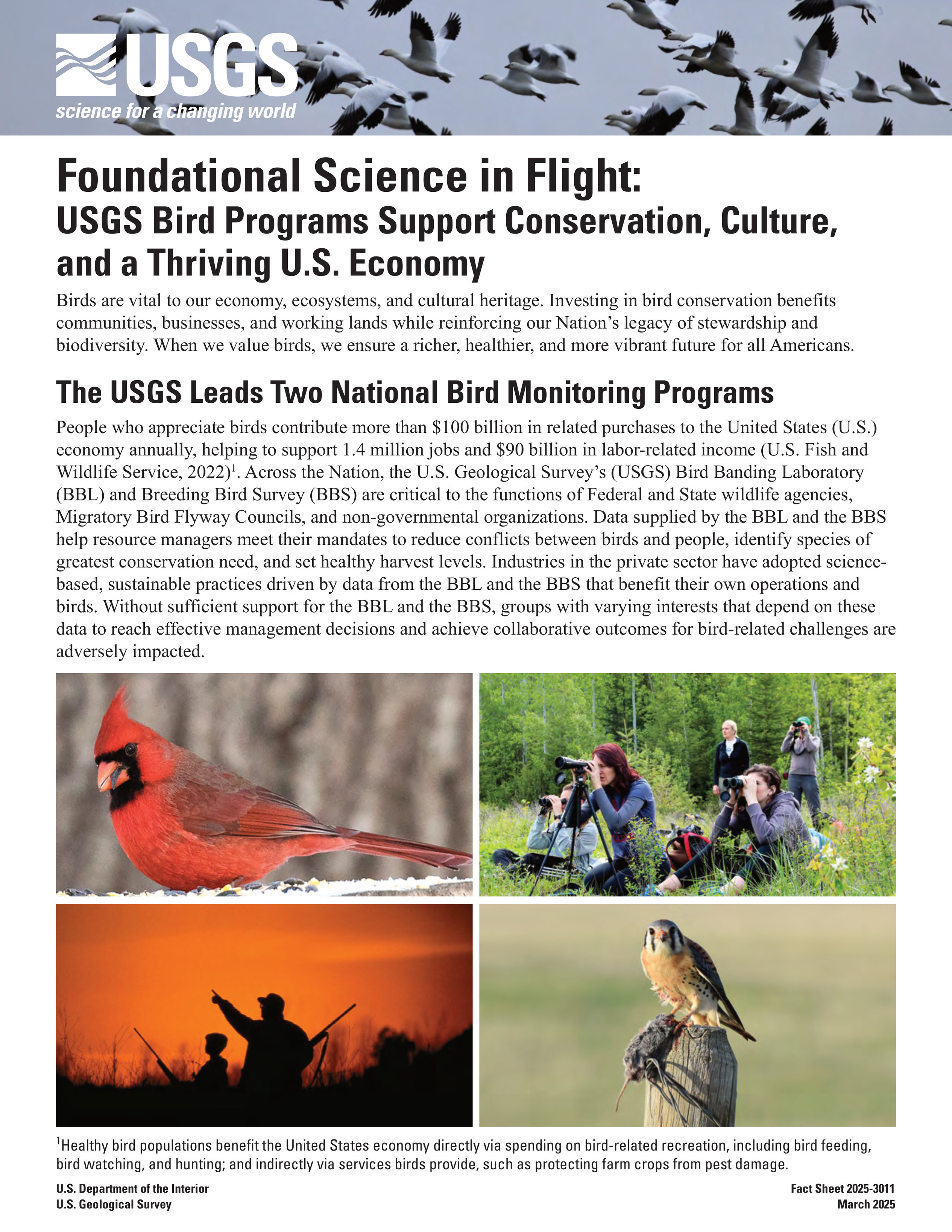
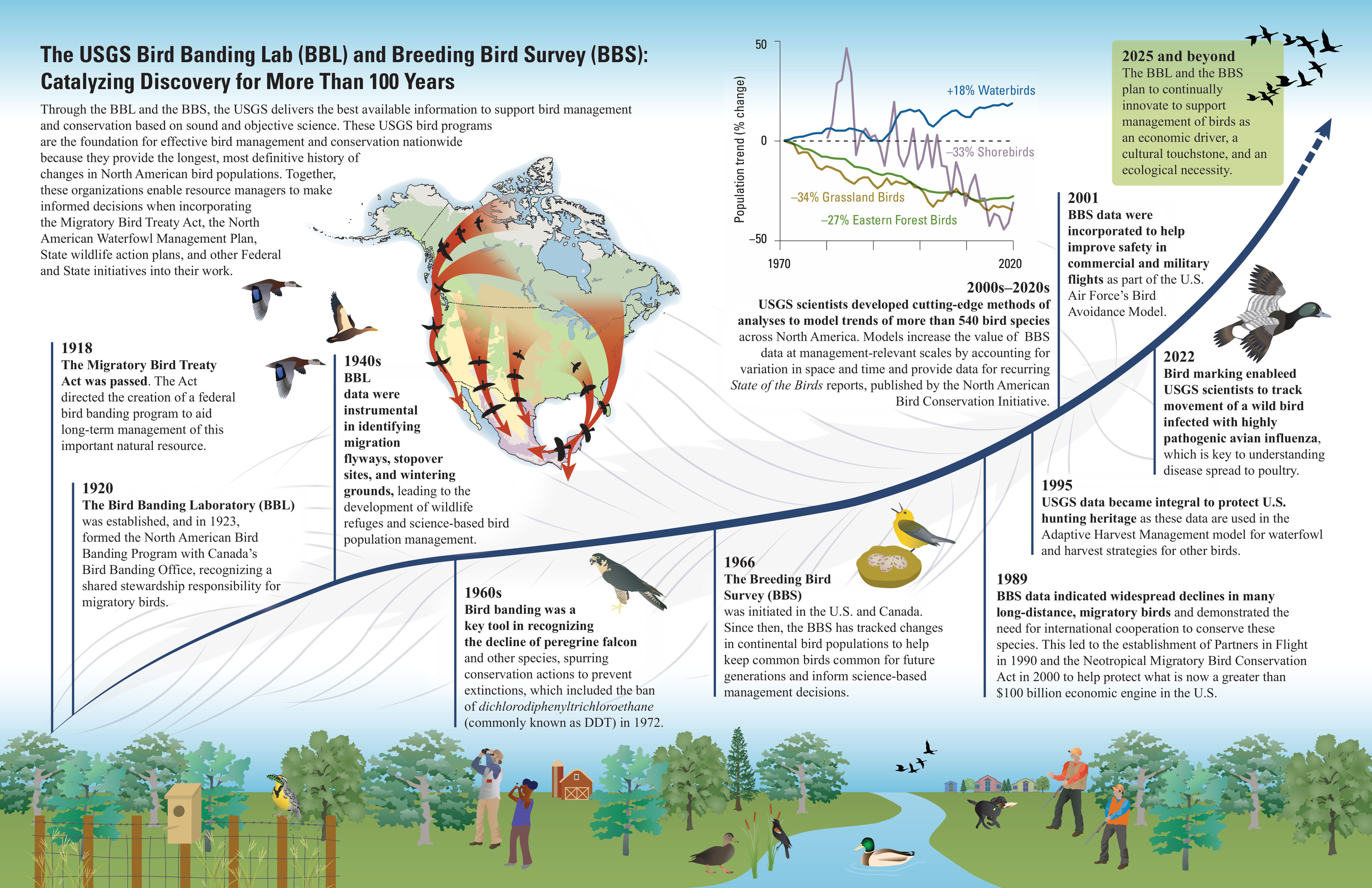
Foundational Science in Flight - USGS Bird Programs Support Conservation, Culture, and a Thriving U.S. Economy
--
https://pubs.usgs.gov/fs/2025/3011/fs20253011.pdf <-- shared technical article
--
#GIS #spatial #mapping #fedscience #economy #ecosystem #heritage #conservation #resources #birds #avian #wildlife #agency #migration #management #planning #spatialanalysis #spatiotemporal #BreedingBirdSurvey #BBL #BirdBandingLaboratory #BBL #flyway #history
@USGS


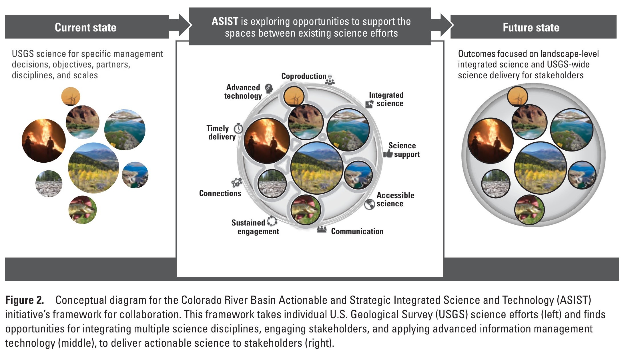
U.S. Geological Survey Colorado River Basin Science and Technology Collaboration Meetings on Drought (2021) - Synthesis of Findings
--
https://pubs.usgs.gov/publication/cir1551 <-- shared publication
--
USGS recent publication about the challenges and barriers land managers and scientists are working on to address the wicked problems of drought in the Colorado River Basin.
#water #hydrology #drought #extremeweather #fedscience #Colorado #ColoradoRiver #ColoradoRiverBasin #watershed #waterresources #watersupply #climatechange ##landmanagers #management #planning #overuse #magicwater #humanimpacts #ecosystems #agriculture #farming #USWest #strategy #GIS #spatial #mapping #waterscience #interdisciplinary #research #adapation #spatialanalysis #spatiotemporal #stakeholder #engagement #cost #economics #coordination #future @USFS @USFS
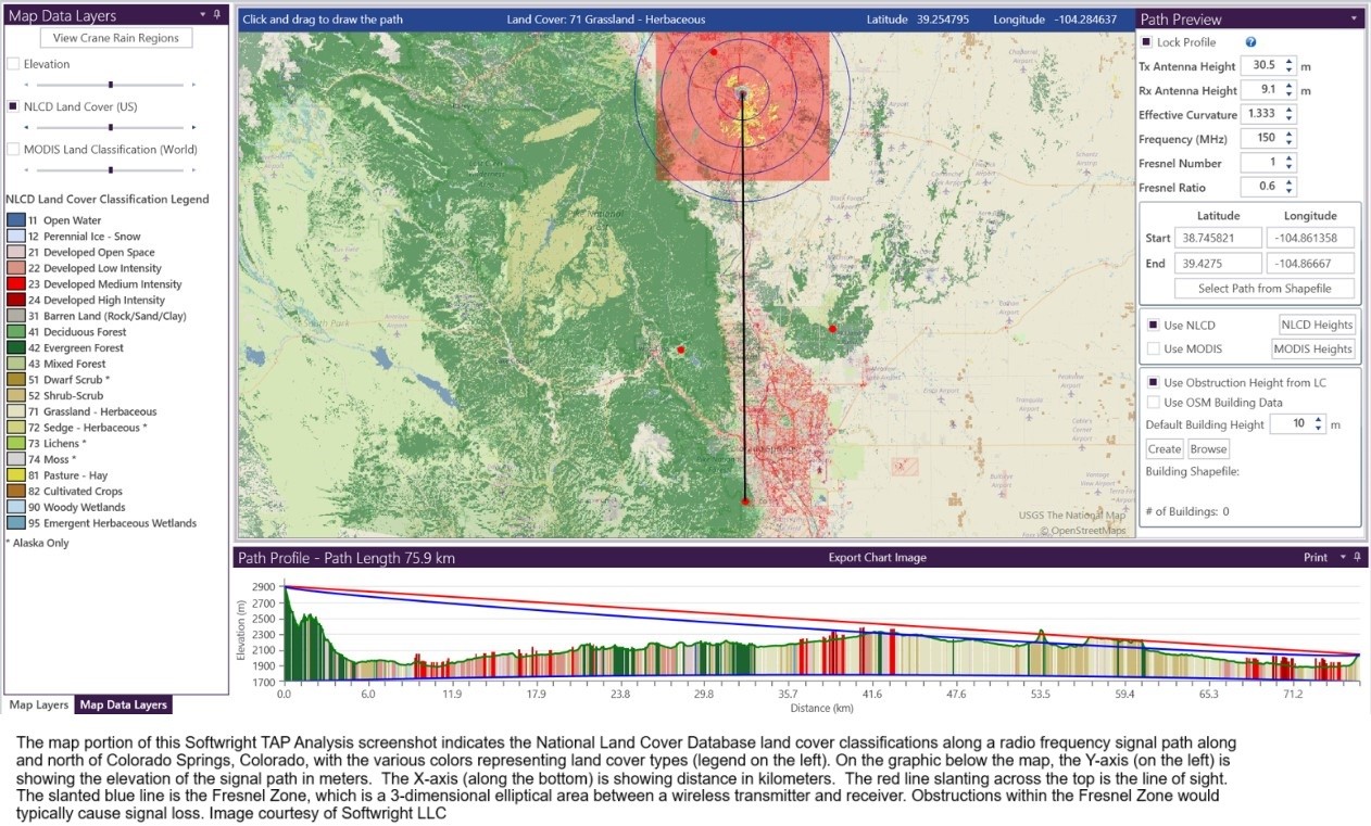
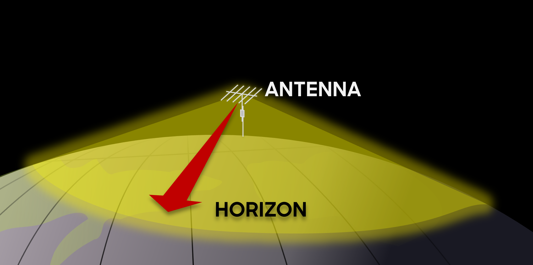
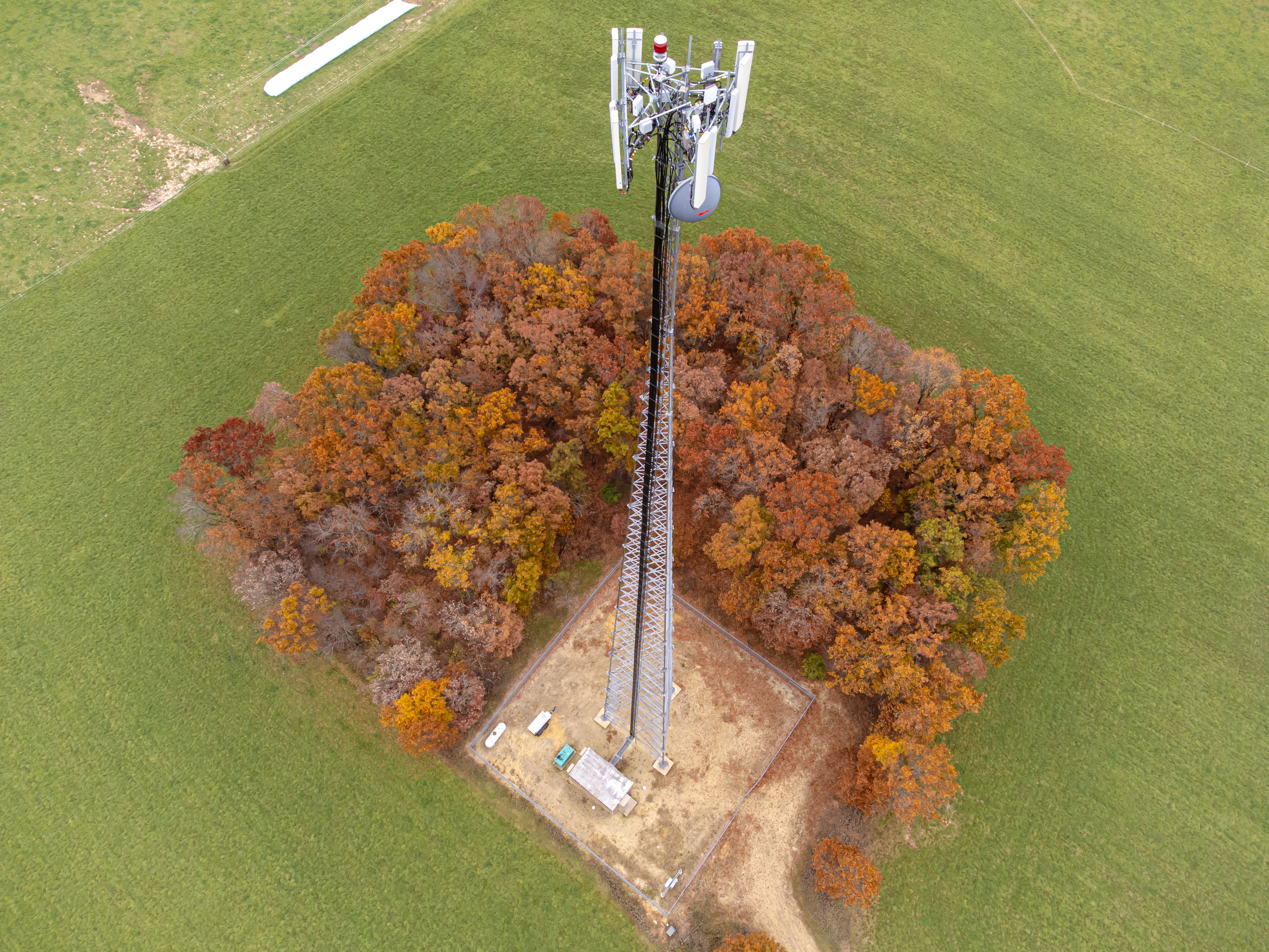
Landsat At Work – Better Wireless Communication - National Land Cover Database (NLCD), Based On Landsat, Helps Plan Clear Signal
--
https://www.usgs.gov/centers/eros/news/landsat-work-a-path-better-wireless-communication <-- shared article
--
https://www.usgs.gov/landsat-missions <-- shared about Landsat
--
https://www.usgs.gov/centers/eros/science/annual-national-land-cover-database <-- shared about NLCD
--
#GIS #spatial #mapping #Landsat #remotesensing #satellite #earthobservation #fedscience #usecase #USGS #EROS #cellphone #mobilephone #telecommunications #communications #cost #benefit #wireless #towers #antennas #landcover #landuse #NLCD #radio #frequency #siting #lineofsight #clutter #economics #risk #hazard #signal #signalquality #USA #value #returnoninvestment
@USGS @USGS_EROS
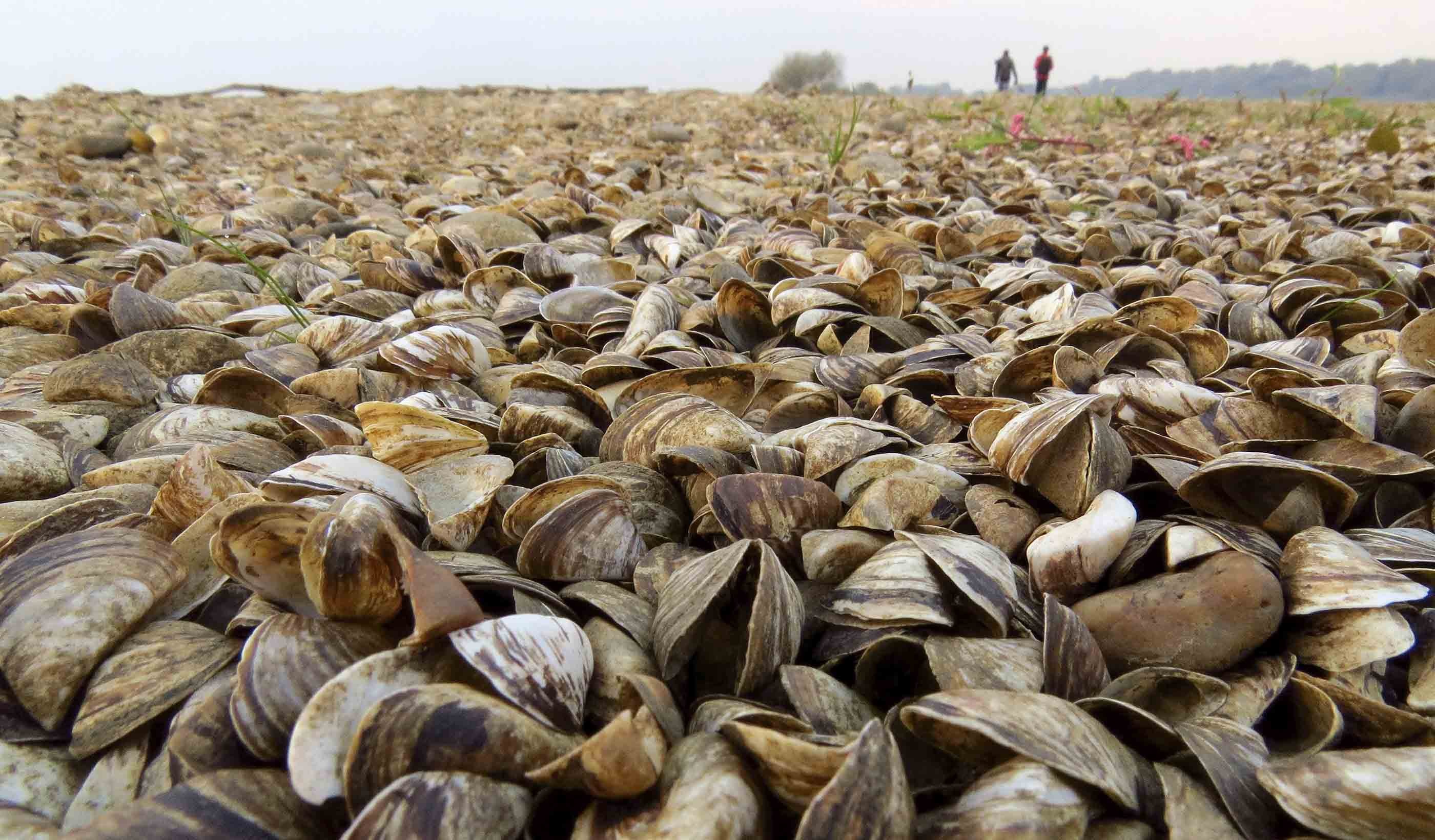
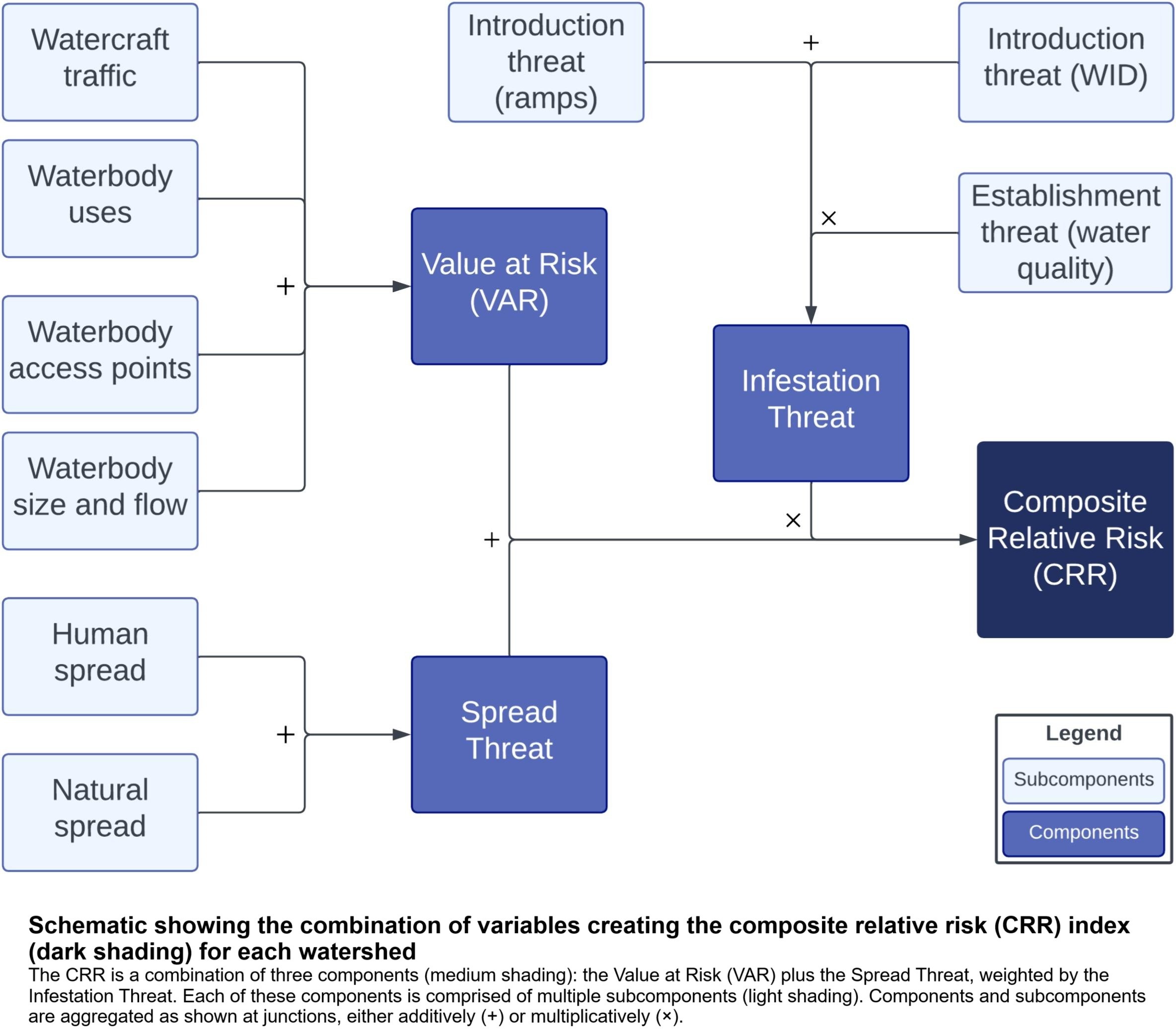
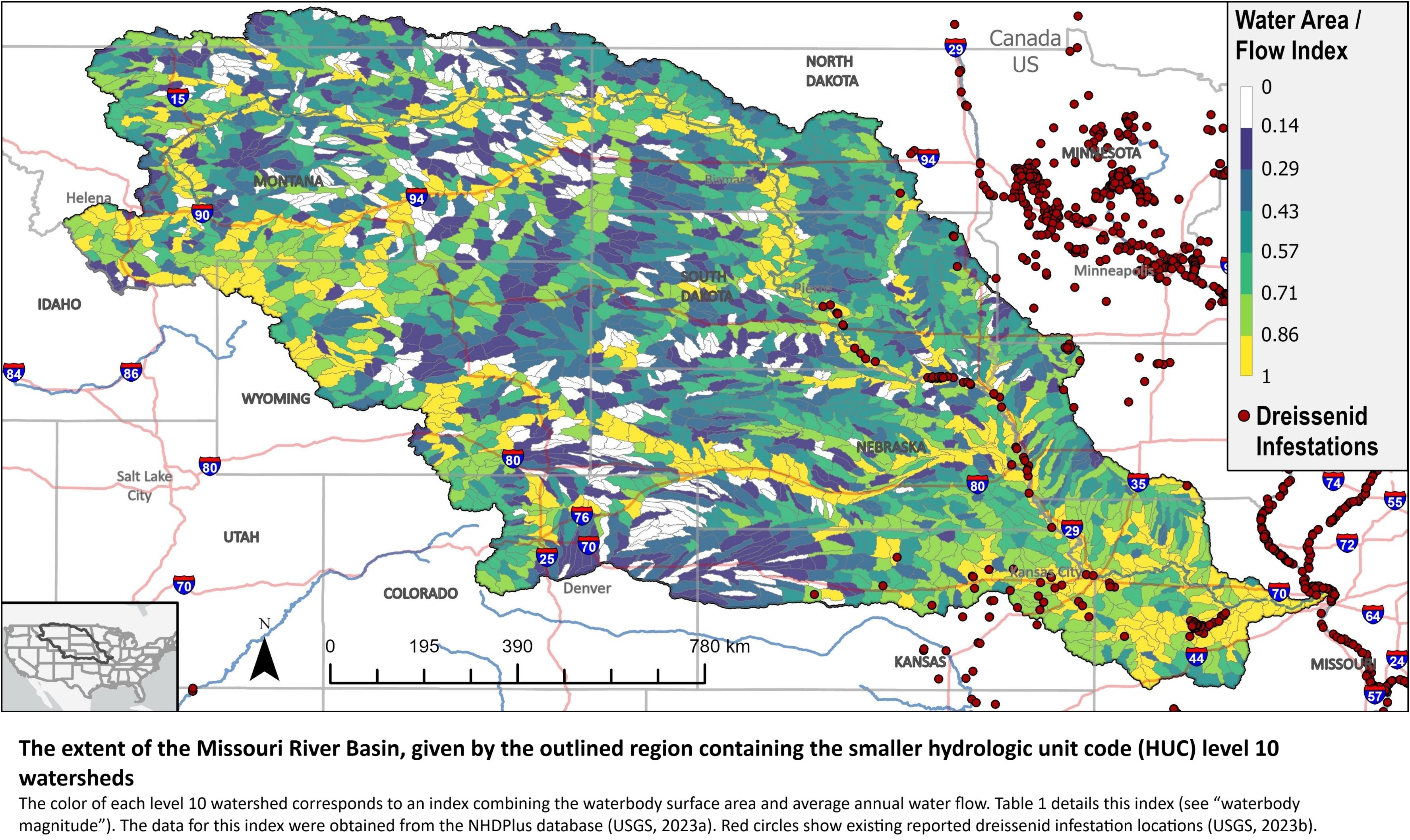
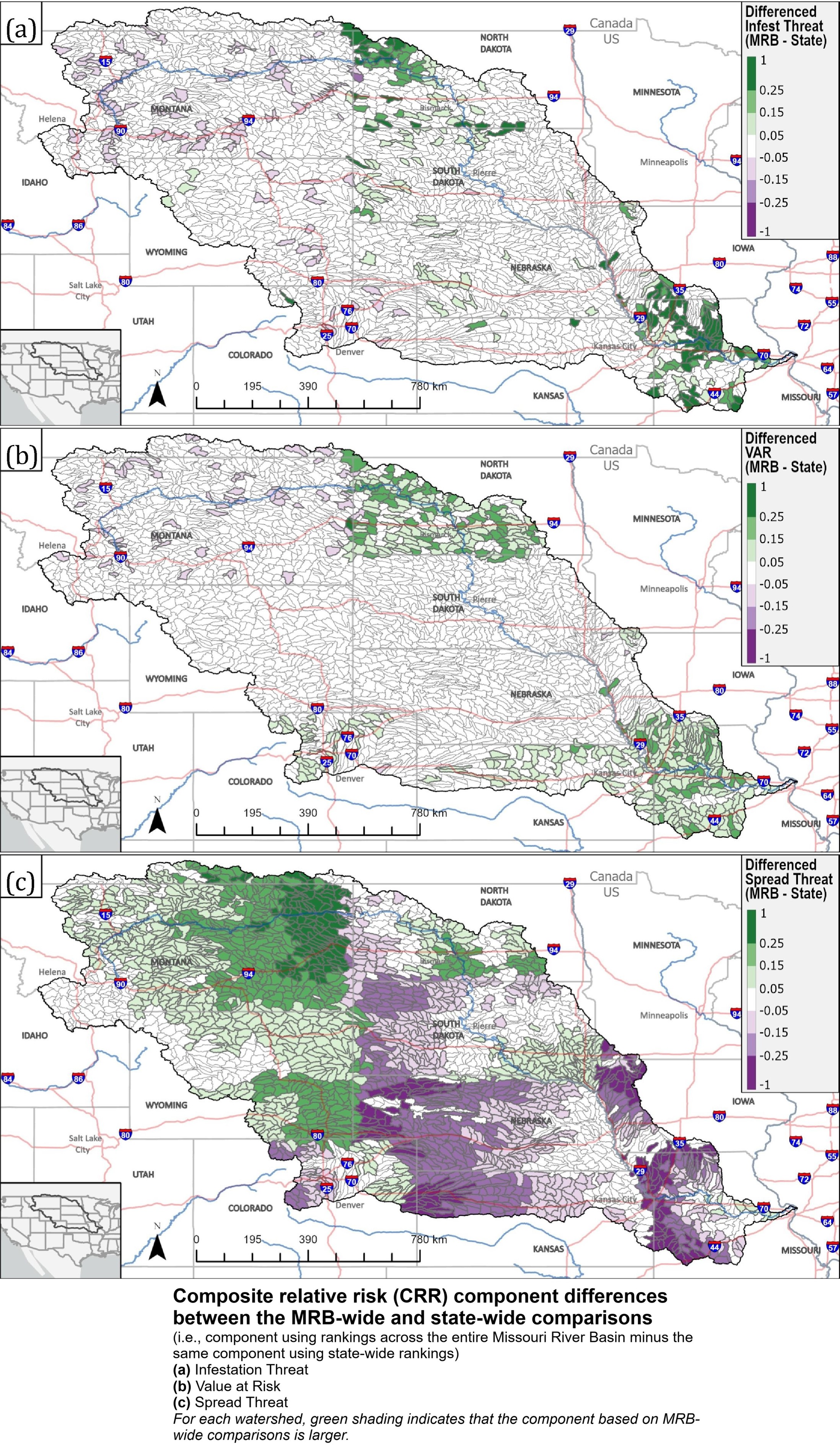
Don’t Move A Mussel - The Role Of Key Environmental Drivers And Management Scale In Assessing Spatial Variation In Dreissenid Spread Risk In The Missouri River Basin
--
https://doi.org/10.1016/j.ecolind.2024.112526 <-- shared paper (Missouri River Basin)
--
https://www.usgs.gov/centers/western-fisheries-research-center/news/assessing-risk-invasive-mussels-spreading-throughout <-- shared technical article (Columbia River Basin)
--
https://rconnect.usgs.gov/webDR/ <-- shared link to webDR: Dreissenid Risk (Missouri River Basin)
--
#GIS #spatial #mapping #fedscience #dreissenids #invasive #invasivespecies #management #mitigation #risk #hazard #riskindexing #webtool #nonnative #ecology #economics #cost #humanimpact #state #basin #water #freshwater #hydrology #basin #watershed #mussel #zebramussel #infested #infestation #watercraft #boating #leisure #pleasure #NorthAmerica #waterbody #decontamination #program #planning #policy #regulations #relativeriskindex #model #modeling #geostatistics #parameters #MissouriRiverBasin #ColumbiaRiverBasin
@USGS
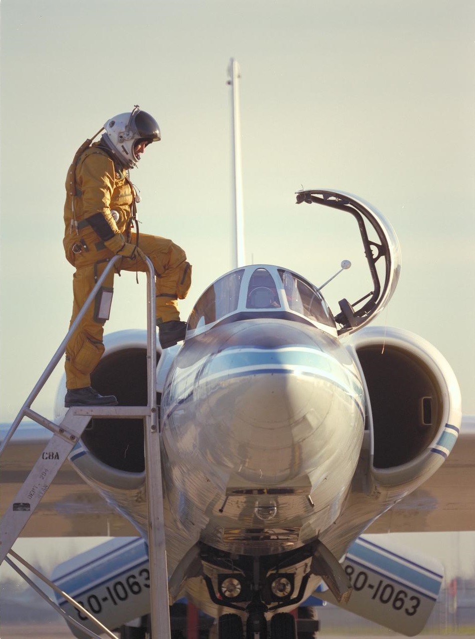
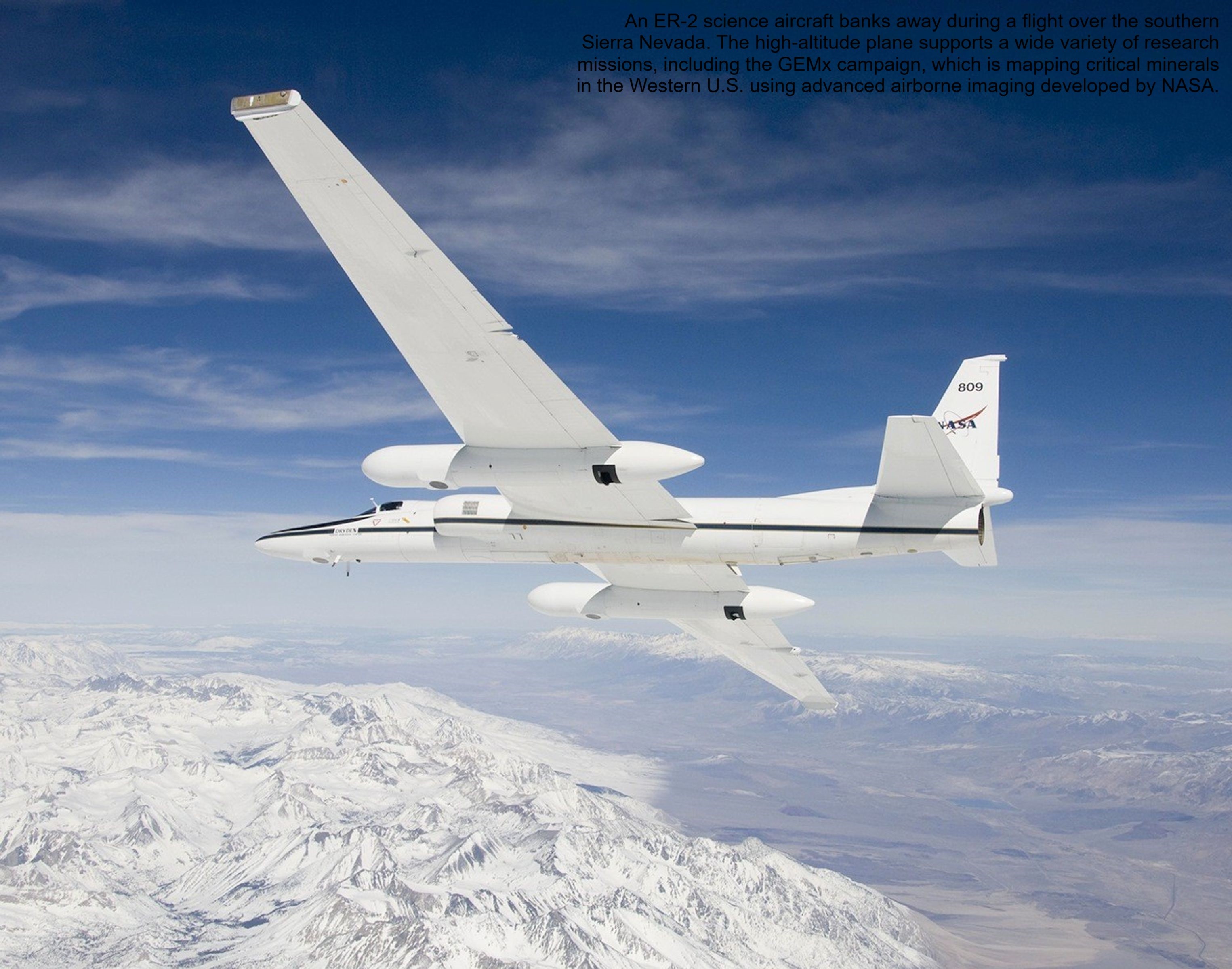
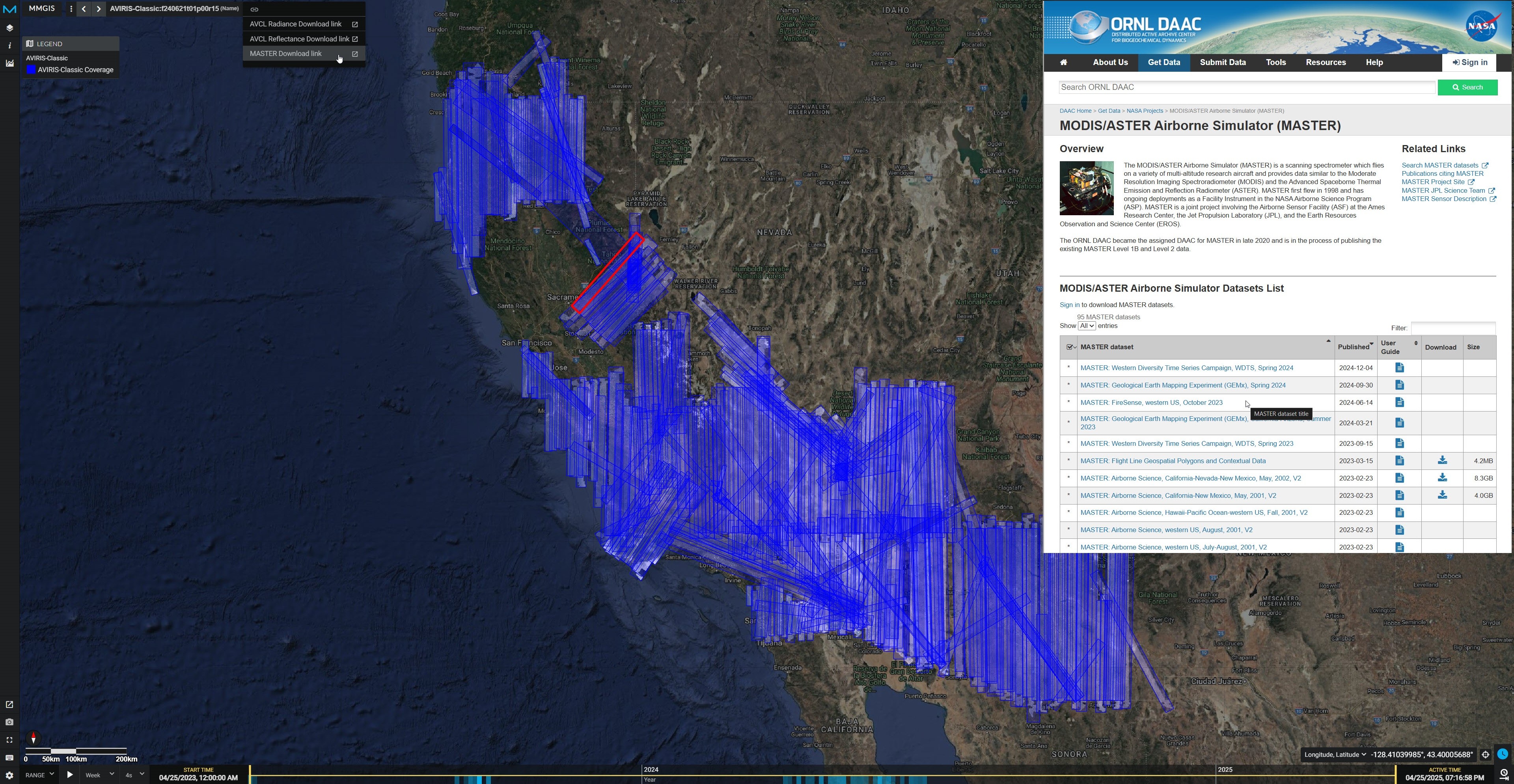
NASA Flights Map Critical Minerals From Skies Above Western US - Technology Used To Chart Other Worlds Is Revealing Minerals In The American West That Are Critical To The Country’s Renewable Energy Future.
--
https://science.nasa.gov/earth/nasa-flights-map-critical-minerals-from-skies-above-western-us/ <-- shared technical article
--
https://popo.jpl.nasa.gov/mmgis-aviris/?mission=GEMx <-- shared GEMx data collection portal
--
#GIS #spatial #mapping #remotesensing #earthobservation #mineral #mineralogy #mining #criticalminerals #USWest #renewableenergy #lithium #GEMx #fedscience #cost #economics #USGS #NASA #GeologicalEarthMappingExperiment #lithium #aluminum #rareearthelements #neodymium #cerium #nationalsecurity #cleanenergy #batteries #smartphones #cellphones #naturalresources #steel #steelmill #dependency #localsources #importing #survey #geology #geologicmapping #exploration #spectrometers #hyperspectral #EMIT #mine #extraction #EarthMRI #opendata
@USGS @nasa

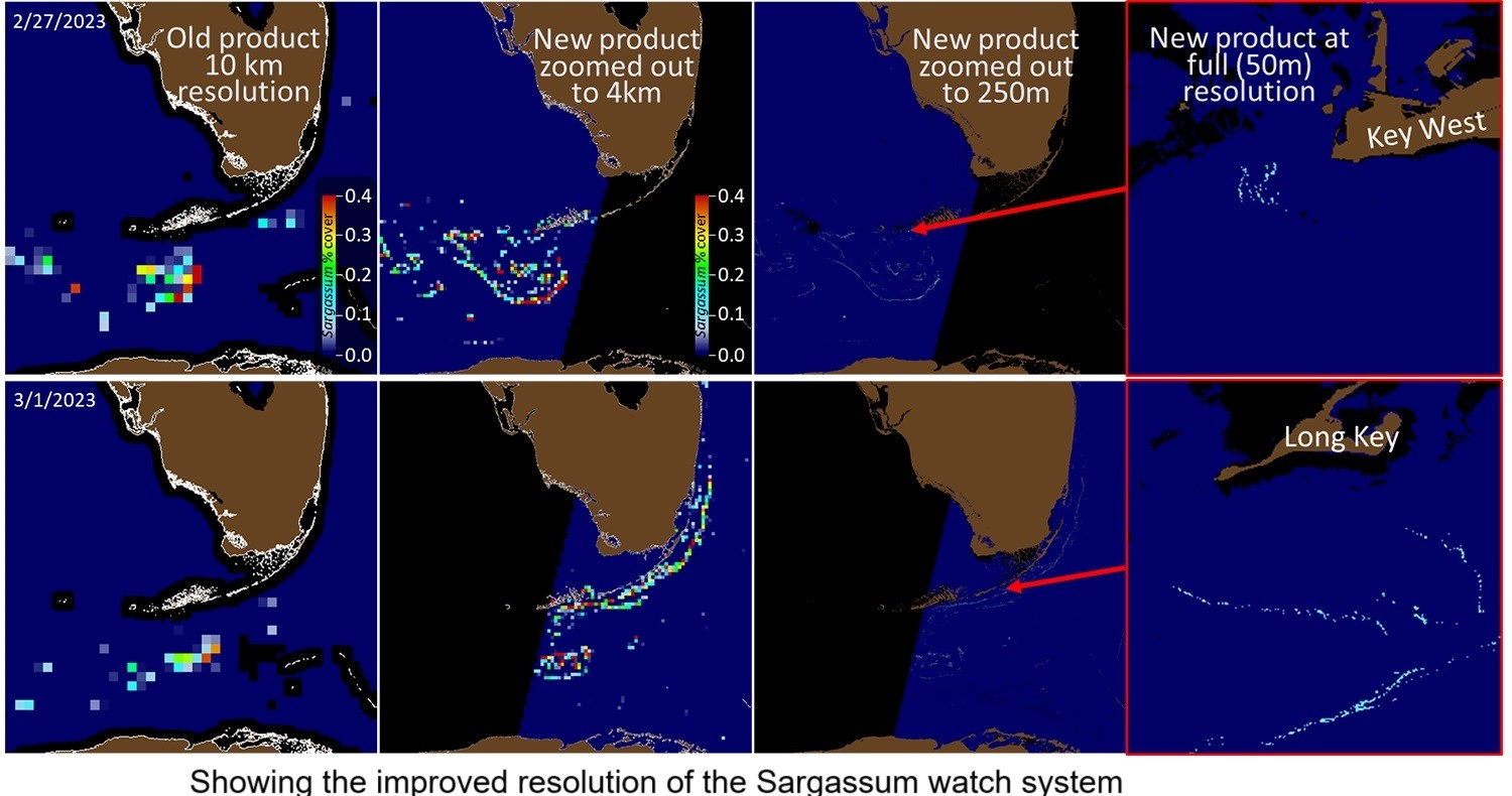
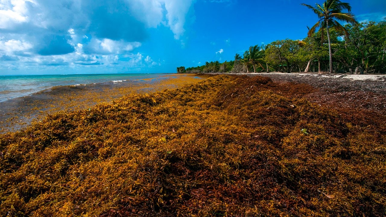
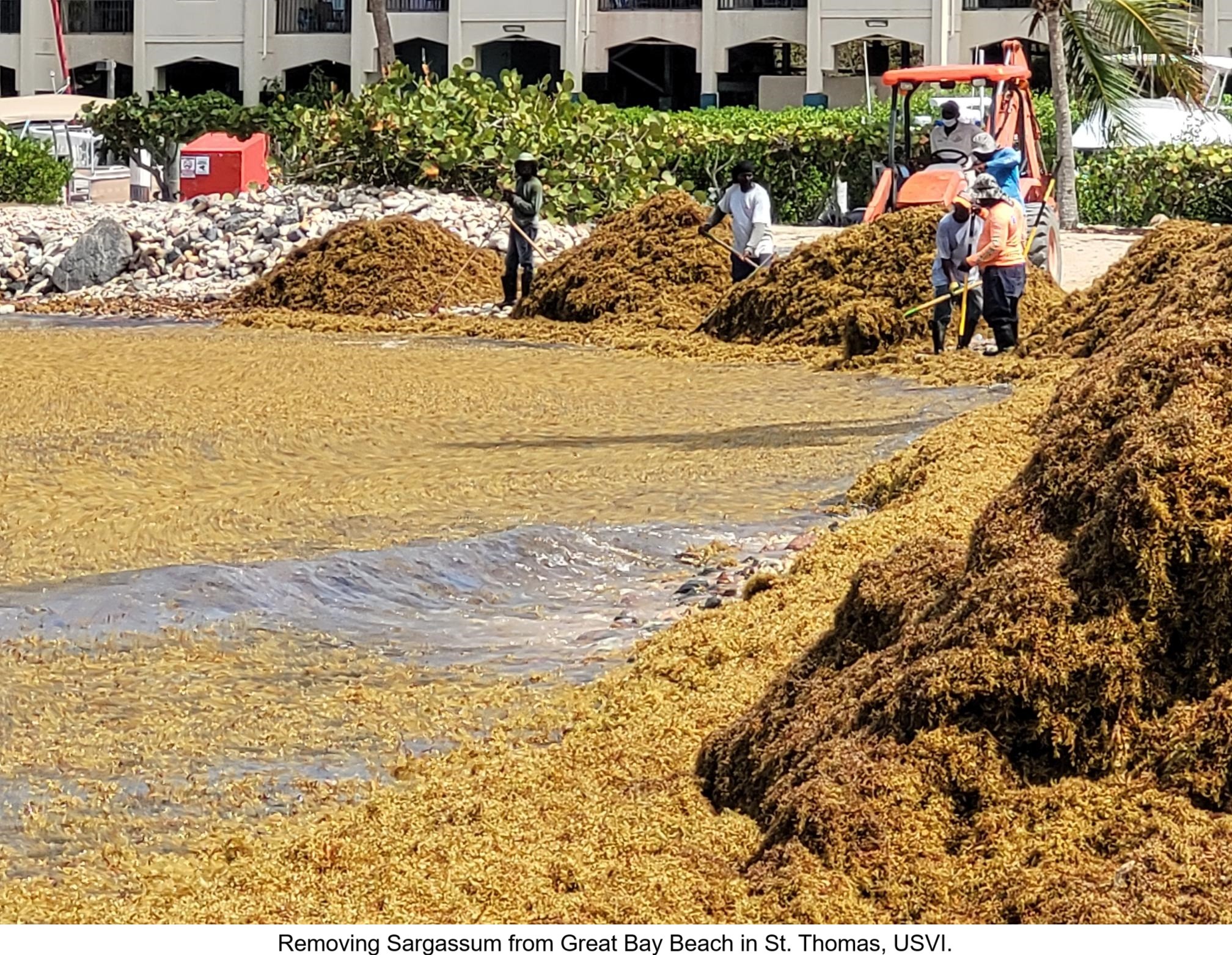
New Sargassum System Takes Aim At A Troublesome Seaweed
--
https://www.usf.edu/marine-science/news/2025/new-sargassum-system-takes-aim-at-a-troublesome-seaweed.aspx <-- shared article
--
https://coastalscience.noaa.gov/project/developing-an-operational-sargassum-hab-monitoring-and-forecasting-system-for-the-southeastern-u-s-and-u-s-caribbean/ <-- shared technical article
--
#GIS #spatial #mapping #remotesensing #satellite #fedscience #earthobservation #Caribbean #florida #puertorico #USVI #seaweed #Sargassum #risk #hazard #damage #impact #cleanup #removal #cost #economics #fisheries #tourism #mitigation #spatialanalysis #detection #spatiotemporal #marine #algal #algalbloom #SargassumWatchSystem #costsaving #inundation #imagery #harmfulalgalbloom #HAB #biomass
@NOAA

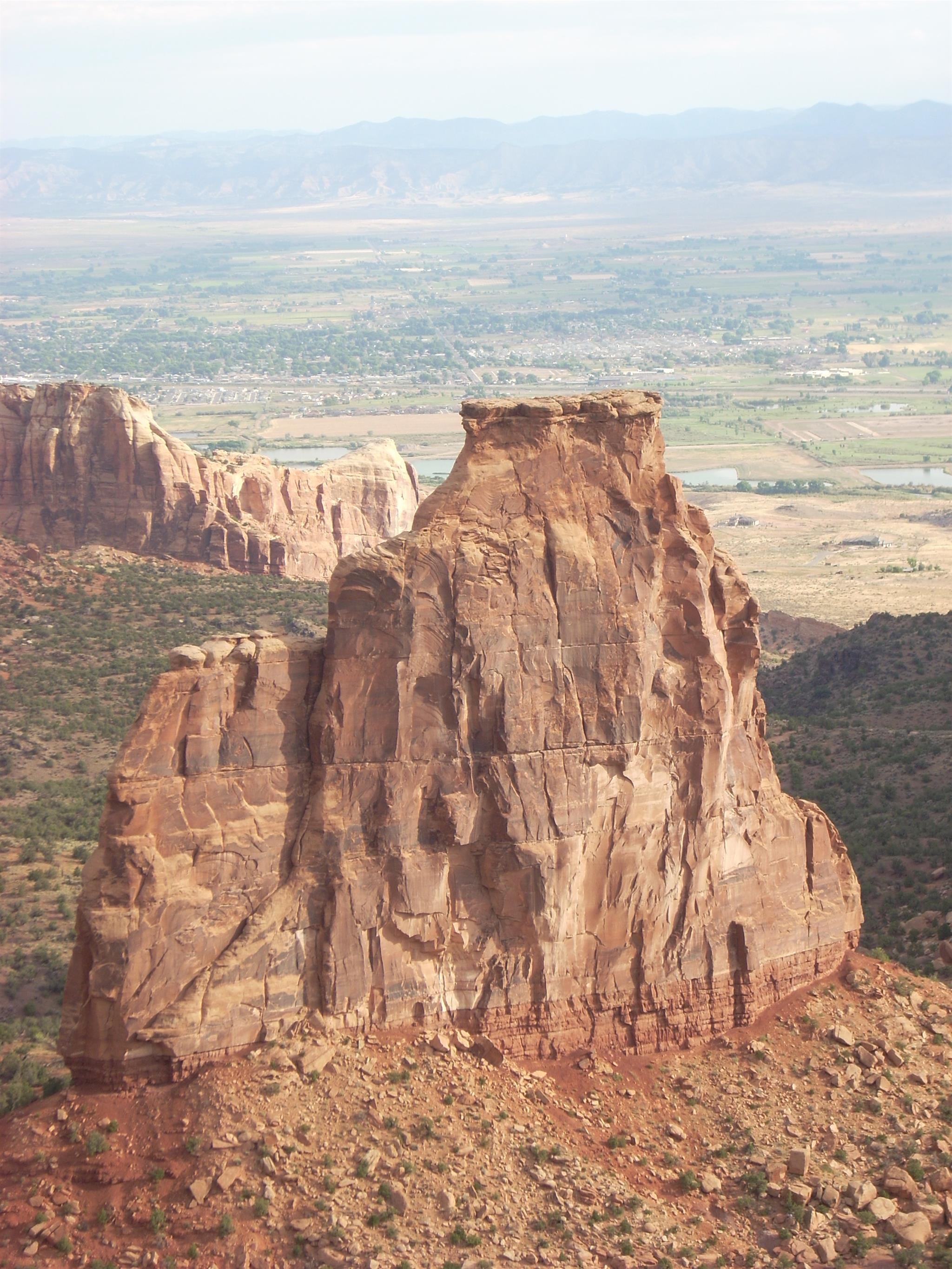
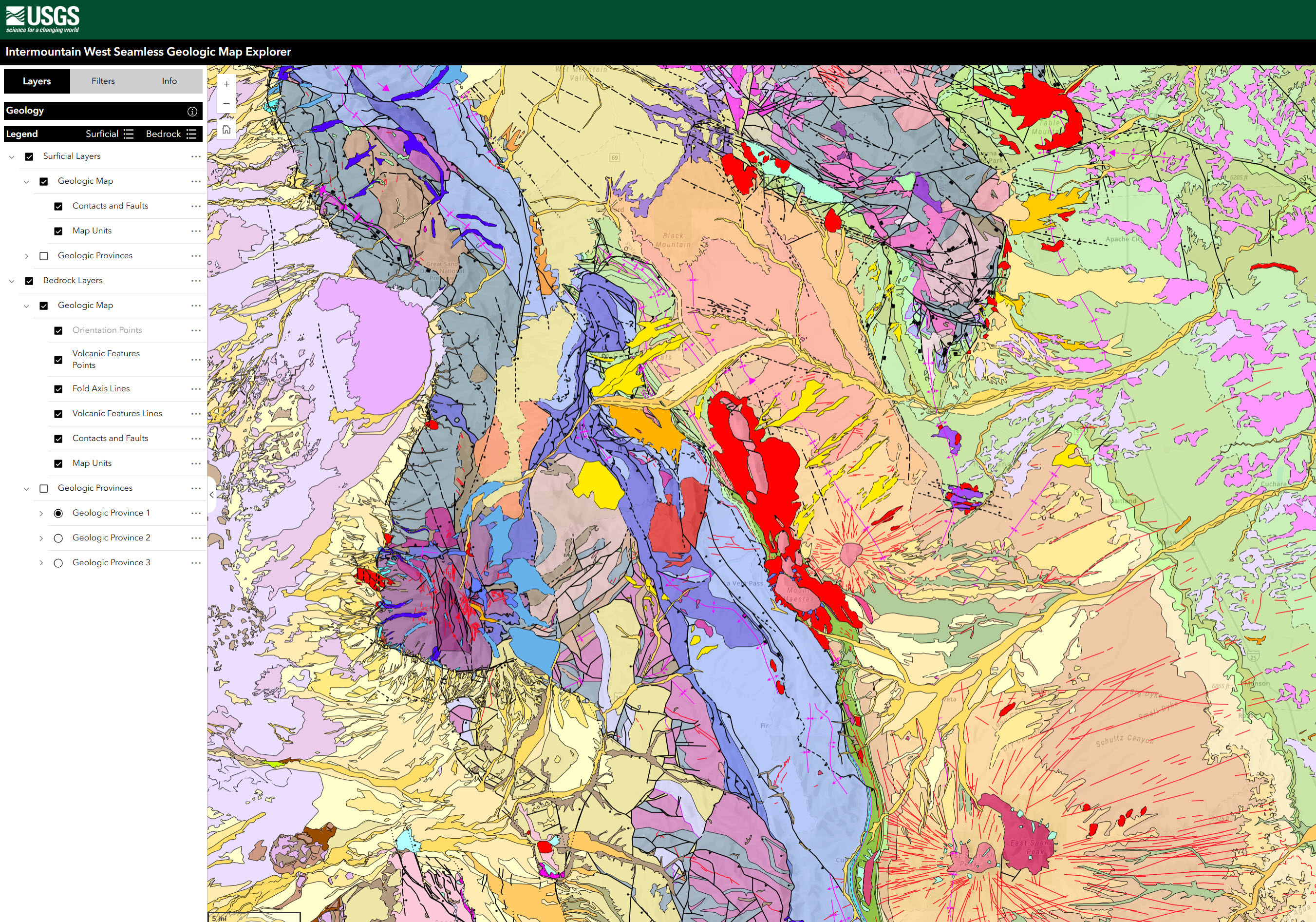
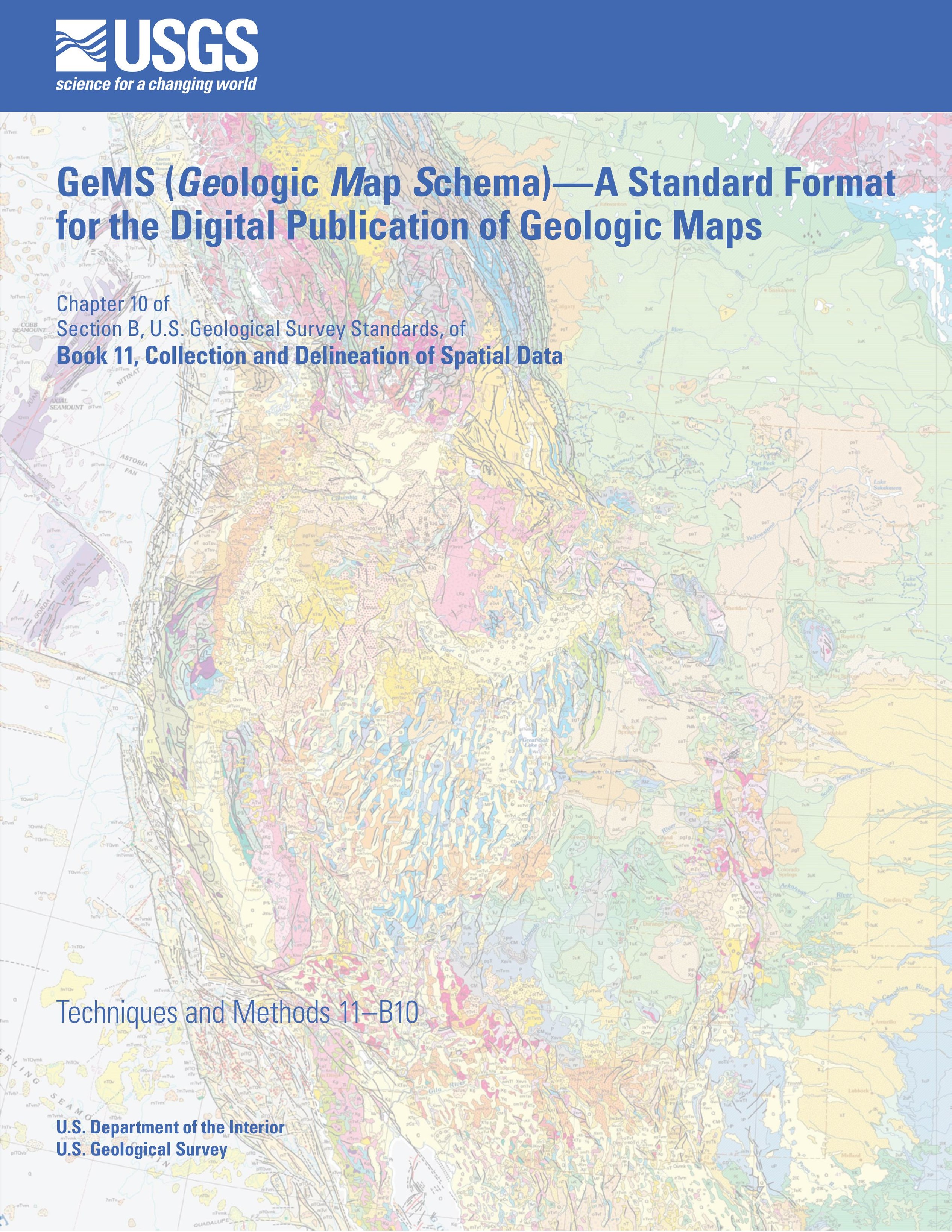
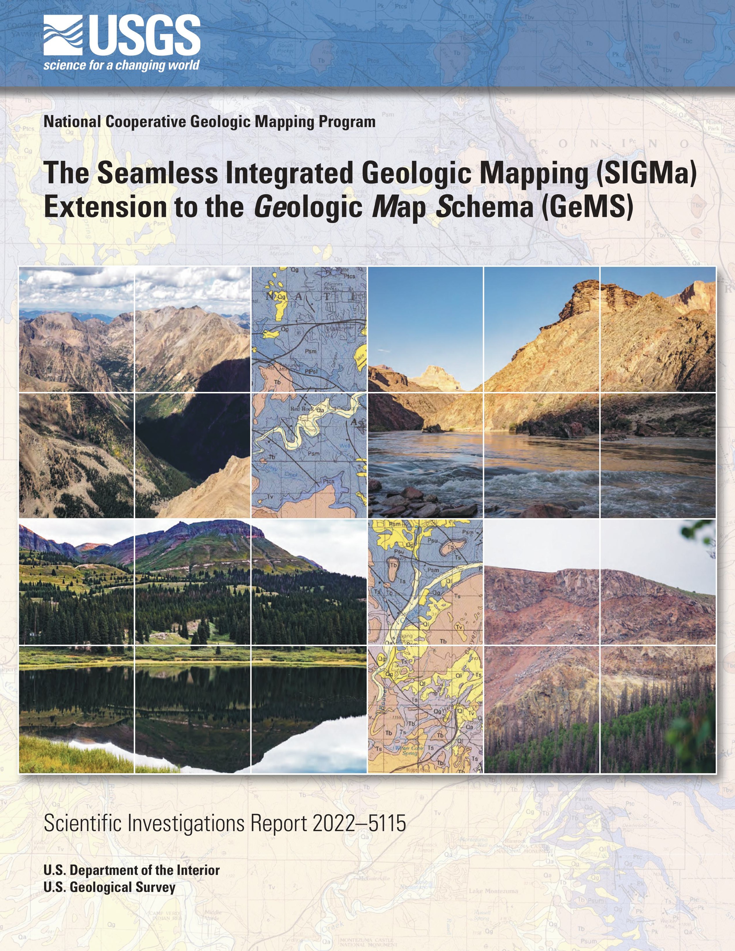
Intermountain West Seamless Geologic Map Explorer - National Cooperative Geologic Mapping Program
--
https://apps.usgs.gov/intermountain_west_seamless_geologic_map_explorer/index.html <-- shared web map / app
--
https://www.sciencebase.gov/catalog/item/65cea1c8d34ec3e1801bf74f <-- shared USGS SB details
--
https://doi.org/10.3133/sir20225115 <-- shared SIGMa-GeMS
--
https://doi.org/10.3133/tm11B10 <-- shared GeMS
--
#GIS #spatial #mapping #geology #geologicmapping #USA #USWest #fedscience #usecase #GeMS #SIGMa #opendata #seamless #IntermountainWest #MapExplorer bedrock #surficial #data #NationalCooperativeGeologicMappingProgram #NCGMP #framework #resources #exploration #Strategic #Planning #ProjectDevelopment #ScientificCollaboration #Colorado #NewMexico #interactive #downloadable
@USGS
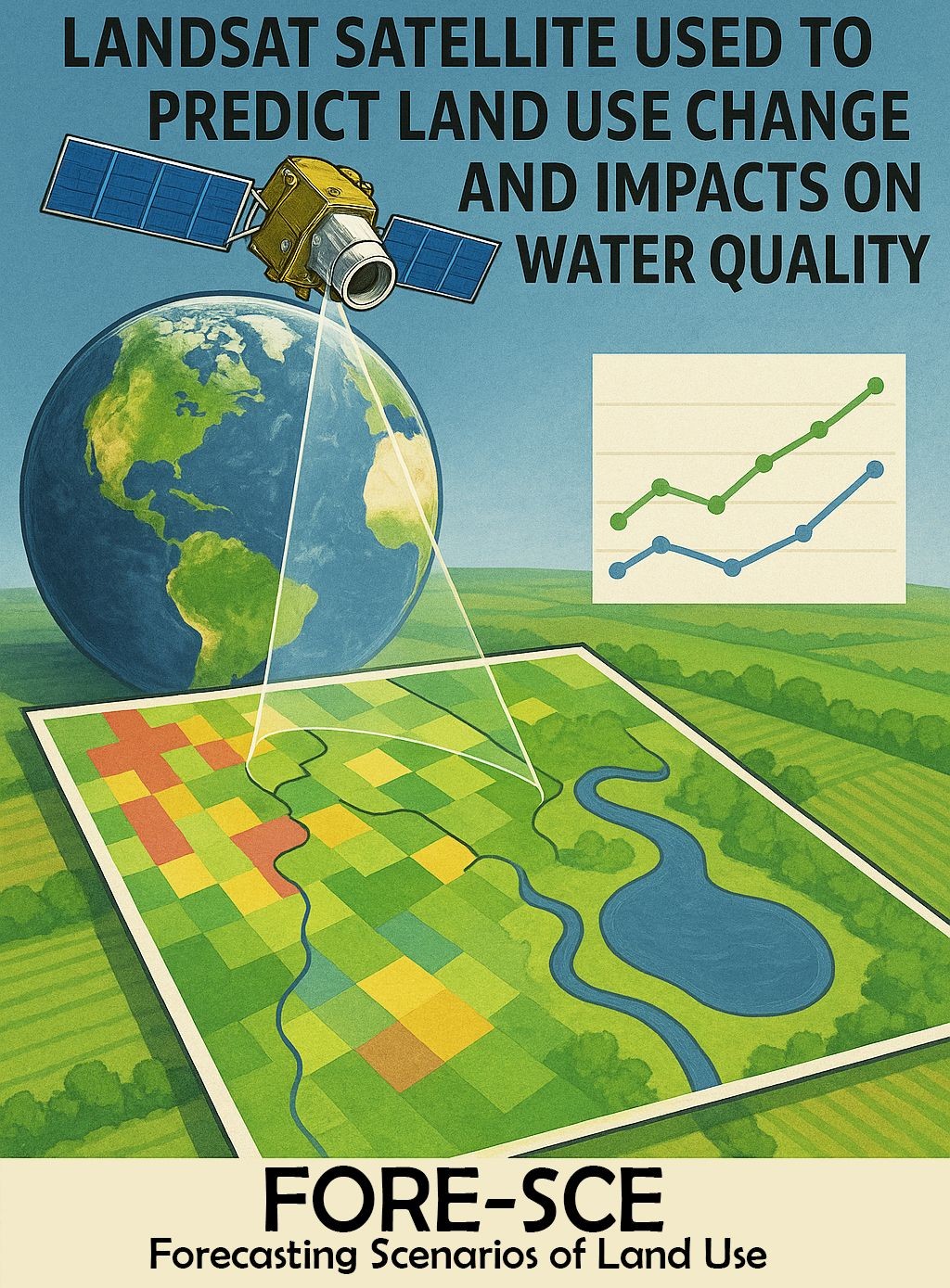
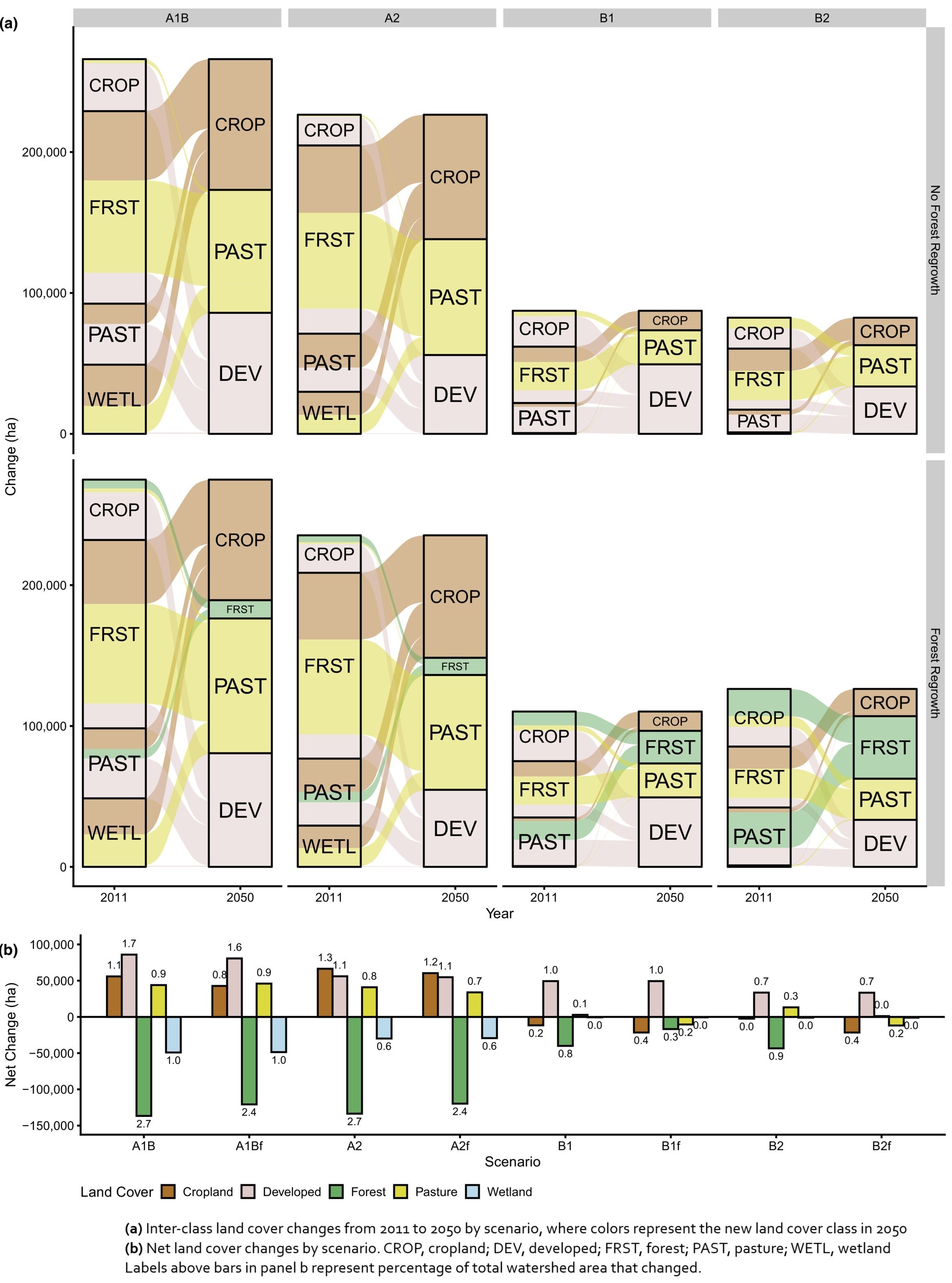
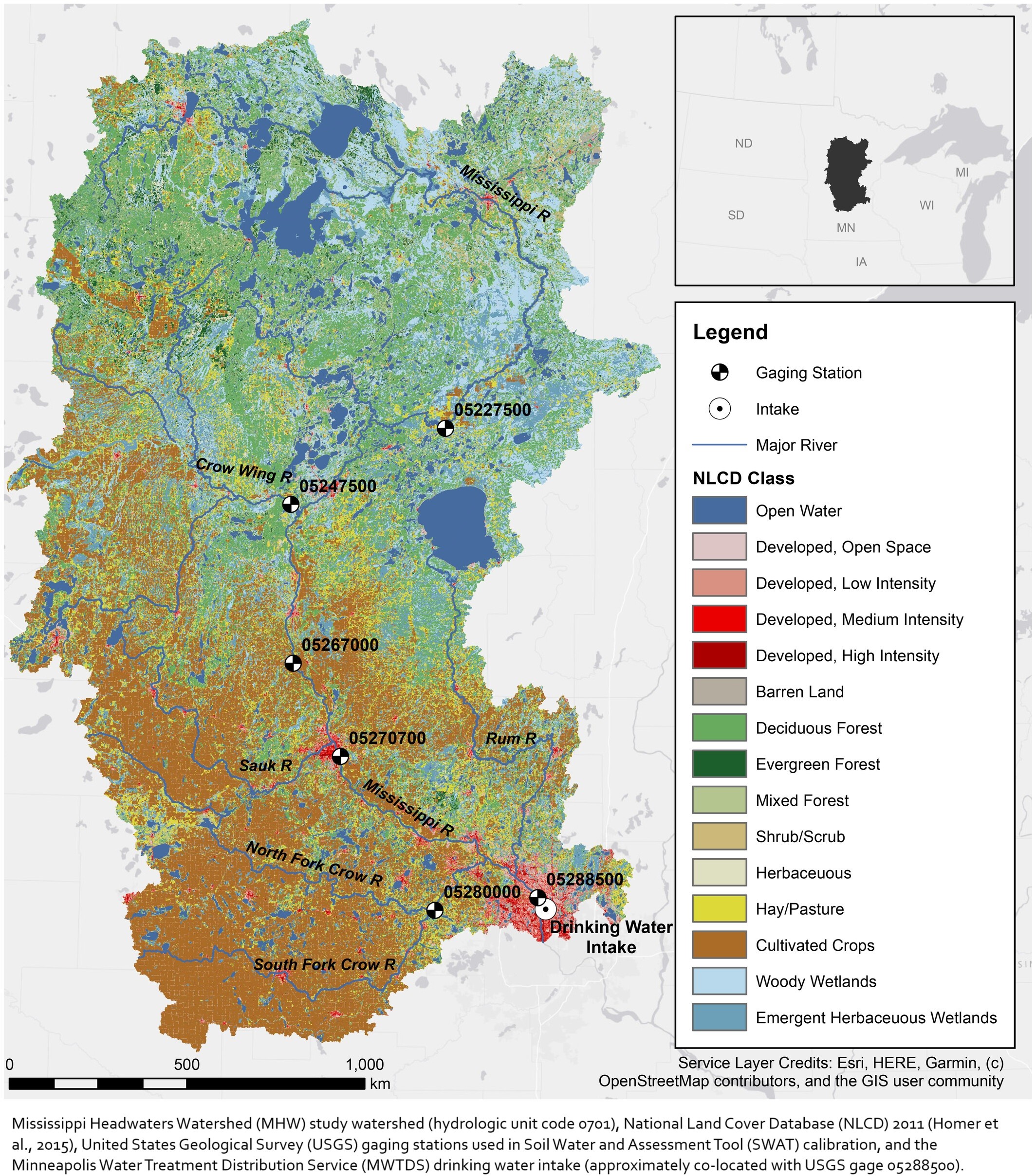
Modeling Future Land Cover And Water Quality Change In Minneapolis, MN, USA To Support Drinking Water Source Protection Decisions
--
https://doi.org/10.1111/1752-1688.13109 <-- shared paper
--
#GIS #spatial #mapping #remotesensing #earthobservation #landsat #fedscience #landuse #landcover #waterquality #model #modeling #spatialanalysis #spatiotemporal #NLCD #Minneapolis #MississippiR #water #hydrology #watersecurity #waterresources #nitrates #phosphorus #cyanotoxins #Minnesota #trees #agriculture #pesticides #fertiliser #farming #potable #runoff #farming #FORESCE #urbanisation #urban #headwater #watershed #planning #urbanplanning #management #nitrogencycle #soil #watertreatment #sediment
Client Info
Server: https://mastodon.social
Version: 2025.04
Repository: https://github.com/cyevgeniy/lmst